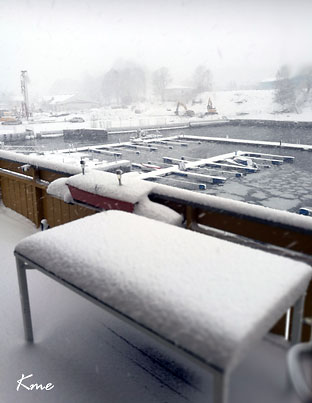
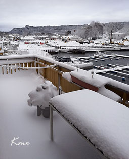
Sånn var det i Slemmestad 23. mars
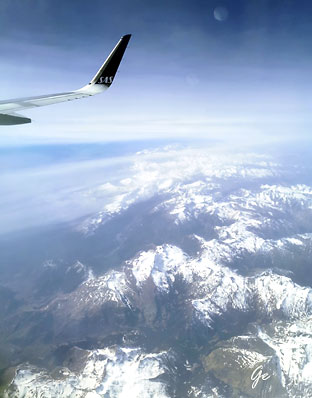
Fint vær over Pyrineene
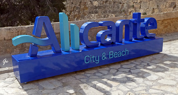
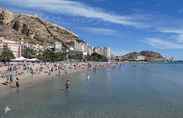
Velkommen til Alicante.
Nå skulle vi ha en uke med sol og litt varme.
Deilig å slippe islagte gater og fortau.
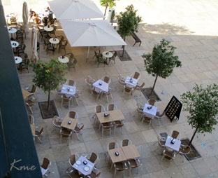
Bilde fra rommet vårt på hotel Eurostar Mediterranea Plaza Alicante
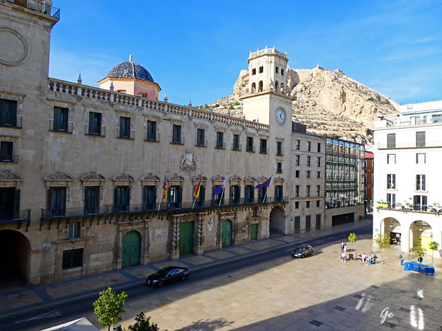
(Alicante ayuntamiento spansk) (Alicante City Hall engelsk)
The Town Hall of Alicante, a majestic 18th-century Baroque building, is an example
of the city’s architectural splendor. With its impressive facade and its iconic “Cota Cero” located inside the building, from where heights above sea level in Spain are measured,
it is a place full of history. Its interior houses works of art and rooms of great heritage
value.
Alicante Town Hall - ALICANTE City & Beach (22. april 2025)
Alicante[a] (Valencian: Alacant) is a city and municipality in the Valencian Community, Spain. It is the capital of the province of Alicante and a historic Mediterranean port. The population of the city was 337,482 as of 2020,
the second-largest in the Valencian Community.
The name of the city echoes the Arabic name Laqant (لَقَنْت) or al-Laqant (اللَّقَنْت), which in
turn reflects the Latin Lucentum and Greek root Leuké (or Leuka), meaning "white".
(9. april 2023) Alicante - Wikipedia
 |
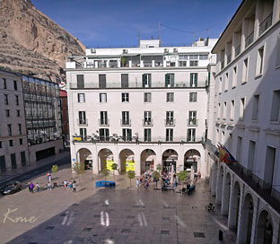 |
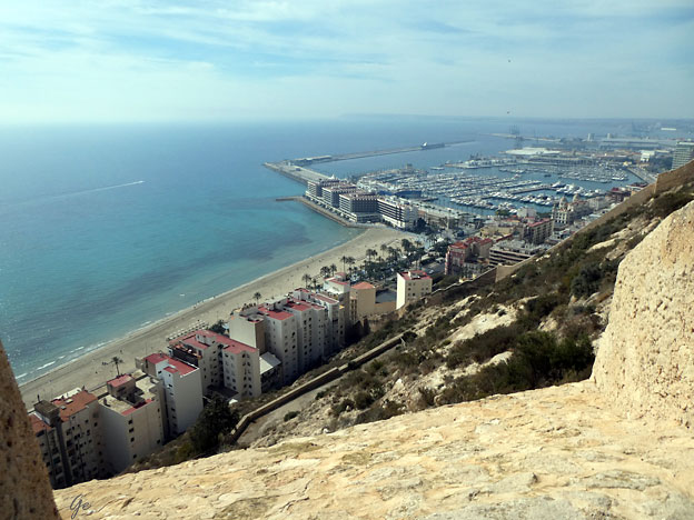
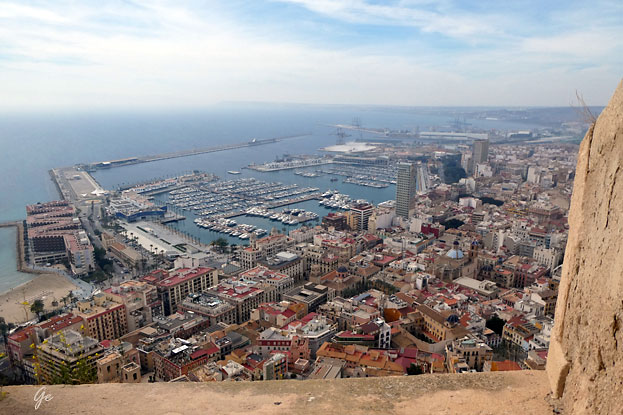
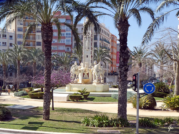
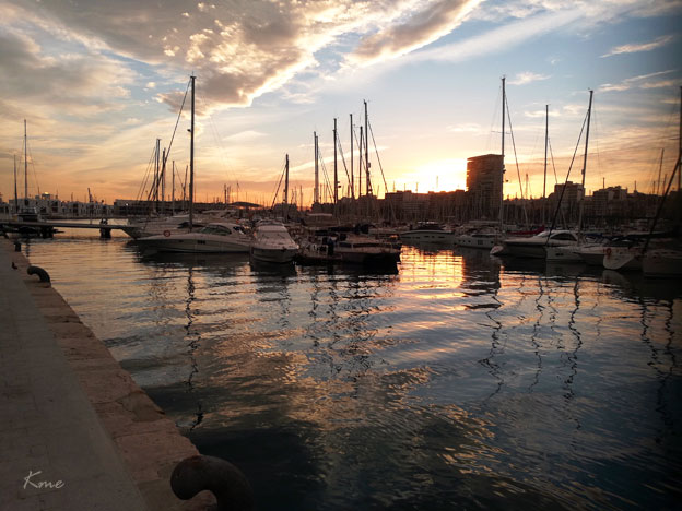
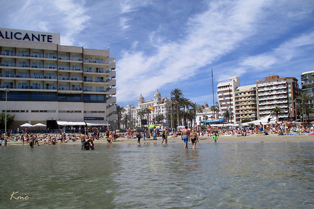
Det var ikke langt ned til havna. Hotellet ligger rett bak huset med kuplene.
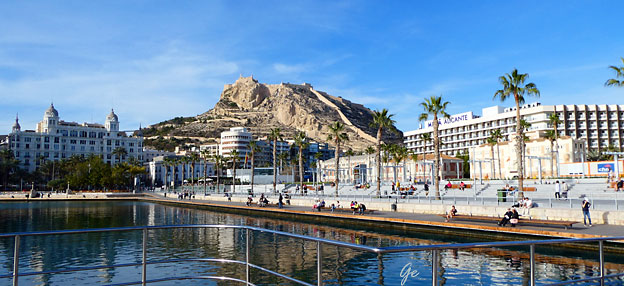
Stranda ligger rett bak det store hotellet til høyre i dette bildet.
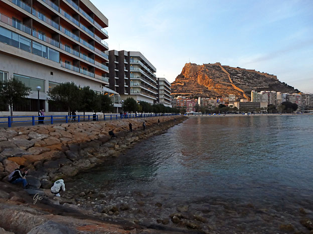
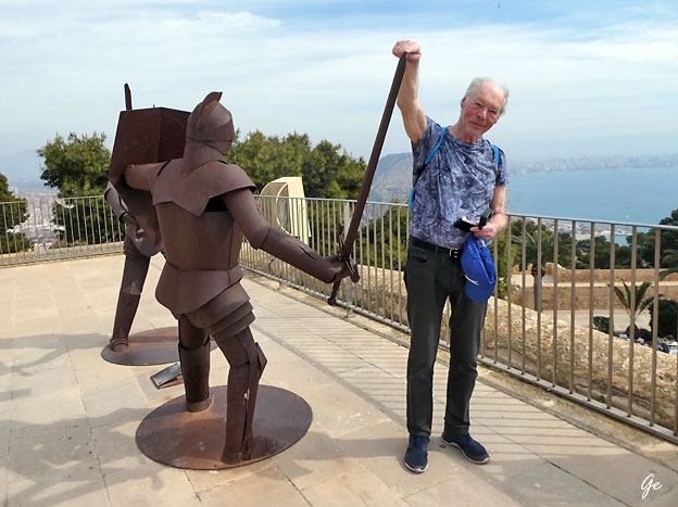
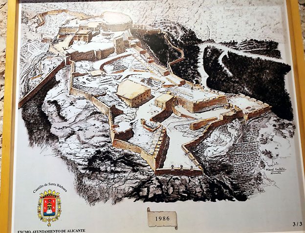
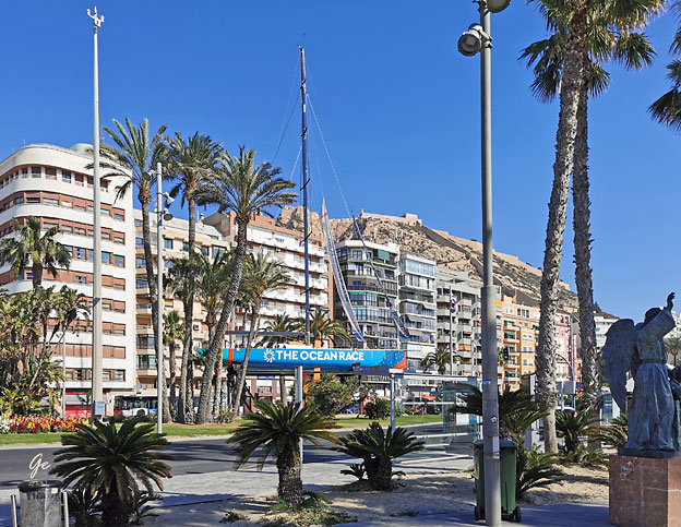
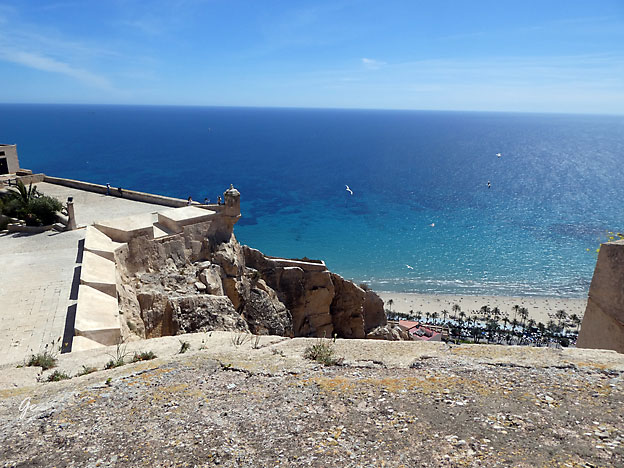
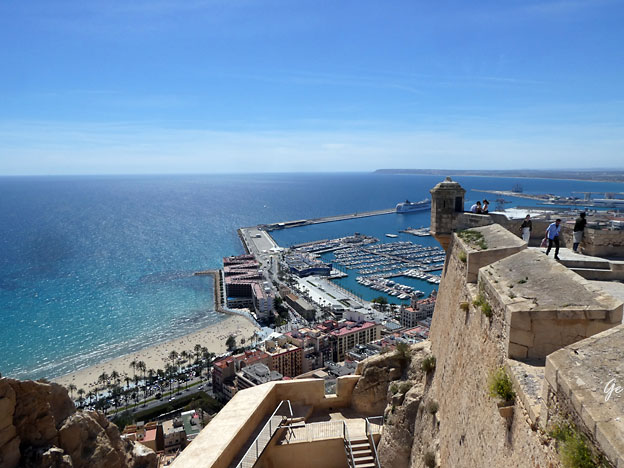
Alicantes store severdighet, festningen Santa Barbara (midt i bildet)
er heller ikke langt unna
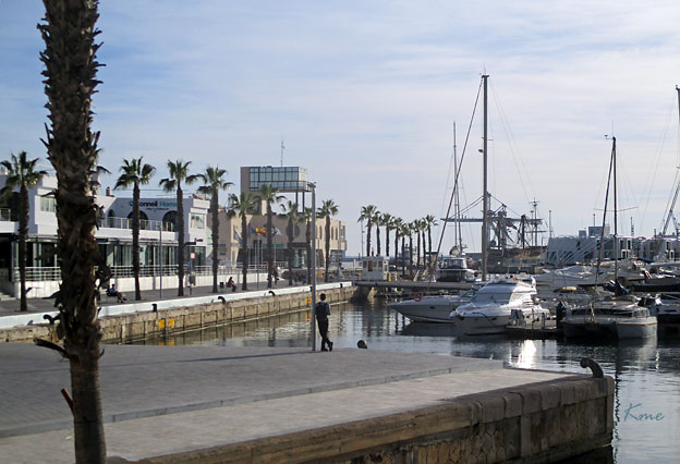
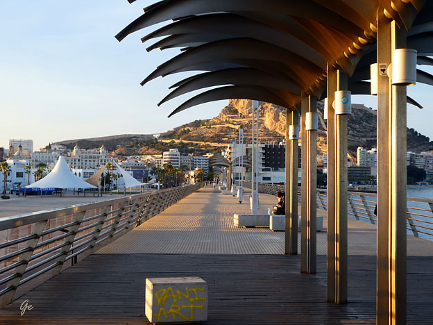
Moloen ved "the Ocean Race Museum".
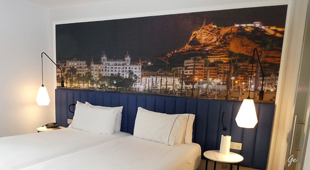
Fint bilde av Alicante bak senga vår.
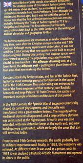 |
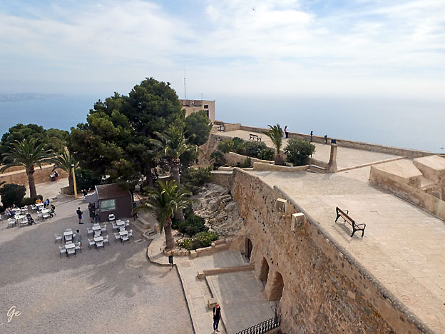
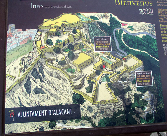
Santa Barbara Castle stands atop
Mount Benacantil. The strategic value of this lookout point, rising up 169 metres above sea level, has encouraged various civilisations to settle here, from Prehistoric times through the Iberian and Roman ages. But it was not until the period of Islamic rule that the first defensive construction was erected, probably following the Treaty of Tudmir signed in 713 by Visigoths and Muslims. The first reference ti this early construction dates back to the 10th Century, in the writings of Arabian chronicler and geographer Al-Razi. The fortress maintained its structure as an Arabic citadel for a long time, even after the Christian Conquest in the mid 13th Century. Although many repairs were undertaken, it was not until 15th Century that the new quarters were built to extend this stronghold. |
separated from the citadel by two trenches - the albacar d enmig and, at the lower level, the albacar vell - putting into place three of the four areas that now make up the fortress.
Constant attacks by Berber pirates, and fear of the Turkish fleet, led to the most intensive period of fortification in the second half of the 16th Century. This undertaking was entrusted to two of the finest engineers of that century: Juan Bautista Antonelli and Jorge Palearo "El Fratin" Hence, the castle is an important example of military architecture of that period.
 |
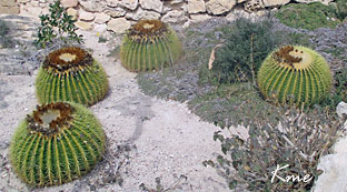 Kaktuser på Santa Barbara |
physiognomy, and the castle was transformed into a great modern fortress. The
majority of the mediaeval elements disappeared, and a large artillery platform
was constructed, which are largely the areas that can still be visited today.
From the mid 19th Century onwards, the castle gradually lost its military importance
until finally, in 1893, the weaponry was removed. At different times
it was used as a prison, until in 1961 it was declared a Historic-Artistic Monument
and opened its doors to the Public.
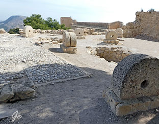
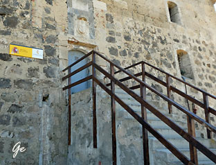
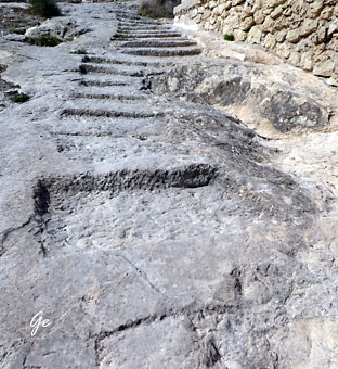 Gammel trapp |
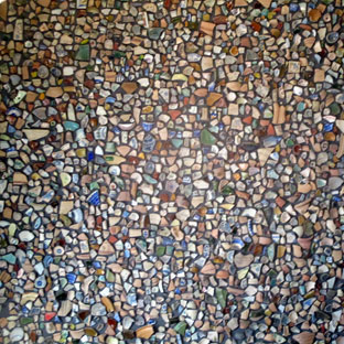 Potteskår blir et fint bilde. |
 |
 |

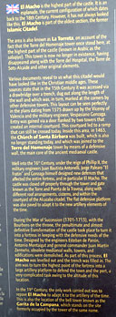 |
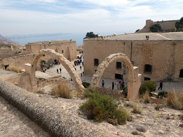
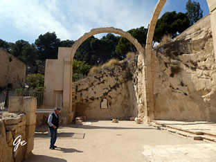
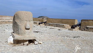
El Macho is the highest part of
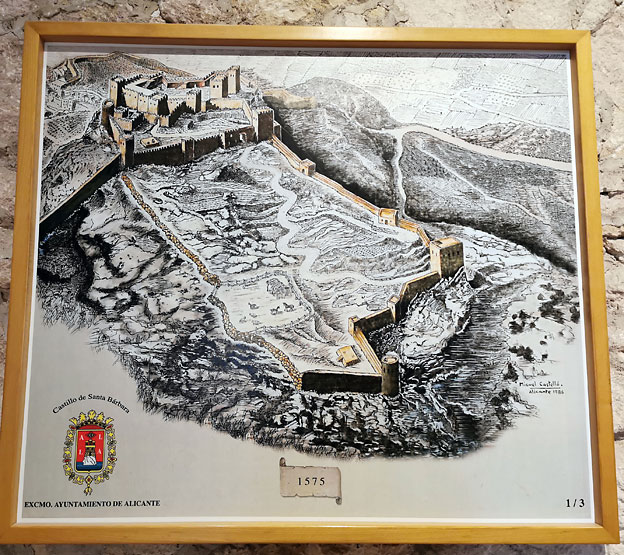
the castle. It is an esplanade, the current configuration of which dates back to the 18th Century. However, it has not always looked like this. El Macho is part of the oldest section, the former Islamic Citadel. The area is also known as La Torreta, on account of the fact that the Torre del Homenaje tower once stood here, at the highest part of the castle (known in Arabic as the saluqiya). This tower is no longer in existence, having disappeared along with the Torre del Hospital, the Torre de Sots-Alcaide and other original elements. Various documents reveal to us what this citadel would have looked like in the Christian middle ages. These sources state that in the 15th Century it was accessed via a drawbridge over a trench, dug out along the length of the wall and which was, in turn, marked at the corners by other defensive towers. This layout can be seen perfectly in the plans dating from 1575 drawn up by the Viceroy of Valencia and the military engineer Vespasiano Gonzaga.Entry was gained via a door flaked by two towers that |
today. Inside this area, in 1463 the church of Santa Barbara was built, which is also no longer standing today and which was joined to the Torre del Homenaje tower by
means of a defensive wall, the main core of the ancient mediaeval castle.
Well into the 16th Century, under the reign of Phillip II, the military engineers Juan Bautista Antonelli, Jorge Palearo "El Fratin" and Gonzaga himself designed new defences that affected the entire fortress, and in particular El Macho. The castle was closed off properly through the tower and gate known as the Torre and Puerta de la Travesa, along with different roof arrangements, cisterns, and within the courtyard of the Alcazaba citadel. The flat defensive platform was also paved to adapt it to the new artillery
elements of the time. During the War of Succession (1701-1713), with the Bourbons on
the throne, the penultimate and almost definitive transformation of the castle took place
to turn it into a fortress in keeping with the defensive needs of the time. Designed by the engineers Estban de Panon, Antonio Montaigut and general commander Juan Martin Zermeno, obsolete mediaeval walls, towers, and edifications were demolished. As part of this process, El Macho was levelled out and the trench was filled in. The aim was to turn
the highest point of the fortress into a large artillery platform to defend the town and
the port, a very complicated task owing to the altitude of this location.
In the 19th Century the only work carried out was to repave El Macho to adapt it to the artillery of the time. This is also the location of the bell tower known as the Garita de la Campana, which stands on the site formerly occupied by the tower of the same name.

Rester av kapellet på Santa Barbara
 |
 |
it you can see the entire bay of Alicante and its land surroundings. The image of the mountain from the beach resembles a face, which is why it is called "the face of the Moor" and is an icon of the city of Alicante.
There are historians who date the origin of the place name to the words bena, an Arabic transcription of pinna, 'peña' in Latin, and laqanti, an adjective that comes from Laqant, Alicante for the Arabs.
Santa Bárbara Castle - Wikipedia (22. april 2025)
 |
 |
 |
 |
 |
 |
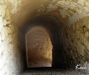
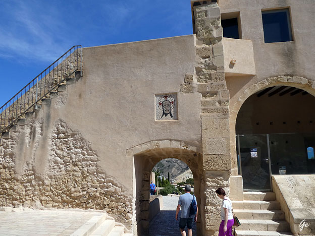
Inngangen til Santa Barbara
 |
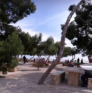
 El Parque La Ereta |
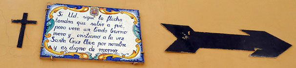
Maskinoversettelse: Hvis du følger pilen må du klatre til fots, men du vil se et søtt maurisk og kristent nabolag samtidig Santa Cruz Cleva ved navn, og det er verdt en tur.
If you follow the arrow you will have to climb on foot, but you will see a cute Moorish and Christian neighborhood at once Santa Cruz Cleva by name and it is worth touring

Calle San Rafael
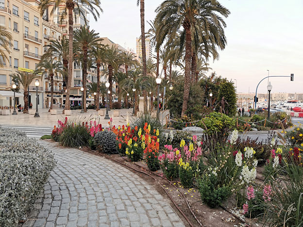
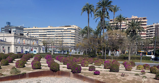
La Explanada de España
 Kveld i Alicante |
 Fra rommet vårt |
Escultura El Regreso de Icaro con Su Ala de Surf
Helt til høyre sees såvidt:
Monumento Homenaje A La Policia Nacional
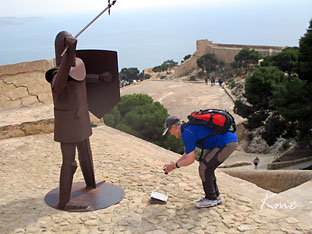
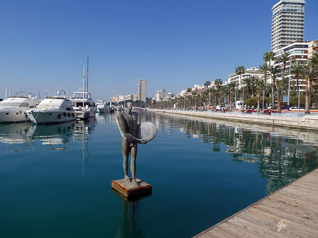
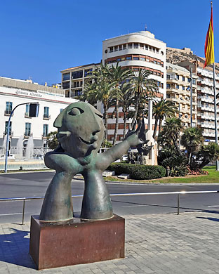 El Adivinador Statue |
 Hop on hop off buss |
Font de Llevant
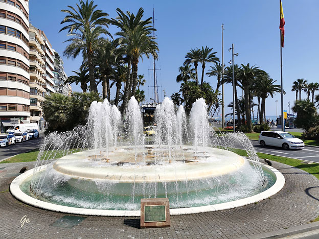
Fuente de la Plaza Mar
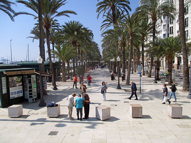
La Explanada de España
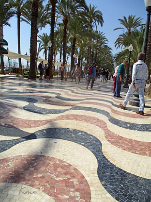 La Explanada de España |
 |
spot for anyone looking to discover the city.
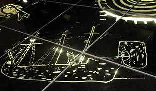
trees that invite you to walk under their shade. Its famous pavement is composed of 6,600,000 tricolor marble tiles and forms a spectacular undulating mosaic that
imitates the waves of the sea, offering a unique visual experience.
lively space.
of Alicante, where history, culture, and an unmistakable Mediterranean atmosphere
blend together.

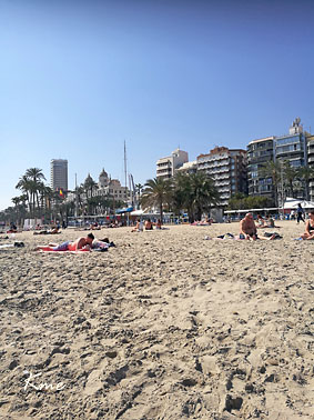
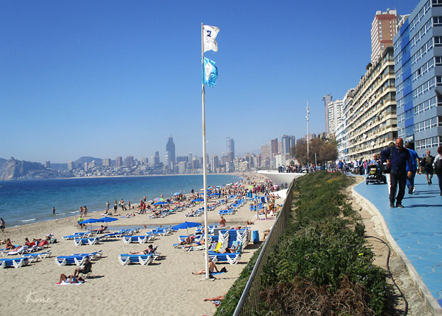
Postiguet Beach is the emblematic beach of Alicante, located right in the heart of
the city, at the foot of Santa Barbara Castle, and just a few steps from the famous Explanada promenade. It stands out for its calm waters, easy access to the
historic center, and facilities that include areas for sports, children’s play zones, and calisthenics equipment. During the summer season, a beach bar is also available.
Next to Postiguet Beach, you’ll find the Paseo de Gomiz, known for its numerous palm
trees, bars, and restaurants, as well as its unique paving stones that create a striking
3D visual effect. Nearby, there are plenty of parking options, both public and private.
In summer, the beach offers leisure and educational services, assistance for bathing
for people with disabilities, and accessible public restrooms.
Postiguet Beach - ALICANTE City & Beach (21. april 2025)
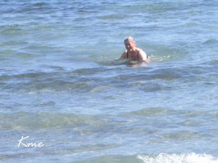 Årets første sjøbad |
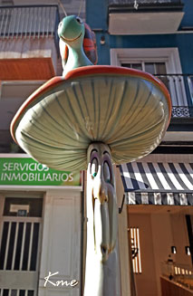 Calle San Francisco |
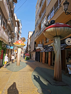 |
Castedo, with the objective of revitalising the area, provoked criticism from the
opposition for its cost – about 66,000 euros. Their installation was subsequently
branded as “botched”.
Alicante’s ‘Mushroom street’ goes viral - The Leader (10. april 2023)
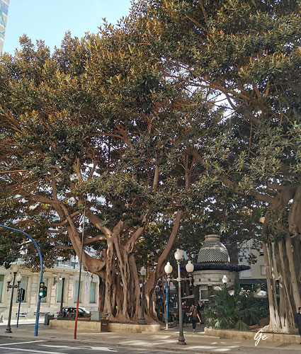 |
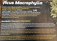 Ficus Macrophylla Evergreen tree that can reach a height of 50 metres. The trunk is thick, with smooth greyish bark. Other examples have aerial roots which form supporting columns for the branches when they reach the soil. This characteristic makes it a very difficult species for limited spaces. The leaves are large and of a brilliant dark green colour. |
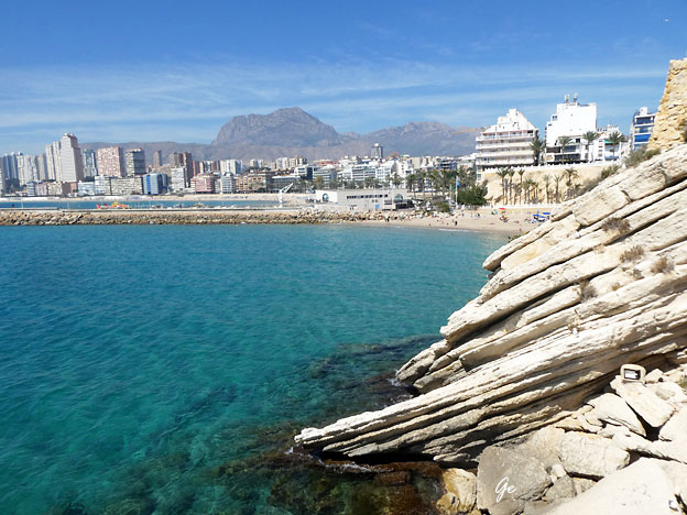
Benidormis a city, town and municipality in the province of Alicante, Valencia, on the Mediterranean coast of Spain.
Benidorm has been a tourist destination within Spain since 1925, when its port was
extended and the first hotels were built, though it would not be until the 1950s that it became renowned as a summer destination for people coming from inland Spain, especially Madrid. Today it is known for its hotel industry, beaches, and skyscrapers and receives as many tourists from abroad as from Spain. According to the 2020 census, Benidorm has a permanent population of 70,450 inhabitants, making it the fifth-most populous town in the Alicante province and the ninth in Valencian Community.
Benidorm - Wikipedia (10. april 2023)
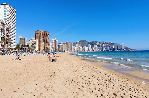
Playa Poniente
Features:
Length: 3,100 metres,
Average Width 74 metres,
Maximum width: 105 metres,
Minimum width 33 metres,
Sand Area 146,239m2
 |
The Virgin
of Suffrage (in Valencian Mare de Déu del Sofratge ) The legend of the Virgin relates that in 1740 the residents of Benidorm were surprised by the arrival on their beaches of a Londoner who had sailed there without a crew. It was believed that perhaps the cause of the disappearance of the crew was the plagueand this struck fear. The authorities, after discussions and consultations, decided to burn the ship. It was burned without removing anything. When the flames were extinguished, the children searched for nails and iron in the ash and found "intact and resplendent" an image of the Virgin with the Child Jesus in her arms, which the ship had brought on its stern. Virgin of the Suffrage (second.wiki) (11. april 2023) |
 Utleiebiler, veldig vanlige i Benidorm |
 Gamle Benidorm |
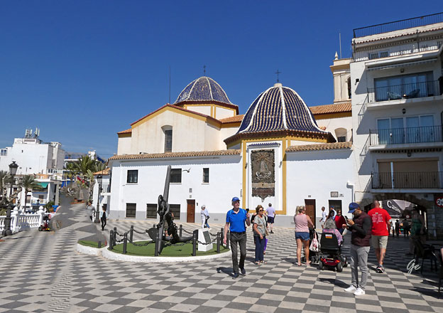
Church of Sant Jaume and Santa Anna
San Jaime Church (Iglesia de San Jaime y Santa Ana) is a blue-tiled domed roof
of the 18th century Parish church. It is dedicated to the patron saint of Benidorm
and is set at the very top of the Old Town on a hill called Canfali.
 |
Built between
1740 and 1780, neoclassical style, the church is
situated near the
Viewpoint Canfali above the old town. In November
they celebrate the major
holidays of Benidorm in honor of St. James and Our
Lady of Suffrage, one of the
most important acts of these parties is the staging
of the discovery of the Virgin
produced in 1740. The recent restoration has
renovated the building envelope and
the frescoes of the vault.
Visitors may seea
statue of the Virgen del Sufragio inside the church,
the well-loved
patron saint of Benidorm.
The Virgin has
her own small chapel containing the little wood
sculpture which, as
the story goes, was found on a boat adrift on the
high seas.
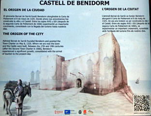 |
The
origin of the city Admiral Bernat de Sarria founded Benidorm and granted the Town Charter on May 8, 1325. here we are now the town and Castle were built. Between the 17th and 19th centuries (after the Second Town Charter in 1666), Benidorm experienced a significant growth, consolidated with the arrival of tourism to the present day. |
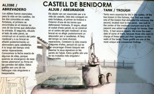 |
Tank
/ Trough Tanks were essential for life in the castles. Of the two known in this fortress, the first was inside one of the towers that defended the entrance; the second, located next to this panel, was built in the center of the medieval courtyard and to its paparet was added later a trough for horses. Over time, it had several repairs. We know that exact date of some of them, because those who were in charge of these tasks put there signature on the walls of tanks. These graffiti are one of the most unique and unexpected findings. |
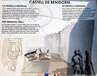 |
The
Medieval Wall On the eastern slope of Punta Canfali, there are remains of the medieval wall that closed the fortified enclosure from the east. The peculiar underlying geological structure has favoured the fracture of the rocky strata on which the wall was based, which has meant the loss of part of the original design, only recognizable at some points on the slope. |
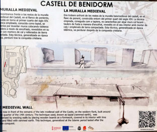 |
La
Muralla Medieval We are now in front of the remains of the late medieval wall of the castle, on the western flank, built around the first quarter of the 14th century. The technique used, known as tapial (rammed earth), was characterized by erecting walls by placing wooden boards as a formwork, covered in its interior with lime --- and filled with rammed earth. This technique, generalized at the Islamic period lasted after ----conquest |
Church of Sant Jaume i Santa Anna
Balcó de la Mediterrània
Fra Balcó de la Mediterrània mot Playa Poniente
 |
 |
Playa Levante
Playa Levante
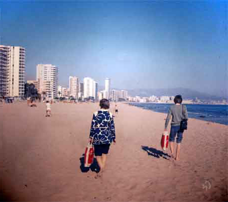
Playa Levante i 1972
 Benidorm 1972 Trolig Playa Poniente |
 Benidorm 1972 Det skal være tatt på Playa Levante. |
 Badevaktene på Playa Levante |
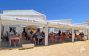
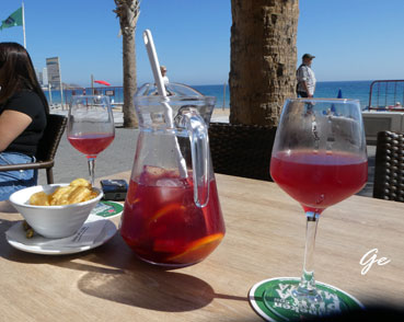 Sangria |
Levante Beach Specialties
Length: 2,084 m
Area: 125,785 m2
Footbaths: 21 units (of 2 pipes), with seawater.
Beach furniture: 10 sectors with 1,390 sunshades and 4,570 sun loungers.
Assistance: 2 assistance points, 5 lifeguard posts and 4 patrolling lifeguards.
Facilities: 1 accessible bath point, 3 children’s play areas, 4 sports and recreational play areas, 21 access walkways, 1 floating leisure platform, 164 litter bins and 2 ecological toilet cubicles.
Blue Flag Certificates: Qualitur “Q”, ISO 9001, ISO 14001
Playa Levante Beach, Benidorm, Costa Blanca (benidormist.com)
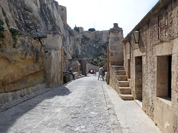
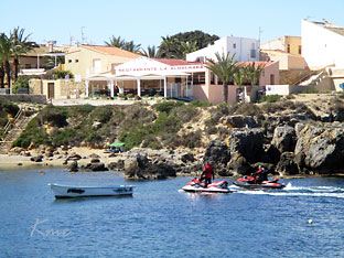
Fredag begynte vi dagen med å undersøke
om det fantes en heis opp til Santa Barbara.
Vi mente vi hadde sett en inngang skilta med
Santa Barbara da vi satt på Hop on hot off-bussen.
Vi fant stedet og der var det en heis, gratis for dm over 65 år.
Vi tok heisen opp, men gikk ned igjen.
The lift is the easiest way to get into the castle if you don’t have a car or you don’t
want to use public transport. It is also the less tiring way up as you don’t need to
hike to the Benacantil hill up to the castle. This would be the recommended access
for the last fit people. The entrance to the lift is located right in front of Postiguet
Beach.
The access to the castle is free but the lift service is not. The Santa Barbara lift
price is 2.70€ to pay by card or cash. The lift service opening hours are the same as
the fortress. The last lift-up is 40 minutes before the castle’s closing time and the
last lift-down is 20 minutes before.
Santa Barbara Castle in Alicante: Lift, Foot or Car? & Tips - Alicante About (11. april 2023)
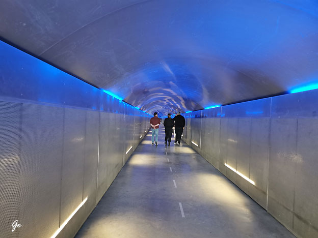
Inngang til heisen opp til festningen Santa Barbara
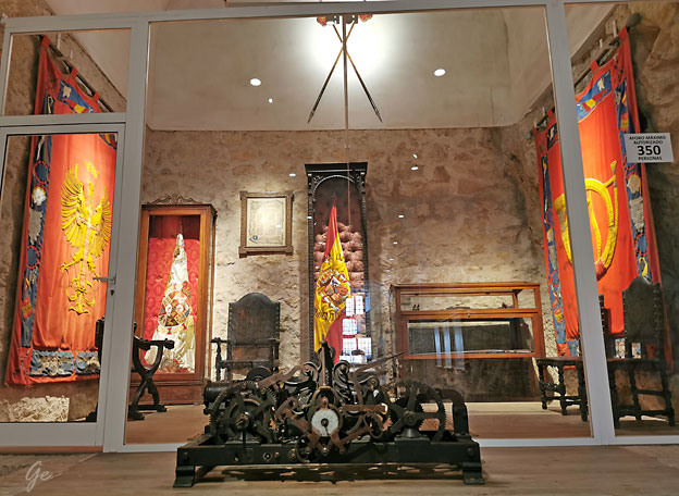
Castillo de Santa Bárbara en Alicante. Sala del Cuartel militar de Felipe II de España
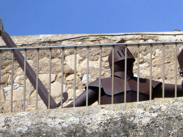
Santa Barbara
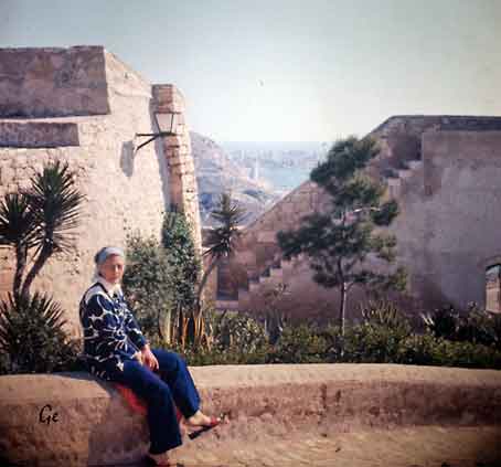 |
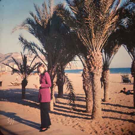
Vi har
dette bide av min mor (Selma). Det er tatt på Santa Barbara i 1972. Da vi var på festningen i år prøvde i å finne hvor bildet var tatt, men det klarte vi ikke. |
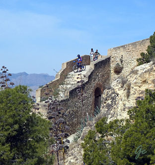 Noen bruker sykkel ned fra Santa Barbara |
 Calle San Rafael |
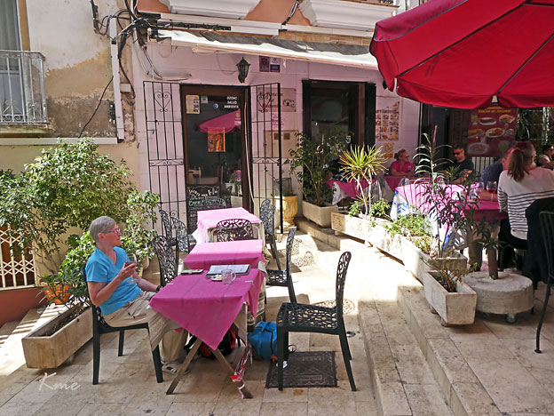
Restaurante Rincon de Antonio i Calle san Rafael
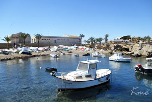
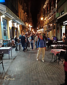
Kveld i Alicante havn
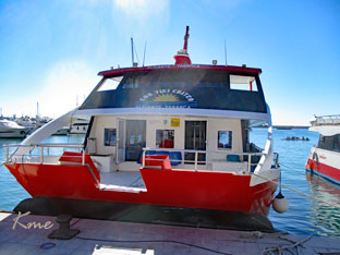
| Lørdag
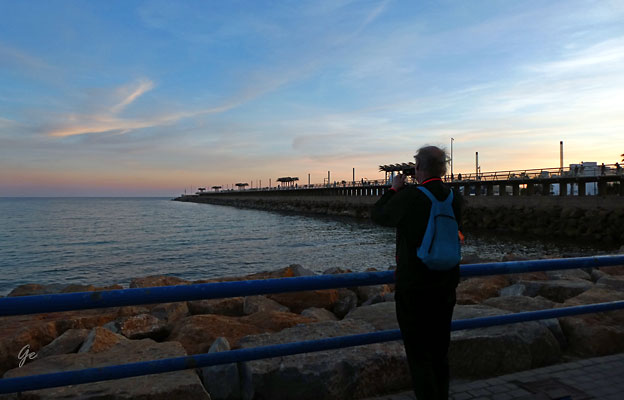
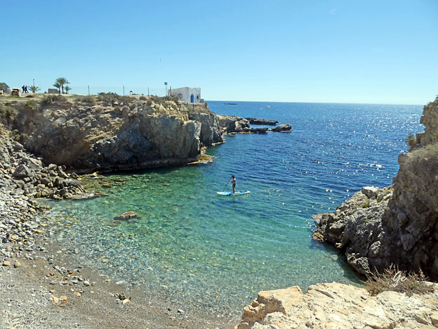
ble en tur til øya Tabarca. Turen tok 1 time med en av Kontiki-båtene. |
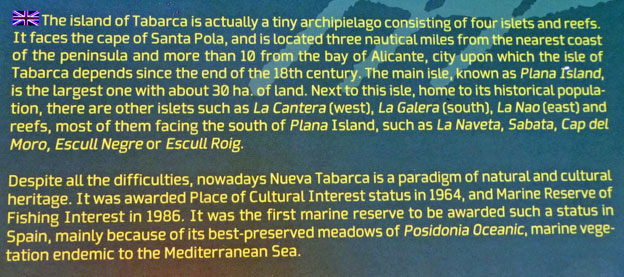
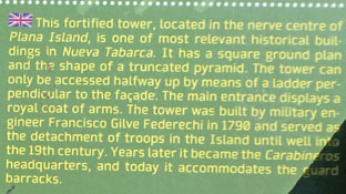
 |
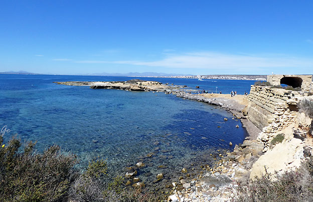
the city of Alicante, 11 nautical miles offshore and near the Santa Pola headland. In fact,
it’s more than just an island: it’s a small archipelago that comprises the islets of La
Cantera, La Galera and La Nao as well as the Isla de Tabarca itself. It is approximately
1,800 metres long and measures some 400 metres across at its widest point.
In the past, its shores were a refuge for Berber pirates and, in the 18th century, King
Carlos III ordered the island to be fortified and a town built, in which to house several families of Genoese fishermen who were being held prisoner in the Tunisian city of
Tabarka. The walls surrounding the town have been officially declared a Historical
and Artistic Site and an Asset of Cultural Interest.
Tabarca Island - ALICANTE City & Beach (alicanteturismo.com) (11. april 2023)
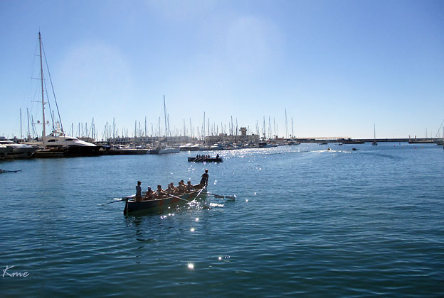
Robåter på havna i Alicante
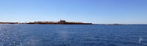
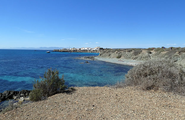
Vi ser Tabarco i det fjerne
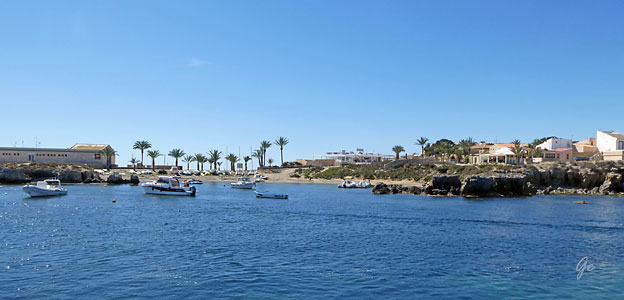
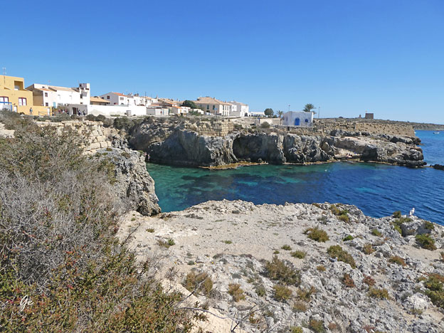
Tabarca
 |
 |
 |
 |
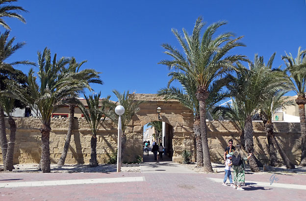
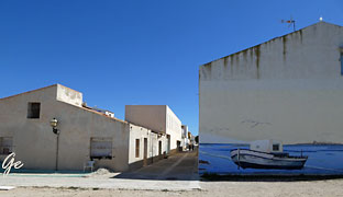
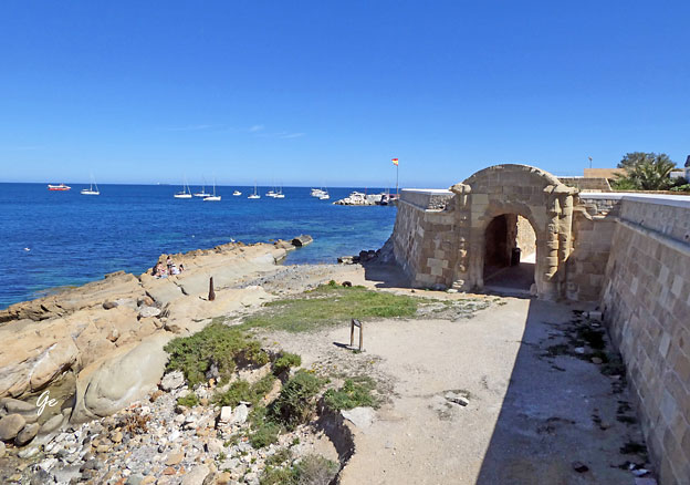
Inngangen til byen.
was a refuge for Barbary pirates up to the end of the 18th century and used as a base for raids on the Levantine coast.
The island's current namesake is a Tunisian islet and town of Tabarka, which was a part
of the Republic of Genoa until it was conquered by the Bey of Tunis in 1741. In 1760,
Charles III of Spain ordered the fortification and repopulation of the Spanish island. A
group of Genoese sailors who had been shipwrecked near the Tunisian Tabarka were
rescued and settled here.
century, the island had a population of around 1,000 people mainly devoted to
fishing. In the early 21st century, the permanent population was around 50, making Tabarca the smallest permanently inhabited Spanish island (although this number
is multiplied by ten during the tourist season in summer).
The main activity of the local population is fishing, with the catch brought to
Santa Pola's fish market, but tourism becomes the most important resource
during summer, especially in July and August.
Tabarca - Wikipedia (11. april 2023)
 |
 |
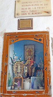
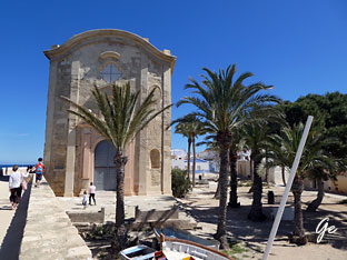
| The church
of San Pedro and San Pablo (in Valencian Esglia
de Sant Pere i Sant Pau ) is a Catholic temple located on the island of Tabarca , in the municipality of Alicante . In 1769 a small chapel already existed, which was expanded into a church and was blessed in 1770 , although its construction was not completed until 1779 . It was declared a Site of Cultural Interest in 1964 along with the rest of the island. Church of San Pedro and San Pablo (Tabarca) (second.wiki) (11. april 2023) |
 |
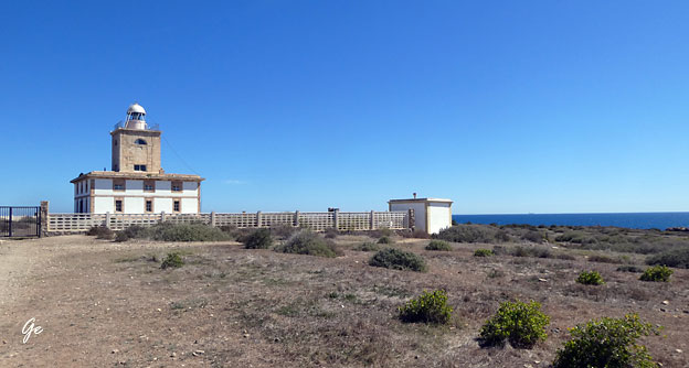
- Lighthouse. Tabarca lighthouse was constructed in 1854 so that passing ships could avoid the rocks and reefs that surround the island. It stands alone in the El Campo paramo. One of the most intriguing features of the lighthouse is its distance from the shore. However, given the island’s flatness, there’s no need for greater visibility. It was previously a school for lighthouse keepers.
- Tabarca
Island: a paradise for all, not just for pirates
(barcelo.com) (11. april 2023)
 |
Nueva
Tabarca Countryside has a very special landscape with meadows dotted with thorny bushes and the sea at the horizon. After the later rains in winter, everything is cloaked in green with several species of gramineae and large variety og flowers that grow quickly. These open xerophyte pastures (adapted to survive with little water) can be found on very little developed soil with a great diversity of ephemeral spring blooming plants. Most plants disappear during the driest summer months. In fact, only intricate thorny bushes remain. They drop their leaves to avoid water loss, a typical strategy of deciduous plants. |
Long time ago this area was intensively altered to grow cereals and legumes. However, the result was rather poor due to the lack of water and nutriens in its soil. Only a plantation of cactus known as Opuntia maxima from mid-20th century has endured, which is now being engulfed by the tasting wild vegetation. Although in a fairly ruinous condition, visitors can still find an old farming house near the lighthouse of the island as a silent witness to the old farming tasks. This modest building deserves to be remembered as part of Neva Tabarcas richest ethnographic heritage.
There is a large variety of insects of great ecological and biogeographical interest because of the geographical location of the archipielago, its sub-desert tendency and its similarity with the fauna typical of the south-east of the peninsula and that of the north of Africa. Darkling beetles are a good example: a numerous family of beetles typical of arid and desert areas in the entire planet which scientists consider good indicators for the conservation of the ecosystem. One of them, the Asida ricoi cobosi, is endemic to Tabarca (exclusive to this place).
 |
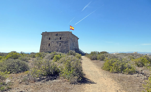
As important as San Jose Tower is
Nueva Tabarca lighthouse, a historical building opened in 1854 and built by Agustin Elcoro Berocibar. It is a large building of late neo-classical style which served as a school for lighthouse keepers. This was the first of a series of lighthouses built along the coastline of the province of Alicante between 1850 and 1854. |
---------------------------------------------------------------------------------------------------------------
Nueva Tabarca Countryside
Curiously enough, up to 5 reptile species live in such a small place: the Bedriaga s skink (Chaicides bedriagai), the Mediterranean house cecko (Hemidactylus turcicus), the European common gecko (Tarentola mauritanica), the Montpellier snake (Malpolon monspessulanus) and the Southern smooth snake (Coronella girondica)
From a conservationist point of view, the most important bird species of the archipielago are the European storm petrel (Hydrobates pelagicus melitensis), the audouin gull (Larus audouinil) and the European shag (Phalacrocorax aristotelis desmarestil) and the Kentish plover (Charadrius alexandrinus). About 25 couples of Storm petrel nest on a small islet called La Galera, which repreent 4% of the spawning stock in the region. Other nesting species in Tabarca are the Thekla lark (Galerida theklae), the Sardinian warbler (Sylvia melanocephala), the Spotless starling (Sturnus unicolor), and the Pallid swift (Apus pallidus)
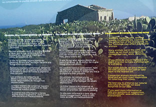 |
Collaborate
in conservation the paths Walk the marked paths, without leaving its boundaries, contributes to the protection of the ecosystem, as our footsteps may affect plants and animals. Many animals live in the cliffs and coves, so we must avoid disturb, damage burrow, nests, watering etc.. If you think we should not pluck any plants, it is best to make a photograph of a drawing. |
or take them to the nearest bin.
Companion animals should not be loose and we must make
responsible for collecting their stools.
The best way to preserve our natural and cultural heritage, not
leave footprints on our walk.
If you want more information or have any questions or suggestions, visit
the webside: www.alicante.es/environment,
 |
 |
| Søndag
var det loppemarked på plassen foran hotellet. Mye å få kjøpte, men det ble ikke noe handling for oss. |
 |
Vi begynte med en tur til thr Ocean Race museum.
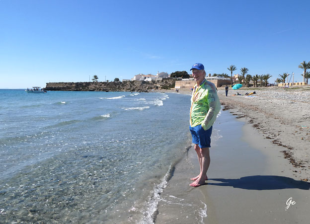
Etterpå henta vi badetøyet og dro på stranda.
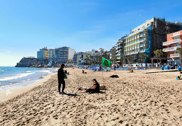
Det var ganske folksomt der denne dagen.
Søndag og varme lokket mange til sjøen.
 |
 |
Siste dag i Alicante.
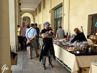
Vi gikk først til Mercado Central.
Det var lite aktivitet der på mandag formiddag.
så det ble ikke lange besøket.
Etterpå rusla vi litt rundt i gatene.
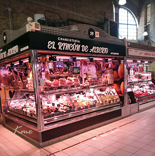 |
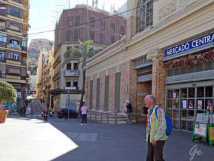 Mercado Central |
 Kakedisk |
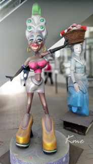 Fine damer på bytur |
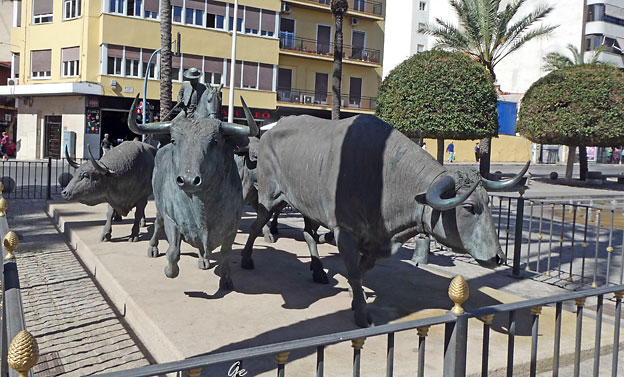
Plassen utenfor tyrefekterarenaen
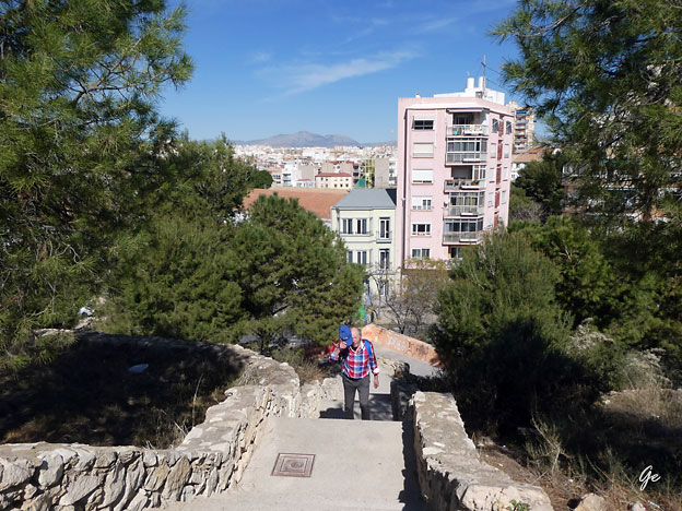
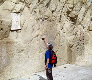
Vi fant en turvei og måtte finne ut hvor den ville føre oss.
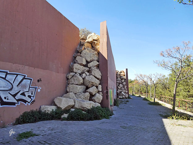
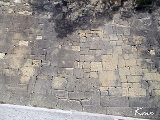
Muren stopper steinsprang fra fjellet Benacantil.
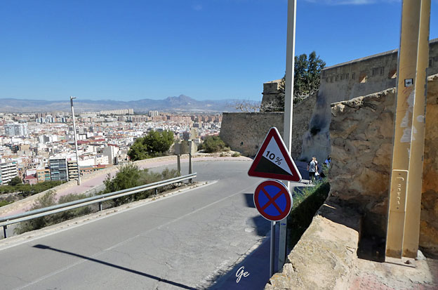
Gangveien vi fant førte selvfølgelig opp til Santa Barbara,
så vi fikk vår tredje tur dit opp.
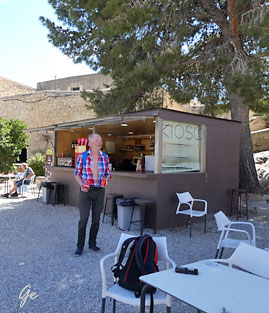 |
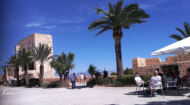
Vi var
tørste og varme etter oppstigningen og satt lenge ved denne kiosken. Vi var innom den ved alle tre besøkene på festningen |
før vi gikk tilbake til sentrum,
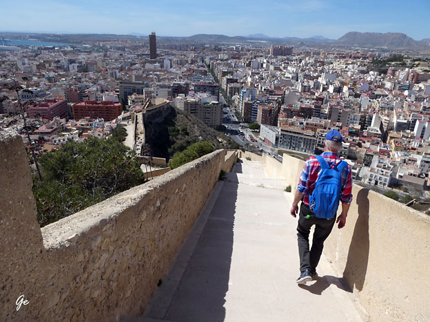
Vi tok en litt annen vei ned enn den vi har brukt før.
Denne gangen gikk vi oppe på en av murene.
Bilde fra Calle san Rafael
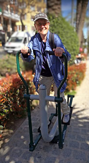 Trening må til |
 Lang regning |
Sånn var det i Slemmestad dagen etter vi kom hjem.