| Vi
reiste til Gardermoen fredag den 5. mai siden flyet vårt skulle gå forholdsvis tidlig neste dag. Vi tok båten fra Slemmestad og skulle ha tog videre. Men det var full stopp i togtrafikkenm så det ble buss videre til flyplassen. Der overnattet vi på Radisson Red. |
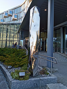
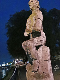
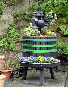
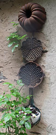
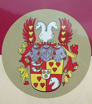
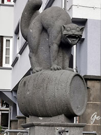
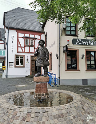
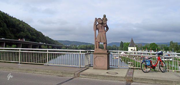
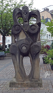
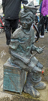
Skulptur
utenfor hotellet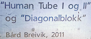 |
Denne gang reiste vi med Vista Travel
fra programmet for reisen:
DAG 1 Oslo – Bonn/Andernach
Du møter reiselederen på Oslo lufthavn om morgenen.
Sammen flyr vi med Lufthansa til Frankfurt.
Fra flyplassen fortsetter vi med buss til Bonn
(avgangen den 6. mai) eller Koblenz
(avgangen den 23. september) hvor
vårt skip, MS Olympia, venter.
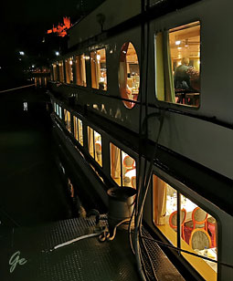
Vi sjekker inn og finner oss til rette om bord.
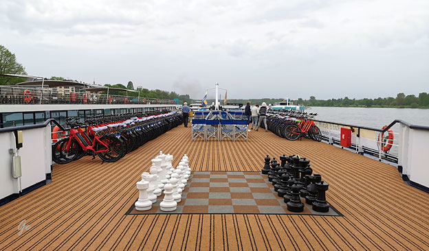
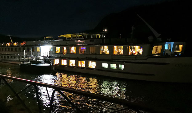
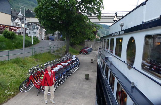
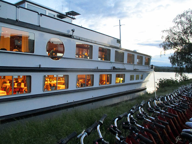
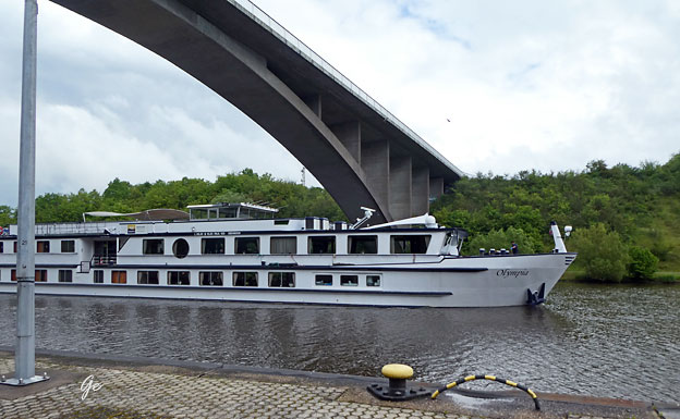
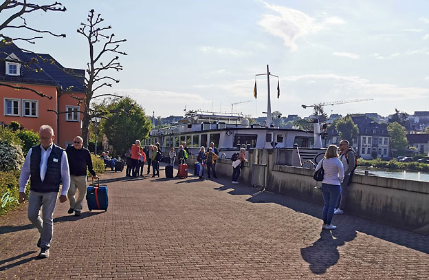
Vi er ombord på MS Olympa.
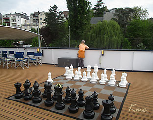
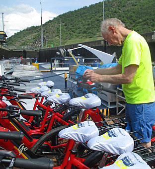
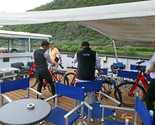
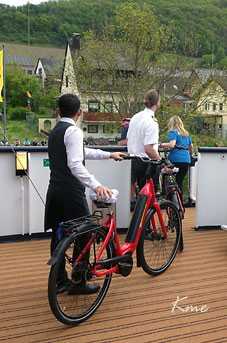
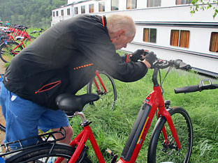
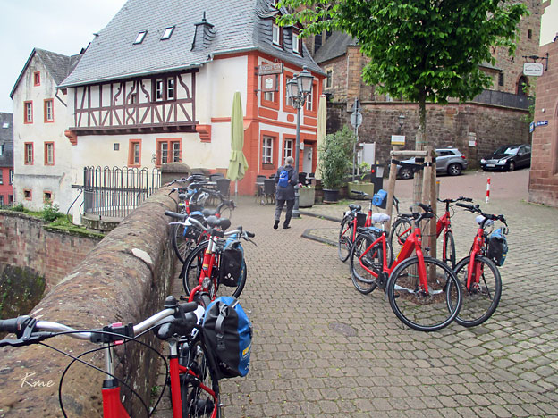
På soldekk står alle syklene og venter på å bli tatt i bruk. Nye alle sammen.
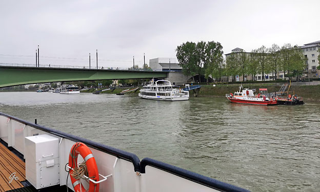
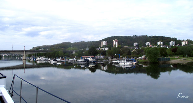
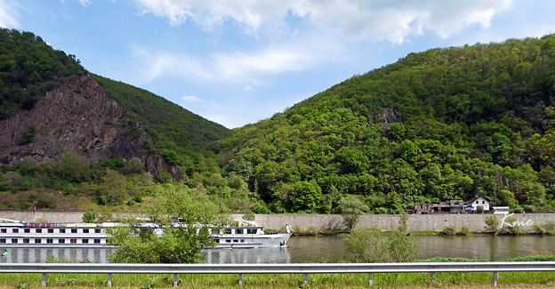
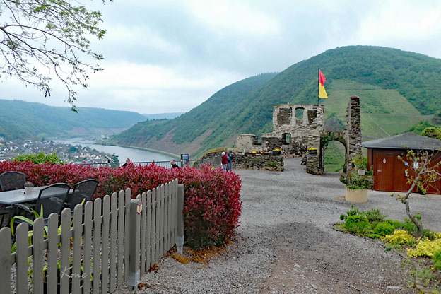
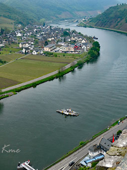
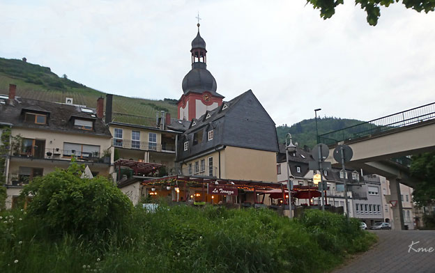
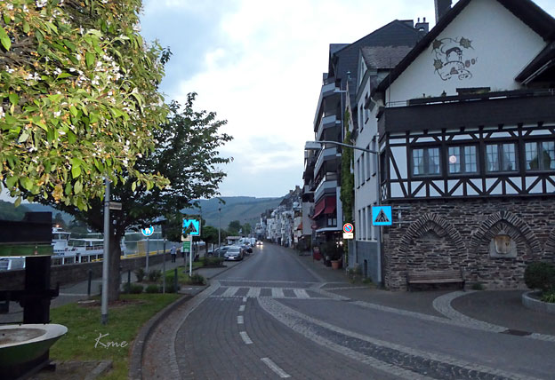
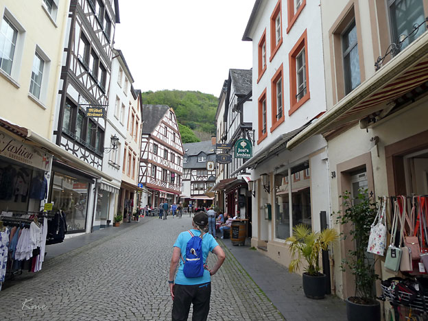
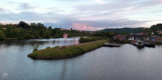
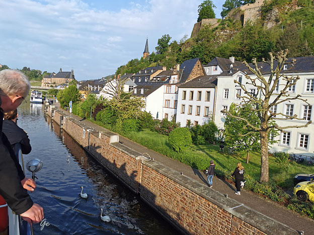
Vi er på vei mot Andernach som ligger litt nord for Koblenz. Elva er Rhinen
Der lå båten den første natta.
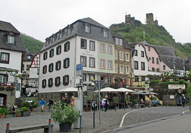
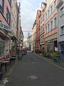
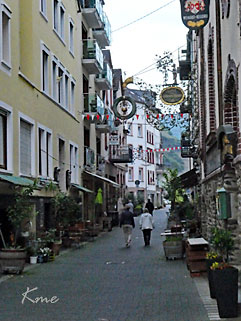
 Etter middag ombord tok vi en tur byen Andernach |
Andernach
is a town in the district of Mayen-Koblenz,
in Rhineland-Palatinate, Germany, of about 30,000 inhabitants. As with most German cities, towns and villages, Andernach has its own local dialect – the "Andernacher Platt" ("Andernachian dialect") in which "Andernach" and the local dialect itself is named "Annenach" and "Annenache Platt". It belongs to the Moselle Franconian language subgroup Andernach - Wikipedia |
The Rhine is one of the major European rivers. The river begins in the Swiss canton of Graubünden
in the southeastern Swiss Alps. It forms part of the Swiss-Liechtenstein, Swiss-Austrian,
and Swiss-German borders. After that the Rhine defines much of the Franco-German
border, after which it flows in a mostly northerly direction through the German Rhineland.
Finally in Germany the Rhine turns into a predominantly westerly direction and flows into the Netherlands where it eventually empties into the North Sea. It drains an area of
9,973 sq km and its name derives from the Celtic Rēnos.
Rhine - Wikipedia
Byport i Andernach
 Bilder fra Andernach |
 |
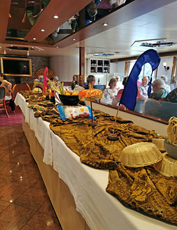
Fasilitetene om bord inkluderer restaurant, salong med bar, og delvis overbygget
soldekk.
Alle lugarene er utvendige og har bad med dusj, hårtørrer, TV, safe, lite kjøleskap
og aircondition. Lugarene er cirka 11 m² og har to separate senger som gjøres om
til sofa på dagtid.
Vinduet i lugarene på øvre dekk kan åpnes. Enkeltlugarene på øvre dekk er 9 m².
MS Olympia 3*+
Rederi: SE-Tours
Byggeår: 1984, renovert 2016
Lengde: 88,5 m
Passasjerer: 96
Elvecruiseskipet MS Olympia (vistatravel.no)
MS Olympia
Fra programmet:
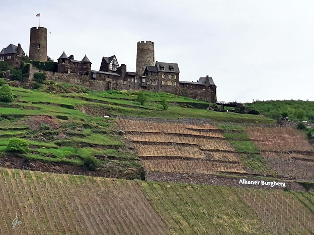
DAG 2 Andernach – Alken – Cochem
I løpet av morgenen har vi startet seilingen opp Mosel. Med skrånende
vinmarker, borger og pittoreske landsbyer, er Moseldalen en sann eventyridyll.
Første stopp er Alken hvor cruisets første sykkeletappe starter. Denne går via
Moselkern til Cochem. Sykkelstiene langs Mosel er lette å sykle og selv om
landskapet er variert er stiene relativt flate, og for det meste asfaltert.
Sykkelstiene går ofte på begge sider av elven. Sykkelveien gjennom Mosel er
også kjent som «Le Chemin de la Moselle» eller «Velo Tour Moselle» og er over
300 km lang. Den starter i Vosges-fjellene i Frankrike og ender ved Koblenz,
der elvene Mosel og Rhinen møtes. Mosel deler også to fjellkjeder – Eifel og
Hundsrück.
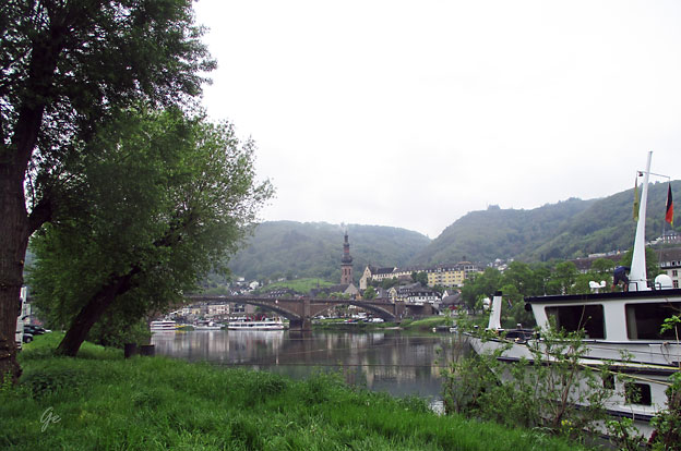
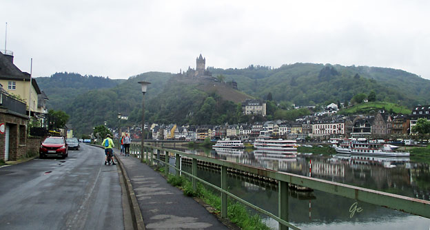
Når vi ankommer Cochem er allerede skipet på plass. Cochem blir ofte kalt
Moseldalens perle. Gamlebyen i Cochem består av smale gater,
bindingsverkshus og mange små vinstuer. Ovenfor gamlebyen troner den
imponerende borgen Reichsburg Cochem fra 1100-tallet. Borgen ble ødelagt
av franske tropper i 1689, men bygd opp igjen i nygotisk stil på slutten av
1800-tallet. Du kan utforske byen på egen hånd, og er været fint frister det
kanskje å ta en pause på en av utendørskafeene langs Mosel og smake
på den lokale vinen?
Skipet ligger til kai i Cochem over natten.
Dag 2 Alken – Cochem ca 29 km
 |
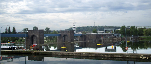
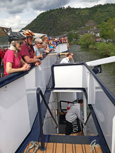
 Vi har kommet til dagens første sluse. |
 |
 Strandsted |
Marina
 |
 |
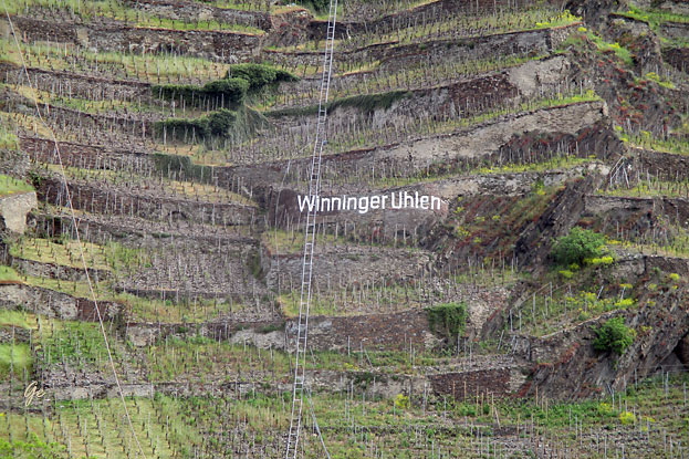
Die Rebfläche im Winninger Uhlen beträgt ungefähr 7 Hektar und der Rebhang
liegt auf einer Höhe von 75 bis 210 m ü. NN. Die Steillage (→ Steillagenweinbau)
verfügt über eine Steilheit von 50 bis 70 % und ist auf Terrassen angelegt.
Die Winzer verwenden die Reberziehungsmethoden Moselpfahl, Trierer Rad, Vertiko
und Drahtrahmenerziehung. Wichtigste Rebsorte ist der Riesling.
Winninger Uhlen – Wikipedia
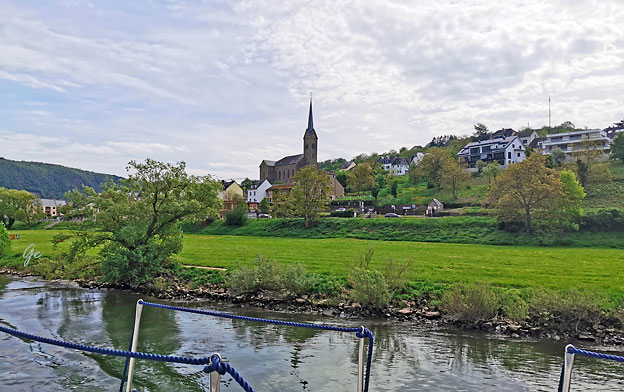
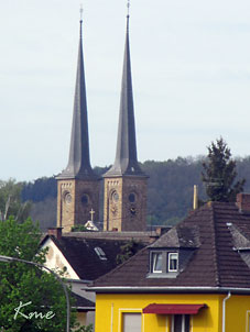
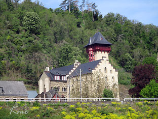
Dieblich med St.Johannes-kirken fra 1844.
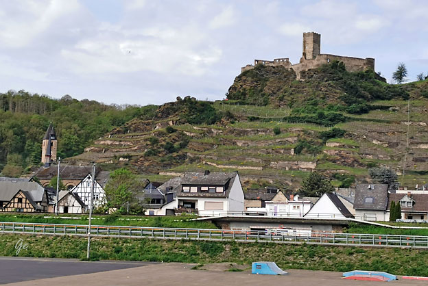
Burg Niederburg
| Of the former castle complex
of Niederburg, there are only remnants left today. These are from the enclosing wall and the wall-lined moat. When and by whom the castle was destroyed is knowledge that has been lost to history. Niederburg - Wikipedia |
 |
 |
 |
The ruins of the Thurant Castle (German: Burg Thurant, also Thurandt or Thurand)
stand on a wide slate hill spur above the villages of Alken on the Moselle in Germany.
From the mid-13th century the archbishops of Cologne and Trier were joint owners and
had their respective property managed by burgraves. As a result, each half of the castle
had its own bergfried, living/domestic buildings and entrance. Pottery finds point to a
Roman settlement on the hill spur, but the first record of the place dates to the year 1209.
Count Palatine Henry I the Tall from the House of Welf probably had a fortification built
on the present site between 1198 and 1206 in order to secure the claims of his brother,
Emperor Otto IV, in the Moselle region. According to tradition, he named the hill castle
after Toron Castle near Tyros in present-day Lebanon, which he had besieged in vain
during the Battle of Barbarossa during the Third Crusade.
Thurant Castle - Wikipedia
Thurant Castle
 |
 |
 |
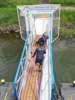
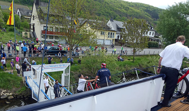
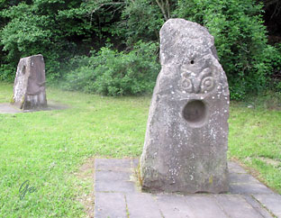
Problemet
med landgangen er løst og syklene kan tas på land. Vi er framme i Alken og klare for den første sykkeletappen. Alken wurde bereits im 10. Jahrhundert als Alkana erstmals erwähnt. Die heutige Schreibweise ist für das 16. Jahrhundert belegt. Es gehörte bis ins 13. Jahrhundert zur Pfalzgrafschaft. Um 1200 erbaute der Pfalzgraf Heinrich zur Sicherung des Gebietes die Burg Thurant. Alken (Untermosel) – Wikipedia |
 |
 |
En rast på Gaststätte Moselgruss i Moselkern
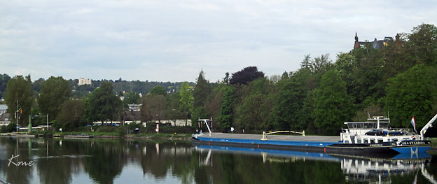
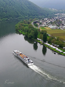
MS Olympia passerer
|
 |
| Vi er
framme i Cochem. Syklene står på land om natta. Vi skal jo syklene videre neste morgen. Sykkelturen fra Alken gikk veldig greit for de fleste. |
 |
The Moselle is a river that rises in the Vosges mountains and flows through north-eastern France and Luxembourg to western Germany. It is a left bank tributary of the
Rhine, which it joins at Koblenz. A small part of Belgium is in its basin as it includes the Sauer and the Our.
Its lower course "twists and turns its way between Trier and Koblenz along one of
Germany's most beautiful river valleys." In this section the land to the north is the Eifel
which stretches into Belgium; to the south lies the Hunsrück. The river flows through a
region that was cultivated by the Romans. Today, its hillsides are covered by terraced
vineyards where "some of the best Rieslings grow". Many castle ruins sit on the hilltops
above wine villages and towns along the slopes. Traben-Trarbach with its art nouveau architecture and Bernkastel-Kues with its traditional market square are two
of the many tourist attractions on the Moselle river.
The name Moselle is derived from the Celtic name form, Mosela, via the Latin Mosella, a
diminutive form of Mosa, the Latin description of the Meuse, which used to flow parallel
to the Moselle. So the Mosella was the "Little Meuse".
The Roman poet Ausonius made it a literary theme as early as the 4th century. In his poem
dated 371, called Mosella, which was published in 483 hexameters, this poet of the Late
Antiquity and teacher at the Trier Imperial Court (Kaiserhof) described a journey from
Bingen over the Hunsrück hills to the Moselle and then following its course to Trier on the
road named after him, the Via Ausonius. Ausonius describes flourishing and rich landscapes
along the river and in the valley of the Moselle, thanks to the policies of their Roman rulers.
The river subsequently gave its name to two French republican départements: Moselle and
Meurthe-et-Moselle.
The source of the Moselle is at 715 m (2,346 ft) above sea level on the Col de Bussang on the
western slopes of the Ballon d'Alsace in the Vosges. After 544 km (338 mi) it discharges into the Rhine at the Deutsches Eck in Koblenz at a height of 59 m (194 ft) above NHN sea level.
The length of the river in France is 313 km (194 mi), for 39 km (24 mi) it forms the border
between Germany and Luxembourg, and 208 km (129 mi) is solely within Germany.
Moselle - Wikipedia
Fra programmet:
DAG 3 Cochem – Zell
Etter frokost starter dagens sykkeletappe som går via Beilstein til Zell.
Underveis passerer vi det som regnes som verdens bratteste vinmarker ved
Bremmer Calmont. Her dyrkes det vindruer i skråninger med 65° helling!
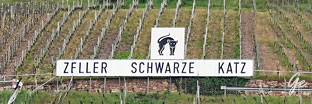
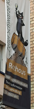
Etappen ender i den lille byen Zell, som ligger i Tysklands største enkeltstående
vinområde med over seks millioner vinstokker. Zell vil for alltid være knyttet til
den populære hvitvinen Schwarze Katz. Varemerket Schwarze Katz er
registrert og beskytter et nøye avgrenset geografisk område av vinmarker som
kan benytte navnet på sin vin. Like ovenfor byen ligger det gamle kruttårnet
Pulverturm med utsikt over gamlebyen. Skipet ligger ved kai i Zell over natten
og vi har god tid til å bli bedre kjent med den lille, sjarmerende byen.
Dag 3 Cochem – Zellca 39 km
Cochem is the seat of and the biggest town in the Cochem-Zell district in Rhineland-Palatinate, Germany. With just over 5,000 inhabitants, Cochem falls just behind
Kusel, in the Kusel district, as Germany's second smallest district seat.
Since 7 June 2009, it has belonged to the Verbandsgemeinde of Cochem.
Cochem - Wikipedia
The Reichsburg Cochem had its first documentary mention in 1130. In 1151,
it was occupied by King Konrad III, who declared it an Imperial castle. In 1688,
the castle was overrun by French King Louis XIV's troops in the course of the
Nine Years' War (known in Germany as the Pfälzischer Erbfolgekrieg, or War of
the Palatine Succession), and the following year, they destroyed it. The castle
complex long lay in ruins before in 1868 it was bought by the Berlin businessman
Louis Fréderic Jacques Ravené for 300 Goldmark and then reconstructed in the
Gothic Revival style. Since 1978 it has been owned by the town of Cochem and is
administered by a company named Reichsburg GmbH.
Cochem - Wikipedia
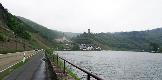
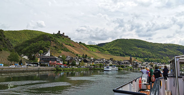
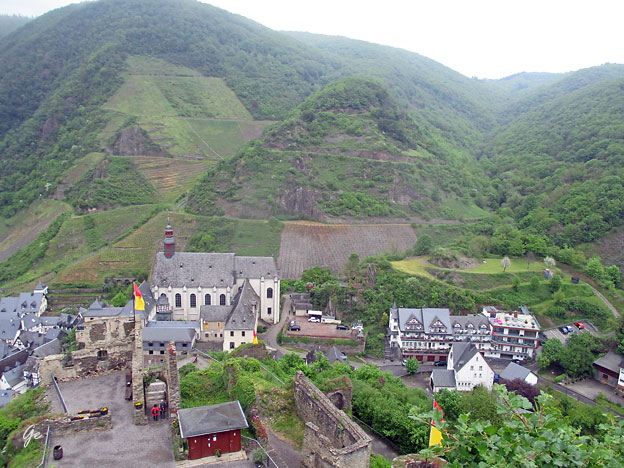
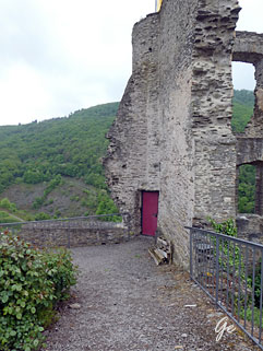
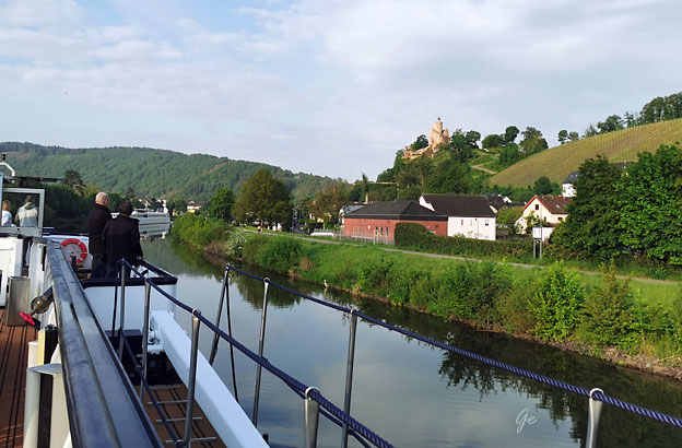
Beilstein med Burg Metternich
Det kom litt regn om morgenen, men dt var opphold da vi begynte å sykle.
Det var meldt mer regn utover dagen, men det regnet kom heldigvi ikke.
Beilstein med Burg Metternich
 |
 |
Beginning in 1268, the village was a fief held by the Lords of Braunshorn.
Under Johann von Braunshorn (1299–1346), Beilstein was granted town privileges
in 1309 by Heinrich VII and was fortified.
In 1309, a Jewish community was founded, whose graveyard up above the castle
still exists today.
Beilstein, Rhineland-Palatinate - Wikipedia
 |
 |
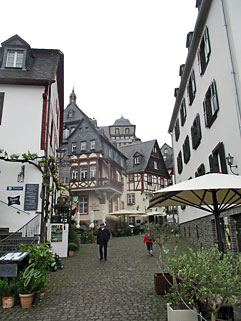
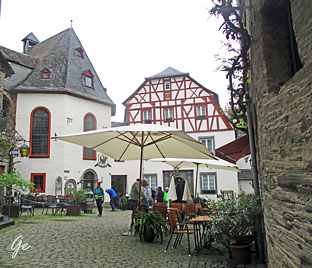
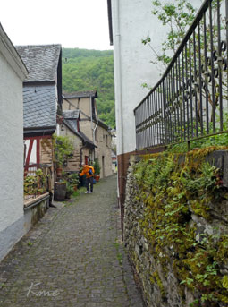
 Noen bilder fra Beilstein |
 |
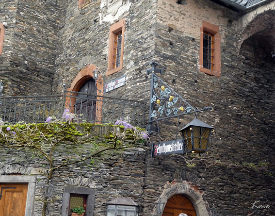
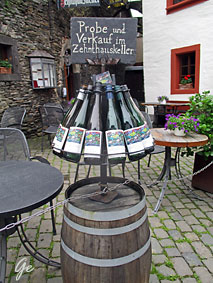
Zenthauskeller i Beilstein
 Gate i Beilstein |
 |
 |
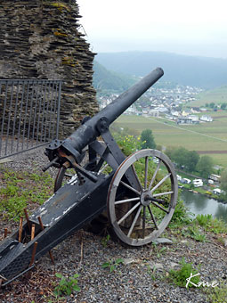
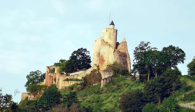
Burg
Metternich The history of the castle goes back to 1268 when the castle (referred to as Bilstein Castle) was first mentioned. It is thought the castle is even older, with some historians indicating 1129 as the year of construction. Until the first half of 17th century, the castle was owned by Counts von Nassau-Dillenburg. In 1637, the castle became the property of the House of Metternich, hence its current name, Metternich Castle. The last member of the family to own the castle was Klemens von Metternich, one of the most famous diplomats of the Austrian Empire – he was foreign minister from 1809 to 1848. In 1689, during the Nine Years' War, the castle was destroyed by French troops. Metternich Castle - Wikipedia |
Burg Metternich
 Burg Metternich |
 |
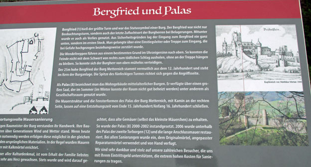
Bergfried hiess der grösste Turm und war das Statussymbol einer Burg. Der Bergfried war
nicht nur Beobachsturm, sondern auch der letzte Zufluchtort der Burgherren bei Belagerungen. Mitunder wurde er auch als Verlies genutzt. Aus Sicherheitsgründen lag der Eingagnzum Bergfried nie ganz unten, sondern im ersten Stock. Man gelangte über eine Einstiegsleiter oder Treppe zum Eingang, die bei Gefahr hochgezogen beziehungswise zerstört wurde.
Die Wendeltreppen führen aus einem bestimmten Grund im Uhrzeigersinn nach oben. So konnten die Feinde nicht mit dem Schwert von rechts zum tödlichen Schlag ausholen, ohne an der Treppe hängen zu bleiben, So konnte sich der Burgherr von oben mühelos verteidigen.
Der 25m hoe Bergried der Burg Metternich stammt vermutlich aus dem 12. Jahrhundert und steht im Kern der Burganlage. Die Spitze der fünfeckigen Turmes richtet sich gegen die Angriffsseite.
 Burg Metternich i 1646 |
 |
Keep was the name of the largest tower and was the status symbol of a castle. The keep
was not only an observation tower, but also the last refuge of the lords of the castle
during sieges. Sometimes it was also used as a dungeon.
For safety reasons, the entrance
to the keep was never at the bottom, but on the first floor. One reached the entrance via
an entrance ladder or stairs, which was pulled up or destroyed in case of danger.
The spiral staircases go up clockwise for a reason. Thus, the enemies could not strike a
fatal blow with the sword from the right without getting caught on the stairs, so the
lord of the castle could defend himself effortlessly from above.
The 25m high Bergried of Metternich Castle probably dates back to the 12th century
and stands in the core of the castle complex. The top of the pentagonal tower is
directed against the attacking side.
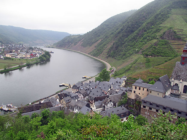
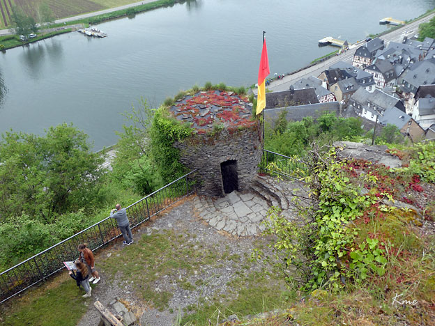
Utsikt fra Mettenich. Mosel og byene Beilstein og Ellenz-Poltersdorf (til venstre)
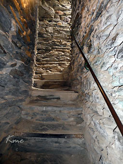 Trappene begynner i 2. etasje |
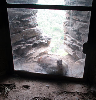 Fuglerede utenfor vinduet i tårnet. |
 Fra Beilstein går det ferge over Mosel. |
 MS Olympia passerer Beilstein. |
Beilstein sett fra Burg Metternich
 |
 |
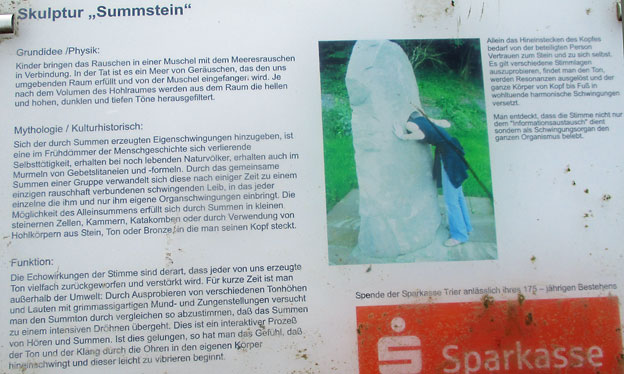
 |
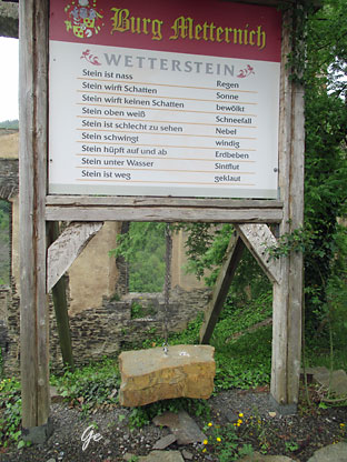
Wetterstein Stein ist nass - Regen Stein wirft Schatten- Sonne Stein wirft keinen Schatten- bewölkt Stein oben weiss- Schneefall Stein ist schlecht zu sehen- Nebel Stein schwingt - windig Stein hüpft auf und ab-Erdbeben Stein unter Wasser - Sintflut Stein ist weg - Geklaut |
 |
 |
Matpakkerast i Nehren
 |
 |
||
|
 |
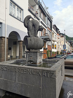
Brunnen ein würdiges Denkmal aus Eifel-Basalt gesetzt. "He steiht ferm wie'n Zeller us'm
Hamm" - "Hier steht fest ein Zeller aus dem Hamm", lautet die Inschrift am Brunnen.
1532 konnten die Trierer mit Unterstützung einer Hundertschaft aus Zell den Ansturm
des Franz von Sickingen erfolgreich abwehren.
"Zeller Schwarze Katz"-Brunnen (Zell (Mosel)) - All You Need to Know BEFORE You Go (tripadvisor.com)
 |
 |
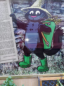
one of the largest wine-growing communities on the Mosel. The most famous vineyard
is the "Zeller Schwarze Katz" (black cat). The wines that come from it are known
worldwide because of their unique quality and wholesomeness. The secret of the
"Zeller Schwarze Katz" begins in 1863, when wine merchants were out and about in
Zell. After an extensive wine tasting at the winery, three barrels were on the shortlist.
But they couldn't quite agree on which was the best.
Suddenly the cat jumped onto one of the barrels, made a hunchback and hissed at
anyone who tried to approach the barrel. The merchants quickly agreed and decided
that the black cat was so persistently guarding on the wine barrel. A short time later,
the same merchants came back to Zell and bought all the wines from the same vineyard
as the one in the barrel so fiercely defended by the cat because this wine had sold like
hot cakes. The vineyard in which this wine was grown was eventually named
"Zeller Schwarze Katz".
Zeller Black Cat (zellerland.de)
 |
 |
Zell (Mosel) is a town in the Cochem-Zell district in Rhineland-Palatinate, Germany. Zell has
roughly 4,300 inhabitants and is the seat of the like-named Verbandsgemeinde.
Zell was founded by the Romans sometime later than AD 70. The outlying centre of Kaimt
had its first documentary mention in 732 or 733. In 1222, Zell was granted town rights.
Beginning in 1332, it was an Electoral-Trier town and until 1794 the seat of an Electoral-Trier Oberamt. With the occupation of the Rhine’s left bank by French Revolutionary troops
in 1794, the town became French. In 1814 Zell was assigned to the Kingdom of Prussia at the
Congress of Vienna. Fires in 1848 and 1857 destroyed a great deal of the Old Town. Since 1946,
the town has been part of the then newly founded state of Rhineland-Palatinate. In 1950 came
the amalgamation of Kaimt. Until 1969, Zell was the district seat of the now abolished district
of the same name.
Zell (Mosel) - Wikipedia
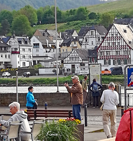
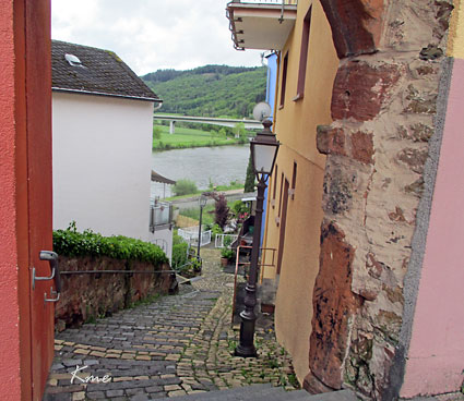
Etter middagen tok vi en tur i byen.
Zell
 |
Det
var så fint at båten vår ble liggende etter at vi var ferdig med sykkelturen. Da hadde vi mulighet for å ta en kveldstur i byen. |
Utsikt fra Zell mot Kaint på den andre siden av elva.
Program for dagen
DAG 4 Zell – Bernkastel-Kues
Dagens etappe tar oss til to av de mest sjarmerende byene langs Mosel.
Vi starter i Zell og sykler første etappe til Traben-Trarbach. Dette er en
liten vinby og en av Tysklands mange dobbeltbyer som opprinnelig besto
av to byer, beliggende på
hver sin side av elven. Etter bybrannen i Trarbach i 1858 og i Traben i
1879, ble begge byene gjenoppbygd i jugendstil. I 1898 ble Trarbach og
Traben slått sammen og forbundet med bro over Mosel. Traben-Trarbach
ligger i delstaten Rheinland-Pfalz, og selv med omkringliggende områder
er dagens innbyggertall bare litt over seks tusen.
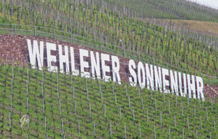
Videre går turen til romantiske Bernkastel-Kues, nok en dobbeltby.
Bernkastel–Kues er en liten by med bare 7500 innbyggere, som opprinnelig
besto av de to byene Bernkastel og Kues på hver sin side av elven.
Bydelene har vært forbundet med bro over Mosel siden 1905.
Den historiske bykjernen er svært sjarmerende, med bygninger som kan
dateres tilbake til senmiddelalderen. Rundt den gamle markedsplassen er
det mange bindingsverkshus, fortauskafeer og butikker. Høyt hevet over
byen ligger ruinene av Landshut-borgen fra 600-tallet. Borgruinen kan
besøkes enten til fots eller med en liten buss som går fra sentrum
av byen. Skipet ligger til kai i byen over natten og det er god tid til å bli
bedre kjent med denne sjarmerende byen.
Dag 4 Zell – Traben-Trarbach – Bernkastel-Kues ca 43 km
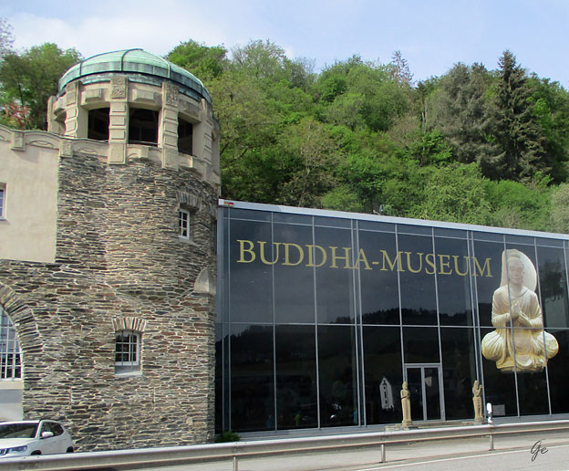
Buddha-museum i Traben-Trarbach
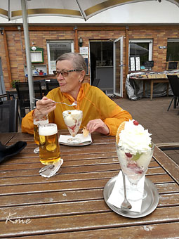 |
En
stor porsjon is i på Cafe & Bistro Kaffeemühle i Ûrtzig-Mühle |
 |
 |
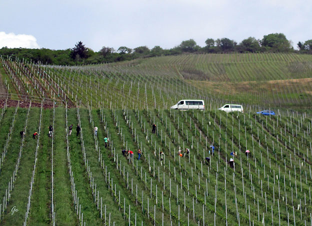
Arbeidere skal sørge for god vinhøst
 Oversettelse til engelsk lenger nede på siden. |
 |
Båten var ikke kommet enda, så vi parkerte syklene og gikk en tur i byen.
 |
 |
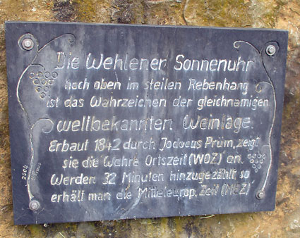
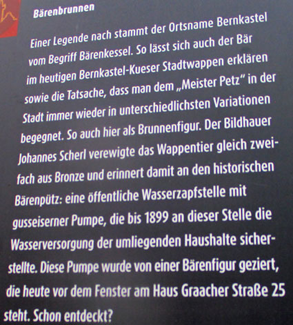
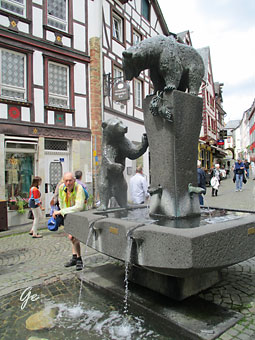
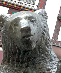
According to legend, the place name Bernkastel comes from the term Bärenkessel. This
also explains the bear in today's Bernkastel-Kue's coat of arms, as well as the fact that
"Master Petz" can be encountered again and again in the city in a variety of variations.
This is also the case here as a fountain figure.
The sculptor Johannes Scherl immortalized this heraldic animal in bronze and thus
reminiscent of the historic Bärenpütz: a public water tap with a cast iron pump, which
until 1899 was used for water supply by the surrounding households.
This pump was adorned with a bear figure, which today stands in front of the window
of the house inGraacher Strasse 25. Already discovered?
Poster machine translation
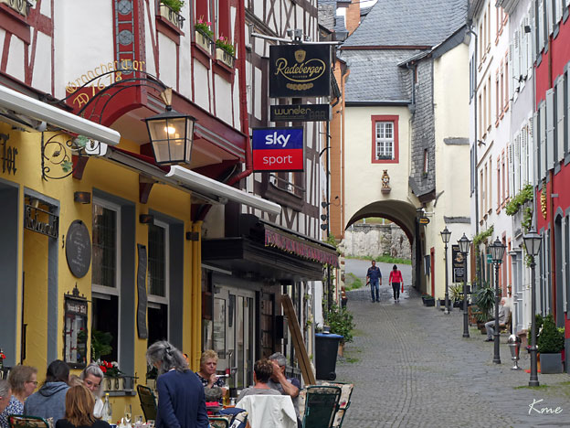
Gate i Bernkastel-Kues
Bernkastel-Kues
The earliest evidence of human habitation (3000 BC) was discovered by archaeologists
in Kues. About AD 370, Decimus Magnus Ausonius, the Roman poet and teacher at the
Imperial court, wrote his poem Mosella. Adalbero von Luxemburg (d. 1036 or 1037),
Provost of the Trier Monastery of St. Paulin, became Lord of Bernkastel in the early
11th century.
In the first half of the 11th century, Bernkastel had its first documentary mention.
At the turn of the 8th century, a geographer described a place called Princastellum.
This is said to be evidence of a Roman castellum in the 4th century near today's Landshut
castle ruin. Pointing to this are, among other things, fittings and finds of ceramic and iron
underneath the castle.
The 12th-century form of the name, Beronis castellum, was a learned re-Latinization,
which was related to Adalbero von Luxemburg. Work was begun on the third castle
building under the lordship of Archbishop of Trier Heinrich II of Finstingen.
On 29 May 1291, King Rudolph I of Germany granted Berrincastel town rights.
The castle, Burg Landshut, which was built at that time, was given this name only in
the 16th century.
In 1401, Nikolaus von Kues, also known by his Latinized name Nicolaus Cusanus, was
born in Moselle shipowner Henne Cryfftz's house, which is well preserved and can be
visited. In 1451, the St.-Nikolaus-Hospital, a hospital for the poor, was built.
The town in its current form came into being on 1 April 1905 through the merger of the
town of Bernkastel with the winemaking village of Kues across the river. In 1926 there
arose great unrest among winemakers along the Moselle, and the financial office in
Bernkastel and the customs office in Kues were stormed.
Bernkastel-Kues - Wikipedia
Program for dagen
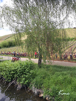
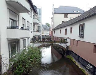
DAG 5 Bernkastel-Kues – Mehring
Fra programmet for dagen:
Sykkelruten i dag tar oss gjennom Piesport, som er det eldste
vindyrkningsområdet i Tyskland – kjent for sine søte og fruktige Riesling-viner.
Historien her går helt tilbake til romertiden, og den største romerske vinpressen
nord for Alpene ble utgravd i området for noen år tilbake.
Den er i dag delvis restaurert. Videre kommer vi til Neumagen-Dhron som er den
eldste vinbyen i Tyskland før vi ender i Mehring, hvor skipet ligger ved kai til
neste dag.
Dag 5 Bernkastel-Kues – Piesport – Neumagen-Dhron – Mehring ca 47 km
 |
 Piesport |
 |
I
Piesport var det noen fra cruiset som skulle på vinsmaking. Vi skulle ikke det, men tok likevel en liten stopp i byen |
Piesport
 |
Former
Klausenhof In the Trier Electorate, which came to an end after the French revolution, it was the clergy that determined the economic development and architecture. In Piesport this important influence is also reflected in many wineries and farms. They characterised the village during this period. The largest building complex was the former farm of the Augustine Monastery in Klausen which was called the "Klausener Gehäus" It dates back to the year 1613. There is a curved gable facade on the oldest part of the building. Above the round-arch gate there are rectangular windows that are symmetrically divided by columns. |
The historical wine cellars are an indication that the wine was probably the monasterys main source of income. The earnings that were generated went to the monastery community, the
tenants and the administrator and helped the monastery remain selfsufficient.
At the end of the 18th century, a front building with a high mansard roof was used as the
residential qaurters. In the portal constructions there is a stone pieta dating back to 1530.
During the Napoleonic period, Josef Hein from Trier bought the Klausenhof at auction for
30.000 francs. The front residential building with the initials JH and the year date 1806 on the portal was transferred to the town in 1830. It was used as the village school until 1970.
Today the building is used as a community centre with festival hall.
The press house and the cellars came into the possession of the Count of Kesselstatt in the
middle of the 19th century and were then transferred to the town of Piesport in 1985.
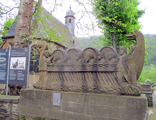
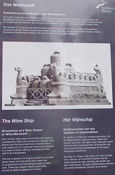
Das Weinschiff
Grabdenkmal eines Winzers oder Weinhändlers
Es wurde insgesamt wurden vier Schiffe gefunden, welche als Gegenstücke gearbeitet
waren. Neben vier Weinfässern aus Holz, welches jedes Schiff mitführt, wurde das
Denkmal durch einen Grabaufsatz aus 14 Kugellamphoren bekrönt, die mit einem
Strohgeflecht bruch- und transportsicher verpackt sin.
Der beinahe 3 m lange Rumpf läuft in einem spitzen Oberwassersporn aus, dessen
Schnabelform zusammen mit den beiden Unheil abwehrenden Augen dem Bug das
Aussehen eines Kopfes verleiht.
Die beiden Drachenköpfe dienten wohl der Abwehr Unheil bringender Mächte.
 |
 |
| The Wine Ship Gravestone of a Wine Grover or Wine Merchant All in all four ships were found that were made as counterparts. Each ship carried four wooden wine barrels and the monument was crowned with a curb made out of 14 globular amphoras wrapped in a mesh of straw making it shatterproof and safe to be transported. The hull is almost 3 m long and ends in a pointed above water ram that looks like a head due to its beak form and the atropaic eyes on each side. Thees two dragon heads presumably served as defence against evel forces. |
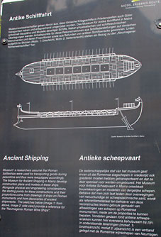
Ancient Shipping Museums researchers assume that Roman battleships were used for transporting goods during peacetime and thus were reequipped accordingly. The Museum for Ancient Shipping in Mainz develop construction plans and models of these ships. Alongside physical and engeneering considerations, the starting points for these constructions and their proportions come from drawings of ships on Roman monuments and from discoveries of ancien shipwrecks. The sketches below (image 1: from above, image 2:side view) provide a reference for the "Neumagener Roman Ships", |
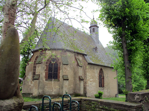
St. Peterskapellet i Neumagen-Dhron
The St. Peterskapelle is located in Neumagen-Dhron on the Moselle.
For thousands of years, viticulture has shaped both the cultural landscape of the Moselle
and the art of living of the people who live in this beautiful region. Get to know this in
probably the oldest wine village in Germany, in Neumagen-Dhron.
Neumagen-Dhron, as the site of the famous Roman wine ship and many other relief and
inscription stones from the 2nd-4th century AD, is considered the "oldest wine village in
Germany". A Roman fortification, a castle, was located there as an example of the last great
heyday of the Roman Empire on the Moselle, which began with Emperor Constantine.
Today, many finds from Neumagen-Dhron can be found in the Rheinisches Landesmuseum
in Trier. Dhron was also settled in Roman times. A walk through the tranquil winegrowing
village with its beautiful wine yards and old mills is worthwhile. An extraordinary listening
experience awaits the visitors - along the archaeological trail, on the site of the late ancient
Roman fort, exciting stories and anecdotes come to life with the new Lauschtour app. Also recommended is a hike through the romantic valley of the Dhron to Papiermühle, where the
Moselle becomes a Hunsrück landscape. The biggest attraction of Neumagen-Dhron is
certainly the "Stella Noviomagi", which is located below the marina in its own harbour basin.
The "Stella" is a roadworthy replica of the famous Neumagen wine ship.
St. Peterskapelle - St Peter's Chapel (visitmosel.de)
 |
 |
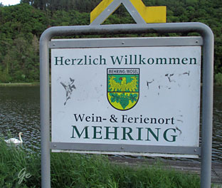
MS Olympia i Mehring
Mehring (Mosel) is a German municipality in the southwest of the federal state
of Rhineland-Palatinate. It is located in the district of Trier-Saarburg, around
14 km east of the district city Trier. There are about 2.400 inhabitants living in
Mehring (Mosel).
Mehring (Mosel) - Travel Guide 2023 | travelguide
Programmet for dagen:
DAG 6 Mehring – Trier
Reisens korteste sykkeletappe gjøres unna i dag gjennom vinområdet Pfalzel
på vei til Trier. Trier er en av Tysklands eldste byer og ble grunnlagt av keiser
Augustus i år 16 f.Kr. Han ga byen navnet Augusta Treverorum, og gjorde den
til regionhovedstad for den galliske delen av Romerriket. Trier er kjent for sine
mange minner fra romertiden, deriblant den gamle byporten Porta Nigra,
amfiteateret og ruinene av det romerske badet
Byen er også det eldste bispesetet i Tyskland. I middelalderen var
erkebiskopen av Trier en meget betydningsfull fyrste som kontrollerte
enorme landområder. Filosofen Karl Marx, opphavsmannen til marxismen,
ble født i Trier i 1818. I forbindelse med tohundreårs jubileet for hans fødsel
ble det avduket en over fem meter høy bronsestatue av han i byen. Det blir
god tid til å benytte ettermiddagen og kvelden til å gjøre deg bedre kjent
med Trier, da skipet ligger til kai over natten.
Dag 6 Mehring – Pfalzel – Trier ca 29 km
 |
 |
 |
 |
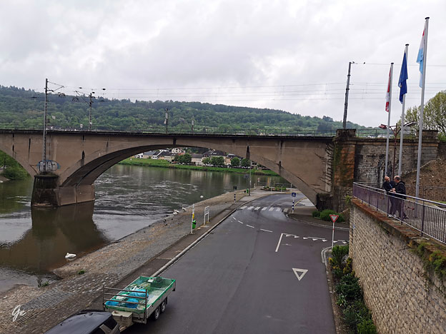
Bro ved Mehring
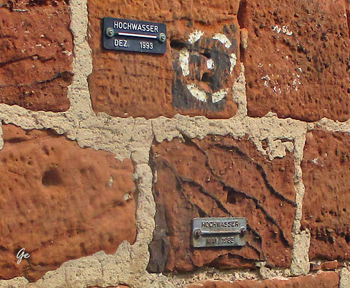 Flommerker 1993 og1983 |
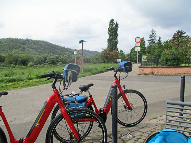
Tekst
kommer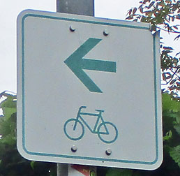 Sykkelveiskiltet vi fulgte |
 |
Die
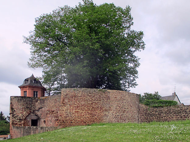
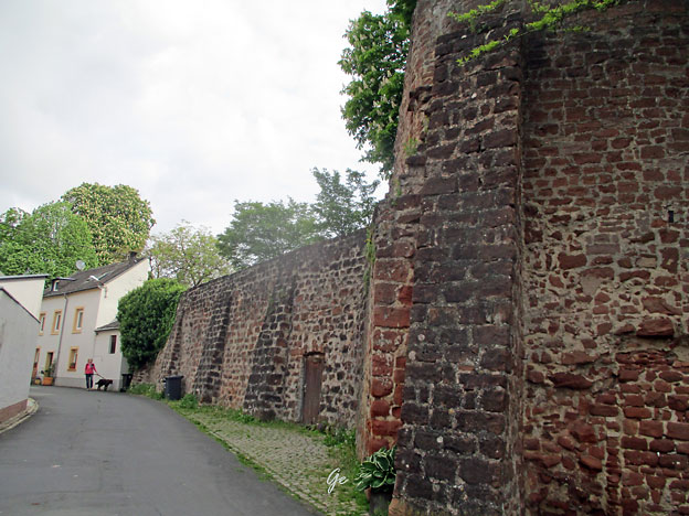
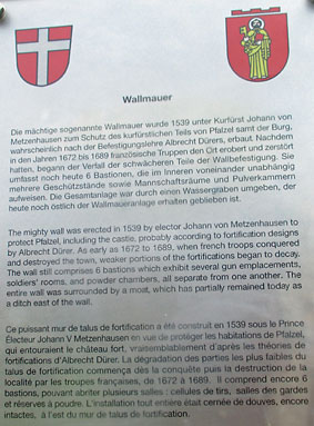
mächtige sogenannte Wallmauer wurde 1539 unter Kurfürst Johann von Metzenhausen zum Schutz des kurfüstlichen Teils von Pfalzel samt der Burg, wahrscheinlich nach der Befestigungslehre Albrecht Dürers, erbaut. Nachdem in den Jahren 1672 bis 1689 französishe Truppen den Ort erobert und zerstört hatten, begann der Verfall der schwächeren Teile der Wallbefestigung. Sie umfasst noch heute 6Bastionen, die im Inneren voneinander unabhängig mehrere Geschützstände sowie Mannschaftsräume und Pulverkammern aufweisen, Die Gesamtanlage war durch einen Wassergraben umgeben, der heute noch östlich der Wallmaueranlage erhalten geblieben ist. |
electoral part of Pfalzel including the castle, probably according to Albrecht Dürer's
fortification theory. After French troops had conquered and destroyed the place in the
years 1672 to 1689, the decay of the weaker parts of the rampart began. It still comprises
6 bastions, which have several gun emplacements as well as soldier quarters and powder
chambers inside, all separate from one another. The entire wall was surrounded by a moat,
which has partislly remained today as a ditch the east of the wall.
Trier
Founded by the Celts in the late 4th century BC as Treuorum and conquered 300 years
later by the Romans, who renamed it Augusta Treverorum ("The City of Augustus among the Treveri"), Trier is considered Germany's oldest city. It is also the oldest seat of a bishop
north of the Alps.
Trier was one of the four capitals of the Roman Empire during the Tetrarchy period in the
late 3rd and early 4th centuries. In the Middle Ages, the archbishop-elector of Trier was an important prince of the Church who controlled land from the French border to the Rhine.
The archbishop-elector of Trier also had great significance as one of the seven electors of the Holy Roman Empire. Because of its significance during the Roman and Holy Roman
empires, several monuments and cathedrals within Trier are listed as a UNESCO World
Heritage Site.
With an approximate population of 110,000, Trier is the fourth-largest city in its state, after Mainz, Ludwigshafen, and Koblenz. The nearest major cities are Luxembourg City
(50 km or 31 mi to the southwest), Saarbrücken (80 kilometres or 50 miles southeast), and Koblenz (100 km or 62 mi northeast).
The first traces of human settlement in the area of the city show evidence of linear pottery
settlements dating from the early Neolithic period. Since the last pre-Christian centuries,
members of the Celtic tribe of the Treveri settled in the area of today's Trier.
The city of Trier derives its name from the later Latin locative in Trēverīs for earlier
Augusta Treverorum. According to the Archbishops of Trier, in the Gesta Treverorum,
the founder of the city of the Trevians is Trebeta. German historian Johannes Aventinus
also credited Trebeta with building settlements at Metz, Mainz, Basel, Strasbourg,
Speyer and Worms.
The historical record describes the Roman Empire subduing the Treveri in the 1st century
BC and establishing Augusta Treverorum about 16 BC. The name distinguished it from the
empire's many other cities honoring the first Roman emperor, Augustus. The city later
became the capital of the province of Belgic Gaul; after the Diocletian Reforms, it became
the capital of the prefecture of the Gauls, overseeing much of the Western Roman Empire.
In the 4th century, Trier was one of the largest cities in the Roman Empire with a population
around 75,000 and perhaps as much as 100,000.The Porta Nigra ("Black Gate") dates from
this era. A residence of the Western Roman emperor, Roman Trier was the birthplace of Saint
Ambrose. Sometime between 395 and 418, probably in 407 the Roman administration moved
the staff of the Praetorian Prefecture from Trier to Arles. The city continued to be inhabited
but was not as prosperous as before.
Trier - Wikipedia
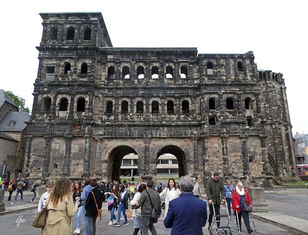
Porta Nigra
 |
 |
of two four-storeyed towers, projecting as near semicircles on the outer side. A narrow
courtyard separated the two gate openings on either side. For unknown reasons, however, the construction of the gate remained unfinished. For example, the stones at the northern (outer)
side of the gate were never abraded, and the protruding stones would have made it impossible
to install movable gates. Nonetheless, the gate was used as a town entrance for centuries until
the end of the Roman era in Trier.
Porta Nigra - Wikipedia
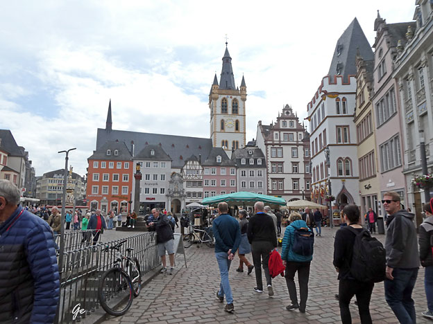
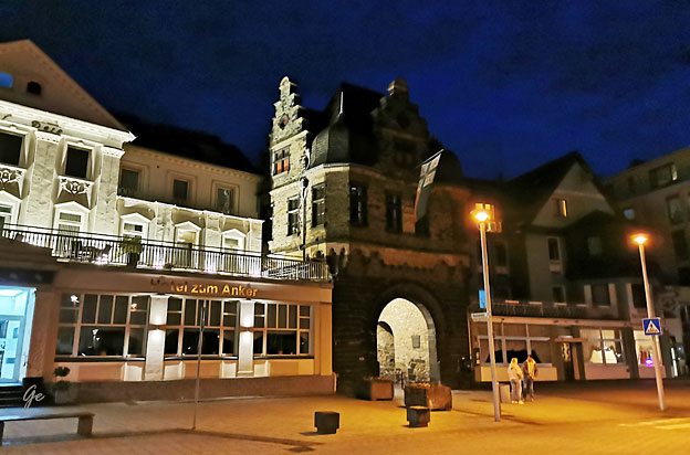
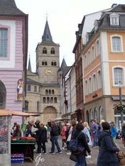
Torvet i Trier
| Trier
St Peterkirken sett fra torget |
 |
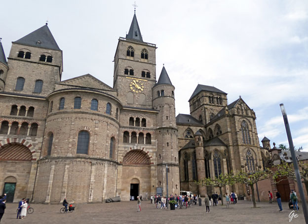
The High Cathedral of Saint Peter
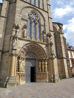 |
The High Cathedral of
Saint Peter in Trier (German: Hohe Domkirche St. Peter zu Trier), or Trier Cathedral (German: Trierer Dom), is a Roman Catholic cathedral in Trier, Rhineland-Palatinate, Germany. It is the oldest church in Germany and the largest religious structure in Trier, notable for its long life span and grand design. The central part of the nave was built of Roman brick in the early fourth century, resulting in a cathedral that was added onto gradually in different eras. The imposing Romanesque westwork, with four towers and an additional apse, has been copied repeatedly. The Trier Cathedral Treasury contains an important collection of Christian art. In 1986 the church was listed as a UNESCO World Heritage Site, as part of the Roman Monuments, Cathedral of St. Peter and Church of Our Lady in Trier. Trier Cathedral - Wikipedia |
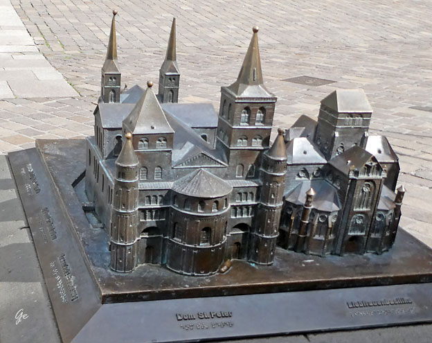
Modell:The High Cathedral of Saint Peter
 |
 |
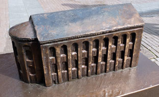 |
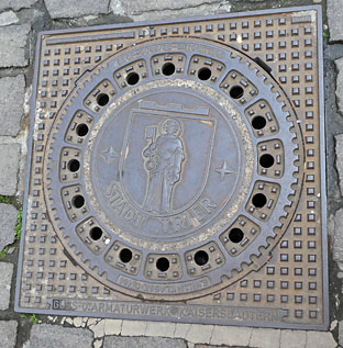
 The Aula Palatina, also called Basilica of Constantine (German: Konstantinbasilika), at Trier, Germany, is a Roman palace basilica and an early Christian structure built between AD 300 and AD 310 during the reigns of Constantius Chlorus and Constantine the Great. Aula Palatina - Wikipedia |
Trier und standen in Personalunion (bis 1797) als Erzbischöfe dem Erzbistum Trier
vor.
Der Renaissance- und Rokokobau war teilweise auf der Grundfläche der römischen Konstantinbasilika gebaut worden. Im 19. Jahrhundert wurde deswegen der Westflügel des Palais niedergelegt, um auf seinem Grund die Basilika wieder zu errichten.
Nach der Enteignung der Kurfürsten unter Napoleon wurde das Kurfürstliche Palais im
19. und am Anfang des 20. Jahrhunderts von französischen und preußischen Truppen als Kaserne genutzt. Im Zweiten Weltkrieg wurde das Gebäude schwer
beschädigt. Anschließend wurden die Wirtschaftsgebäude, das sogenannte
Niederschloss, mit Ausnahme des Roten Turms und eines Portals vollständig abgerissen.
Heute beherbergt der Bau verschiedene Behörden. Teile des Nordflügels werden von der evangelischen Gemeinde genutzt, Teile des Südflügels dienen repräsentativen Zwecken.
Der Palastgarten im Süden des Palais steht seit Beginn des 20. Jahrhunderts der
Öffentlichkeit als Park zur Verfügung.
Kurfürstliches Palais – Wikipedia
of the Prince-Bishops of Trier (until 1794). They ruled the electorate as electors
Trier and stood in personal union (until 1797) as archbishops of the Archdiocese of Trier
before.
The Renaissance and Rococo buildings were partly built on the site of the Roman Basilica of Constantine. In the 19th century, the west wing of the palace was demolished in order to
rebuild the basilica on its grounds.
After the expropriation of the Electors under Napoleon, the Electoral Palace was rebuilt in
the 19th and at the beginning of the 20th century used by French and Prussian troops as
barracks.
During World War II, the building became heavy damaged. Subsequently, the farm
buildings, the so-called Lower castle, with the exception of the Red Tower and a portal
completely demolished.
Today, the building houses various authorities. Parts of the north wing are used by the
Protestant community, parts of the south wing serve representative purposes.
Since the beginning of the 20th century, the palace garden in the south of the palace has
been the Available to the public as a park.
Kurfürstliches Palais – Wikipedia (maskinoversatt)
 |
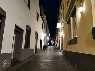
I
Trier var vi på en guida tur. Guiden fortalte masse om byens historie. |
Dagens program
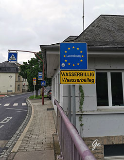
DAG 7 Trier – Wasserbillig (Luxemburg) – Saarburg
I dag seiler skipet først på Mosel før det tar inn på sideelven Saar. Tidligere var
Saar en viktig transportåre for industrien i Saarland, som i hovedsak dreide seg
om kull, jern og stål.
Råmateriale og ferdige produkter ble fraktet med skip på Saar, via Mosel og Rhinen,
til den store havnen i Rotterdam. Dagens sykkeletappe går først langs Mosel til
Wasserbillig, som ligger i Luxembourg. Videre sykler vi til Saarburg, også kjent som
«lille Venezia».
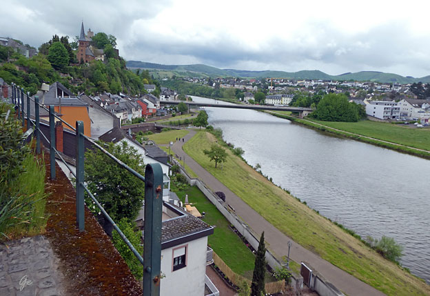
Saarburg er en liten by med rundt åtte tusen innbyggere, som ligger i hjertet av
vinområdet i Saardalen. Leuk, en liten sideelv av Saar, renner tvers gjennom byen
og i sentrum stuper Wasserfall Saarburg (Saarburgfossen) 20 meter ned mellom
husene, som er bygget tett på fossen. Ovenfor byen ligger slottet Saarburg,
grunnlagt av grev Siegfried av Luxembourg for over tusen
år siden. Borgen tilhørte kurfyrstene av Trier fra 1064 og var deres
favorittresidens på 1300-tallet.
Dag 7 Trier – Wasserbillig (Luxembourg) – Saarburg ca 38 km
 Luxembourg Tyskland Wasserbillig (Luxembourgish: Waasserbëlleg is a town in the commune of Mertert, in eastern Luxembourg. As of 2005, Wasserbillig has 2,186 inhabitants, which makes it the largest town in Mertert. |
 |
Around 100 AD, there was already a town where Wasserbillig is situated which the
Roman named Biliacum. This is also where the second part of Wasserbillig's name
comes from (-billig from Biliacum). It was mainly a transloading harbour for goods
coming down the Sauer or by cart. During the construction of the bridge over the
Sauer in 1952, remnants of an old Roman bridge were found
Wasserbillig - Wikipedia
Elva Sure kommer fra Vaux-sur-Sûre i Ardennene i sørøstre Belgium
Mosel. Brua går mellom Wasserbillig i Luxembourg og Oberbillig i Tyskland
 |
Fra
Wasserbillig tok vi ferge over tilOberbillig i Tyskland. Ved fergekaia sto disse fine skulpturene. |
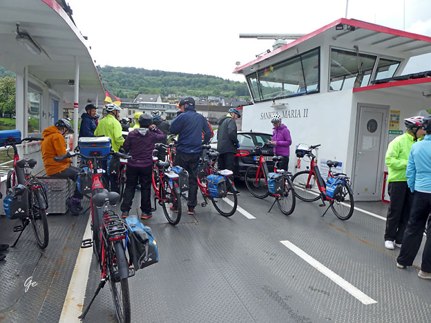
The Sankta Maria II ferry is the first fully electric operated car ferry for inland waters
in the world. She sails between Wasserbillig and Oberbillig and replaces the previous
Sankta Maria ferry. This saves around 14,000 litres of diesel fuel per year.
The power required for this transmission comes from the drive batteries, which are
recharged overnight with shore power (approx. 6 hours charging time). The battery
capacity is designed for 13 hours of ferry operation plus a further 13 hours as a safety
backup.
MOSEL FERRY SANKTA MARIA 2 - Ostseestaal GmbH & Co. KG - Best in 3D
MS Olympia på Saar
The Saar is a river in northeastern France and western Germany, and a right tributary
of the Moselle. It rises in the Vosges mountains on the border of Alsace and Lorraine
and flows northwards into the Moselle near Trier.
It has two headstreams (the Sarre Rouge and Sarre Blanche, which join in Lorquin), that
both start near Mont Donon, the highest peak of the northern Vosges. After 246 kilometres
(153 mi) (129 kilometres; 80 miles in France and on the French-German border, and
117 kilometres; 73 miles in Germany) the Saar flows into the Moselle at Konz
(Rhineland-Palatinate) between Trier and the Luxembourg border. It has a catchment area
of 7,431 square kilometres (2,869 sq mi).
Saar (river) - Wikipedia
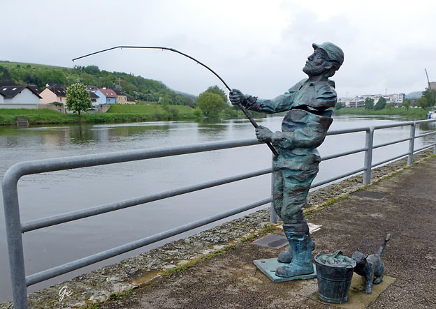
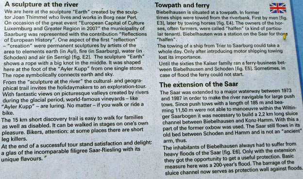
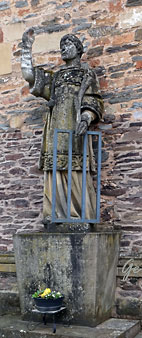
A sculpture at the river.
We are here at the sculpture "Earth" created by the sculptor Joan Thimmel who lives
and works in Borg near Perl. On Occasion of the great event "European Capital of
Culture Luxemburg and Greater Region in 2007" the minicipality of Saarburg was represented with the contribution "Reflections of European History".
One aspect of the first "reflection" - "creation" were permanent sculptures by artists
of the area to elements earth (in Ayl), fire (in Saarburg), water (inSchoden) and air
(in Serrig).
The sculpture "Earth" shows a rope with a big knot in the middle. It was shaped
here at the foot of the "Ayler Kupp" from one single stone.
The rope symbolically connects earth and sky.
 |

Syklene parkeres. Saarburg er best til fots
 |
Saarburg
is a city of
the Trier-Saarburg district, in the
state
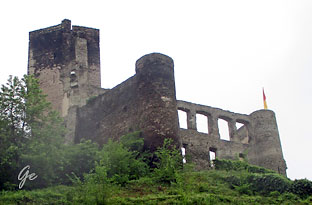
of Rhineland-Palatinate, Germany, on the banks of the river Saar in the hilly country a few kilometers upstream from the Saar's junction with the Moselle. Now known as a tourist attraction, the river Leuk flows into the town center and makes a spectacular drop of some 60 feet before joining the larger Saar that bisects the town. The waterfall is the result of a 13th-century project to redirect the Leuk through the city center. |
The history of the city begins with the construction of the now-ruined castle by Graf Siegfried of Luxembourg in 964. It received its town charter in 1291. The city has a bell foundry, the Glockengießerei Mabilion, which has been in operation since the 1770s, and as of 2003 the only
one in Germany that produces bronze bells.
Saarburg - Wikipedia
Fossen og mølla
Elva Leuk renner gjennom byen.
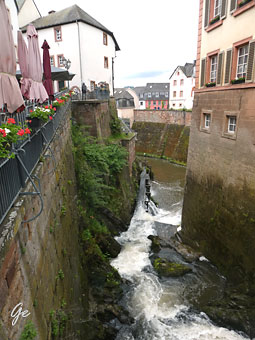 |
Fossen
midt i byen. |
 Elva Leuk ovenfor fossen |
 |
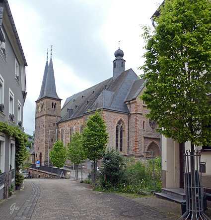 |
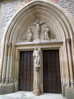
St
Laurents Parish Church stands onthe site of a 13th- century, Chapel of the holy Cross, which was under the authority of the mother church of the district, St Lambert, situated about 2 km to the north. By 1368 this chapel had already been named St Laurents church. A few years later it was accorded the status of a parish church, after the Archbishop of Trier, Kuno von Falkenstein, granted the church the right to perform baptisms in 1730. The reason for this was the big distance which lay between chapel and mother church, as well as the growing number of |
 |
 |
 |
In
1426 the citizens of Saarburg instituted and funded the early mass on a regular basis, and a parish priest was installed. in 1563 a second tower was erected at the south side of the west tower. In 1695 the extended church (which by then hadtwo wings and three naves) was officially dedicated by the Auxiliary Bishop of Trier, Johannes Petrus Verhorst. The crypt of the Barons von Warsberg was constructed under The High Altar. In 1803 Saarburg became a parish of the district and St Laurents Church was declared a parish church in its own right. 1854/55 a neo-gothic edifice was built in a north-sout direction; only the old twin steeples were integrated in this new part. The window in choir were donated by King Willian IV. Half the church was destroyd by bombs during an air raid on the bridge over the Saar on 23. December 1944. The woodn beam ceiling and the dolumns you see today were reconstructed from 1946 to 1949. |
 |
Mange
cafeer langs elva. |
Vi sier farvel til Saarburg sentrum
og sykler tilbake til MS Olympia.
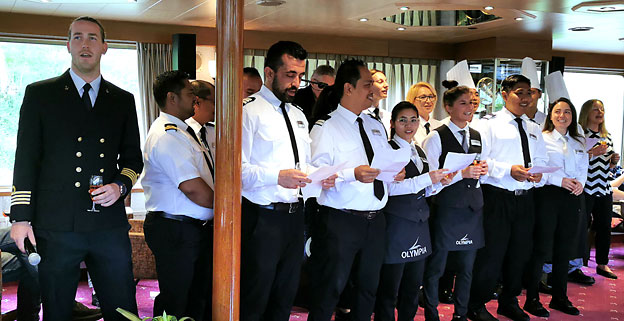
Korsang av mannskapet under avskjeds-cocktailen.
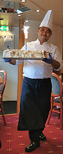 |
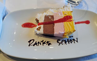 Iskake med lys til dessert. |
Saarburg fra båten
Lørdag 13. mai 2023
Fra programmet:
DAG 8 Saarburg – Oslo
Et opplevelsesrikt sykkelcruise er over og etter frokost sjekker vi ut av skipet.
Vi reiser med buss til Lufthavnen i Frankfurt og flyr direkte tilbake til Norge
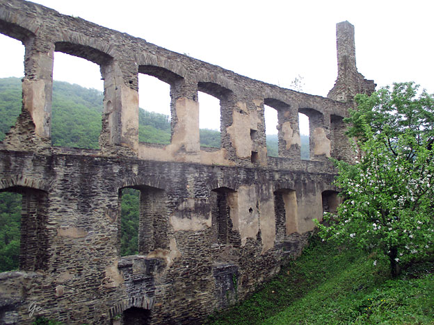
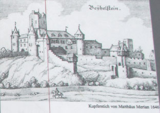
The castle, which was probably built in the 10th century, was first mentioned in a
document in 964. In that year it was given by the Archbishopric of Trier as a fief to Count Siegfried of Luxembourg. After the death of Siegfried's son Adelbero in 1046,
the castle reverted to the Archbishopric of Trier.
Saarburg (castle) - Wikipedia
 |
 Freiheitslinde |
Bussen har kommet.
Cruiset er over
 |
 En kort stopp langs veien |