Søndag 20.
mai 2018
Med Norwegian
til Bergen
og overnatting på Comfort
Hotel Bergen Airport
|
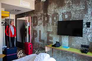
Rommet vårt i Bergen
|
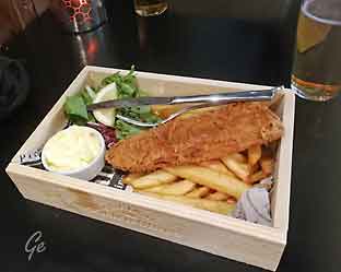
Middagen:
fish and chips
|
|
Mandag 21. mai 2018
Bergen - Færøyene med Atlantic
Airways
Vi fikk nøkkelen til leiebilen og
kjørte til hotel
Vågar.
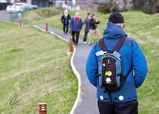
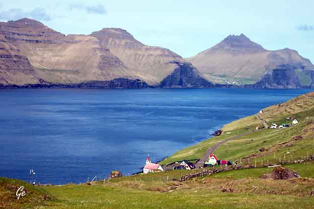
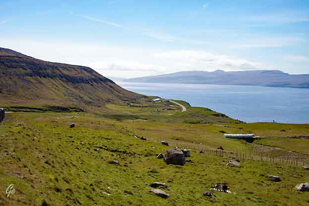
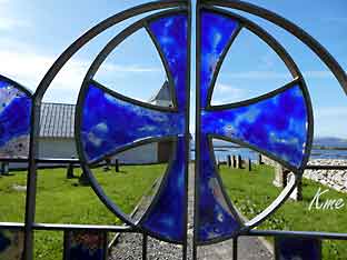
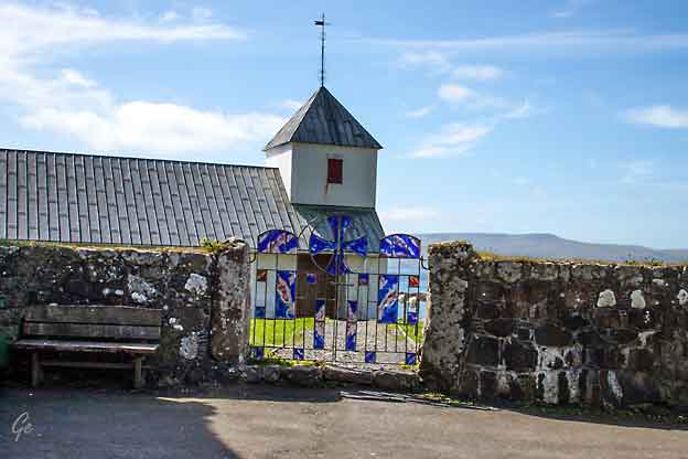
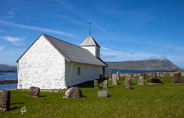
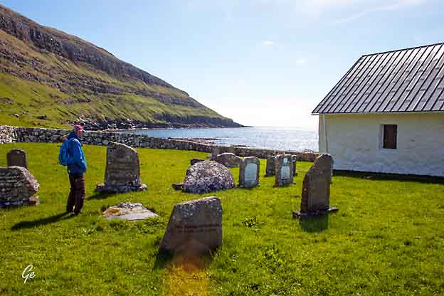
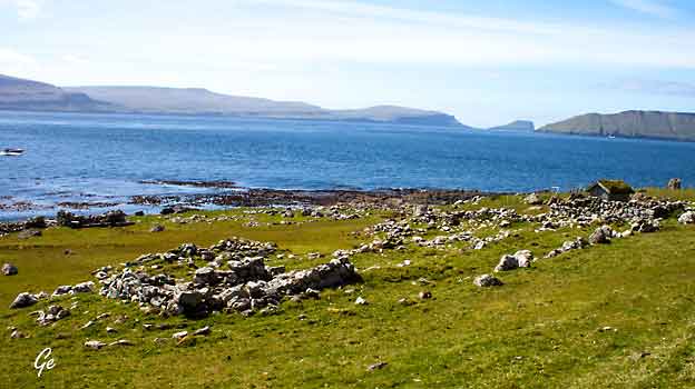
Der sjekket vi inn før vi begynte å utforske Færøyene.
|
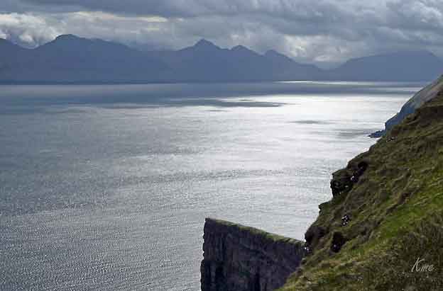
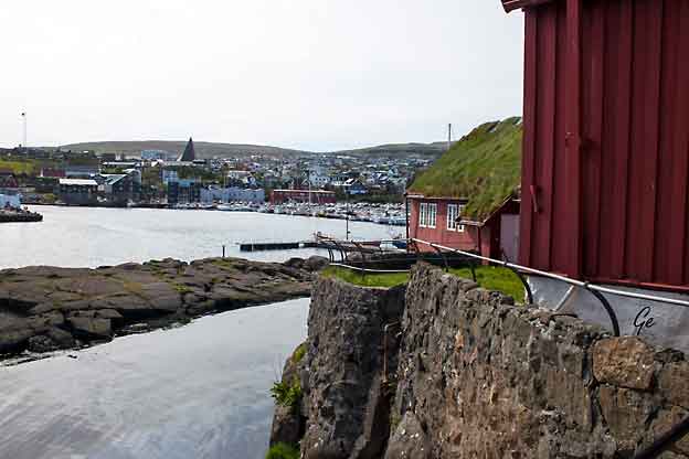
Faroe
Islands
Located in the Northeast Atlantic, the Faroe Islands
comprise 18 small islands, characterised by steep
cliffs, tall mountains, narrow fjords – and a
population of
50,000.
The Faroese language derives from Old
Norse, which was spoken by the Norsemen
who settled the islands 1200 years ago.
Through the centuries, the Faroese have defied the
harsh nature and living
conditions. Enduring today is a nation in which the
living standard is one of the
highest in the world. A highly industrial economy
mainly based on fisheries and aquaculture continues to
flourish, while a Nordic welfare model ensures
everyone
the opportunity to explore his or her own potential.
Faroese maritime expertise is widely renowned
and the Faroe Islands
export seafood to all six continents.
https://www.faroeislands.fo/
|
|
|
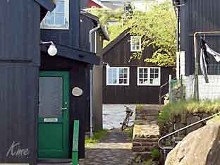
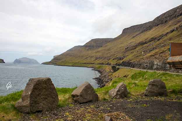
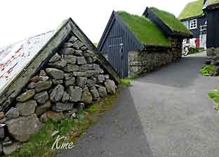
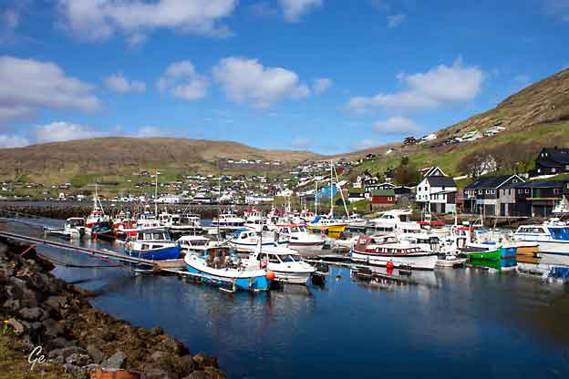
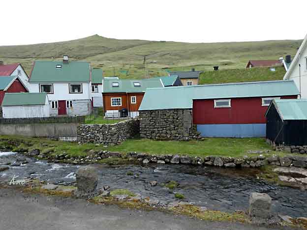
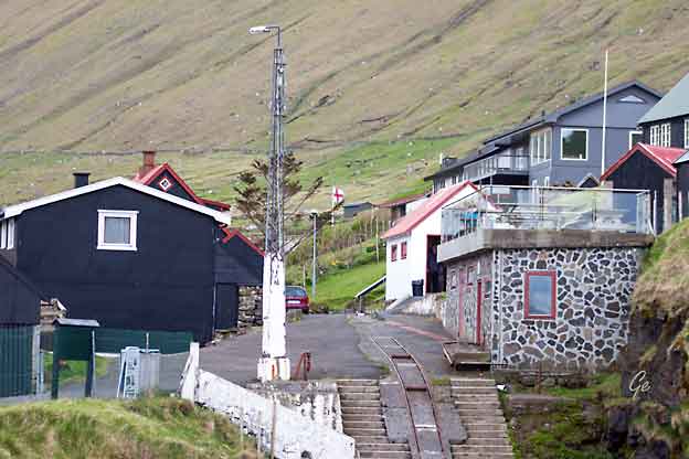
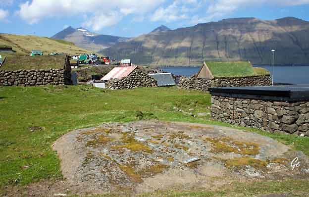
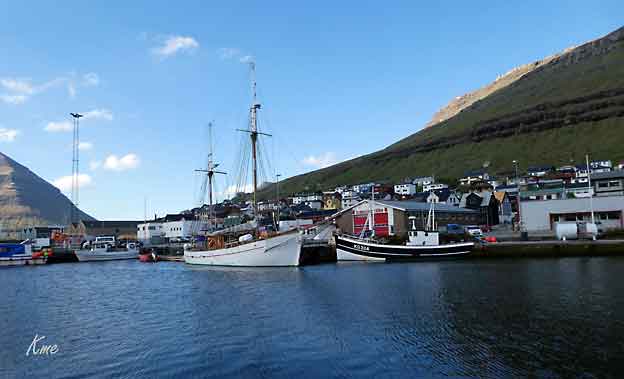
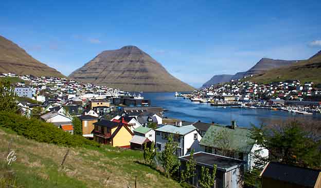
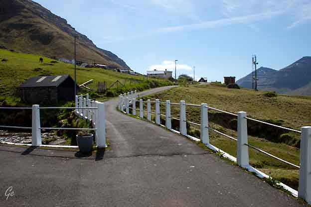
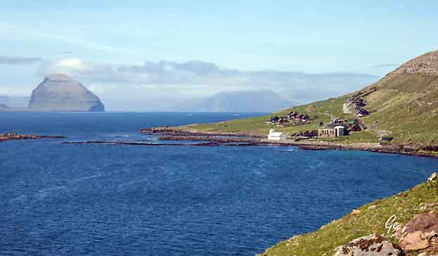
Vágar
is the first port of call for most foreigners
travelling to the Faroe Islands,
as it is home to the islands’ only airport, Vágar
Airport.
An airfield was built there during World War
II by the British, who occupied
the Faroe Islands with the islanders' consent. After
the war it lay unused for
about 20 years, but was then put back into service and
expanded/modernised
as required. It handles about 290,000 passengers a
year (2016). Such large
numbers by Faroese standards put a considerable strain
on transport facilities,
with the result that a road tunnel (Vágatunnilin)
measuring 5 km (3 mi) in
length and running under the sea now connects Vágar
with the two largest
islands in the Faroes and thus the
capital Tórshavn.
https://en.wikipedia.org/wiki/V%C3%A1gar
|
Vágar (Danish: Vågø)
is one of the 18 islands in the archipelago
of the Faroe Islands and the most westerly of
the large islands.
With a size of 178 square kilometres (69 square
miles), it ranks
number three, behind Streymoy and Eysturoy.
Vágar region also
comprises the island of Mykines.
The Vagar island shape is very distinct, since it
resembles a
dog'shead.
Sørvágsfjørður is the mouth
and Fjallavatn is the eye.
https://en.wikipedia.org/wiki/V%C3%A1gar
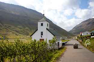
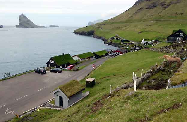
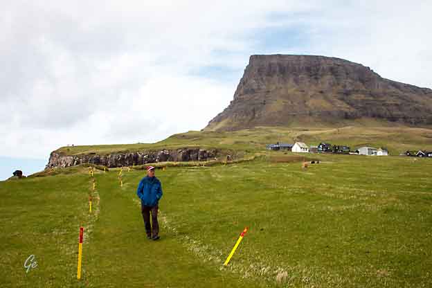
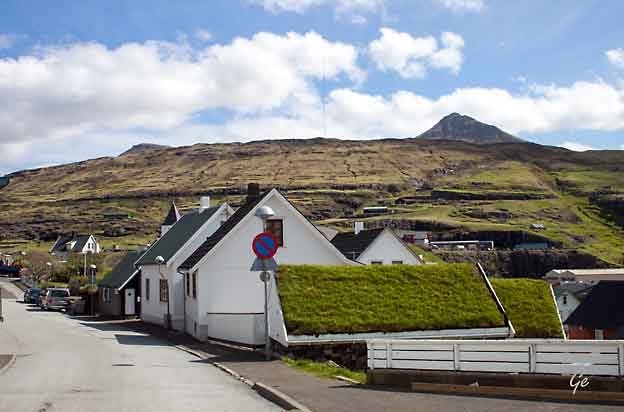
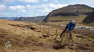
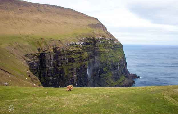
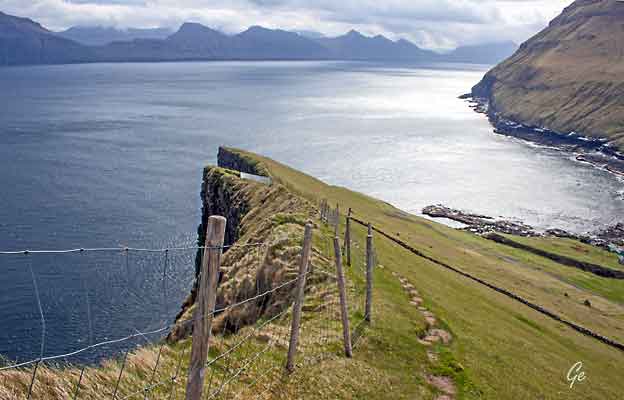
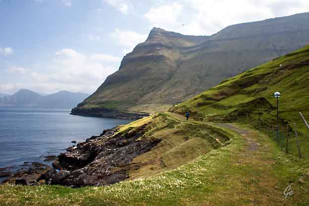
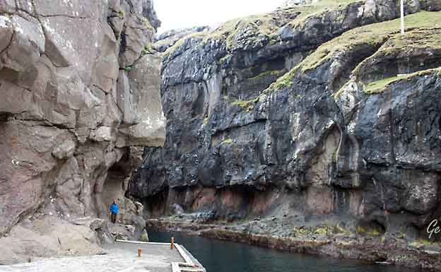
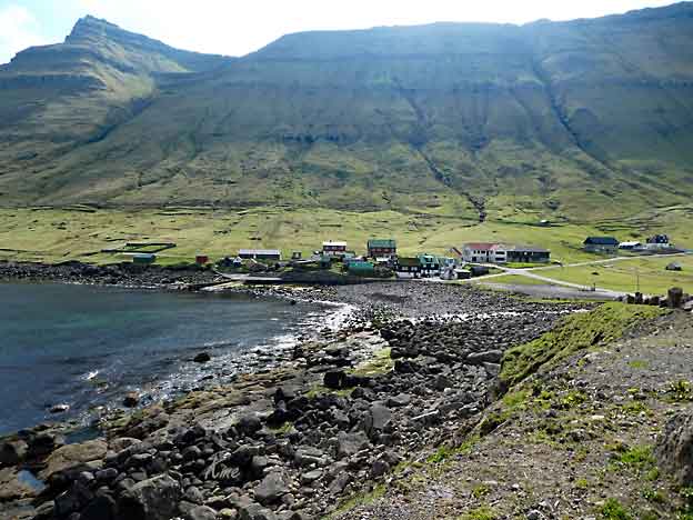
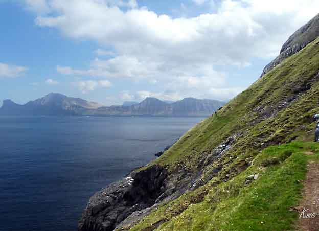
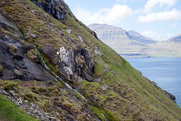
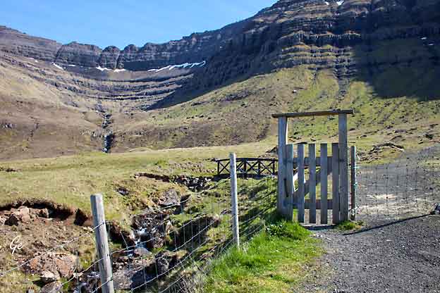
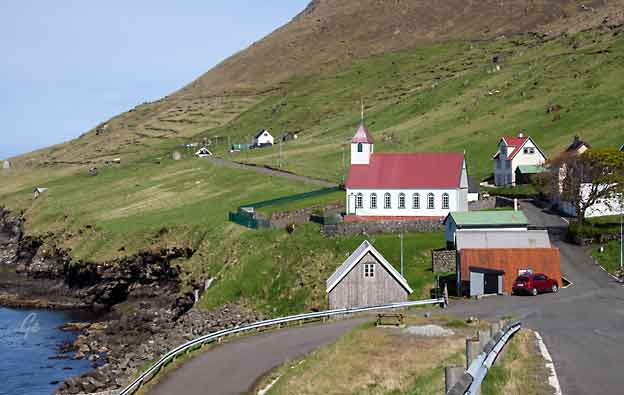
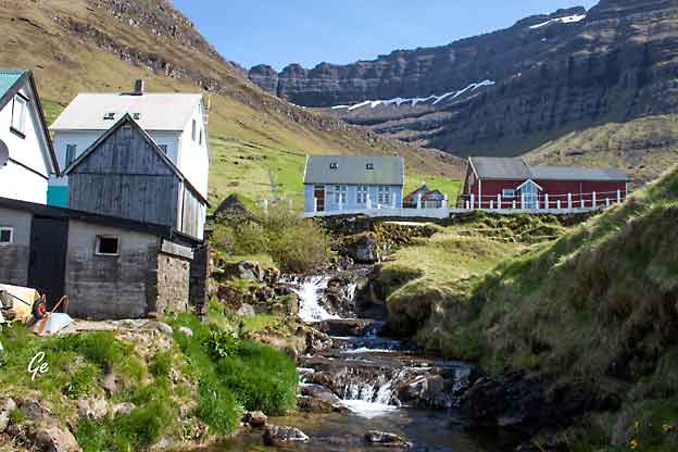
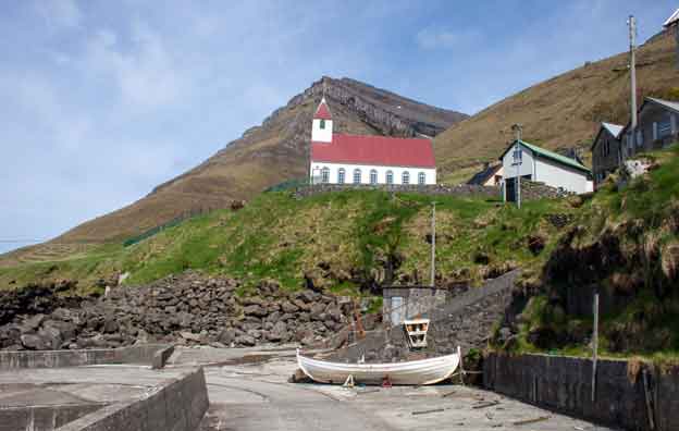
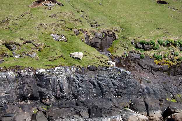
Tur til Sørvágur, Bøur og Gásadalur
|
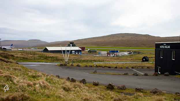
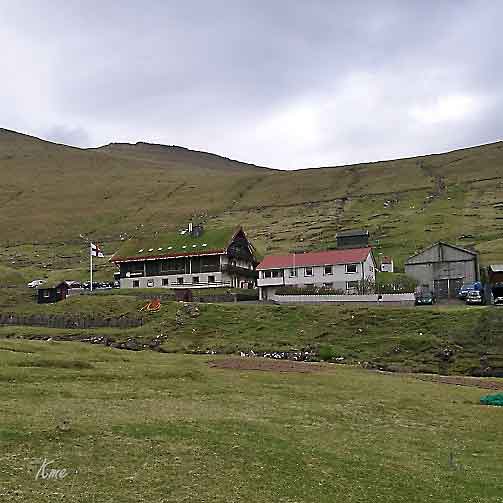
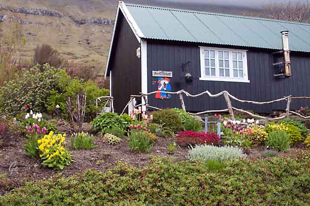
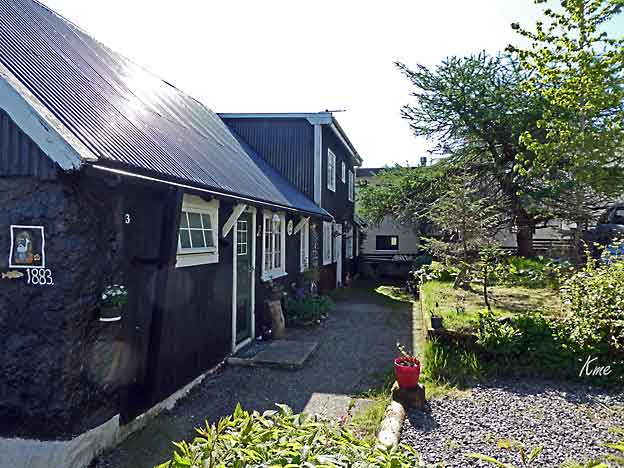
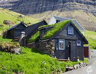
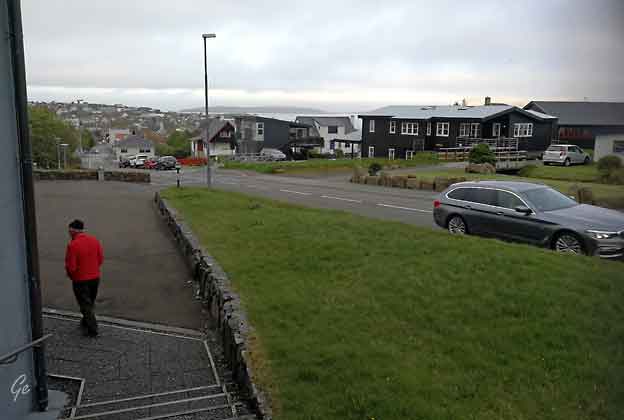
Hotel Vágar
med kort vei til flyplassen.
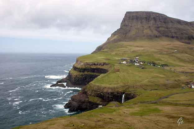
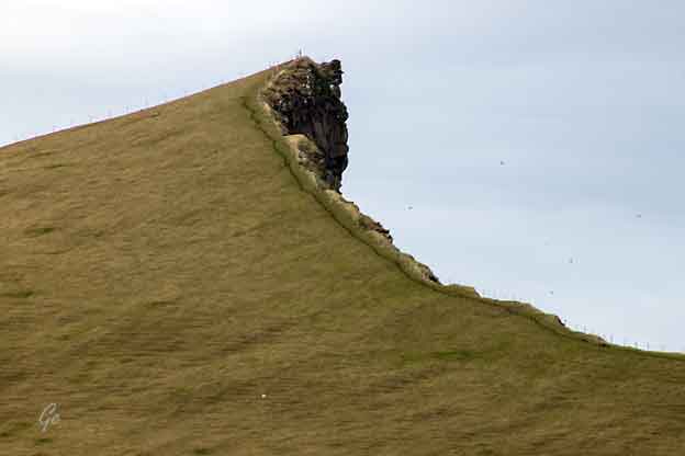
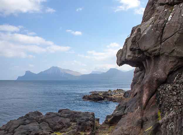
Mykines (Danish: Myggenæs)
is the westernmost of the 18 main islands of the
Faroe Archipelago.
On the northern side of the island is the valley
Korkadalur, where there are
great columns of basalt, called the Stone-wood. To
the west of Mykines is the
1 km long islet Mykineshólmur, with
several sea stacks clustered at its western
end, where a lighthouse was built in 1909. A
40 m long footbridge connects its
eastern end with Mykines.
Geology[edit]
Mykines belongs to the
oldest part of the Faroe Islands and was
formed about 60 million years ago. The Faroese basalt is
divided into three
phases of eruption, the lower and oldest, the middle,
and the upper and
youngest; the lowest formed by the eruption of
low-viscosity lava through
long fissures, forming flat volcanoes. In the sound
between Mykines and Mykineshólmur, Holmgjogv, one can
see one of the most copious such flows on
the Faroes, with a depth of about 50 m. The
interspersed layers of softer
volcanic tuff between the layers of basalt are
differentially eroded, so forming,
especially on the steep northern side of the islet, some
of the richest bird
cliffs in the world.
https://en.wikipedia.org/wiki/Mykines,_Faroe_Islands
Mykines til høyre i
bildet under
|
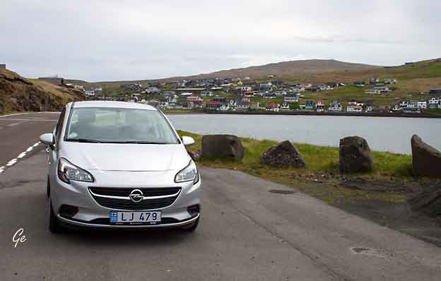
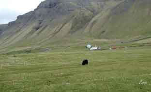
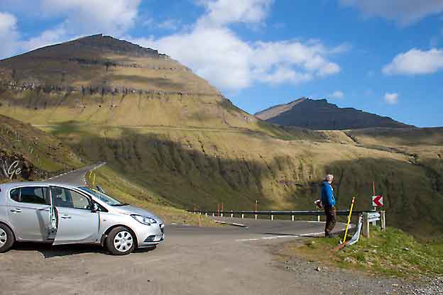
Leiebilen vår på Færøyene.
I bakgrunnen tettstedet Sørvágur
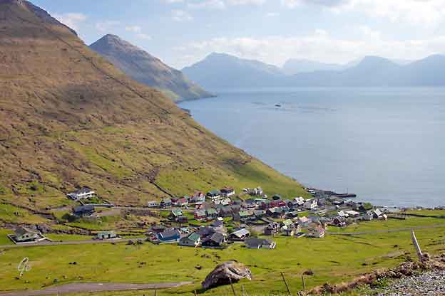
The name Sørvágur
translates to "The Bay of Sør". While the second half
of the
name makes sense given the fact that the village is
located at a bay, the first
half is more mysterious. Legend has it that the first
man to settleat this place
was called 'Sørli' and hence the village was named in
honour of him. Another explanation on the origin
of 'Sør' comes from the old-Norse 'Seyr' which is a
word for sand (seyr is also a word for foggy rain).
Sørvágur has quite a large sandbeach in comparison
with other Faroese
villages and towns, and therefore it was speculated
that the original name of
Sørvágur was Seyrvágur, and during the course of
time, Seyrvágur became
Sørvágur. During the first half of the 20th century
local people in Sørvágur
tried to correct this historical injustice and used
the name Seyrvágur instead
of Sørvágur. However, this trend died out again. One
reason may be that there
is no proof in the Faroese historical records that
justifies the name Seyrvágur.
As of today (2005) nobody has come up with at
reasonable explanation to
the origin of the name Sørvágur.
Sørvágur is considered to be one of the oldest
villages in the Faroe Islands.
Population (january 1, 2017) 1032
https://en.wikipedia.org/wiki/S%C3%B8rv%C3%A1gur
|
|
|
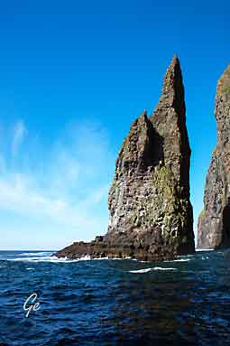
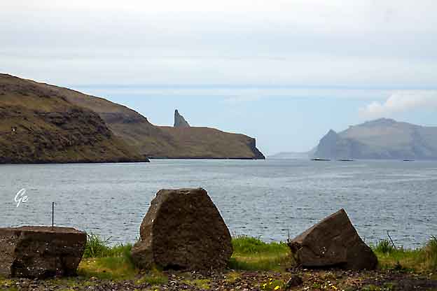
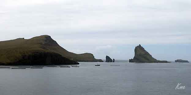
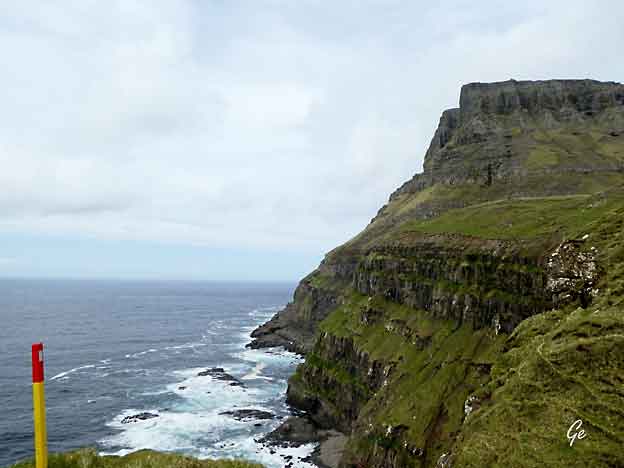
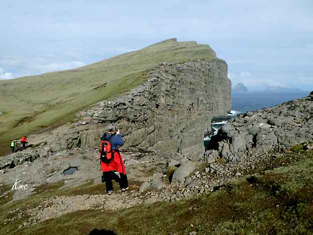
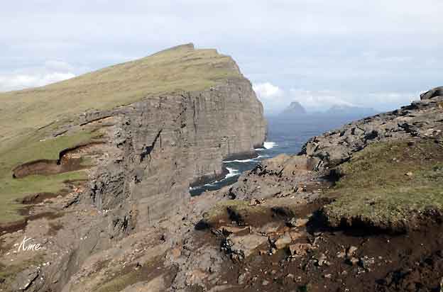
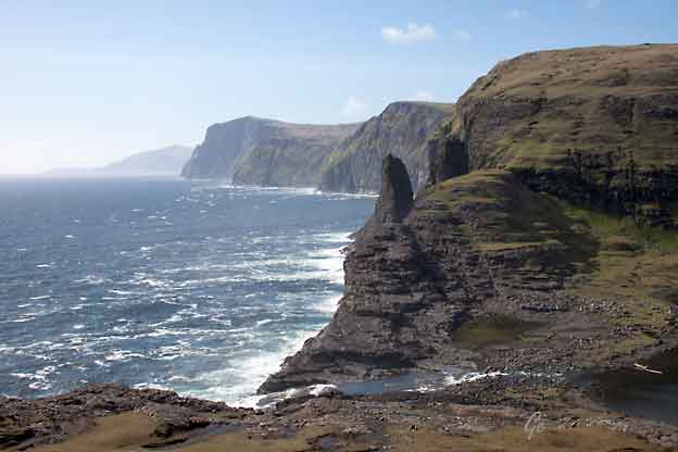
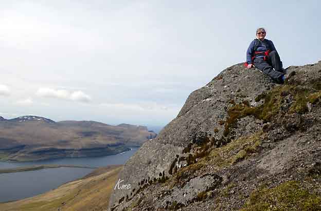
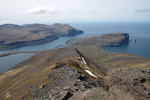
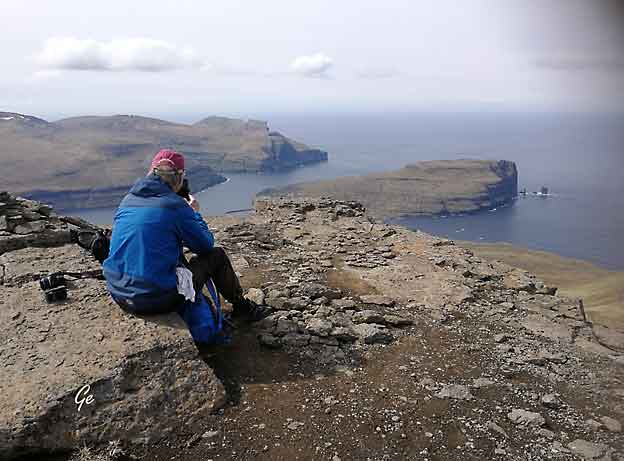
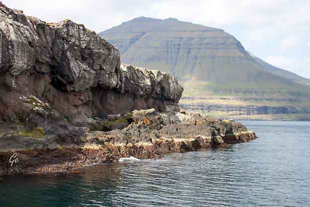
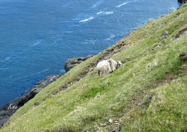
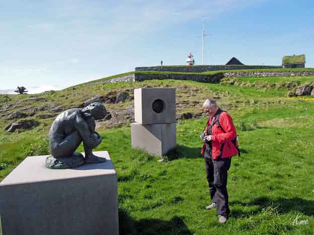
Tindhólmur
is a stunning islet located next
to Vagar island in the Faroe
Islands.
The unpopulated craggy islet is known for its
spiky shape.
|
The islet holds extreme contrasts.
One side of the islet is pure green hillside
all the way to the top. The southern face of
Tindhólmur is
sheer basalt cliff.
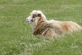
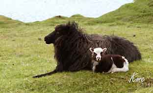
There are merely sheep on the uninhabited
islet. A great spot to
see Tindhólmur is from the village Bøur.
(25.
oktober 2023)
Tindhólmur
| Guide to Faroe Islands :
Guide
to Faroe Islands
|
|
|
THE
EAGLE OF TINDHÓLMUR ISLET
Tindhólmur has a very gloomy legend
attached to it:
Tindhólmur is now un inhabited, there is a reason for
this.
Legend has it that a local farmer named Rasmus used to
live on the islet.
Rasmus was originally from Sørvágur, but he had so
many disagreements
with his fellow villagers, that they offered him their
part of the land on
Tindhómlur islet to get rid of him and make him move
there.
Rasmus had a rich life on the islet. He had a lot of
sheep, the outfield on the
islet was overgrown, and there were a lot of birds and
fish at his disposal on
the isle
|
But one day everything changed. A huge eagle came and
took Rasmus’
two-year-old child and flew with it on the highest
peak on the islet. The
mother of the child hurried up on the peak but by then
it was too late.
The young of the eagle had already eaten the eyes of
the child. This peak
is called Ørnatindur that can be translated into “the
peak of the Eagle”.
After that, Rasmus and his family moved away from
Tindhólmur islet – and
it has been uninhabited ever since.
On Tindhólmur islet it is still possible to see the
remains of Rasmus’
residence and boathouse.
(25. oktober 2023)
Places - Places (visitfaroeislands.com)
|
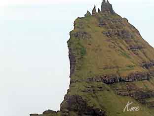
Tindhólmur
These are named of the peaks: Ytsti, Arni,
Lítli, Breiði, Bogdi which can be translated
into: Farthest, Eagle, Small, Broad and Bent.
|
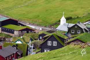
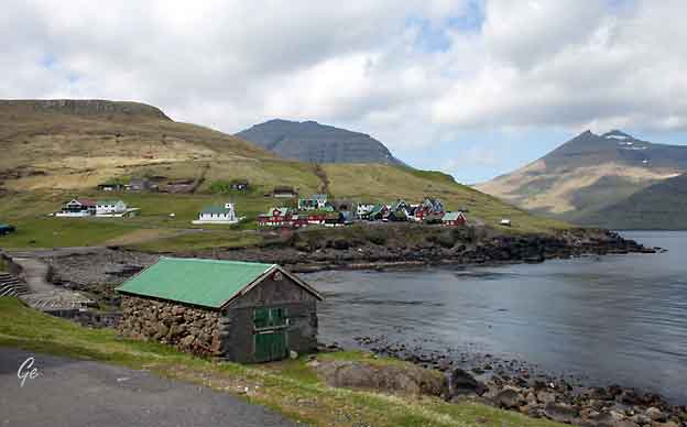
Bøur
|
Bøur (Danish: Bø)
is a village in the Sørvágur Municipality of
the Faroe Islands,
4 km west of Sørvágur, with a population of 75
(2012). Bøur is an ancient
settlement and is mentioned in the so-called Dog
Letter dating from 1350 AD,
but it is probably older. The village is also mentioned
as having a church in a document dated 1710, but it is
not known when the first village church was built.
https://en.wikipedia.org/wiki/B%C3%B8ur
|
Bøur og Tindholmur
|
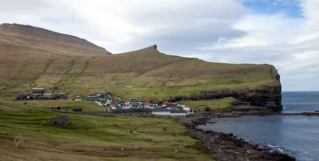
Gásadalur
There is a story that the village was
named after a woman called Gæsa,
who came from Kirkjubøur.
|
She had eaten meat during the
Lent fast, and for this
unholy deed all her property
was confiscated. She fled to
the valley on Vágar, which
was named after her. Most
other village stories are
about spirits and elves.
A more likely explanation is
that Gásadalur (Goose Valley)
is named after the wild geese,
which from ancient times have
travelled to the valley.
https://en.wikipedia.org/wiki/G%C3%A1sadalur
|
Gásadalur (Danish: Gåsedal)
is a village located on the west side of Vágar,
Faroe Islands, and enjoys a panoramic view over to the
island of Mykines. Gásadalur is located on the
edge of Mykinesfjørður, surrounded by the highest
mountains on Vágar. Árnafjall towers to a
height of 722 metres to the north,
and Eysturtindur
to the east is 715 metres high. Here too, the view
south to Tindhólmur and Gáshólmur is
quite magnificent.
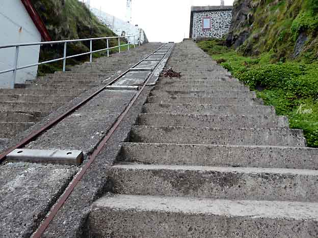
The landing site is very poor, because it is located
somewhat higher than the
seashore. So if the residents wanted to fish they were
obliged to keep their boats near Bøur. In 1940,
during the British occupation of the Faroe
Islands, a stairway
was built from the beach up to the village.
In order to reach any of the other villages, they had
to take the strenuous route over mountains more than
400 metres high. This explains why the village
population has become smaller and smaller. In 2002
there were only sixteen people living in Gásadalur,
and several of the houses stand empty today. It had a
population of
18 in 2012.
|
Karl Martin på en fin
tursti fra landsbyen Gásadalur
In 2004 a tunnel was blasted through the
rock, and it is possible to drive
through by car. The residents hope this will mean that
the village
population will increase again. There are good
opportunities for farming,
and the same number of fields as in Bøur, but here
only a few are royal
estate. Most of them are freehold land.
https://en.wikipedia.org/wiki/G%C3%A1sadalur
|
Gásadalur |
Gásadalur
|
Grete på tur i
Gásadalur |
Gásadalur |
Tindhólmur sett fra Gásadalur |
Gásadalur |
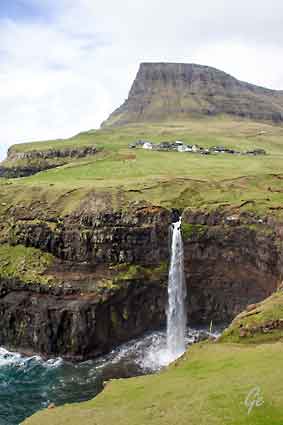
Gásadalur is
a gorgeous waterfall named after a small village
Gásadalur, on the Island Vágar/Faeröer.
Gásadalur is fed by a small river that runs from
north to south
and ha a descent of 600 meters.
The waterfall Gásadalur drops down, in a single
drop, over
60 meters and ends in the Atlantic Ocean.
When driving on road 45 to Gásadalur there is a
left turn
(just before the village) going to the perfect
viewpoint on the
waterfall Gásadalur.
http://www.europeanwaterfalls.com/waterfalls/gasadalur/
|
Mulafossur og landsbyen Gásadalur |
Gásadalur har
en liten kafe (2018)
som er verd et besøk
|
|
In Faroese, the
name appears
as Føroyar. Oyar represents the plural
of oy, older Faroese for 'island'. Due to sound
changes, the modern Faroese word for island
is oyggj. The first element, før, may
reflect an Old Norse word fær ('sheep'),
although this analysis is sometimes disputed because
Faroese now uses the word seyður (from Old
Norse sauðr) to mean 'sheep'. Another possibility
is that the Irish monks, who settled the island around
625, had already given the islands a name related to
the Gaelic word fearann, meaning 'land' or
'estate'. This name could then have been passed on to
the Norwegian settlers, who then
added oyar (islands). The name thus
translates as either 'Islands of Sheep' or 'Land
Islands' (23. januar 2023)
Faroe
Islands - Wikipedia
|
Gásadalur |
|
Fra
Gásadalur
kjørte vi til Midtvágur. Der gikk
vi
tur langs stien til Trælanipa
og Bøsdalafossur
|
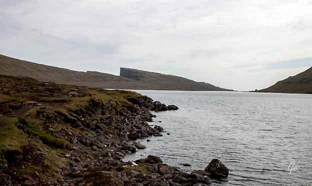
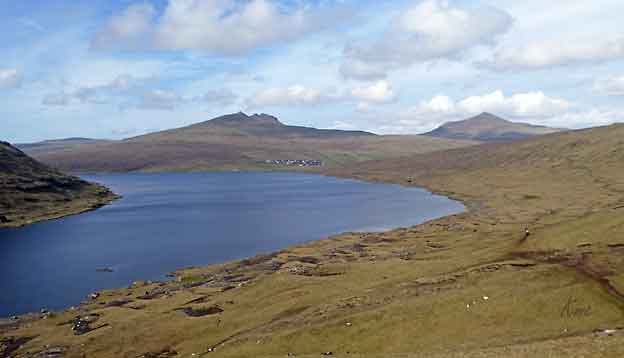
Lake Sørvágsvatn/Leitisvatn
Sørvágsvatn is the largest lake in
the Faroe Islands. It is situated on the island
of Vágar between the municipalities
of Sørvágur and Vágar. Its area is
3.4 km2,
more than three times the size of Fjallavatn, the
second largest lake, also located
on Vágar.
Among the locals, there is disagreement regarding the
name of the lake. The inhabitants
of Sørvágur to the west
prefer Sørvágsvatn, which means "the lake by
Sørvágur". The inhabitants
of Miðvágur and Sandavágur to the
east prefer
Leitisvatn, which means "the lake by Leiti", referring
to the territory on the east
side of it.
The lake is located very close to the ocean, but its
surface is about 40 meters above
the level of the sea. It is surrounded by a higher
cliff which prevents it from
emptying fully into the ocean, the
waterfall Bøsdalafossur being the outlet.
The greater height of the cliffs on either side of
Bøsdalafossur can give the illusion from certain
perspectives that the lake is higher above sea level
than it is.
|
Sørvágsvatn/Leitisvatn
During World War II, the British army built an
airfield (now Vágar Airport) to the
west of the lake. They also built a station to
support seaplanes. The first aircraft to
land on the lake was
a Catalina from RAF Coastal Command, in
1941.
Sørvágsvatn
- Wikipedia (23. januar
2023)
|
Sørvágsvatn/Leitisvatn
|
Bratte fjell og myke vidder
|
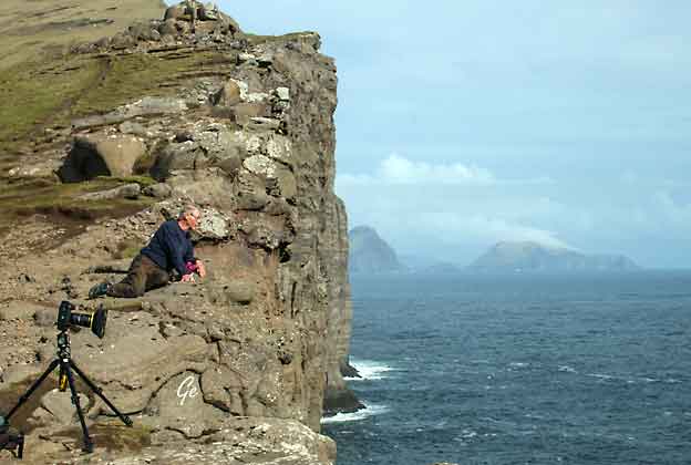
Fuglefotografer i arbeid
|
Grete tar også bilder, men ikke av
fuglene.
|
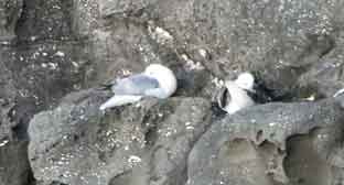
Karl Martin fikk et brukbart
bilde av måkene.
|
|
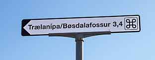
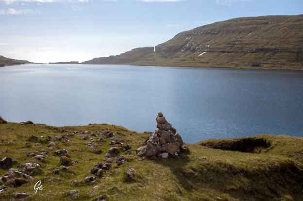
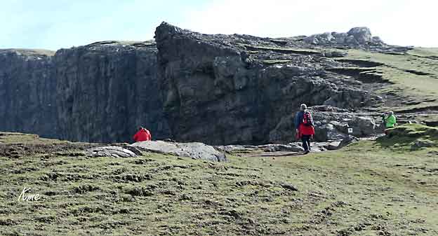
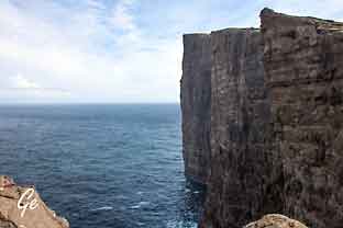
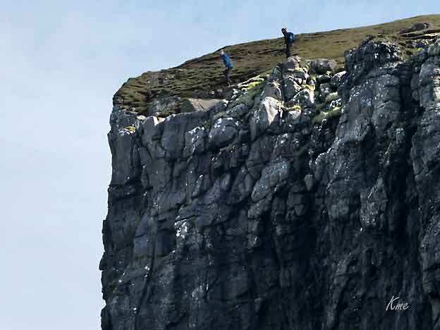
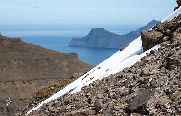
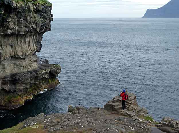
Trælanípa is a perpendicular cliff on Vágar
Island in the unexplored
Faroe Islands. The cliff treats travellers to one of the
most renowned
nature attractions in the Faroe Islands.
From Trælanípa, in English the Slave Cliff, you
can see the freshwater
Lake Leitisvatn. Standing at this viewpoint will make
the lake look as if
it floats above the salty North Atlantic ocean.
Trælanípa
• Lake Above the Ocean | Guide to Faroe Islands :
Guide to Faroe Islands
(23. januar 2023)
|
Karl Martin synes det er langt ned til
sjøen,
selv om han ikke er på toppen av klippen.
|
|
Ikke gå for langt ut!
|
Grete går mot Bøsdalafossur.
|
|
Right:
This is the view
of Bøsdalafossur waterfall – where
the Sørvágsvatn
lake actually meets the Atlantic Ocean. As you can see
the water
levels aren’t so different after all!
https://thetravelblog.at/faroe-islands-hike-sorvagsvatn-traelanipa/
|
|
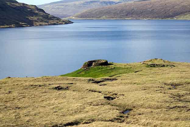
Rund
steinbygning ved Sørvágsvatn/Leitisvatn
|
Sørvágsvatn/Leitisvat.
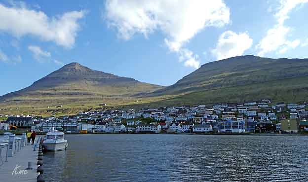
Tettstedet er Miðvágur
|
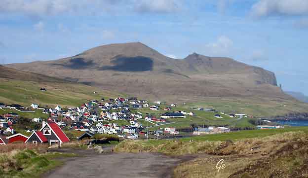
Miðvágur (IPA: [ˈmiːvɔavuɹ], dansk: Midvåg)
er et tettsted på Færøyene, sør på
øya Vágar. Miðvágur var administrasjonssentrum
i Miðvágs kommuna frem til
1. januar 2009, da fikk tilsvarende funksjon i
nye Vága kommuna. 1. januar 2009 hadde Miðvágur 1
062 innbyggere, en liten økning
fra 1980- og 1990-tallet.
Dette gjør Miðvágur til et av Færøyenes største
tettsteder.
|
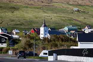
Miðvágur
med kirken fra 1952
|
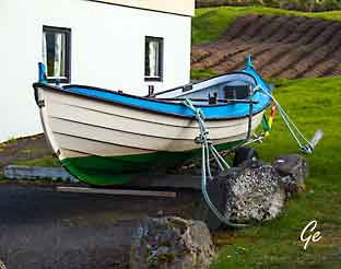
Båten er
godt fortøyd, selv i hagen.
|
Antageligvis var Miðvágur,
fra vikingtiden, et av Færøyenes opprinnelige
tingsteder. Miðvágur er imidlertid første gang nevnt
i Hundebrevet fra
slutten av 1300-tallet, men ting tyder altså på at
stedet er eldre. I 1899
gjorde Færøyene sin
største grindfangst noensinne, med 1 300
individer
i Miðvágur.
Et kjennetegn på dialekten i Miðvágur er at
«i» og «ið» i slutten av ord
uttales som /i/, og ikke som /e/ slik som
i øvrige færøyske dialekter.
https://no.wikipedia.org/wiki/Mi%C3%B0v%C3%A1gur
|
Tirsdag 22. mai 2018
|
Vi
begynner bilturen
rundt på Færøyene.
Dagens etappe: Vestmanna,
Eidi, Slættaratindur, Gjøgv.
Overnatting på Gjåargardur
|
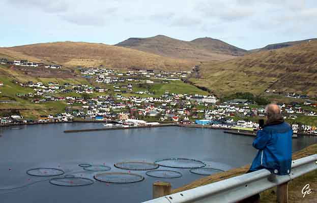
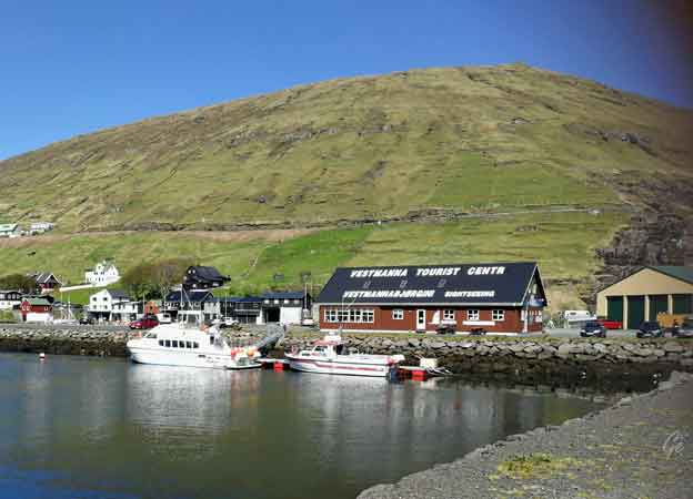
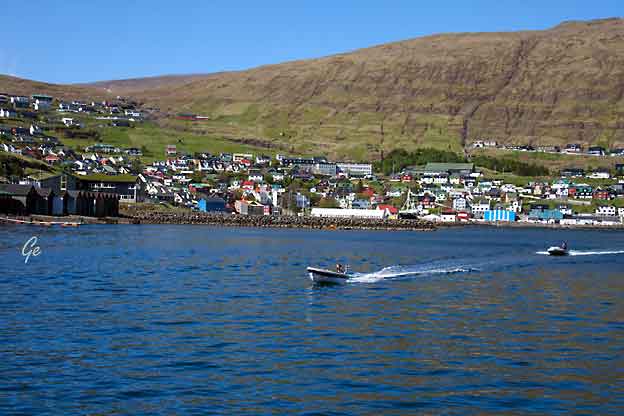
Vestmanna (dansk: Vestmanhavn)
er en bygd og
et sogn på Færøyenes største
øy, Streymoy. Vestmanna ligger i en bukt
ved Vestmannasund, som skiller
Streymoy fra Vágar.
Den 1. januar 2015 hadde Vestmanna 1 214
innbyggere, noe som gjør bygden
til den største bebyggelsen
på Norðstreymoy.
Vestmanna er en av Færøyenes beste, naturlige
havner. Fiskeri, havbruk og
maritim industri har avløst landbruket som
bygdens viktigste
næringsveier. Halvparten av Færøyenes vannkraft
produseres i
Vestmanna, hvor SEV også har hovedkontor.
Vestmanna var et viktig fergested frem til åpningen av
Vágatunnilin i 2002. Mange turister kommer til
bygden for å beskue
fuglefjellene på nordvestkysten, Vestmannabjørgini.
https://no.wikipedia.org/wiki/Vestmanna
|
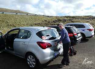
Vestmanna
Karl Martin ser ut over Vestmanna.
Vi reiste innom Vestmanna for å undersøke tider for
turistbåten som går derfra.
Den hadde akkurat gått ut. Neste tur skulle være om et
par timer.
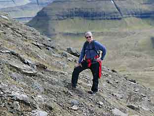
Vi valgte å reise til Slættaratindur i steden. Det var
nydelig vær for en topptur.
|
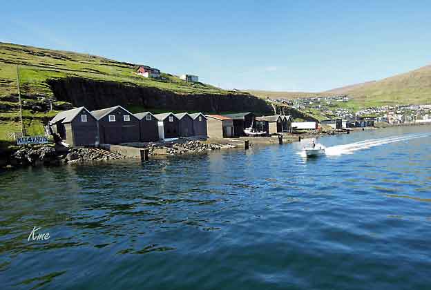
Havna i Vestmanna
|
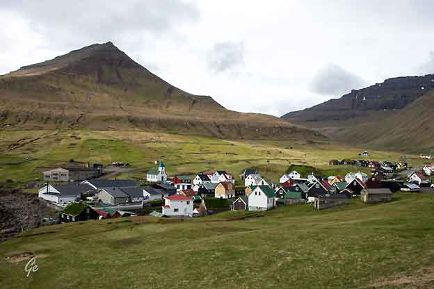
Eidi
Byen Eiði på Eysturoy
|
Eysturoy is part of the Faroe
Islands in the North Atlantic. Eysturoy, meaning
East island (pronounced ['estroi], is the
second-largest island in the Faroe
Islands, both in size (286.3 km²) and population
(10,586). The population is
spread over 38 towns and villages. It is separated by
a narrow sound from the
main island of Streymoy. Eysturoy is extremely rugged,
with some 66 separate mountain peaks, including
Slættaratindur, the highest peak in the archipelago.
Important towns on Eysturoy are Fuglafjørður in the
north and the densely
populated area of the municipalities of Runavík and
Nes in the south.
https://wikitravel.org/en/Eysturoy
|
Eiði
is in the far north-west of Eysturoy and the road goes
left just after the 'bridge across the Atlantic.
There is also a superb mountain road linking Eiði with
Gjogv.
https://wikitravel.org/en/Ei%C3%B0i
Eiði [ˈaiːjɪ]
(Northern
Faroese [ˈɔiːjɪ]; Danish: Ejde) is a
village located on the north-west tip
of Eysturoy, Faroe Islands.
Its name
means isthmus in the Faroese language.
The town has a
population of 669 inhabitants. Eiði was settled by
Vikings in the
9th century AD. In the center of the village there is
a large stone
church from 1881.
https://en.wikipedia.org/wiki/Ei%C3%B0i
|
Eiði kirke fra
1881 |
Litt mat må man ha før en
topptur.
|
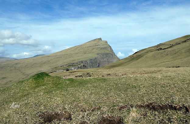
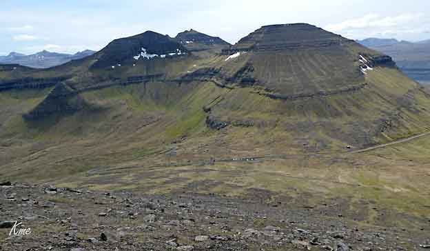
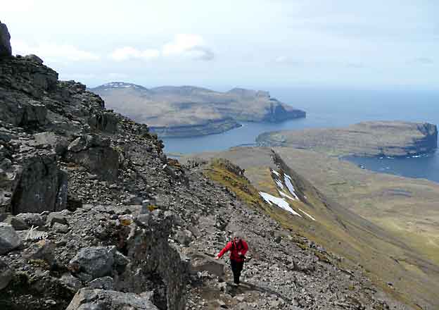
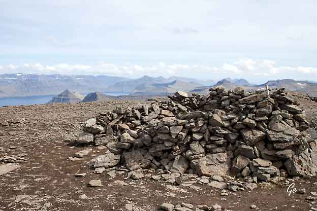
Slættaratindur is
the highest mountain in the Faroe Islands located
on Eysturoy Island. It translates directly into the
‘Plain Mountain Peak’ due to the summit’s flat surface.
The mountain elevates 880 meters (2887 feet) above sea
level.
Slættur means flat and indeed the summit is smooth
enough for Faroese dancing
and for photo opportunities in all directions. The flat
area on the very top of Slættaratindur is roughly 1000
square meters.
Slættaratindur is accessible throughout the year. The
hike to Slættaratindur is
popular among locals and travellers alike. You should
watch out for icy surfaces during winter from November
to April. The path is not visible in snow so it is not
recommendable to venture up the mountain on your own
during the winter season.
|
Slættaratindur
Første hinder på vei til toppen
var et sauegjerde.
|
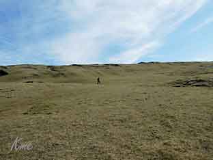
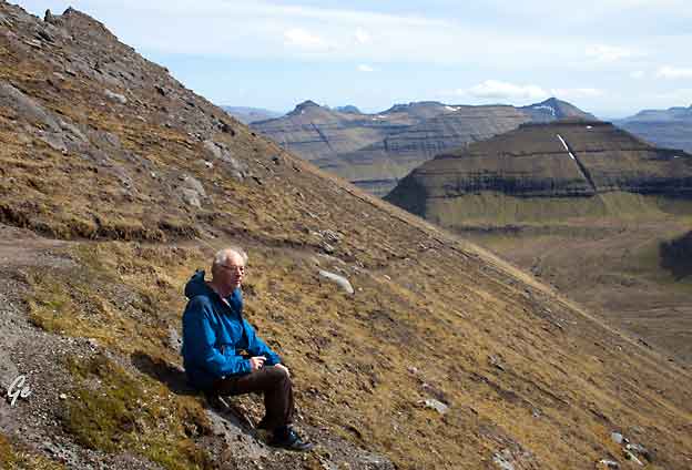
Det er bratt, Grete må ta en
pustepause.
|
The easiest route to the top is
from Eiðisskarð mountain pass west
of Funningur
and east of Eiði. Both villages sit at the foot
of the mountain. Park your car at Eiðisskarð.
Parking here will cut the climb to the top by half.
You will hike 500
meters uphill. The hike will take 2 hours or less.
Particularly in clear weather, you will see the
entire archipelago from this location.
You will have a great view of the sea
stacks, Risin & Kellingin when
standing on the northern part of the summit.
Slættaratindur
• Highest Mountain | Guide to Faroe Islands :
Guide to Faroe Islands
(23. januar 2023)
|
Slættaratindur
|
|
Haldórsvík på
den andre siden |
Nesten oppe
|
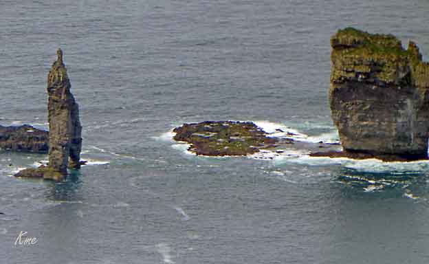
Risin and Kellingin (bilde til
høyre og under)
Risin & Kellingin is a pair of sea-stacks
in the wild Faroe Islands. These basalt
rock formations lie off the coast of Eysturoy
island far away from the crowds.
Experiencing these striking offshore
monoliths is always worth it. Risin &
Kellingin translates to “the Giant and his Wife”. A
must-see when in the Faroe Islands.
Risin
& Kellingin | Guide to Faroe Islands : Guide to
Faroe Islands
(23. januar 2023)
A legend tells how, once upon a time, the giants
in Iceland were envious and
decided that they wanted the Faroes. So the giant
and the witch (his wife in some versions of the
story) were sent down to the Faroe Islands to bring
them back.
A legend tells
how, once upon a time, the giants
in Iceland were envious and decided
that they wanted the Faroes. So the giant and
the witch (his wife in some versions of the
story) were sent down to the Faroe Islands to
bring them back.
|
Risin og Kellingin
They reached the north-westernmost
mountain Eiðiskollur (see map), and the
giant stayed in the sea while the witch climbed up the
mountain with a heavy
rope to tie the islands together so that she could push
them onto the giant's back. However, when she attached
the rope to the mountain and pulled, the northern
part of the mountain split. Further attempts were also
unsuccessful, and they
struggled through the night, but the base of the
mountain was firm and they
could not move it.
If the sun shines on a giant or witch, it turns to
stone. So it was that as they
continued to struggle they didn't notice time passing,
and as dawn broke a shaft
of sunlight put a stop to their efforts by turning them
to stone on the spot. They
have stood there ever since, staring longingly across
the ocean towards Iceland.
Risin
og Kellingin - Wikipedia
(23. januar 2023)
|
|
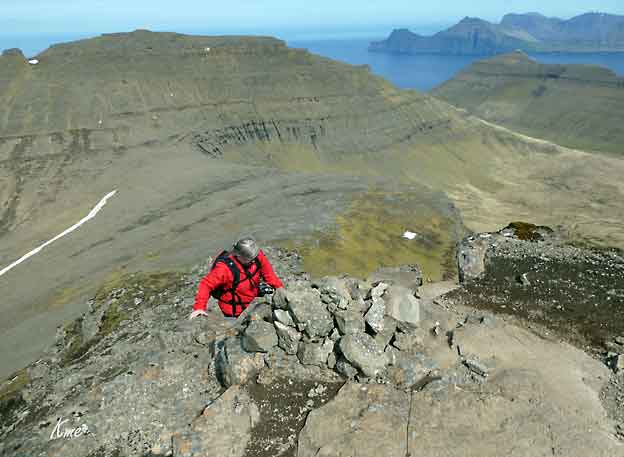
Grete går den siste meteren til topps.
|
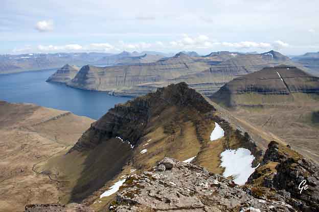
|
Den flate toppen på Slættaratindur.
|
|
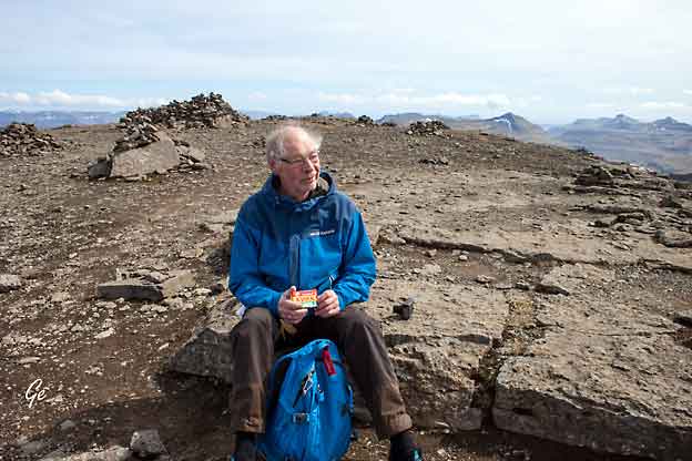
Medbragt kvikk-lunsj nytes på
toppen.
|
En liten hvil på vei ned igjen også.
Vannet er Eiðisvatn
Lake
Eiði (Faroese: Eiðisvatn) is a lake on the
island of Eysturoy in the
Faroe Islands. Lake Eiði is located between the
villages of Eiði and Ljósá.
It is the fifth-largest natural lake in the Faroe
Islands, with a natural size of 47 hectares (120
acres) that has been increased to 1.14 square
kilometers
(0.44 sq mi). The size of the lake was
increased by walls 22 and 13 m high,
constructed by the SEV company in connection
with the Eiði power plant,
which uses the lake as a reservoir. Electricity
production was started in 1987.
Two tunnels redirect water from adjacent valleys to
Eiði.
https://en.wikipedia.org/wiki/Lake_Ei%C3%B0i
|
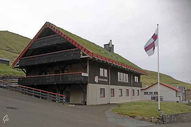
SO LANGT BURTUR,
OG TÓ SO NÆR
Langt burtur frá dagliga
sjagginum, umgirdur av vakrari náttúru,
liggur Gjáargarður – eitt tað hugnaligasta
gistingarhúsið í Føroyum.
Vælkomin á
Gjáargarður
https://www.gjaargardur.fo/
|
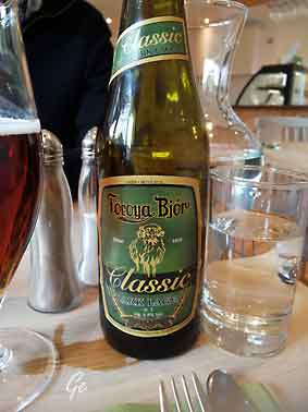
Föroya
Bjór er navnet på et bryggeri
på Færøerne og betyder
Færøernes øl.
Bryggeriet ligger i
Klaksvík og er landets eneste siden
2007, hvor Restorffs
Bryggjarí lukkede. |
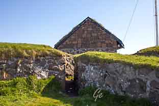
Gjógv
Gjógv
is the northernmost village on Eysturoy
Island in the unbelievable
Faroe Islands. The settlement is located
at the end of a deep valley with no other
villages in sight.
The village bears its name from a
beautiful 200-meter-long gorge. The
sea-filled gorge in the village has been used as
a natural harbour. For centuries the villagers
used the natural ravine as their landing ground
for boats. There
are stairs all the way down to the gorge.
Visitors can stand here and enjoy the sound of
the sea.
There are no
more than 100 houses in the settlement. You will
also find the
guesthouse Gjáargarður in this remote
village. It takes less than an hour to drive
from the capital, Tórshavn, to Gjógv.
Gjógv
• Village on Eysturoy Island | Guide to
Faroe
Islands : Guide to Faroe Islands
(23. januar 2023)
|
Föroya Bjór
producerer hovedsagelig til Færøerne, men der
sælges dog
øl flere steder i Danmark, mest
i København, men også i byer så
som Vejle, Aalborg og Århus.
Navnet er lidt ejendommeligt: Øl hedder almindeligvis
også øl på færøsk,
mens bjór er sjældent. Og bogstavet ö
i Føroya (genitiv af Føroyar –
Færøerne)
bruges sædvanligvis kun i festlig, gammeldags stil.
Denne stil understreges
også ved, at bryggeriet selv skriver Klakksvík
med kk – den ældre form.
Bryggeriet blev grundlagt i 1888 af Símun í
Vági (1863-1935).
Dermed er Föroya Bjór en af de ældste virksomheder på
Færøerne.
https://da.wikipedia.org/wiki/F%C3%B6roya_Bj%C3%B3r
|
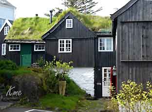
Bebyggelse i Gjógv
|
|
The village church dates from 1929. It was the
first one to be consecrated in
the village and the first one to feature services in
Faroese.
Before that, the villagers walked to
Funningur for church and burial services.
https://en.wikipedia.org/wiki/Gj%C3%B3gv
The church in
Gjógv has a history of its own. It was built in
1929 and was
the first church to be inaugurated in Faroese. Its
altarpiece is of a particular
interest; it shows Jesus walking on water – not the
lake
of Genesareth, but “í Djúpunum” which is the name for
the waters off Gjógv.
https://gjaargardur.fo/en-GB/Gjogv/The-village-walks-and-adventures.aspx#.W0N_T9IzaUk
Vi kom i prat med en mann fra Gjógv. Han fortalte litt om
stedet og om kirken.
Den var plassert nord-syd og
ikke øst-vest som andre kirker på Færøyene.
Sånn var den mer synlig når båtene kom inn fra havet.
|
|
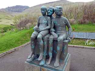
On
the opposite side of the road
(from the church) a sculpture
stands as a memorial
to fishermen lost at sea, bearing
the names and ages of men from
the late nineteenth to the mid
twentieth century.
The sculpture of a mother and two
children looking out to sea was
created by Janus Kamban.
https://en.wikipedia.org/wiki/Gj%C3%B3gv
|
Til høyre: bebyggelsen i Gjógv og elva som
renner gjennom byen.
Under:
En fin hage i Gjógv |
|
|
|
|
|
Denne
fine hagen er nærmeste nabo
til hotellet på stedet, Gjáargarður.
|
|
Onsdag 23. mai 2018
Dette var den eneste dagen på
turen med "dårlig vær".
Det var overskya og blåste kraftig.
Men det regna heldigvis ikke.
Vi skulle være i Gjógv hele dagen.
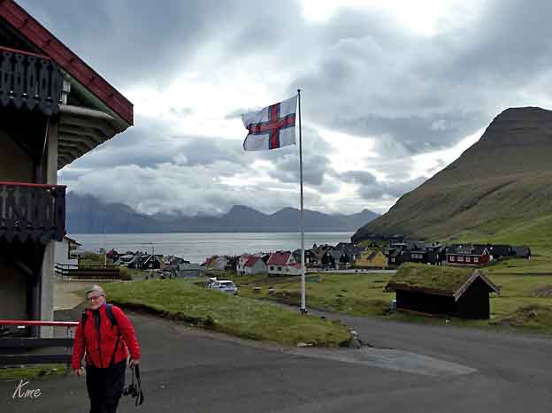
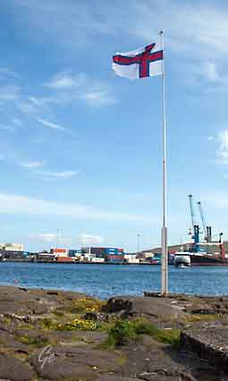
The flag of the Faroe
Islands is an offset cross,
representing Christianity.
It is similar in design to other Nordic
flags – a tradition set by the
Dannebrog of Denmark, of which the Faroe
Islands are an autonomous
country.
The flag is called Merkið, which means "the
banner" or "the mark".
It resembles the flags of
neighbouring Norway and Iceland.
https://en.wikipedia.org/wiki/Flag_of_the_Faroe_Islands
|
Grete utenfor Gjáargarður. Det ser ut som
hun fryser,
men det er vel heller litt mye vind for en østlending. |
|
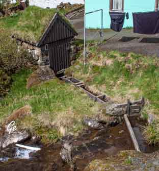
Båten er godt festa her
også, selv på land.
De er vant med litt vind på
disse kanter.
|
|
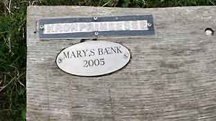
Mary’s benk
If you take a walk along the bank of the gorge, you
will get a first-hand look
at puffins in and around the cliffs. A bench has been
erected at the tip to
which the trail along the bank will lead you in memory
of Crown Prince
Frederik and Crown Princess Mary’s visit in Gjógv in
2005. The bench is
named “Mary’s bænk” – in English Mary’s Bench after
Crown Princess Mary.
https://gjaargardur.fo/Gjogv/The-village-walks-and-adventures.aspx#.XV54MugzaUk
Gjogv, walks and
adventures (22.8.2019)
|
|
Vi
gikk først en tur ut til
Kronprinsesse Marys Benk.
En fin spaservei fører dit ut.
|
|
Grete ved Kronprinsesse Marys Benk.
|
Etterpå gikk vi opp i høyden over
landsbyen.
Her er et bilde av Gjógv tatt like etter vi startet
oppstigningen. |
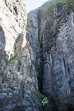
Kløfta som har gitt byen navn.
|
Bratt er det overalt.
|
Sauene er fornøyd bare
de har nok gress.
|
|
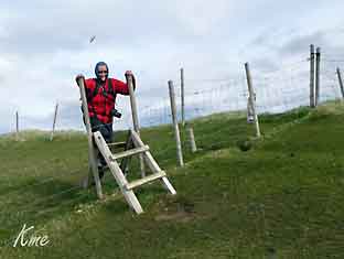
Vi må over et sauegjerde igjen.
|
If you really want
to get the Faroese nature under your skin, you should
take
a walk in the mountains surrounding Gjógv. The
mountain walk opportunities
around Gjógv are endless!
You can take a walk along the bank of the
gorge, out to “Ovara Nasa”, then
uphill along the coastline until you reach a sheep
house at the top.
From here you have a spectacular view of the bird
cliffs before and below you
so close that you can almost reach out and touch the
fulmars nesting there.
This walk only takes about 45 minutes and will boost
your blood circulation.
https://gjaargardur.fo/en-GB/Gjogv/The-village-walks-and-adventures.aspx#.W0N_T9IzaUk
Gjogv, walks and adventures
(22.8.2019)
|
Stien vi gikk. Det er gjerde mot stupet,
men vi holdt oss mye enda
litt lenger inn på land på grunn av den sterke vinden.
|
Ned i kløfta. Karl Martin snakker med en
lokal mann
som er nede for å se til båten sin.
|
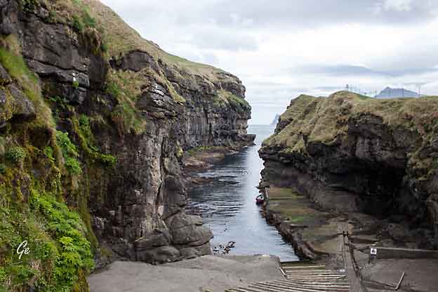
Kløfta og trappa ned.
|
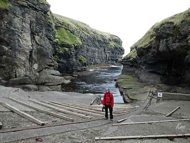
Grete begynner på trappene opp igjen.
|
The gorge,
which is one of the main attractions of Gjógv, is in
the northern
part of the village.
A flight of steps enables you to walk down to the
landing place for boats.
https://gjaargardur.fo/en-GB/Gjogv/The-village-walks-and-adventures.aspx#.W0N_T9IzaUk
Gjogv,
walks and adventures, (22.8.2019)
|
Etter lunsj gikk vi en tur i motsatt
retning.
Her ser vi Gjógv og høyden vi gikk opp til om
formiddagen. |
|
Vi var også innom kafeen i Gjógv, Gjåarkaffi |
|
Torsdag 24.
mai 2018
|
Vi
forlot Gjógv
etter frokost.
Reiseruta var: Elduvik, Glyvrar/Runavik, Søldarfjordur,
Klaksvik |
En fotopause langs veien. Herfra ser vi
ned til bygda Funningur og
Funningsfjørður.
|
Funningur
|
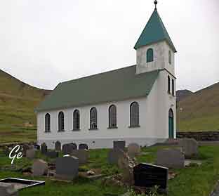
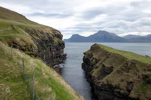
Elduvik
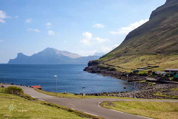
Veikryss. Herfra ser vi over til Kalsoy.
Elduvík is located in
the Funningsfjørður-inlet on Eysturoy's
northeast side.
The village which has a population of 23 is split
into two parts by a small
river. The church in Elduvík dates from 1952.
Visible from Elduvík is the nearby island
of Kalsoy.
https://en.wikipedia.org/wiki/Elduv%C3%ADk
(22.8.2019) |
After about three kilometres, the lovely village of
Elduvík appears ahead. Elduvík is
an ancient settlement. It is not known exactly how old
it is, but according to
historical documents it dates back to no later than
1350 -1400, but it may well be
older. Elduvík has retained much of its old, charming
characteristics.
In the old days, there was no church in the village,
and therefore all important
religious ceremonies, including funerals, had to take
place in Oyndarfjørður.
When you arrive in the village, you see a flat rock
onthe right side of the road.
It is called Líksteinur (Corpse Stone). This is where
the people of Elduvík said
farewell to their loved ones before their coffin was
carried to Oyndarfjørður.
The first church in Elduvík was established in 1951.
At the western end of the village, there is a
magnificent gorge called
Elduvíksgjógv, which is worth a visit.
Oyndarfjørður
- Elduvík - Visit Runavík (visitrunavik.fo)
(27. februar 2022)
|
|
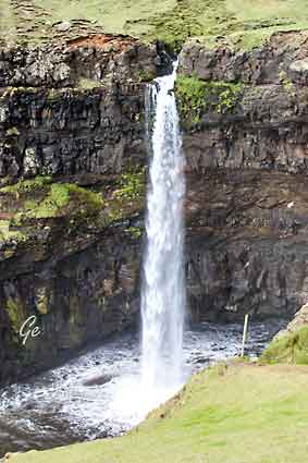
Vi gikk først en tur ut til Elduvíksgjógv.
Det var en fin turvei ut dit. |
|
|
|
|
ENJOY HIKING ALONG THE OLD
VILLAGE PATH FROM
OYNDARFJØRÐUR TO THE CHARMING VILLAGE OF ELDUVÍK
Vi gikk denne stien i motsatt retning, og
ikke helt fram til Oyndarfjørður.
Hiking
Once you have walked about
one kilometre you will come to Elduvíkslíð,
the grassy sloping hillside between the two villages. To
the left you will
see the mountains Middagsfjall and Tyril, and to the
right you have a
fine view to the north of Kalsoy. Note specifically the
two characteristic
peaks, the jagged Nestindur and the somewhat flat
Borgarin, creating
a wonderful harmony together.
|
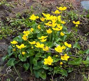
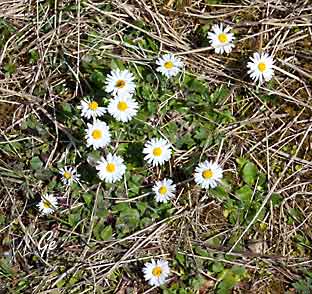
The Faroese national flower is
the buttercup – in Faroese called
"Sólja".
Caltha palustris, known as
marsh-marigold
|
|
It was
in the area below Nestindur that Páll Fangi hid from
authorities in the
1600s, because he was wanted for murder. Páll
was a farmer’s son in Mikladalur.
A maid on the farm was in love with him, but the
feelings weren’t mutual.
The jilted maid took revenge by insinuating that Páll
had murdered his father
because the father had given the farm to his brother.
Páll was convicted of
murder and imprisoned in Tórshavn, but he managed to
escape from prison
three times. On one of the occasions, he hid for a
whole year in a cave in the
rugged area under Nestindur.
The terrain in Elduvíkslíð is rather steep, but the
path is good. Further on, you
have a view of the small village of Funningur that
lies wedged between the high mountains on the other
side of the fjord. One of them is Slættaratindur,
which – with its 880 metres – is the highest mountain
in the Faroe Islands.
After about three kilometres, the lovely village of
Elduvík appears ahead.
Oyndarfjørður
- Elduvík - Visit Runavík (visitrunavik.fo)
(27. februar 2022)
|
Her går det rett i havet.
|
Sauene klarer seg bra i bratt.
|
|
Vi kom helskinna
tilbake til Elduvik
|
|
When you arrive in the village,
you see a flat rock on the right
side of the road. It is called
Líksteinur (Corpse Stone).
This is where the people of
Elduvík said farewell to their
loved ones before their coffin
was carried to Oyndarfjørður.
Oyndarfjørður - Elduvík
-
Visit Runavík (visitrunavik.fo)
(27. februar 2022)
|
|
Vi skulle på hjemmebesøk klokka 15 00, og hadde litt god
tid til det.
Vi fant ut at litt sør for der vi skulle få kaffe og
kaker skulle det være en kafe.
Vi kjørte dit og spiste hamburger med pommes frites,
masse pommes frites.
Etterpå rusla vi litt rundt i området ved kafeen.
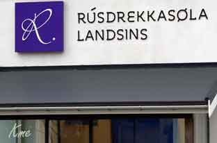
Vi fant blant annet Vinmonopolet, eller Rusdrekkasøla på
færøyisk.
|
|
Det
ser ut til å være slutt på
finværet igjen.
Tåka legger seg over toppene.
Heldigvis var det bare
forbigående.
|
|
|
|
Her fikk vi god kaffe og god kake.
Huset var koselig og hagen flott,
men vertinnen hadde dessverre litt liten tid til å prate
med oss.
Vi var der en snau halvtime, så fortsatte vi mot
Klaksvik på Bordoy.
The first settlement
at Klaksvík dates back to Viking times, but it
was not
until the 20th century that the district merged to
form a large, modern
Faroese town that became a cultural and commercial
centre for the
Northern Isles and the Faroe Islands as a whole.
Klaksvík is located between two inlets lying
back to back. It has an
important harbour with fishing industry and a modern
fishing fleet.
Originally, four farms were located where Klaksvík is
now.
In time, they grew into four villages: Vágur,
Myrkjanoyri, Gerðar and
Uppsalir; which finally merged to form the town of
Klaksvík in 1938. |
Borðoy (Danish: Bordø) is an island in
the north-east of the Faroe Islands.
Its name means 'headland island'. There are eight
settlements: Klaksvík
(the second largest town in the
Faroes), Norðoyri, Ánir, Árnafjørður, Strond, Norðtoftir, Depil and Norðdepil.
There are also three abandoned settlements:
Skálatoftir, Múli and Fossá,
all in the north. Múli was one of the remotest
settlements in the Faroes –
there was no road link until 1989, before which goods
had to be brought
in via helicopter or boat. The last people left in
1994.
https://en.wikipedia.org/wiki/Bor%C3%B0oy
|
What
triggered the development of the town was the
establishment of a
centralized store for all the northern islands on the
location.
The brewery Föroya Bjór in Klaksvík
is a Faroese family brewery, founded in
1888. The ram has been the symbol of the brewery since
the early beginning.
Since August 2007, when Restorffs
Bryggjarí went out of business, Föroya
Bjór has been the only producer of beer and soft
drinks in the Faroe Islands.
With the opening of the Leirvík sub sea
tunnel, the Norðoyatunnilin in April
2006,
Klaksvík gained a physical link with the mainland of
the Faroe Islands and
can now be considered one of its key ports. Several
developments are under
way to exploit this symbiosis, including a new
industrial park located by the
tunnel entrance. Klaksvík is home
to Summarfestivalurin.
https://en.wikipedia.org/wiki/Klaksv%C3%ADk
|
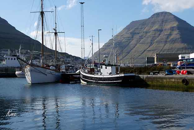
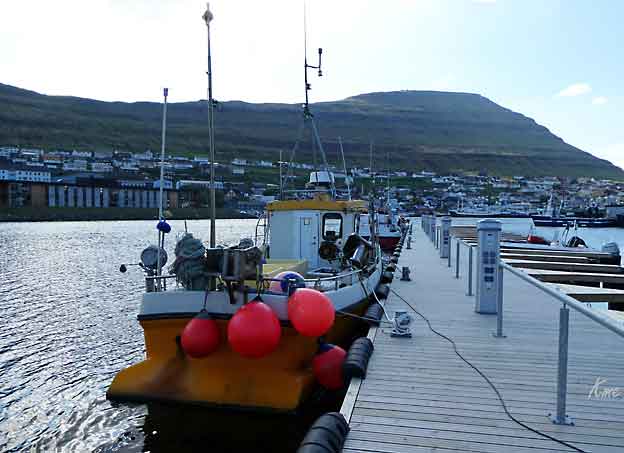
Klaksvik
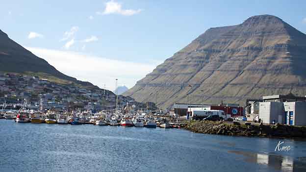
Klaksvik havn
|
|
|
|
|
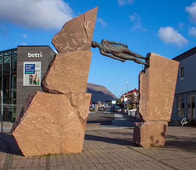
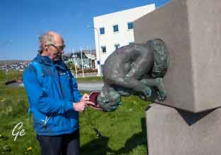
Fipan Fagra by Hans Pauli Olsen
accidentally on our way into the town. It
is made of bronze and granite and was erected
to celebrate
the centenary of the
founding of the
municipality in 2008.
It is an unusual piece with a naked man
wedged sideways between two
pieces of rock.
https://www.travelblog.org
/Europe/Faroe-Islands/blog-814678.html
|
|
|
Fredag 25. mai 2018
Vi skulle forlate Klaksvik,
men først måtte vi se
Christianskirken.
Vi lot bilen stå ved hotellet
(Klaksvik
hotel)
og spaserte ned til kirken.
Bildet av mannen er fra
huset på bildet
til høyre.
|
|
|
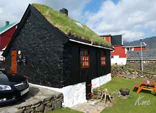
Koselig hus og hage i Klaksvik
|
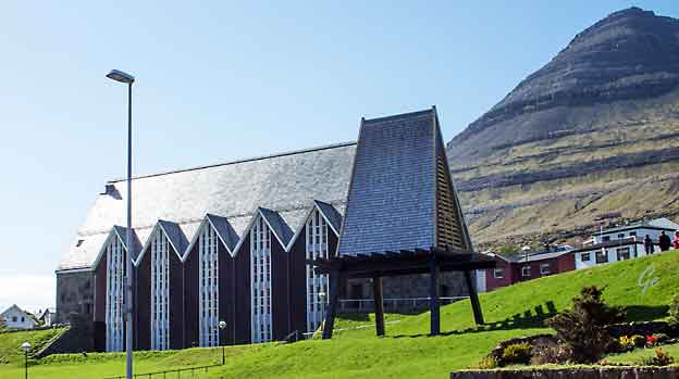
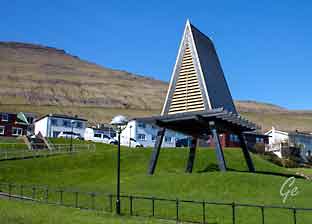
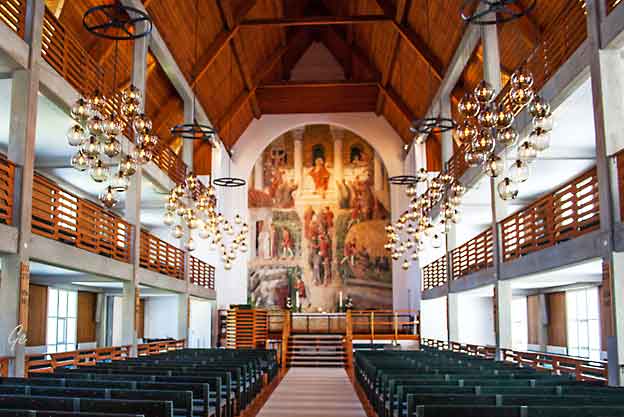
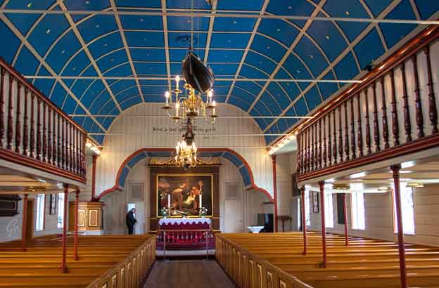
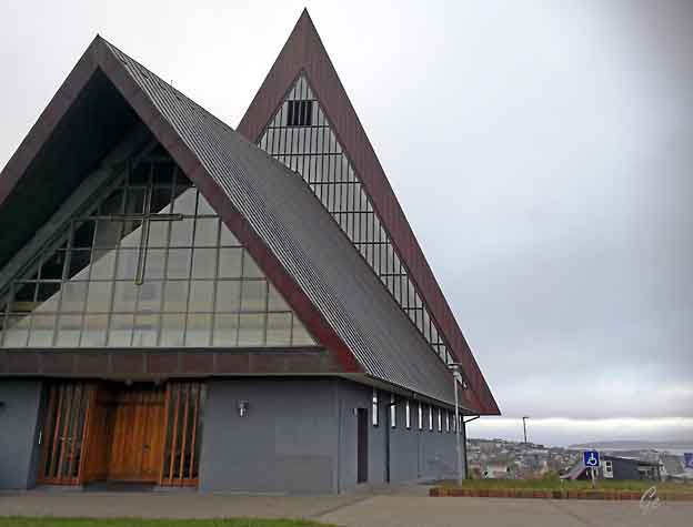
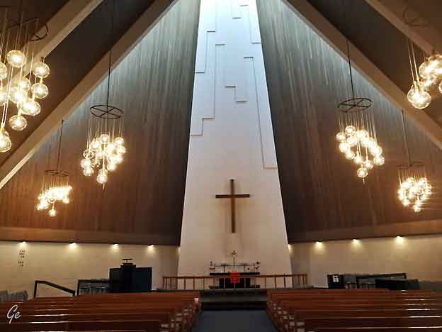
Christianskirkjan, Christianskirkjan (Christian's Church)
is a modern church
building in Klaksvík, the second-largest
town in the Faroe Islands. It was
consecrated in 1963. The architect was Peter Koch,
a Dane. Aesthetically,
it is one of the islands’ most notable modern
buildings in the country.
Christian's
Church of Klaksvík, which is designed without any
integral towers, is reminiscent of a Faroese wooden
church, classical Viking buildings, or Faroese farms.
The outer walls are made of basalt blocks, and the long
sides of the roof frame have five unbroken gables. The
large window frontage is made in one frame.
The bell tower stands somewhat apart from the
church building.
The nave is centred around the imposing
altarpiece of the Great Banquet, which is seven metres
high. The painting had existed long before the church
was built. Peter Koch is said to have made the painting
his focal point in designing the church. It was created
by the Danish church artist Joakim
Skovgaard in 1901 as a fresco for
the cathedral church in the Danish city
of Viborg. Due to the moisture of the walls of the
cathedral church, there was the risk that the piece
could be destroyed. It was therefore put on canvas in
1910 and placed in the National Museum of
Denmark so that it could later be made available to
Koch for Christian's Church.
|
|
|
The stained glass in the rose window was
created by Danish artist Ulrikke Marseen.
The design depicts Christ as the one who bears the
weight of the world. This Gothic piece
hearkens to the ruins of the Magnus
Cathedral in the Faroese
village of Kirkjubøur. The baptismal
font is made of granite and is also
Danish.
It is about 4,000 years old and was originally
a pagan offering vessel. It comes
from a ruin of a church in North Zealand in
Denmark, and was gifted to the church
by the National Museum of Denmark.
The organ has 29 stops and was built
in 1974 by Jensen & Thomsen in Hillerød,
Denmark. From the roof beams hangs a Färöboot, an
eight-person áttamannafar
(a boat specific only to the Faroe Islands). This was
the last boat to be built for the rectory
in Viðareiði. The boat was sold
to Fugloy in 1912 and was one of the boats
which was out at sea on the day before Christmas in 1913
for fishing – on the calamitous day on which several
boats went missing, including boats from Skarð.
All adult men from that village perished that night.
Two memorial plaques hang in the church. One bears
witness that the church was
built in commemoration of the Farese fishermen and
sailors who, sailing as
civilians, lost their lives at the time of
the British occupation of the Faroe Islands
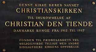
in World War II. The other plaque reports that the
church was built in memory of
the Danish King, Christian X, after whom the church
is named, as Christian's Church.
Christianskirkjan
- Wikipedia (27. februar 2022)
|
Christianskirkjan
|
|
|
|
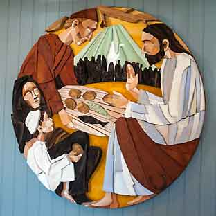
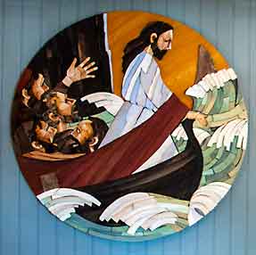
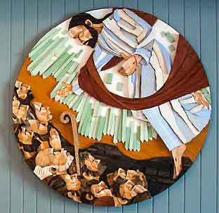
In the Spring of 2013, Edward
Fuglø created ten, mixed-media wood and
acrylic ornamental reliefs
for Christianskirkjan, Christian’s
Church, in Klaksvík, Faroe Islands.
The reliefs depict scenes from the life
of Jesus. The medium wood is quite appropriate
when we think of the
Saviour as the foster
son of Joseph,
the carpenter.
2016
(edwardfuglo.com) (25.
oktober 2023)
|
|
Farvel til Klaksvik
|
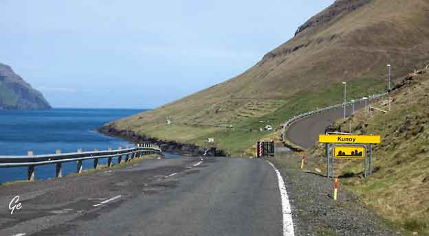
Fra
Klaksvik skulle vi til Torshavn,
men først tok vi en tur ut til Kunoy.
På bildet: Kunoy-tunnelen.
|
|
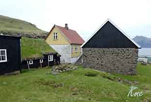
Kunoy is one of the
island in the northern part of the Faroe Islands. The
island is
long and narrow. Due to its steep mountains with
kilometres of rock face, there
are only two villages on the island: Kunoy
and Haraldssund.
There is road connection all the way
from Tórshavn to this island. When getting to
Kunoy from the capital, you drive through tunnels, a
bridge, an undersea tunnel
and finally crossing an embankment to reach Haraldssund
on Kunoy island.
From Haraldssund there is a tunnel that leads to the
village Kunoy. The tunnel
through the mountain has one lane only and is very
narrow.
The name of the highest peak on Kunoy island is
Kúvingafjall (830 m). Kunoy
translates directly to Woman island.
When in the village Kunoy on the west side of Kunoy
island, you will have a
great view of Kalsoy island. You will see the
Kalsoyarfjørður fjord, where aerial
filming of Kalsoy island were captured in the James Bond
movie No Time To Die.
Kunoy
| Guide to Faroe Islands : Guide to Faroe Islands
(27 . februar 2022)
|
Kunoy
|
Kunoy er en bygd
på Færøyene. Den ligger på vestkysten av
øya Kunoy, som
den har sitt navn fra, og er administrasjonssentrum
i Kunoyar kommuna. 1.
januar 2009 hadde Kunoy 84 innbyggere, mot
49 i 1985
Bygda Kunoy er første gang nevnt i Hundebrevet.
Et sagn fra bygda forteller at
det høyt oppe på øya Kunoy ligger en planke
fra Noas ark. Det vokser muslinger og
små konkylier på den. Folk som har gått seg
ville i tåken har sett planken, men
ingen som har lett etter den har noensinne funnet den.
Kunoy
(bygd) – Wikipedia (24. januar 2023)
|
Kunoy med utsikt mot Kalsoy
|
Kunoy kirke
|
I 1867 ble Kunoyar
kirkja reist. For å kunne finansiere kjøpet
av altertavle og lysekrone ble man enige om at hver båt
skulle gi én fisk til kirken etter hver
fisketur. Nabobygda Haraldssund på østkysten
er sannsynligvis eldre enn Kunoy, mens Skarð i
dag er avfolket. Tidligere var postbåten fra Klaksvík
den eneste forbindelsen til omverdenen. Det ble først
veiforbindelse mellom Kunoy og Haraldssund i 1988,
da en tunnel ble sprengt ut gjennom fjellene, og videre
en veidemning over fra Haraldssund til Borðoy.
Dette la grunnlaget for at de fleste av Kunoys
innbyggere i dag kan arbeide i Klaksvík.
Kunoy
(bygd) – Wikipedia
(24. januar 2023)
|
Da
Kunoy kirken blev indviet, var taget af skiffer, men
dette er senere
udskiftet til rødt bølgeblik.
På hver side har kirken grønmalede vinduer.
Indgangsdøren sidder på
vestgavlen, der vender ud mod sundet. Kirken er
allerede kort efter
opførelsen, blev malet indvendigt, hvilket er lidt
usædvanligt.
Det meste af inventaret stammer fra kirkens opførelse.
Altertavlen forestiller "den korsfæstede" af Vilh. B.
Kirkesølvet fra 1830'erne er overført fra den
tidligere kirke.
I tårnet hænger en klokke omstøbt fra den tidligere
kirke.
http://www.danske-kirker.dk/index.php/19-faeroerne/218-kunoy-kirkja
|
Fjellene på Kunoy
|
Terrasser på Kunoy
|
Potetåker
|
Tusenfryd
|
|
Hus i Kunoy
|
Kværnhus
|
|
Elva gjennom landsbyen
|
og broa over elva
|
Kirken sett fra fjøra
|
og trappene ned til fjøra.
|
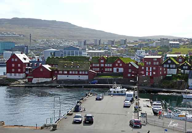
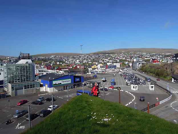
Torshavn
Fra Kunoy kjørte vi direkte til Torshavn
og sjekket inn på Torshavn
hotel
Torshavn, the
capital and largest town of the Faroe Islands is located
in the southern part on the east coast of Streymoy.
Torshavn
means ‘Thor's Harbor’, named after the god of
thunder and
lightning in Norse mythology. Founded in the 10th
century, it is considered
to be one of the oldest capitals in Northern Europe.
The city of Torshavn has fish-processing plants, a
shipyard, and produces
woolen products that add to the economy and of the
town.
Known
mostly for the Vikings, Torshavn is surrounded with
mountain
Húsareyn to its north at a height of about 1,140 ft
and Kirkjubøreyn to
the southwest at 1,100 ft height. Fishing, fish
processing, shipbuilding,
construction and handicrafts are the major
activities of the Faroese people.
The Faroese government situated in the remarkable
Tinganes peninsula
of Torshavn town was initially located on Tinganes.
Since 1856, it has
been located on the town square, Vaglið where the
city was temporarily
occupied during World War II by few dynasties.
The
early days of Viking settlement at Torshavn
begins more than thousand
years ago where it’s administrative and
political centre and the Faroese
Government offices positioned in the old listed
buildings add to the historic
glory of the town.
|
Today,
Torshavn looks like a modern town owing to modern
communication
and infrastructure. It is not much isolated as it
used to be in the past
centuries. It has even retained its unique
character, mesmerizing charm
that sets its different from any other capital in
the world.
The
city witness a budding number of people who come
to it to
enjoy its harbors,
striking and dramatic scenery, countryside sea,
age-old history, culture and the old fortress built
in 1630 to protect
the market from pirates. This has remarkably
increased its population.
https://www.torshavn.com/v/city-info/
|
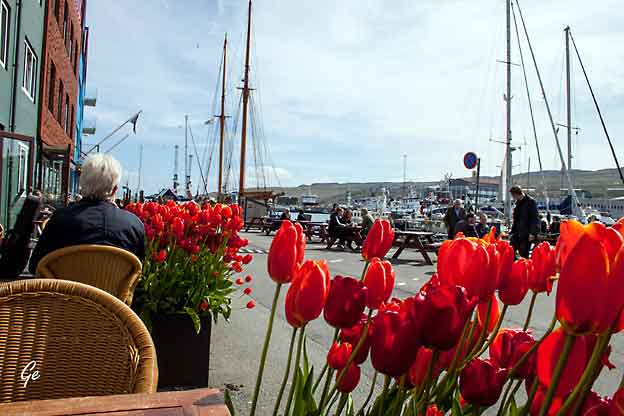
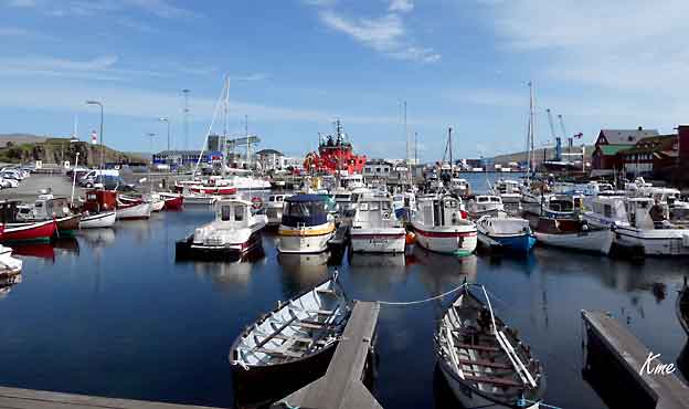
En fin dag for utepils på Torshavn
Waterside.
|
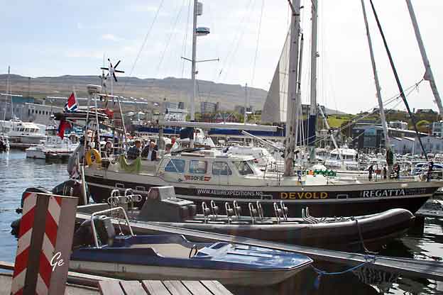
Det lå en norsk seilbåt i havn.
|
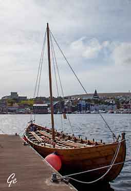
Vikinger?
|
Flagget på Tinganes
|
|
|
Tinganes is
the oldest part of the capital in the Faroe
Islands, Tórshavn. Among its grass roofed houses
you will find the Prime Minister’s Office and
other government buildings.
‘Ting’ translates to Parliament and the small peninsula
has been the centre of power
in the Faroe Islands since the Viking Age. This rocky
ground made up the settings for the annual parliamentary
assembly.
The first settlers
gathered here each summer to discuss the state of the
island group. They came from all the different islands
in the archipelago to solve twists and assign different
tasks.
These cobblestone streets are open to the public. Walk
around the red houses and you will see signs such as
‘Ministry of Finance’ and ‘Ministry of Foreign Affairs’
on the doors.
All the ministers in the
government of the Faroe Islands have weekly meetings in
Tinganes. Buildings here date back to the 17th and 18th
century.
Walk to the tip of the bedrock and you will see the
harbour area in Tórshavn. Turn towards the foremost
building on the peninsula. This is the Prime Minister’s
Office.
A flagpole with the Faroese flag sits
next to the building.
(23. janiar 2023)
Tinganes
| Guide to Faroe Islands : Guide to Faroe Islands
|
Tórshavn domkirke (færøysk:Havnar kirkja [ˈhaunaɹ
ʧɪɹʧa],
eller Dómkirkjan er den nest eldste bevarte kirken på
Færøyene.
Den er en luthersk domkirke og menighetskirke i
Torshavn.
Kirken ligger i byens eldre del, og ble oppført i
1788.
Bare Olavkirkjan i Kirkjubøur er eldre.
Tórshavn domkirke er hvitkalket med skifertak.
Domkirken ligger i den nordlige enden av halvøya
Tinganes,
og er en av Tórshavns hovedattraksjoner.
Den har vært sete for Færøyenes biskop siden
1990.
https://no.wikipedia.org/wiki/T%C3%B3rshavn_domkirke
|
|
|
|
Trange
gater og koseligehus.
|
|
|
|
Nólsoyar Páll (originally,
Poul Poulsen Nolsøe)
(11 October 1766, Nólsoy – 1808
or 1809, near Sumba) is a
Faroese national hero.
He was a seaman, trader, poet,
farmer and boat builder who
tried to develop direct trade
between the Faroes and the
rest of Europe and introduced
vaccination to the islands.
He went missing in the winter
of 1808/09 sailing home
from England.
https://en.wikipedia.org/wiki/N
%C3%B3lsoyar_P%C3%A1ll
|
Nólsoyar Páll
statue by Hans Pauli Olsen
|
|
Lørdag 26. mai 2018
Tur til Kirkjubøur
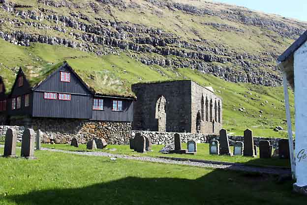
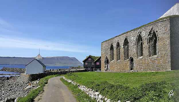
Kirkjubøur (Danish: Kirkebø)
is the southernmost village on Streymoy, Faroe
Islands. The village is located on the south-west coast
of Streymoy and has a
view towards the islands
of Hestur and Koltur towards the
west, and to Sandoy towards the south. It lies
south of the new ferry port of Gamlarætt,
which opened in 1993.
The village is the Faroes' most important historical
site, with the ruins of the
Magnus Cathedral from around 1300, Saint
Olav's Church (Olavskirkjan), from
the 12th century and the old farmhouse
of Kirkjubøargarður from the 11th
century. In 1832, a runestone was found near
the Magnus Cathedral in
Kirkjubøur. The stone which is referred to as
the Kirkjubøur stone dates back
to the Viking Age.
Kirkjubøur
- Wikipedia (24.1.2023)
|
Kirkjubøur
Veien til Kirkjubøur
|
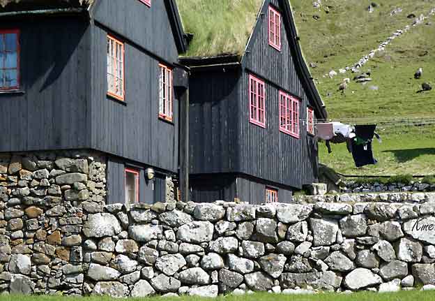
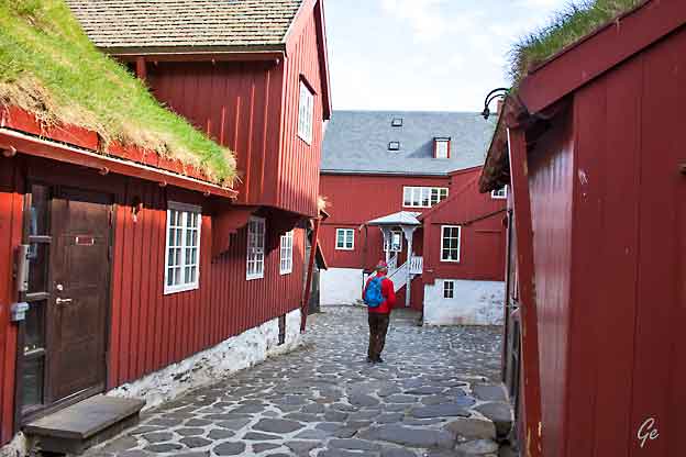
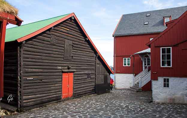
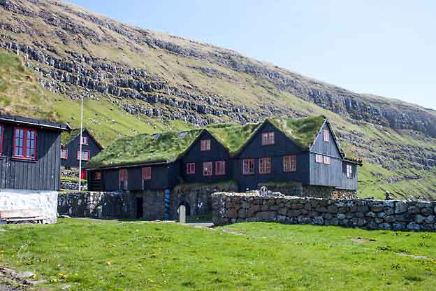
Kongsgården
|
|
Kirkjubøargarður (Faroese for Yard
of Kirkjubøur, also known as
King's Farm) is one of the oldest still inhabited
wooden houses of the
world, if not the oldest.
The farm itself has always been the largest
in the Faroe Islands.
The old farmhouse of Kirkjubøur dates back
to the 11th century.
It was the episcopal residence and seminary of
the Diocese of the
Faroe Islands, from about 1100.
The legend says, that the wood for the block houses
came as driftwood
from Norway and was accurately bundled and
numbered, just for being s
et up. Note, that there is no forest in the Faroes
with the exception of a wood
in northern Tórshavn, and wood is a very valuable
material. Many such wood
legends are thus to be found in Faroese history.
The oldest part is a
so-called roykstova (reek parlour, or smoke
room).
Perhaps it was moved one day, because it does not fit
to its foundation.
Another ancient room is the loftstovan (loft
room). It is supposed that Bishop
Erlendur wrote the 'Sheep Letter' here in 1298.
This is the earliest document
of the Faroes we know today. It is the statute
concerning sheep breeding on
the Faroes. Today the room is the farm's library.
|
The stórastovan (large
room) is from a much later date,
being built in 1772.
Though the farmhouse is a museum, the
17th generation of the
Patursson Family, which has occupied it since 1550, is
still living here.
Shortly after the Reformation in the Faroe
Islands in 1538,
all the real estate of the Catholic Church was seized
by the
King of Denmark. This was about half of the land in
the Faroes,
and since then called King's Land ('kongsjørð').
The largest piece
of King's Land was the farm in Kirkjubøur due to the
above-mentioned episcopal residence.
This land is today owned by the Faroese government,
and the Paturssons are tenants from
generation to generation.
It is always the oldest son, who becomes King's
Farmer,
and in contrast to the privately-owned land, the
King's Land
is never divided between the sons.
https://en.wikipedia.org/wiki/Kirkjub%C3%B8argar%C3%B0ur
|
|
Bilder fra Kongsgården
|
|
|
Modell av Magnuskatedralen
|
|
Saint Olav's Church is
a medieval church in the village
of Kirkjubøur in Streymoy, Faroe Islands. It
was built before 1200, which makes it the oldest church
of the
Faroe Islands. Until the Reformation, it served as
the seat of the Catholic bishop.
The pew ends from the church were transferred in 1875,
after the church was
restored, to the National Museum of
Denmark in Copenhagen and were returned
to Faroe Islands and exhibited at the National
Museum of the Faroe Islands in 2002.
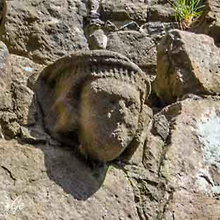
There are 14 pew ends, 11 depicting the Apostles, and
the three remaining ones depicting other Biblical
figures. They were on several occasions featured on
postal stamps — in 1980 (4 stamps), in 1984 (4 stamps),
and in 2001 (4 stamps).
A runestone, the Kirkjubøur stone, was found in
1832 in the church.
Today it is in the National Museum of the Faroe Islands.
https://en.wikipedia.org/wiki/Saint_Olav%27s_Church,_Kirkjub%C3%B8ur
|
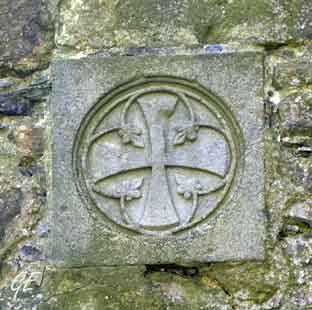
Olavskirken
Glasskunsten ved inngangen
til kirken er utført av Tróndur Patursson.
https://no.wikipedia.org/wiki/%C3%93lavskirkjan
|
Olavskirken og kirkegården
|
Olavskirken og kirkegården
|
Kongsgården, Magnuskatedralen og litt av
Olavskirken
|
|
Olavskirken og Magnuskatedralen
|
Bilder fra
Magnuskatedralen |
|
Bilder fra Magnuskatedralen
|
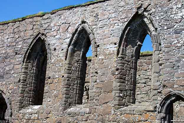
St. Magnus
Cathedral (Danish: Magnuskatedralen) is
a ruined cathedral
in the village of Kirkjubøur on the island
of Streymoy in the Faroe Islands.
The ruins are the largest medieval building in the Faroe
Islands.
Bishop Erlendur (1269–1308) started construction in
about the year 1300.
However, the building was never completed, because it
was never roofed.
|
|
Bilder
fra Magnuskatedralen |
The cathedral remains in
an unfinished state to this day.
The only known relic of St. Thorlak of
Iceland is contained with other
saints' relics in a lead box in the sanctuary's end wall
("The Golden Locker").
Conservation work on
the Cathedral started in 1997, as it became clear
that the ruin was deteriorating at a rapid pace, with
more and more
mortar falling away due to the elements, mostly from
rain, but also salty
sea air and sea water. During 2002-2004, a wooden shed
was erected
around most of the ruin, giving it enough shelter to
dry out, before work
could begin on preservation. The shed drew
considerable criticism
because of its looks.
https://en.wikipedia.org/wiki/Magnus_Cathedral
|
Kirkjubøur
|
Ved Kirkjubøur
|
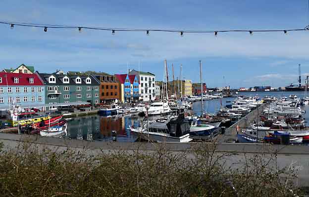
Torshavn
museum, Nordens Hus, Vestur-kikjan, Torshavn Skanse o.a
Utenfor Nordens Hus
The Nordic
House (Faroese: Norðurlandahúsið) Coordinates:  62.022039°N
6.784631°Wis a cultural institution in the Faroe
Islands. Its aim is to support 62.022039°N
6.784631°Wis a cultural institution in the Faroe
Islands. Its aim is to support
and
promote Nordic and Faroese culture,
locally and in the Nordic region.
Erlendur Patursson (1913-1986), Faroese
member of the Nordic Council,
brought forward the idea of a Nordic cultural house in
the Faroe Islands.
A Nordic competition for architects was held in 1977,
where 158 architects participated. Winners
were Ola
Steen from Norway and Kollbrún
Ragnarsdóttir from Iceland. By staying true
to folklore the architects built
the Nordic House to resemble an
enchanting hill of elves. The building
is
considered to be one of the most beautiful
in Scandinavia. The house opened
in Tórshavn in 1983.
The Nordic House is organized as a cultural
organization under the Nordic
Council of Ministers. The Nordic House is run by a
steering committee of 8,
of which 3 are Faroese and 5 from the outside Nordic
countries. Also there is
a local advisory body of 15 members, representing the
Faroese cultural
organizations. For a 4-year period, the steering
committee appoints a
director of the house.
https://en.wikipedia.org/wiki/Nordic_House_in_the_Faroe_Islands
(22.8.2019)
|
Bilde fra Nasjonalmuseet i Torshavn
The National Museum
of the Faroe Islands has exhibitions in the
museum
building on Brekkutún 6 in Tórshavn. The
galleries tell the natural and
cultural history of the Faroe Islands. This goes back
to the origin of the
landmass dating back 65 mya, through the
pre-settlement era and the
culture etc. from the Viking Ages and the Middle Ages.
Displays include
rocks and minerals, birds, plants and fish, as well as
items from the
farming live and the maritime live in the Faroe
Islands. The famous
Kikjubøstólarnir, which are parts of the original
benches from the
Ólavskirkjan (St. Olav's Church) of Kirkjubøur are
amongst the most
valued cultural items of the National Museum on
Brekkutún 6. These were
in Denmark for many years but have now returned to the
Faroe Islands.
https://en.wikipedia.org/wiki/National_Museum_of_the_Faroe_Islands
|
Bilder Fra Nasjonalmuseet i Torshavn
|
|
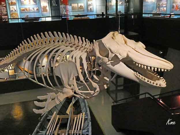
Spekkhogger på Nasjonalmuseet i Torshavn
|
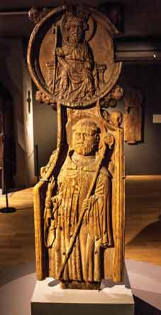
Kirkestol fra Olavskirken på
Kirkjubøur.
Olav den Hellige over
abbedhelgenen Brendanus
|
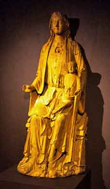
Jomfru Maria med barnet.
Denne sto i også i Olavskirken på
Kirkjubøur
til kirken ble ombygget i 1874
|
|
Trappa nedenfor Havnar kirke i Torshavn.
Et populært sted å slappe av på fine dager.
|
|
|
|
Vesturkirkjan (Vestkirken)
er en kirke i Tórshavn på Færøerne. Den
stilrene og moderne kirke med kobbertaget blev indviet
i 1975. Vesturkirkjan er blevet et af Tórshavns
vartegn, og dens form ligner et skib med sejl. Det 42
meter høje tårn er formet som en lodret halveret spids
pyramide.
Kirken ligger i den vestlige del af byen, på hjørnet
mellem Jóannes Patursonargøta
og Frælsið, og fungerer som sognekirke for vestbyen,
mens Tórshavn Domkirke betjener den østlige
del.
Kirkerummet med 800 siddepladser står med sine hvide
murstensmure i kontrast
til de sorte stengulvfliser.
|
Kirkens
orgel er
et Frobenius-orgel fra 1973 med 16
stemmer.
Alterkorset er lavet af den danske
guldsmed og billedkunstner Bent Exner.
Den 5. juni 2006 blev der foran
kirken indviet et mindesmærke lavet af
billedhuggeren Hans Pauli
Olsen for Sigmundur Brestisson, som
ifølge
Færingesagaen i
år 999 førte kristendommen til
Færøerne.
Vesturkirkjan er om sommeren åbent fra mandag til
fredag kl. 15-17.
Overfor kirken ligger parken Viðarlundin úti
í Grið.
Vesturkirkjan
- Wikipedia, den frie encyklopædi
(24. januar 2023)
|
Utsikt fra Vestukirkjan
Streymoy (Danish: Strømø)
is the largest and most populated island of the
Faroe Islands. The capital, Tórshavn, is located
on its southeast coast.
The name means "island of currents". It also refers to
the largest region of
the country that also includes the islands
of Hestur, Koltur and Nólsoy.
|
The
island is oblong in shape and stretches roughly in
northwest-southeast
direction with a length of 47 kilometres (29 miles)
and a width
of around 10 kilometres (6 miles). There are two
deeply-indented fjords in
the southeast: Kollafjørður and
Kaldbaksfjørður. The island is
mountainous, especially in the northwest, with the
highest peak
being Kopsenni (789 metres (2,589 ft)). That area
is dominated by
over 500-metre-high (1,640 ft) cliffs.
The area is known as Vestmannabjørgini, which means
Cliffs of Vestmanna.
Like the rest of the Faroe Islands there are
numerous short streams and
minor lakes. The main vegetation is grass, with no
trees. Some of the villages
have planted trees inside or just outside the village.
These parks need to have
fences around them in order to keep sheep out.
Streymoy is separated from the
nearby Eysturoy to the east, the
second-largest island of the Faroe Islands, by
the narrow sound of Sundini.
To the west lies the island of Vágar, and to the
south the island of Sandoy.
Three additional smaller islands are situated around
the southern tip of
Streymoy: Koltur, Hestur and Nólsoy.
There are about 23,693 inhabitants on the island
(7-2017), which represents
more than 45% of the whole population of
the Faroe Islands. The majority of
them reside in the capital Tórshavn which
has a population of about 21,000 in
the municipality, of which 13,089 live in Tórshavn,
3,956 in Hoyvík and 2,110
in Argir, Hoyvík and Argir are suburbs of
Tórshavn, but they have grown
together. Around 1,202 people live in Vestmanna,
789 in Kollafjørður.
Besides being the seat of the
government Tórshavn is also the chief port,
seat of the university and the commercial centre of
the islands.
https://en.wikipedia.org/wiki/Streymoy
|
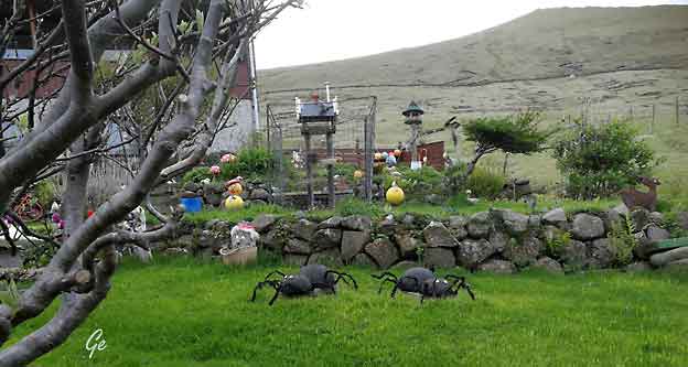
Søndag 26. mai 2018
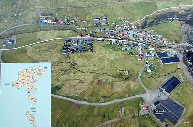
Først en tur til Skansen i
Torshavn,
så kjørte vi tilbake til Vestmanna for å ta båtturen der.
|
Utsikt fra hotellrommet vårt. Pyramiden er
Vesterkirkjan.
|
Også utsikt fra hotellrommet. Litt tåke på
toppen denne morgenen.
|
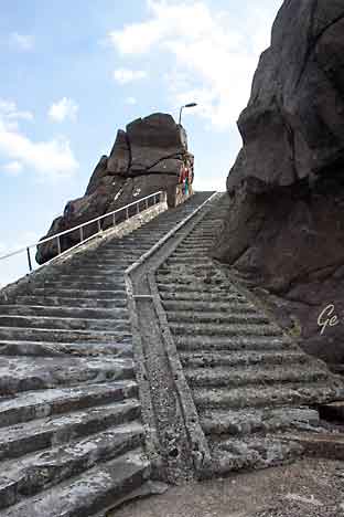
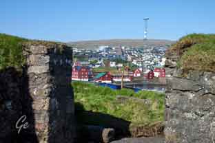
Torshavn Skansin
Skansen og fyret
|
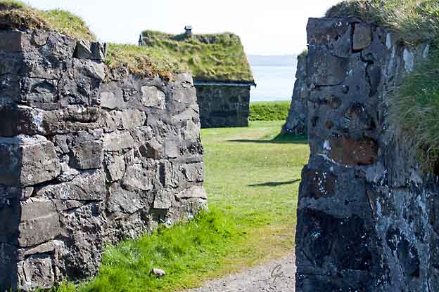
|
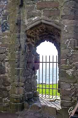
Skansin is a historic fortress
in Tórshavn, the capital of the Faroe Islands.
Skansin is located on a hill beside the port of
Tórshavn. The fort was built in
1580 by Magnus Heinason to protect against
pirate raids of the town, after he
himself was nearly caught up in one such raid. The fort
was expanded
considerably in 1780 and went through a series of
rebuilds for many years
afterwards.
During the Second World War the fort served
Britain as a military base.
Two 5.5 inch guns date from the British occupation,
standing along with many
older Danish cannons.
|
|
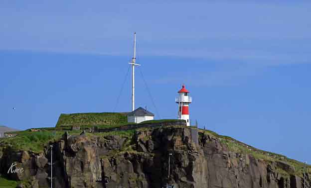
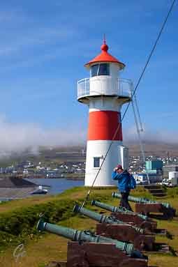
One of the Faroese lighthouses,
the
Skansin Lighthouse (Skansin
international lighthouse), towers
over the fortress, pointing the way
to the capital.
The strategic location of the fort offers
views of Tórshavn port, surrounding
landscape and views
out towards Nólsoy island
Skansin
- Wikipedia
(23. januar 2023)
|
Skansin lighthouse og
de gamle kanonene
|
Skansin og Skansin Lighthouse
|
|
|
Fríða (Frida)
by Hans
Pauli Olsen, a modern
sculpture, at Torshavn,
Faroe Islands
|
|
Skansin, Fríða og Grete
|
Torshavn sett fra Skansin. Det er kø til
Smyril Line.
|
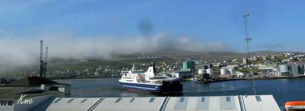
Smyril Line går ut. Fortsatt ligger det
tåke på toppene.
|
|
Tørrfisk utenfor restaurant i den
gamle bydelen.
|
|
|
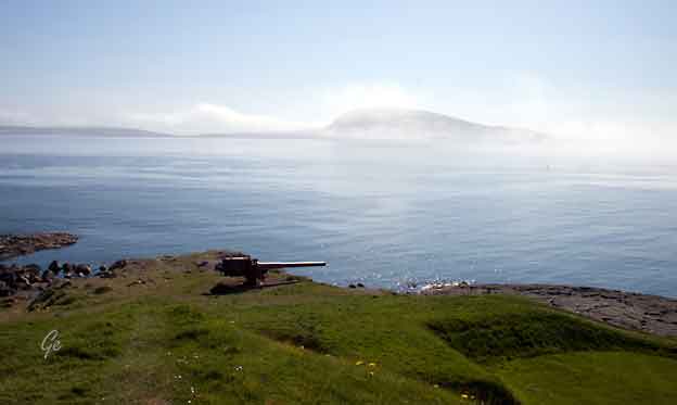
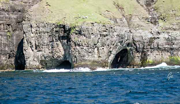
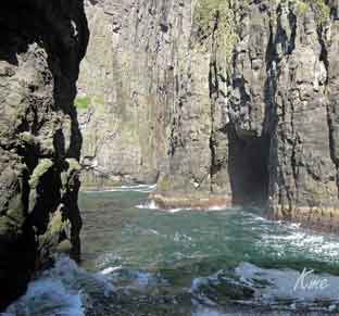
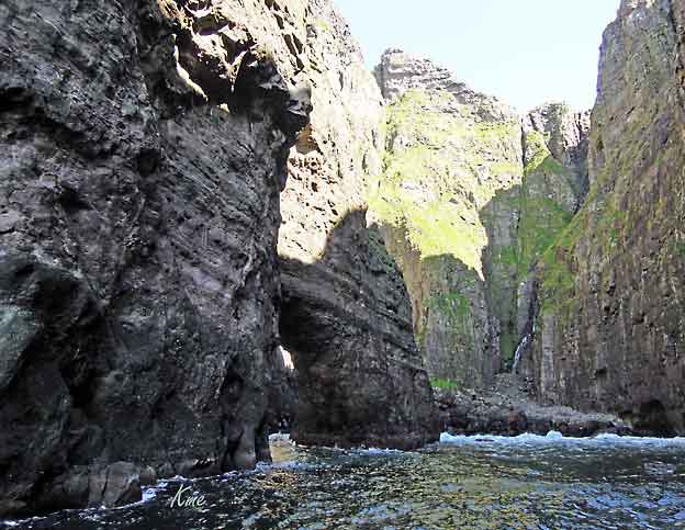
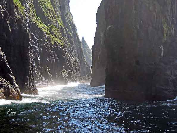
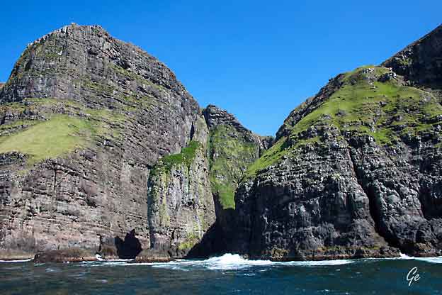
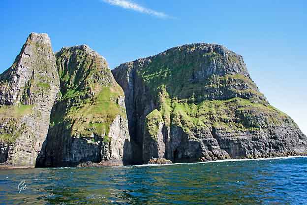
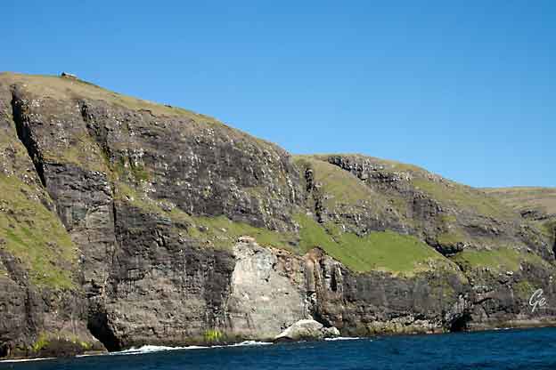
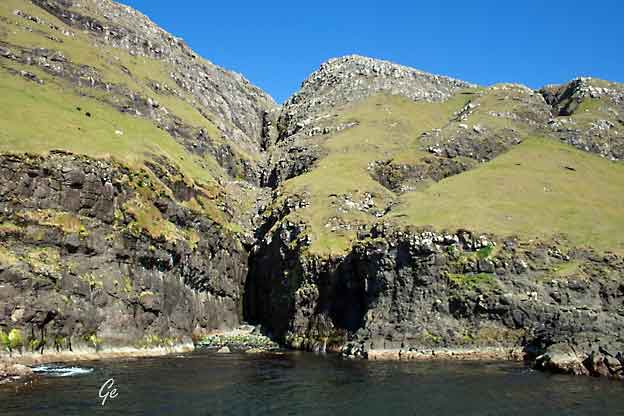
Vestmanna -
Boat tour
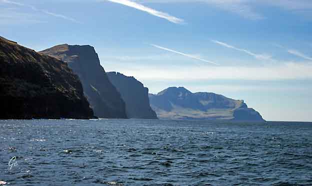
These cliffs are one of
the most popular tourist attractions in the Faroe
Islands.
The classic boat tour to Vestmanna Sea
Cliffs is made from April to October. All
boats depart from the village Vestmanna. It takes
less than half an hour to sail
to the sheer cliffs, sea stacks rising sky-high from the
ocean, and dark basalt
grottos.
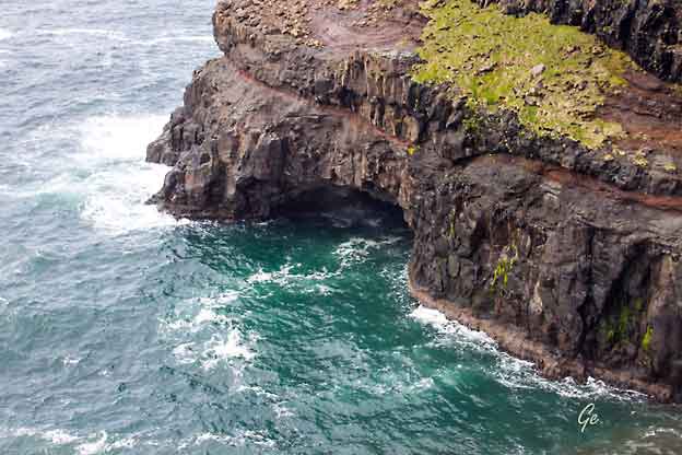
Vestmanna Bird Cliffs are known as Vestmannabjørgini by
the locals. These cliffs
make up 5 kilometre of the coastline on Streymoy
island north of Vestmanna.
There is a fantastic wildlife here as birds are nesting
in the cliffs and thrive flying
in the untouched surroundings.
Boat tours to the Vestmanna Sea Cliffs take two hours.
Weather permitting, you
will sail into natural grottos and caves formed by the
waves crashing into the
rock walls.
Along the way to the sea cliffs, you will
have Vágar island on your left hand side.
Here you will also pass the now uninhabited
village Slættanes. The nearest village
not far from the cliffs is Saksun lying deep
into a narrow strait that leads to a
natural tidal lagoon.
Vestmanna
Bird Cliffs | Guide to Faroe Islands : Guide to Faroe
Islands (27 . februar 2022)
|
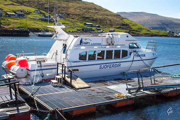
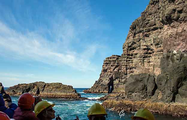
Vestmanna, båttur
Vestmanna turistsenter og båten Freyur
|
|
Vær forsiktig når du går fjelltur på
Færøyene
|
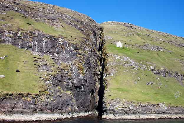
Den fraflyttede byen Slettanes
|
|
|
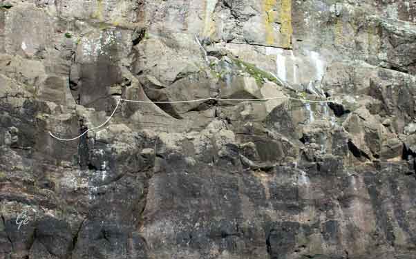
Sikkerhetstau, brukes under utsetting og
innsamling av sauer
|
|
|
|
|
Det er trangt inne
mellom klippene.
Heldigvis hadde
skippern god
kontroll.
|
|
|
|
|
Klippen Elefanten
|
|
|
|
|
Sauene klarer seg godt i det bratte
terrenget
|
Blomster mellom steinene
|
Vi er tilbake i Vestmanna. Noen gutter
skal vise seg for oss.
|
Vestmanna
|
Leynar
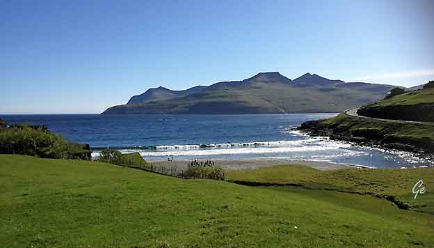
Leynar (Danish: Lejnum)
is a village in the Faroe Islands, a
self-governing
overseas administrative division of Denmark.The
village is on the western
coast of the island of Streymoy in the
municipality of Kvívíkar. The 2005
population was 120. Leynar is the birthplace of
Faroese actor Sverri Egholm (1930–2001).
https://en.wikipedia.org/wiki/Leynar
|
Leynar, dansk:
Lejnum) er en bygd på Færøyene. Den
ligger i Kvívíkar
kommuna på Streymoys vestkyst.
Bebyggelsen ligger spredt i åsene
ovenfor stranden Leynasandur, som
er et populært badested og rekreasjonsområde
om sommeren.
I dalen like ved Leynar ligger
innsjøen Leynavatn, hvor det er
populært å fiske. Fra Leynar
går Vágatunnilin over
til Vágar.
Leynar er første gang nevnt i 1584.
1. januar 2009 hadde Leynar
113 innbyggere, mot 70 i 1985
https://no.wikipedia.org/wiki/Leynar
|
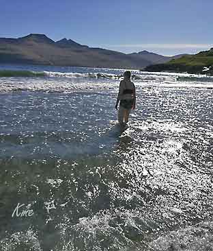
Grete skal bade
|
|
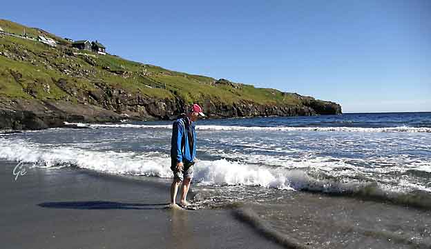
Karl Martin nøyer seg med å vasse.
|
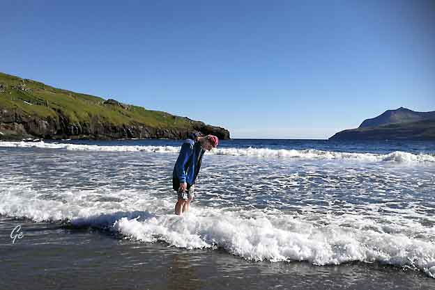
Karl Martin på Leynar strand.
|
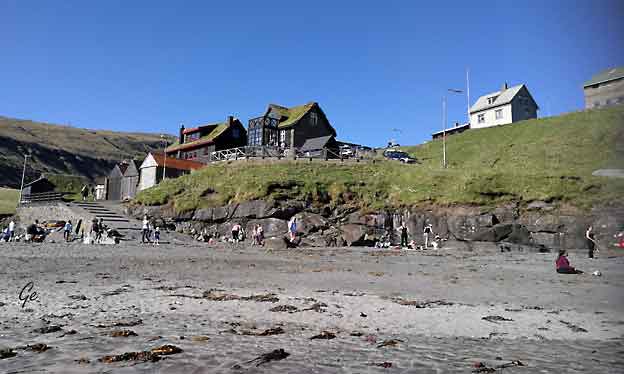
Noe av bebyggelsen i Leynar.
|
Så var det
egentlig slutt på ferien på Færøyene.
Den siste natta bodde vi flyplasshotellet Vágar hotel,
for vi skulle ha en tidlig avgang til Bergen.
Derfra med Norwegian til Oslo og tog og båt hjem.
|
Tekst og
bilder: Grete og Karl Martin Emblemsvåg
|
tilbake
til 1. side
|
|