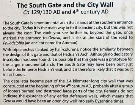
Fra programmet for reisen:
Flyavgang fra Oslo Gardermoen med Turkish Airlines
ved lunsjtid, flybytte i Istanbul, og så ankommer vi
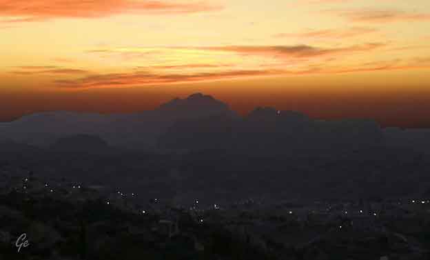
Amman rundt midnatt og kommer oss i hus.
Nattstille gater her hvor Midt-Østens nyere historie
har gjort byen til det moderne Jordans hovedstad, en
summende storby og et sentrum i regionen.
Vi har et par dager til å oppleve byen og ha den som
base for spennende dagsturer.
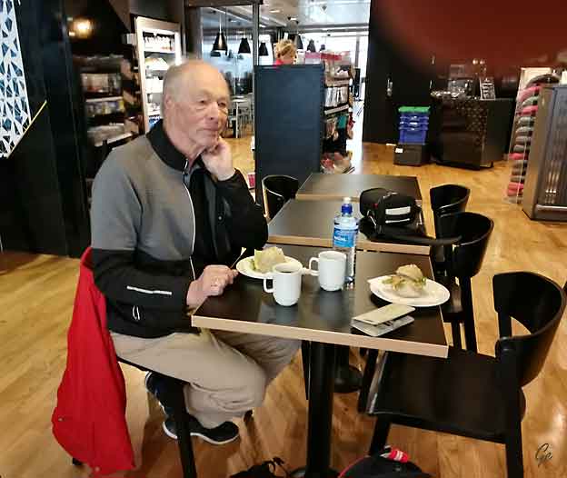
Karl Martin får seg litt mat og kaffe før flyavgang.
Vi er på Ritazza på Gardermoen.
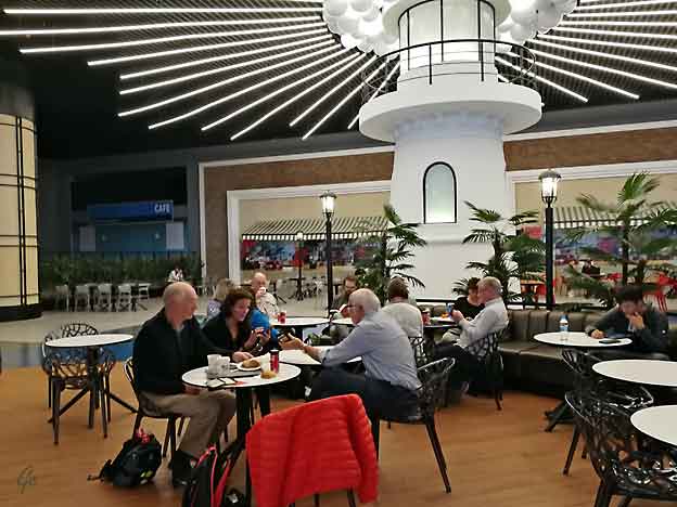
Så er vi kommet til den nye flyplassen i Istanbul.
Istanbul Airport
in the history of the Turkish Republic, opened for service on October 29, 2018;
since April 6th 2019, the airport is operational with all units and at full capacity.
Covering an area of 76,5 million square meters, the new airport serves as a
global hub between Asia, Africa and Europe.
https://www.istairport.com/en
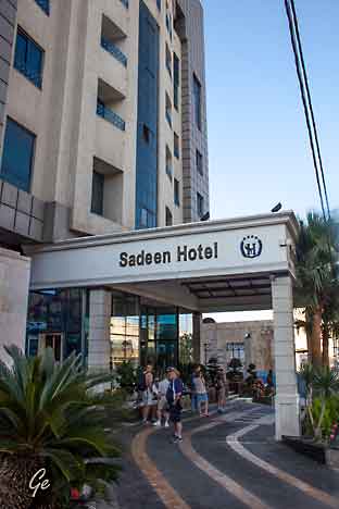
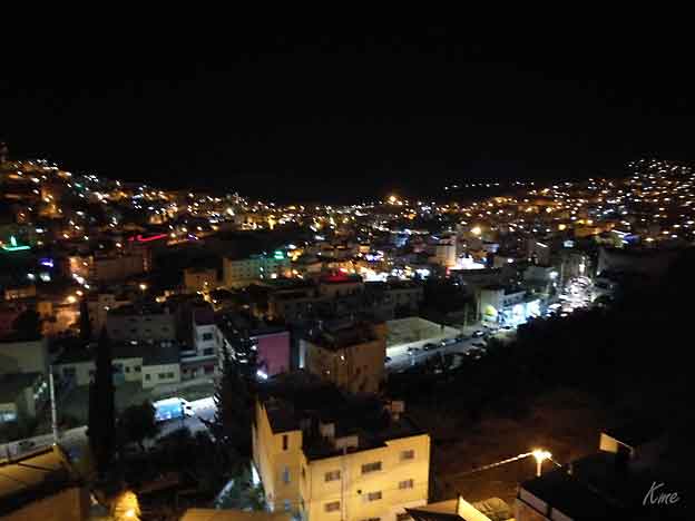
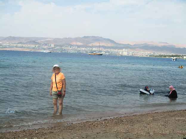
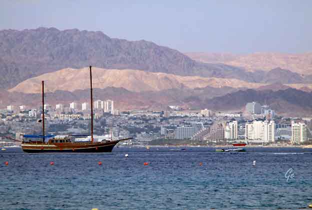
I Amman bodde vi på Sadeen hotel. Dette er utsikten fra rommet vårt.
Sadeen Amman Hotels & Suites offers to guests the ultimate facilities and
comforts. It is a hotel for travelers looking for luxury in private surrounding
with convenient location. Service from our associates is swift, professional
and friendly.
http://sadeenhotel.com/about-us/
Reisen gikk fint og hotellet var bra.
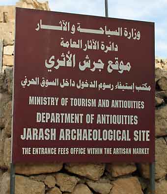
Program for dagen:
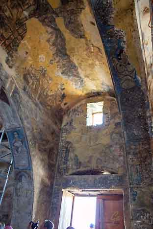
Veien øst for Amman fører gjennom sand- og stenlandskaper, så flatt
og endeløst, med oppkommer her og der, hvor omayyadene, det første
muslimske dynastiet, bygde jaktslott, landsteder.
De var egentlig nomader, men utviklet en bykultur i Damaskus og
lengtet nok tilbake til ørkenens vide horisonter.
Ruinene er til dels så godt bevarte at de hjelper fantasien.
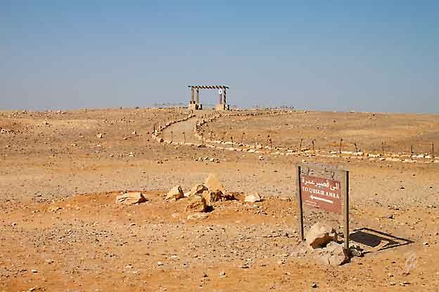
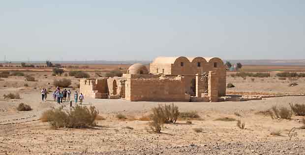
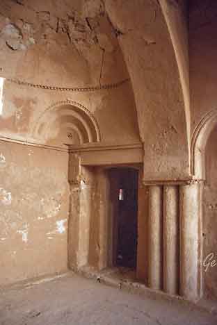
Et av dem, Qasr Amra, står på UNESCOs verdensarvliste.
T. E. Lawrence brukte dem til base for sine raid mot ottomanenes
stillinger i området og mot jernbanelinjen mot Mekka.
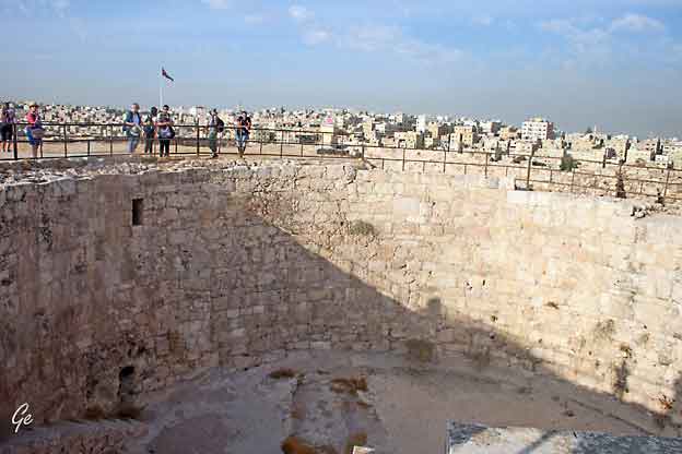
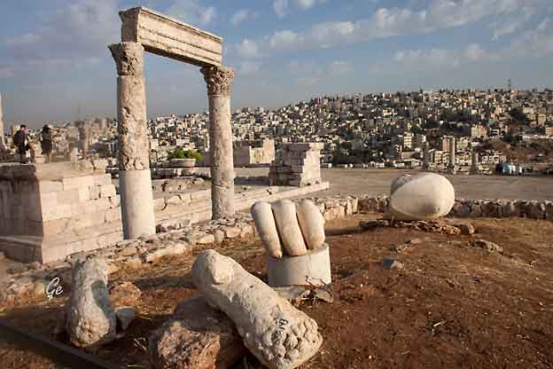
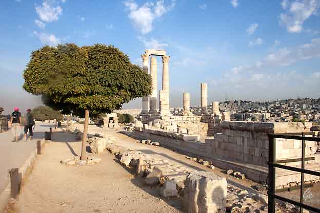
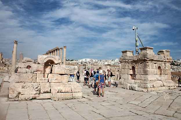
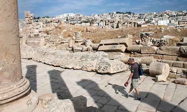
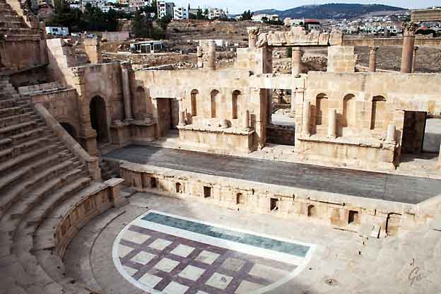
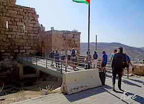
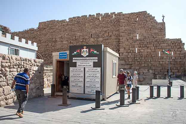
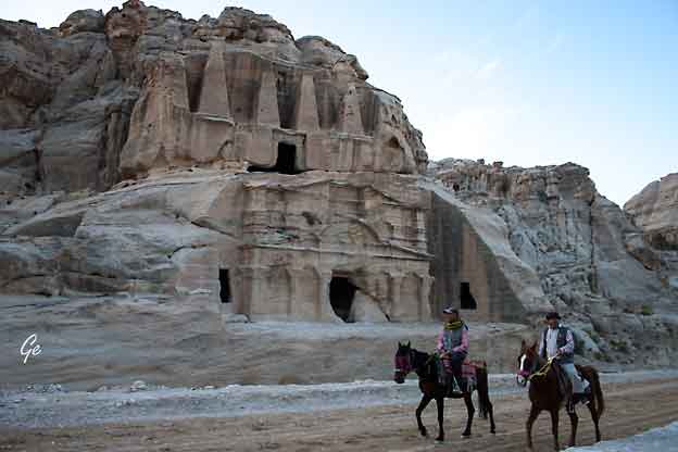
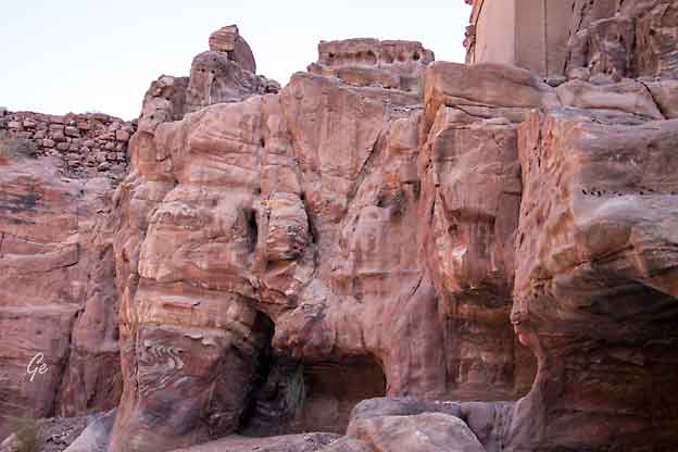
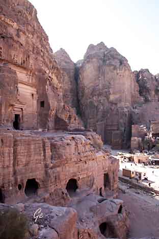
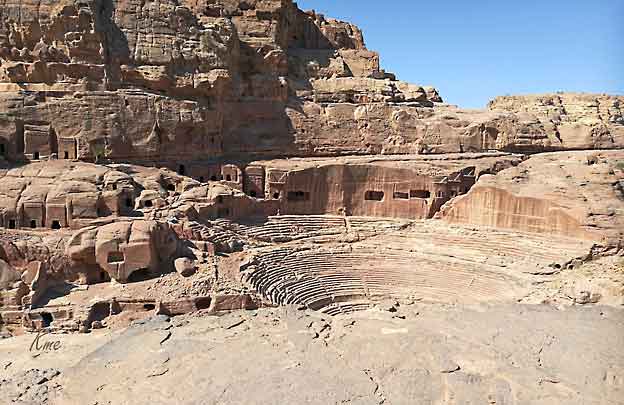
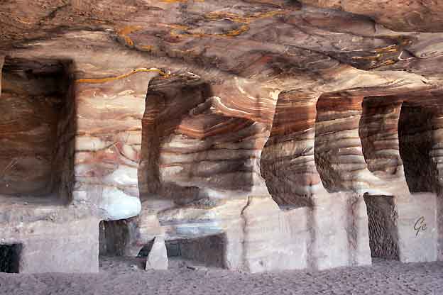
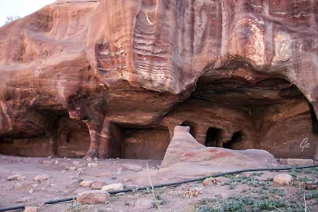
Tilbake i Amman skal vi utforske byen. Vi ser Citadell-høyden med
levninger fra romersk, bysantinsk og arabisk tid. Under føttene våre
ligger 7000 års historie. Nede i byen ligger et romersk teater og
historiske museer.
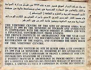 |
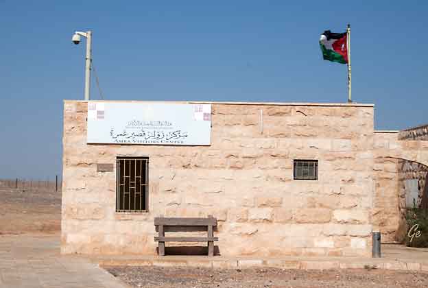
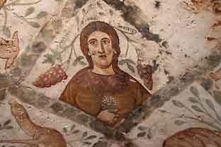
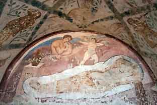
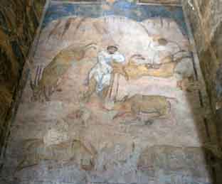
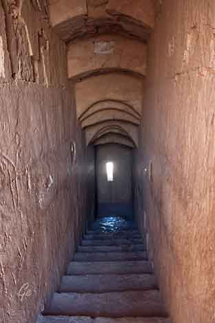
The visitors Centre of the site of Quseir Amra was built in 1999 by the ministry of Tourism and Antiquities in cooperation with the french Embassy in Amman and with a Finansial contribution from UNESCO. The french institute of archaeology for the near east (IFAPO) carried out the |
and furnished the show room of the visitors Centre.
 |
Quseir
Amra has been inscribed upon the World Heritage list of the Convention concerning the protection of world Cultural and Natural Heritage. Inscription on this list confirms the exceptional universal value of a cultural or natural site, which deserves protection for the benefit of all humanities. |
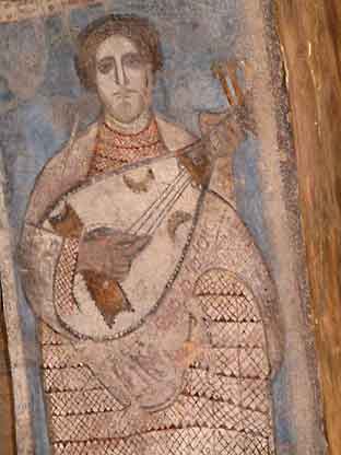
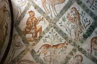
time used as a temporary lodging for members of the ruling Umayyad family.
The most outstanding features are reception hall and the baths, both richly
decorated with figurative murals that reflect the secular art of the time.
Along
with the intriguing architecture of the building Qusayr
Amra is also
famed for its wall paintings. Each wall painting in
the castle depicts the
life of the Umayyads with images of wrestlers,
half-naked women, dog
races and hunting. These paintings were a pleasant
surprise to historians
as they shed some light on the livelihood of the
Umayyads.
during the 8th Century. In the changing room, visitors will find a painting with
three blackened faces which is believed to reflect the three life stages.
The most famous painting on site is the Dome of Heaven; a map of the
northern hemisphere sky located in the domed ceiling.
The map includes the zodiac signs and is thought to be the very first map of
the universe painted onto a curved surface.
https://touristjordan.com/qusayr-amra/
 |
 |
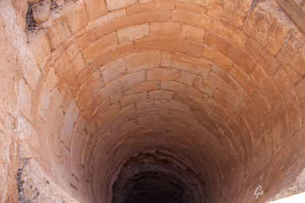
Brønnen i Quseir Amra
 |
 |
 |
 |
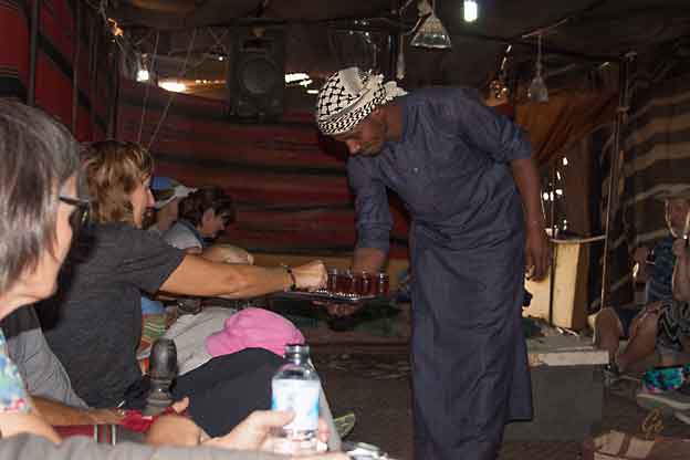
Servering av te
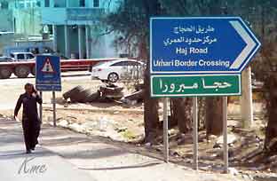
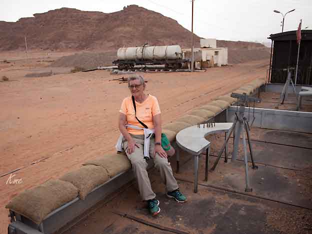
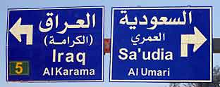 Vi er ikke langt fra grensen til Irak og Saudi Arabia |
 |
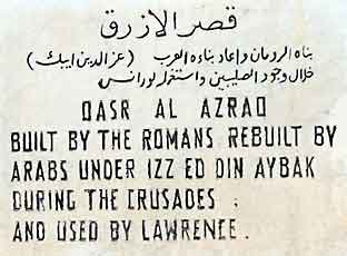
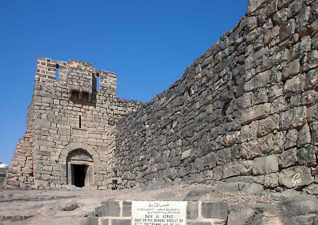
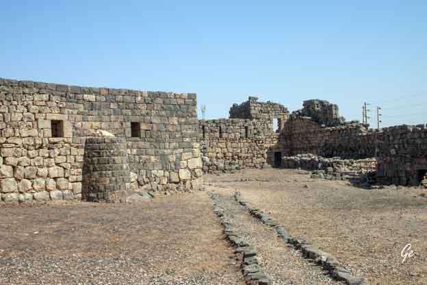
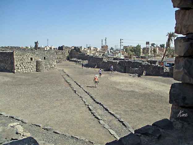
The strategic significance of the castle is that it lies in the middle of the Azraq
oasis, the only permanent source of fresh water in approximately 12,000
square kilometres (4,600 sq mi) of desert. Several civilizations are known to
have occupied the site for its strategic value in this remote and arid desert area.
The area was inhabited by the Nabataean people and around 200 CE fell under
the control of the Romans. The Romans built a stone structure using the local
basalt stone that formed a basis for later constructions on the site, a structure
that was equally used by the Byzantine and Umayyad empires.
when 'Izz ad-Din Aybak, an emir of the Ayyubids, redesigned and
fortified it. The fortress in its present form dates to this period.
In the 16th century the Ottoman Turks stationed a garrison there, and
T. E. Lawrence (Lawrence of Arabia) made the fortress his desert
headquarters during the winter of 1917, during the Great Arab Revolt
against the Ottoman Empire. His office was in the chamber above the
entrance gatehouse. It had an additional advantage in modern warfare:
the flat nearby desert was an ideal place to build an airfield.
https://en.wikipedia.org/wiki/Qasr_Azraq
 |
 |
 |
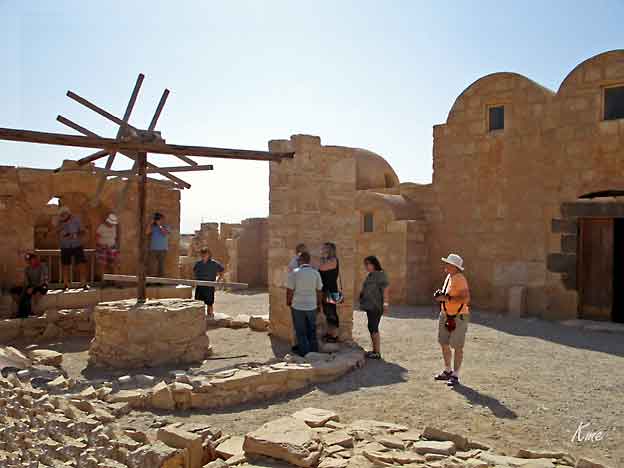
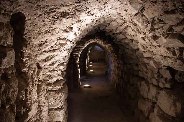
Fra
Dasr al Azraq kjørte vi videre til Kharaneh som kan ha blitt brukt som overnattingssted. |
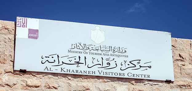
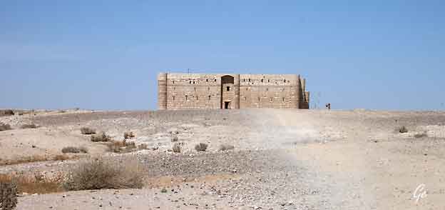
Qasr Kharana (Arabic: قصر خرّانة), sometimes Qasr al-Harrana, Qasr al-Kharanah, Kharaneh or Hraneh, is one of the best-known of the desert
castles located in present-day eastern Jordan, about 60 kilometres (37 mi)
east of Amman and relatively close to the border with Saudi Arabia. It is
believed to have been built sometime before the early 8th century AD,
based on a graffito in one of its upper rooms, despite visible Sassanid
influences. A Greek or Byzantine house may have existed on the site.
It is one of the earliest examples of Islamic architecture in the region.
 |
 |
internal arrangement does not suggest a military use, and slits in its wall
could not have been designed for arrowslits. It could have been a caravanserai,
or resting place for traders, but lacks the water source such buildings usually
had close by and is not on any major trade routes.
https://en.wikipedia.org/wiki/Qasr_Al-Kharanah
 |
 |
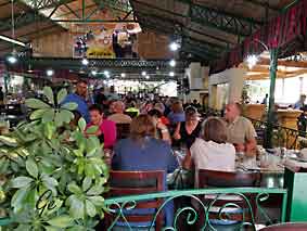
Nå var det tid for lunsj
 |
 |
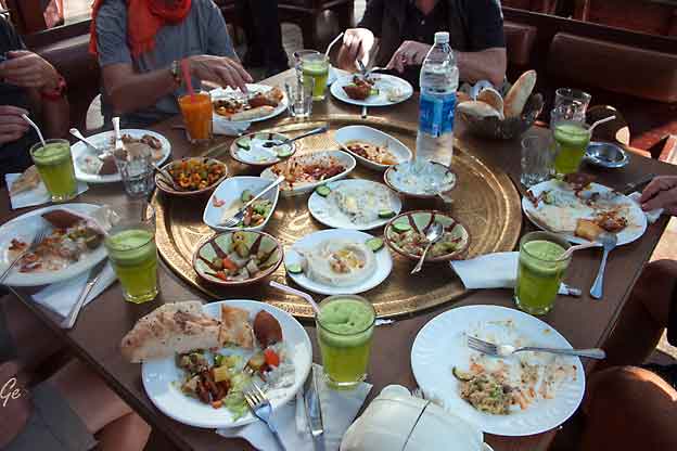
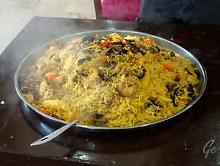
Fin restaurant og fin servering. Mange forskjellige retter,
men sånn er visst skikken i Jordan. God mat.
Restauranten var alkoholfri, så det ble juice til maten.
Vi ble anbefalt Lemon and lime juice og valgte det. God.
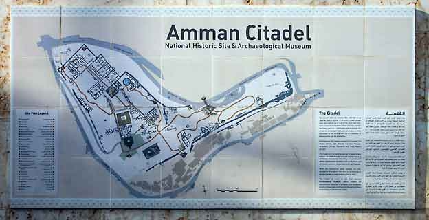
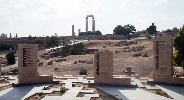
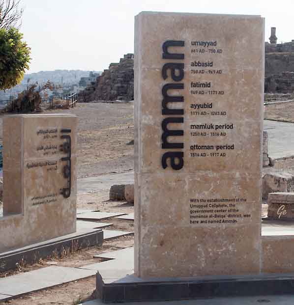
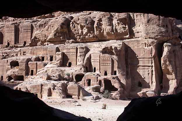
 The Amman Citadel is a historical site at the center of downtown Amman, Jordan. Known in Arabic as Jabal al-Qal'a, (جبل القلعة), |
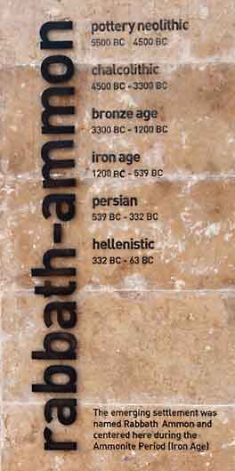 |
Amman. Evidence of occupation since the pottery Neolithic period has been found.
It was inhabited by different peoples and cultures until the time of the Umayyads,
after which came a period of decline and for much of the time until 1878 the former
city became an abandoned pile of ruins only sporadically used by Bedouins and
seasonal farmers. Despite this gap, the Citadel of Amman is considered to be among
the world's oldest continuously inhabited places.
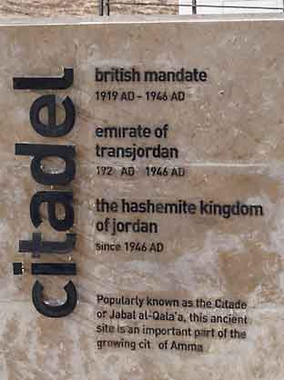 |
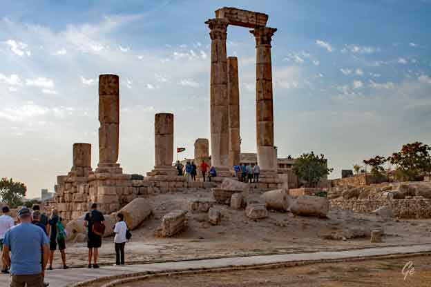
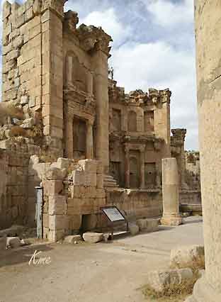
The Citadel is considered an important site because it has had a long history of occupation by many great civilizations. Most of the buildings still visible at the site are from the Roman, Byzantine, and Umayyad periods. The major buildings at the site are the Temple of Hercules, a Byzantine church, and the Umayyad Palace. Though the fortification walls enclose the heart of the site, the ancient periods of occupation covered large areas. Historic structures, tombs, arches, walls and stairs have no modern borders, and therefore there is considerable archaeological potential at this site, as well as in |
Archaeologists have been working at the site since the 1920s, including Italian, British, French, Spanish, and Jordanian projects, but a great part of the Citadel
remains unexcavated.
https://en.wikipedia.org/wiki/Amman_Citadel
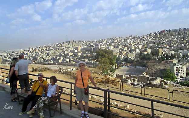
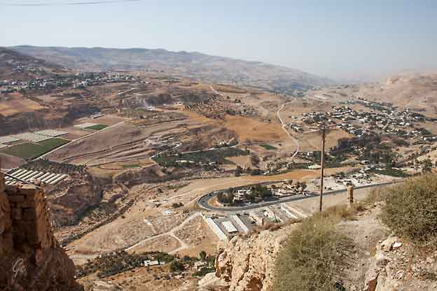
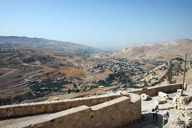
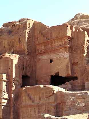
Grete ser på utsikten mot Amman og det romerske teateret der nede.
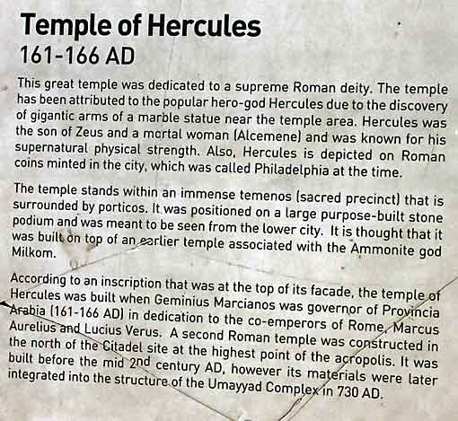 |
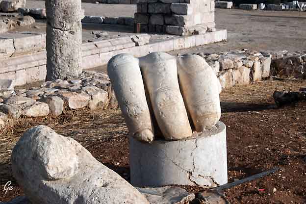
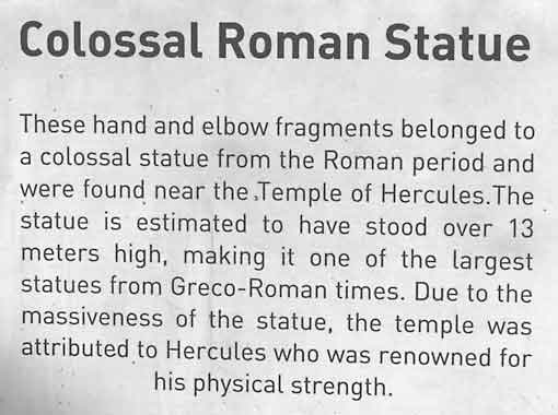
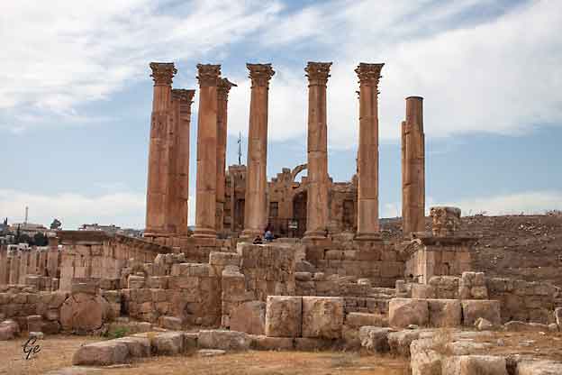
Temple of Hercules 161-166 AD This great temple was dedicated to a supreme Roman Deity, The tenple has been attributed to the popluar hero-god Hercules due to the discovery of gigantic arms of a marble statue near the temple area. Hercules was the son of Zeus and a mortal woman (Alcemen) and was known for his supernatural physical strength. Also, Hercules is depicted on Roman coins |
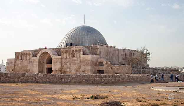
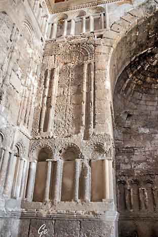
Umayyad Palace
| The Umayyad Palace The buildings that formed part of the Umayyad Palace are the best-preserved structure at the Amman Citadel. It is believed to have been built between the 7th and 8th Century. The palace originally covered a large complex of buildings, but most of it was destroyed by an earthquake. The domed audience hall is still in a good condition and its grand design was used to impress visitors to the palace. Within the Umayyad complex is a courtyard containing the ruins of residential buildings and the Cistern which was used to transport water to the palace. https://touristjordan.com/amman-citadel/ |
 |
 |
 |
 |
 |
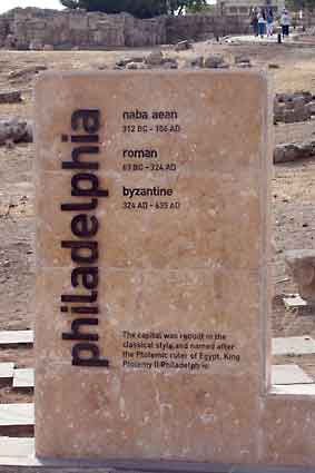
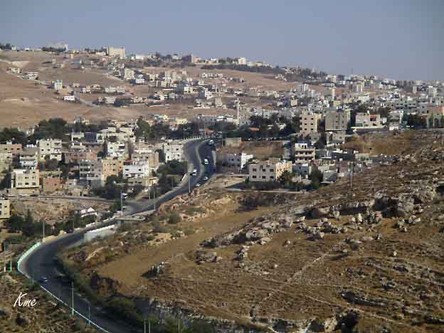
is the capital and most populous city of Jordan, and the country's economic,
political and cultural centre. Situated in north-central Jordan, Amman is the administrative centre of the Amman Governorate. The city has a population
of 4,007,526 and a land area of 1,680 square kilometres (648.7 square miles).
Today, Amman is considered to be among the most modernized Arab cities.
It is a major tourist destination in the region, particularly among Arab and
European tourists.
The earliest evidence of settlement in Amman is in a Neolithic site known as '
Ain Ghazal, where some of the oldest human statues ever found dating to
7250 BC were uncovered. During the Iron Age, the city was known as Ammon,
home to the Kingdom of the Ammonites. It was named Philadelphia during its
Greek and Roman periods, and was finally called Amman during the Islamic
period.
dates to the late 19th century when Circassian immigrants were settled there by the Ottoman Empire in 1867. The first municipal council was established in 1909. Amman witnessed rapid growth after its designation as Transjordan's capital in
1921, and after several successive waves of refugees: Palestinians in 1948 and
1967; Iraqis in 1990 and 2003; and Syrians since 2011. It was initially built on
seven hills but now spans over 19 hills combining 27 districts, which are
administered by the Greater Amman Municipality headed by its mayor Yousef Shawarbeh.] Areas of Amman have gained their names from either the hills
(Jabal) or the valleys (Wadi) they occupy, such as Jabal Lweibdeh and Wadi
Abdoun. East Amman is predominantly filled with historic sites that frequently
host cultural activities, while West Amman is more modern and serves as the
economic center of the city.
https://en.wikipedia.org/wiki/Amman
 |
 |
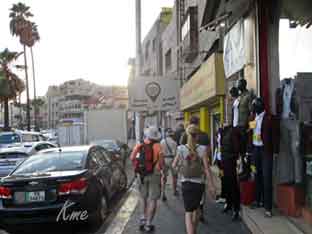
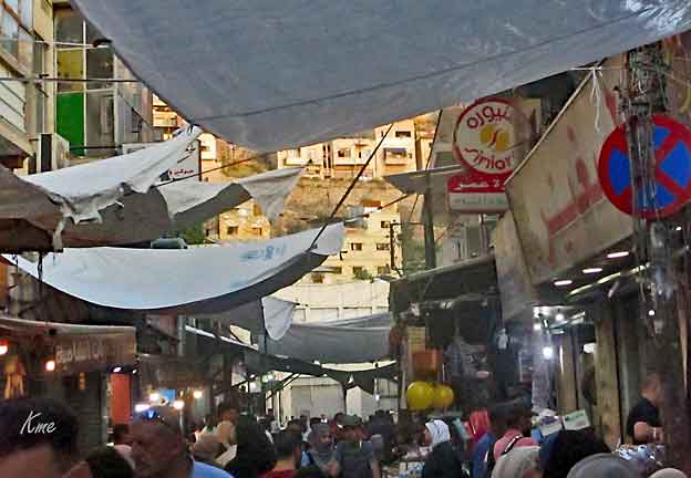
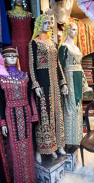
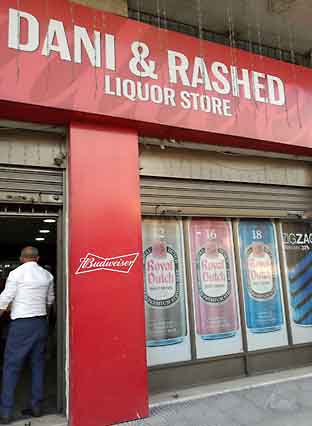
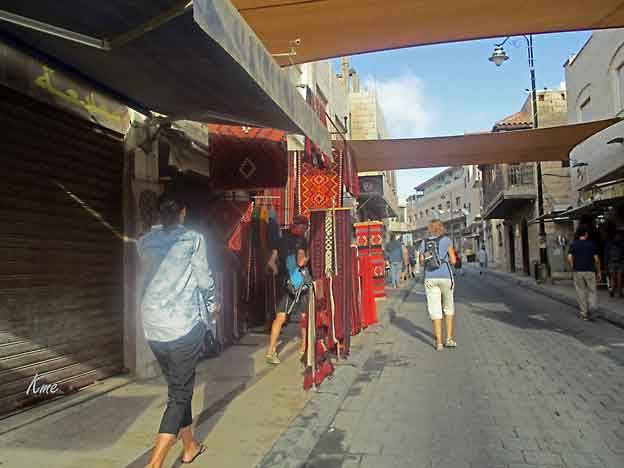
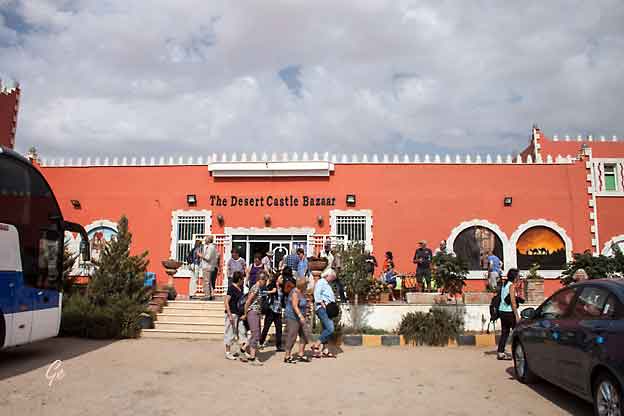
Vi går gjennom markedet i Amman sentrum.
 |
 |
 |
 |
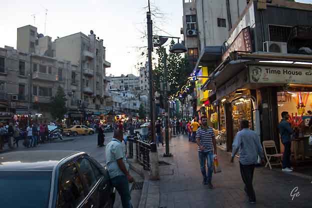
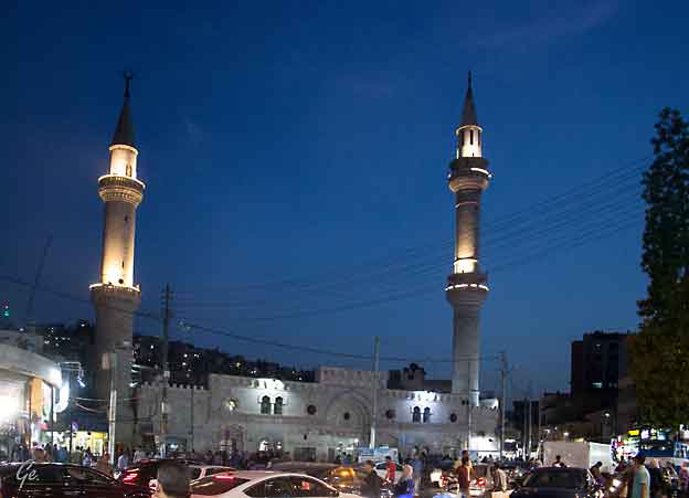
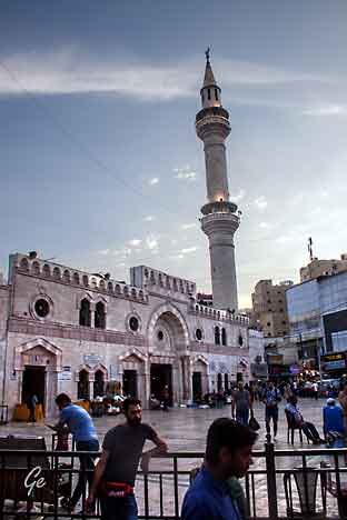
Grand Husseini Mosque
 |
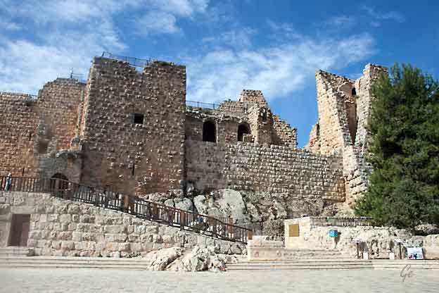
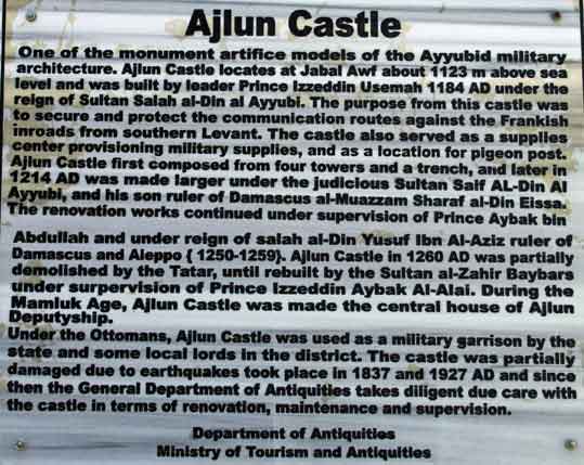
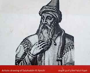
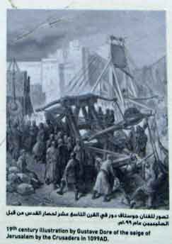
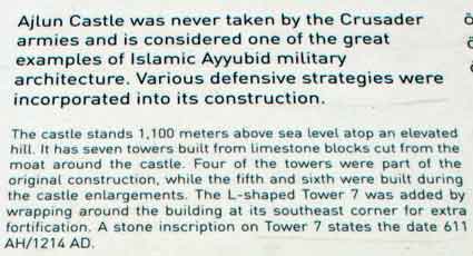
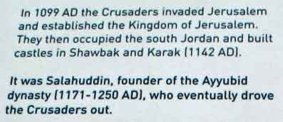
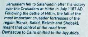
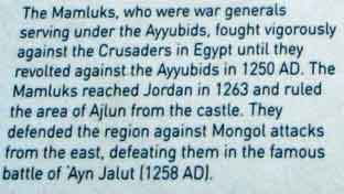
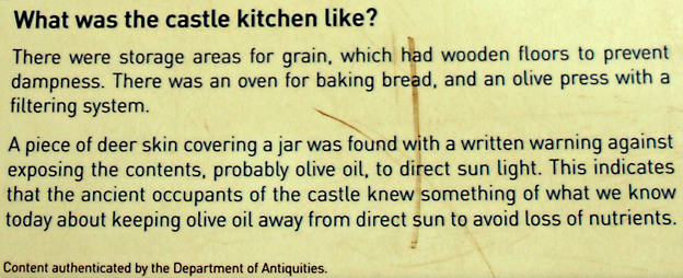
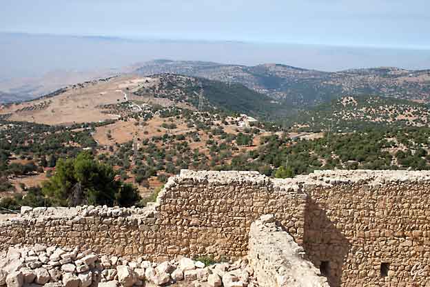
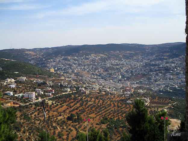
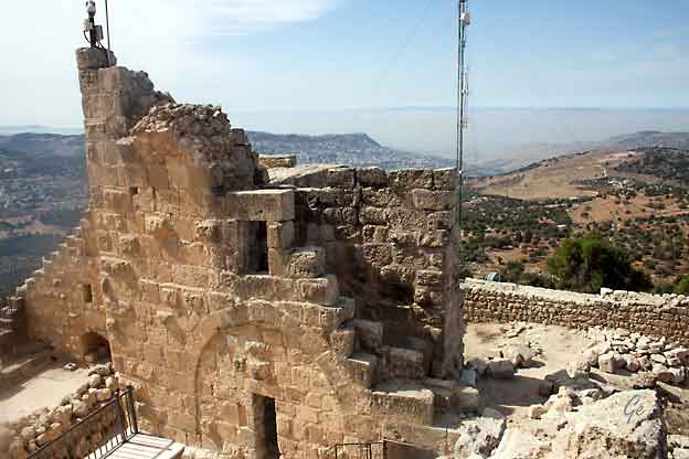
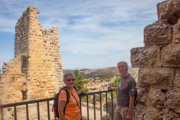
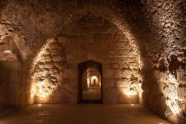
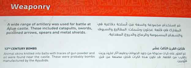
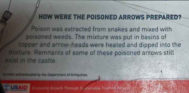
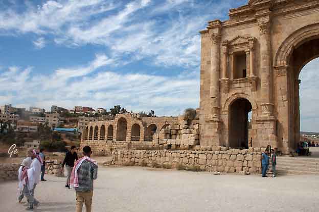
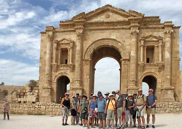
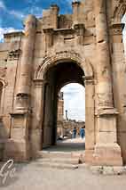
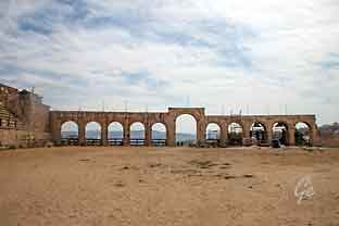
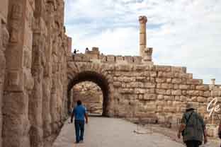
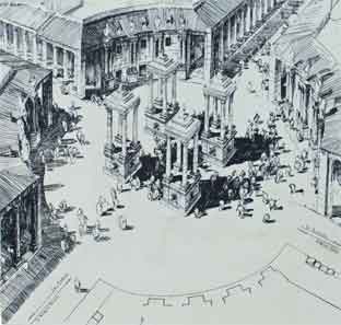
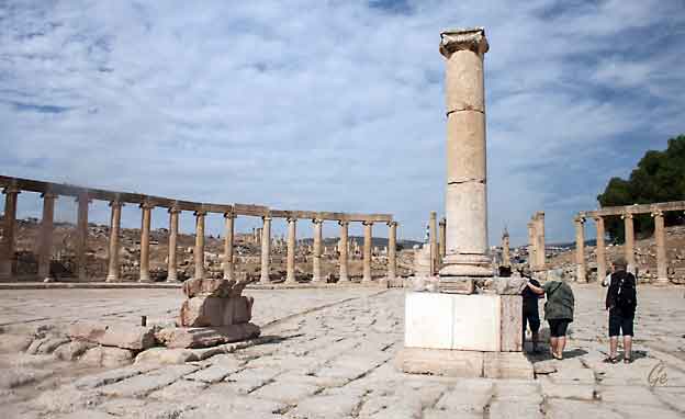
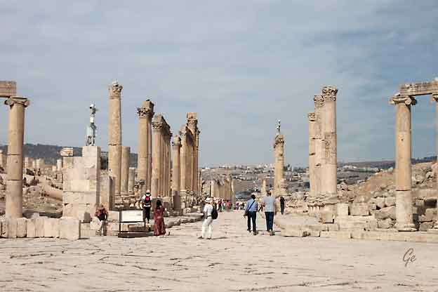
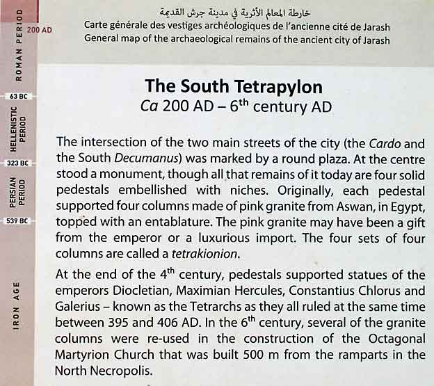
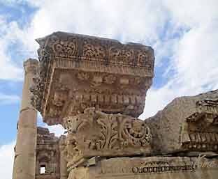
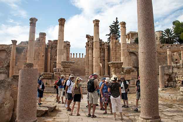
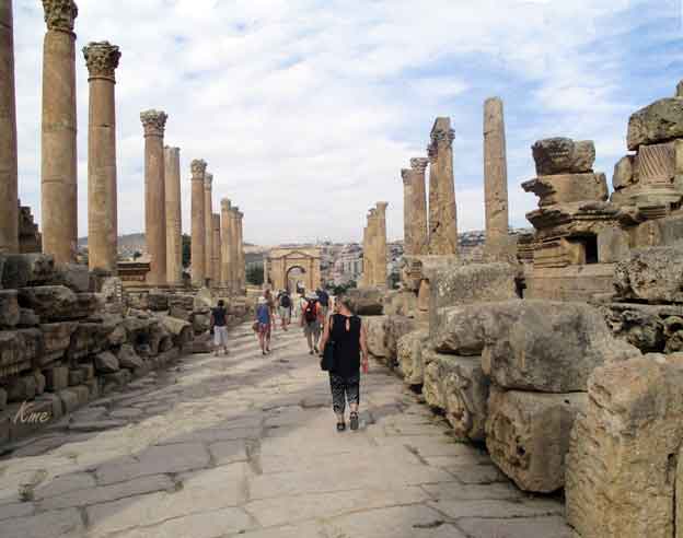
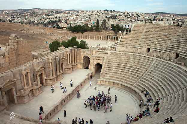
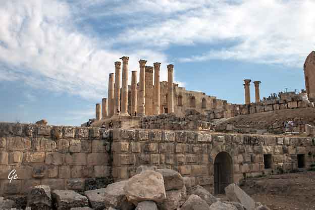
Program for dagen: Ute i skogkledde åser ligger festningen Ajlun, bygget av en general som sto under kommando av Saladin, han som førte korsfarerne til nederlag sist på 1100-tallet. Ajlun markerer østgrensen for korsfarernes erobringer. Den kontrollerte karavanetrafikken mellom Damaskus og Egypt. Korsfarerne prøvde å innta festningen, men klarte det aldri. I byen ligger en av regionens eldste moskeer, en gammel kirke som ble tatt i bruk av den nye tro. Fra Ajlun reiser vi til "Østens Pompeii", Jerash, den best bevarte by i Dekapolis, Romerrikets utpost i Levanten. Det spesielle med Jerash er byens ovale forum, et torv som ellers alltid ble bygget med rette vinkle. I Jerash vaier utrolig nok de klassiske søylene i vinden! |
 |
 |
 |
 |
 |
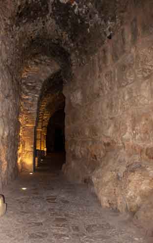 |
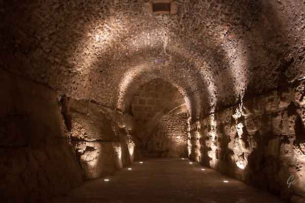
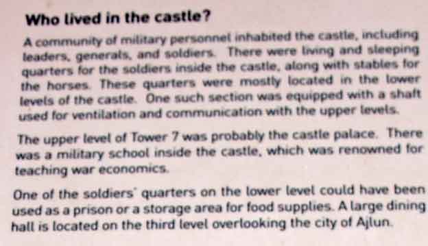
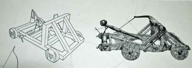
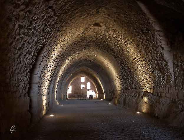
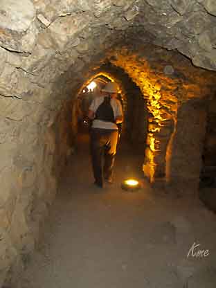
A community of military personnel inhabited the castle, including leaders, generals, and soldiers. There were living and sleeping quarters for the soldiers inside the castle, along with stables for the horses. These quarters were mostly located in the lower levels of the castle. One such section was equipped with a shaft used for ventilation and communication with the upper levels.
The upper level og Tower 7 was probably the castle palace. There was a military school inside the castle, which was renowned for teaching war economics.
One of the soldiers quarters on the lower level could have been used as a prison or a storage area for food supplies. A large dining hall is located on the third level overlooking the city of Ajlun.
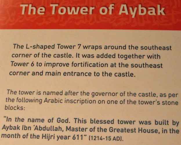
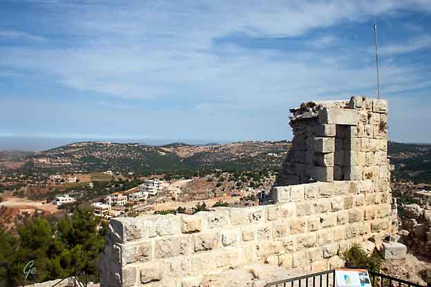
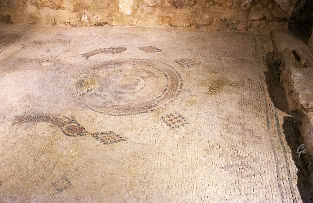
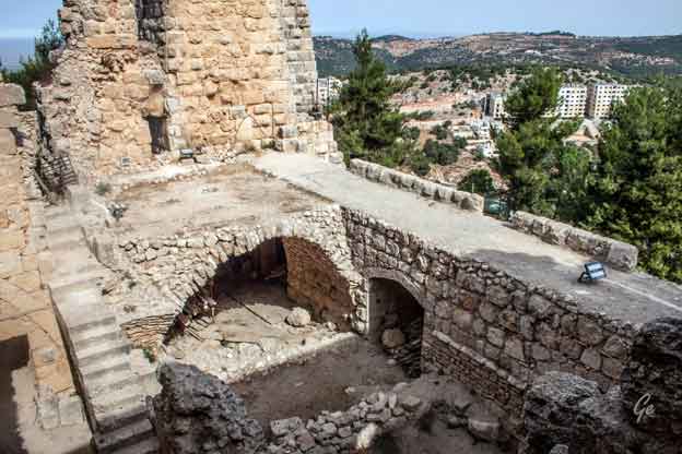
Våpenrommet
 |
 |
 |
 |
 |
 |
 Etter lunsj kjørte vi til den gamle romerske byen i Jerash. |
 |
 |
 |
 |
 |
 |
Jerash (Arabic: جرش; Ancient Greek: Γέρασα) is a city in northern Jordan. The city is the administrative center of the Jerash Governorate, and has a population of 50,745 as of 2015. It is located 48 kilometres (30 mi) north of the capital city Amman. The earliest evidence of settlement in Jerash is in a Neolithic site known as Tal Abu Sowan, where rare human remains dating to around 7500 BC were uncovered. |
century CE, when the 749 Galilee earthquake destroyed large parts of it,
while subsequent earthquakes contributed to additional destruction.
However, in the year 1120, Zahir ad-Din Toghtekin, atabeg of Damascus
ordered a garrison of forty men stationed in Jerash to convert the Temple of
Artemis into a fortress. It was captured in 1121 by Baldwin II, King of
Jerusalem, and utterly destroyed. Then, the Crusaders immediately
abandoned Jerash and withdrew to Sakib (Seecip); the eastern border
of the settlement.
Jerash was then deserted until it reappeared by the beginning of the Ottoman rule
in the early 16th century. In the census of 1596, it had a population of 12 Muslim households.
However, the archaeologists have found a small Mamluk hamlet in the Northwest Quarter which indicates that Jerash was resettled before the Ottoman era. The excavations conducted since 2011 have shed light on the Middle Islamic period as
recent discoveries have uncovered a large concentration of Middle Islamic/Mamluk structures and pottery. The ancient city has been gradually revealed through a
series of excavations which commenced in 1925, and continue to this day.
Jerash today is home to one of the best preserved Greco-Roman cities, which
earned it the nickname of "Pompeii of the East". Approximately 330,000 visitors
arrived in Jerash in 2018, making it one of the most visited sites in Jordan. The
city hosts the Jerash Festival, one of the leading cultural events in the Middle
East that attracts tens of thousands of visitors every year.
https://en.wikipedia.org/wiki/Jerash
 |
 |
and water running down the walls. The water ways were destroyed by the
earthquake though.
https://www.notscaredofthejetlag.com/jerash-pictures-beautiful-ruins/
 |
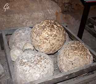
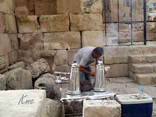 Her selges kaffe, te og kalde drikker. |
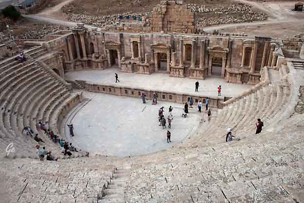
Built about AD 165 and enlarged in 235, the beautiful little
North Theatre was most likely used for government meetings
rather than artistic performances. Originally it had 14 rows of
seats, with two vaulted passageways leading to the front of the
theatre, as well as five internal arched corridors leading to the
upper rows.
Many of the seats are inscribed with the names of delegates who
voted in the city council.
https://www.lonelyplanet.com/jordan/jerash/attractions/north-theatre
/a/poi-sig/1442851/361072
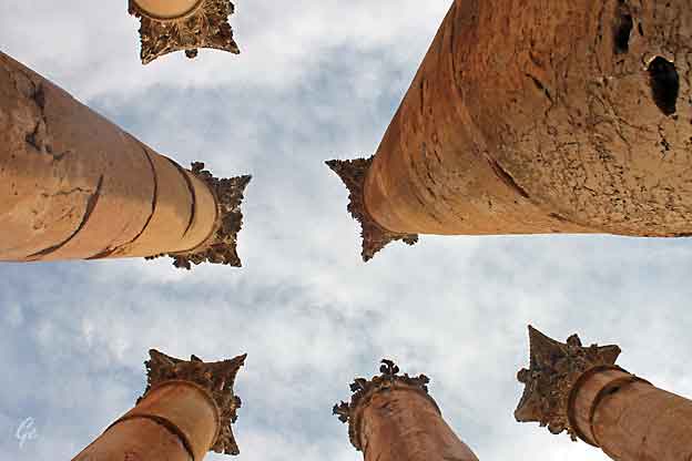
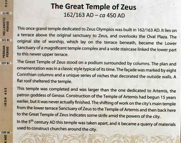
Artemis was the patron goddess of the city and was highly esteemed by the Hellenistic population of Gerasa, while the Semitic part of the population preferred Zeus. Construction of the temple was finished in CE 150, during the
reign of Emperor Antoninus Pius.
The building had a hexastyle portico with twelve columns, of which eleven are still standing. Corinthian capitals decorating the columns are very well preserved. The temple walls had three entrances decorated with three Corinthian pilasters.
The Temple of Artemis supposedly was the most beautiful and important temple of ancient Gerasa, containing fine marble paneling and a richly decorated cult statue within the cella.
If still in use by the 4th-century, the temple would have been closed during the persecution of pagans in the late Roman Empire. In the early 12th century the temple was converted into a fortress by a garrison stationed in the area by the
Zahir ad-Din Toghtekin, atabeg of Damascus.
Baldwin II, King of Jerusalem, captured and burned the fortress in CE 1121-1122.
The inner faces of the temple walls still clearly show the effect of the great fire.
The temple, along with other ruins in the area of Gerasa, was excavated b
y Clarence Stanley Fisher and his expedition in 1930s.
https://en.wikipedia.org/wiki/Temple_of_Artemis,_Jerash
 Interesting fact: you can put the end of a spoon between the base and the column and see how the column moves constantly. In a way, this is a built-in earthquake safety feature and possibly the reason why so many of them are still standing. https://www.notscaredofthejetlag.com/jerash- pictures-beautiful-ruins/ |
 |
The South Theater Built during the reign of Emperor Domitian, between 90-92AD,
the South Theater can seat more than 3000 spectators. The first level of the ornate
stage, which was originally a two-storey structure, has been reconstructed and is
still used today. The theater's remarkable acoustics allow a speaker at the centre
of the orchestra floor to be heard throughout the entire auditorium without raising
his voice.
Two vaulted passages lead into the orchestra, and four passages at the back
of the theater give access to the upper rows of seats. Some seats could be
reserved and the Greek letters which designate them can still be seen.
The South Theater of Jerash Jordan (luxorandaswan.com) (24. mars 2022)
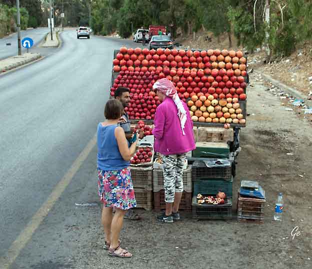
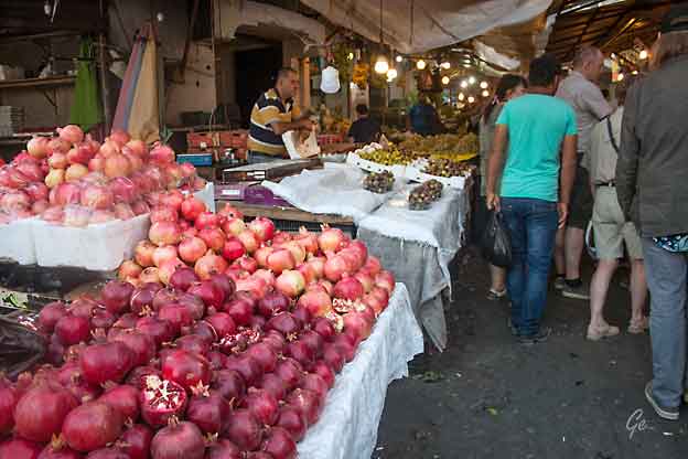
Han selger granatepler.
The pomegranate (Punica granatum) is a fruit-bearing deciduous shrub in the family Lythraceae, subfamily Punicoideae, that grows between 5 and 10 m
(16 and 33 ft) tall.
The fruit is typically in season in the Northern Hemisphere from September to
February, and in the Southern Hemisphere from March to May. As intact arils or
juice, pomegranates are used in baking, cooking, juice blends, meal garnishes,
smoothies, and alcoholic beverages, such as cocktails and wine.
https://en.wikipedia.org/wiki/Pomegranate
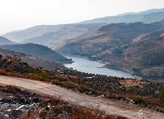
The King Talal Dam is a large dam in the hills of northern Jordan, across
the Zarqa River. The dam was started in 1971, with the original
construction being completed in 1978 at a height of 92.5 meters.
https://en.wikipedia.org/wiki/King_Talal_Dam
 |
 |
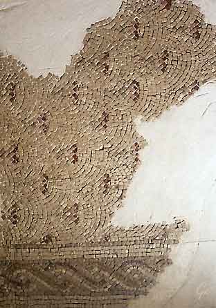
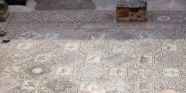
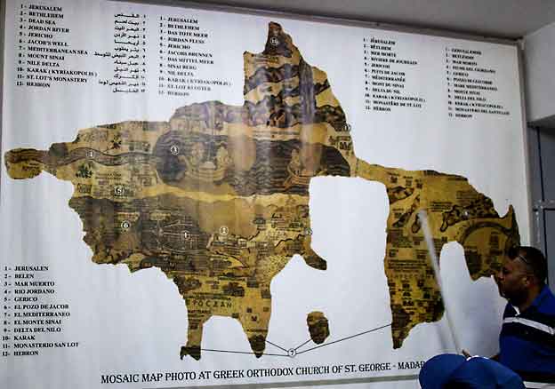
Først til Madaba, kjent for sine mosaikker fra ulike tidsepoker.
Spesielt kjent er det 25X5 meter store mosaikk-kartet fra 500-tallet e. Kr.
som viser Palestina og nedre Egypt. Vi opplever vår egen reiserute slik
bysantinerne så den.
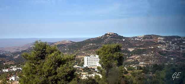
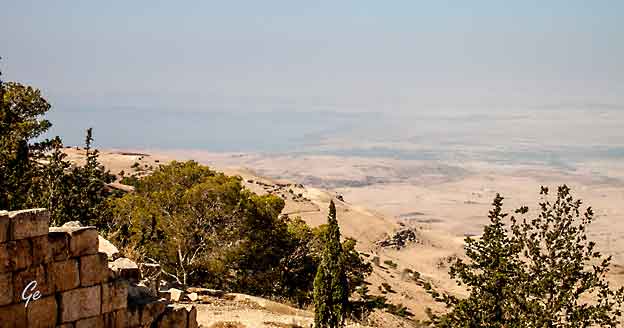
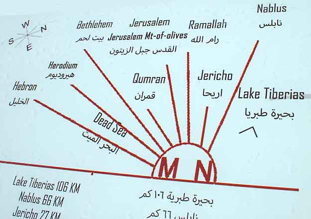
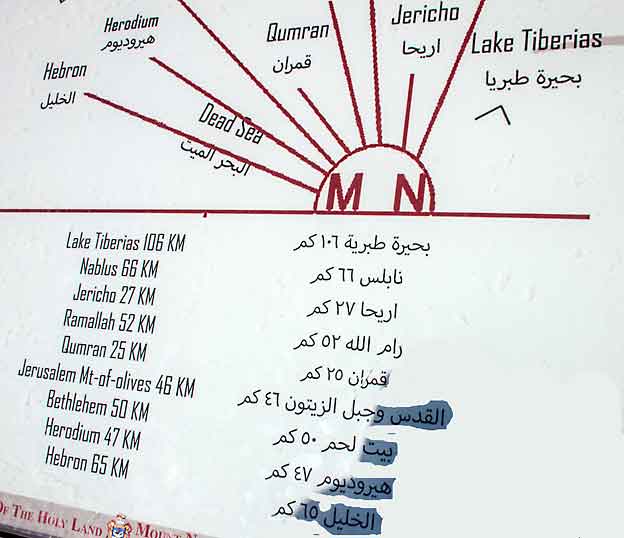
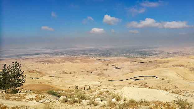
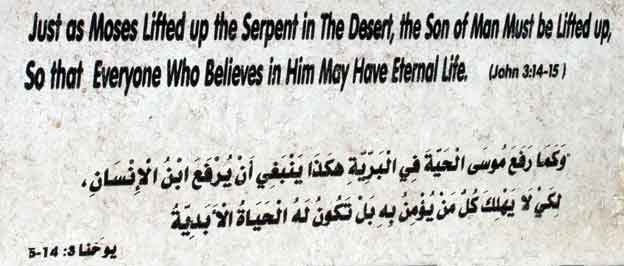
Så til Mount Nebo 710 moh, fjellet der Moses fikk se inn i det lovede land
etter sin førti år lange ørkenvandring. Flott utsikt. På en klar dag kan vi
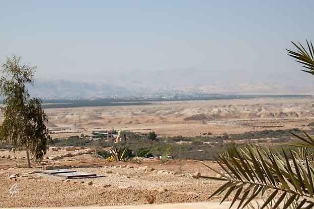
se Dødehavet, Jeriko, tårnene på Oljeberget, Jordan-elven.
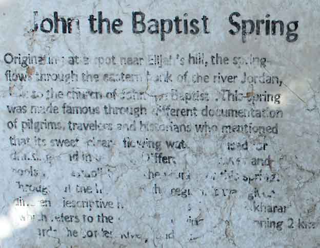
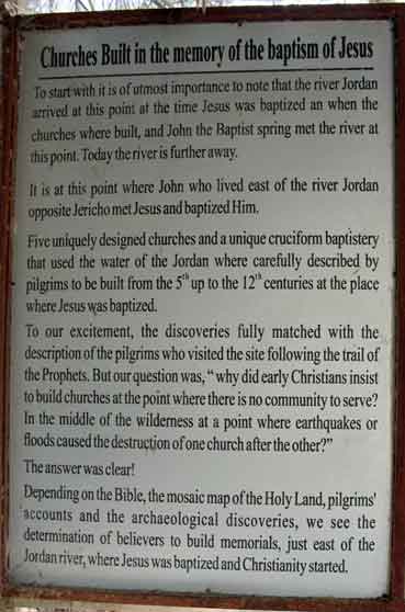
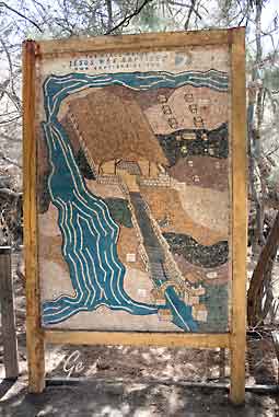
Og så ned til Jordan-elven ca 400 meter under havoverflaten.
Det sies at det var her omtrent at Jesus møtte sin fetter Johannes og ble
døpt i elven. Mange kirkesamfunn har bygget helligdommer her, vi besøker
den lille lutherske kirken som er utsmykket av norske Håkon Gullvåg.
Han har gjort stedet til noe helt spesielt, midt i sumpaktig ørkenområde,
forunderlig landskap. Står på UNESCOs verdensarvliste.
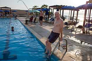
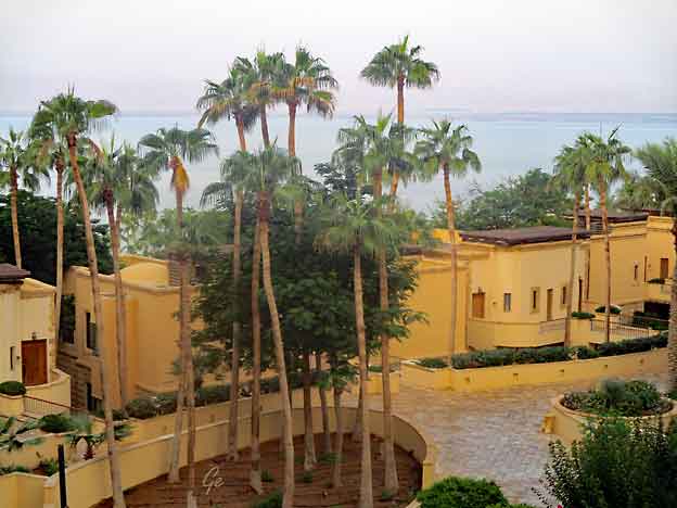
Vi kommer til vårt hotell ved dødehavet i tide for en dukkert.
Ikke dykk, det svir!
(fra reiseprogrammet)
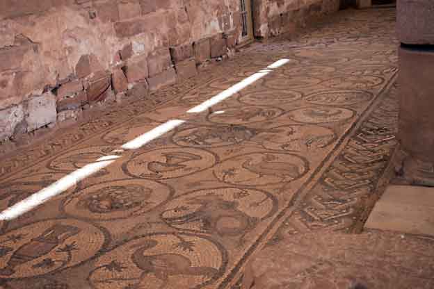
Vi er Madaba på vei til den gresk-ortodokse kirken for å se mosaikk-kartet.
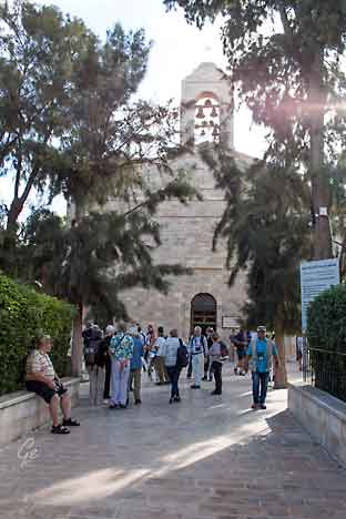 |
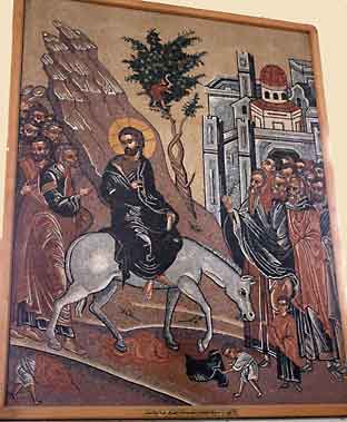 St George`s Church in Madaba |
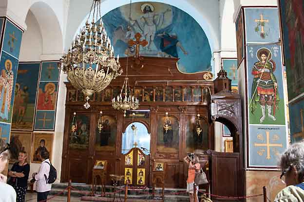
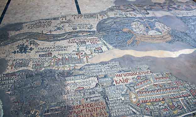
The Madaba Map, also known as the Madaba Mosaic Map, is part of a floor
mosaic in the early Byzantine church of Saint George in Madaba, Jordan.
The Madaba Map is of the Middle East, and part of it contains the oldest
surviving original cartographic depiction of the Holy Land and especially
Jerusalem. It dates to the 6th century AD.
https://en.wikipedia.org/wiki/Madaba_Map
 |
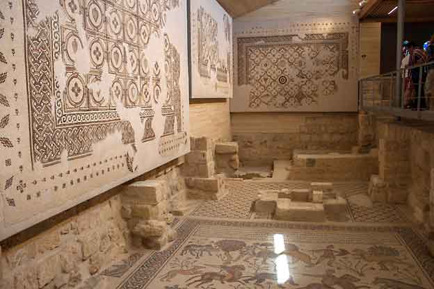
 A mosaic is a piece of art or image made from the assembling of small pieces of colored glass, stone, or other materials. It is often used in decorative art or as interior decoration. Most mosaics are made of small, flat, roughly square, pieces of stone or glass of different colors, known as tesserae (singular tessera). Some, especially floor mosaics, are made of small rounded pieces of stone and called pebble mosaics. Mosaics have a long history, starting in Mesopotamia in the 3rd millennium BC. |
Pebble mosaics were made in Tiryns in Mycenean Greece; mosaics with
patterns and pictures became widespread in classical times, both in Ancient
Greece and Ancient Rome. Early Christian basilicas from the 4th century
onwards were decorated with wall and ceiling mosaics. Mosaic art flourished
in the Byzantine Empire from the 6th to the 15th centuries; that tradition
was adopted by the Norman Kingdom of Sicily in the 12th century, by the
eastern-influenced Republic of Venice, and among the Rus in Ukraine.
Mosaic fell out of fashion in the Renaissance, though artists like Raphael
continued to practise the old technique. Roman and Byzantine influence led
Jewish artists to decorate 5th and 6th century synagogues in the Middle East
with floor mosaics.
Mosaic was widely used on religious buildings and palaces in early Islamic
art, including Islam's first great religious building, the Dome of the Rock in
Jerusalem, and the Umayyad Mosque in Damascus. Mosaic went out of fashion
in the Islamic world after the 8th century.
https://en.wikipedia.org/wiki/Mosaic
 |
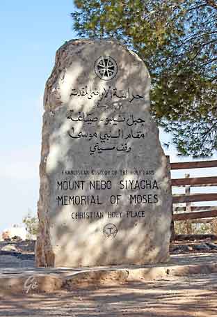 |
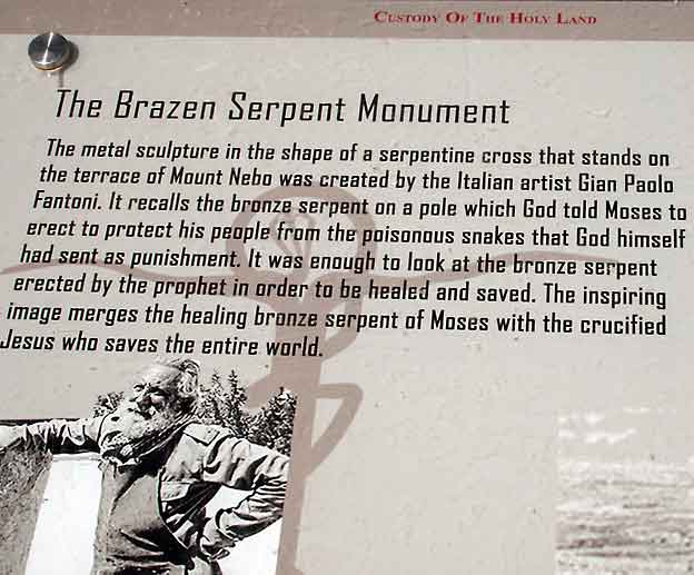
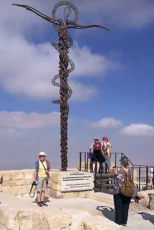
Mount Nebo is steeped in religious significance as it is believed to be the place
that Moses stood on to view the sacred Promised Land before his death.
According to the Book of Deuteronomy Moses died on Mount Nebo and was
buried in Moab. In the fourth century, a small monastery was built by Egyptian
monks on the mountain peak in memory of Moses. This church was then
reconstructed in the fifth century into a basilica. The basilica still stands on
Mount Nebo today and contains a fascinating collection of Byzantine mosaics.
https://touristjordan.com/mount-nebo/
Utsikten fra Mount Nebo
 |
 5. Mosebok 32 48-52 The Lord said to Moses that same day,“Go up to this mountain of the Abarim, Mount Nebo, in the land of Moab beside Jericho. Look at the land of Canaan, which I am giving to the people of Israel for their own. Then die on the mountain you go up, and join your people, as Aaron your brother died on Mount Hor and joined his people. |
waters of Meribah-Kadesh, in the Desert of Zin and you did not honor Me as
holy among the people of Israel. You will see the land from far away, but you
will not go into the land I am giving the people of Israel.”
Now Moses went up from the valleys of Moab to Mount Nebo, to the top of Pisgah, beside Jericho. And the Lord showed him all the land, Gilead as far as Dan, all of Naphtali, the land of Ephraim and Manasseh, all the land of Judah as far as the
sea in the west, the Negev and the plain in the valley of Jericho, the city of palm
trees, as far as Zoar. Then the Lord said to him, “This is the land I promised
Abraham, Isaac and Jacob, saying, ‘I will give it to your children.’ I have let you
see it with your eyes, but you will not go there.”
So Moses the servant of the Lord died there in the land of Moab, as the Word of
the Lord said. And He buried him in the valley in the land of Moab, beside
Beth-peor.
But no man knows where he is buried to this day. Moses was 120 years old when
he died. But his eyes were not weak, and his strength had not left him.
The children of Israel cried for Moses in the valley of Moab for thirty days.
Then the days of crying and sorrow for Moses came to an end.
By the
4th century AD, Mount Nebo had already become a
pilgrimage site
and a church and sanctuary were built on Siyagha to
honor Moses.
In the 6th century AD, monks constructed a Byzantine
monastery on Siyagha,
which lasted for almost six centuries. While the
building is no longer there,
the mosaics from this time period are still visible.
The site was abandoned
by the 16th century. In 1993, Mount Nebo was purchased
by the Franciscans
who restored the site. It is an active Franciscan
monastery today that is open
to visitors.
https://www.touristisrael.com/mount-nebo/16954/
Jordansk sang og dans ved inngangen til Mount Nebo.
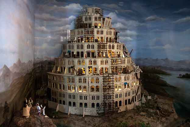
Babels Tårn
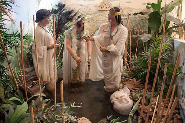
Faraos datter finner kurven med Moses i Nilsen
of the museum which includes information on the religious history of Mount Nebo
and the surrounding area. The museum is currently undergoing a project which
aims to create the largest mosaic in the world at 30 meters long with 3.5 million pieces.
visitors can take part in the project by placing a piece into the mosaic.
The museum also offers a variety of workshops for visitors of all ages.
https://touristjordan.com/mount-nebo/
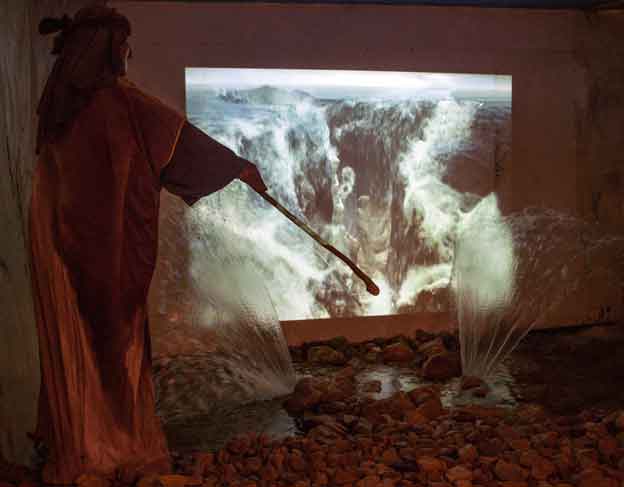
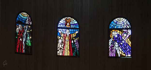
Rødehavet deler seg
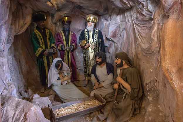
Jesus blir født i Betlehem
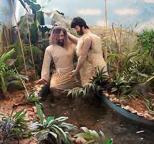 Johannes døperen døper Jesus ved Jordan-elva |
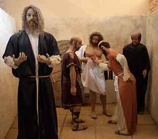 Disippelen Thomas kjenner på sårene til Jesus. |
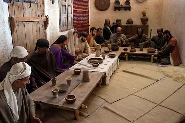 |
Påskemåltidet
i Jerusalem |
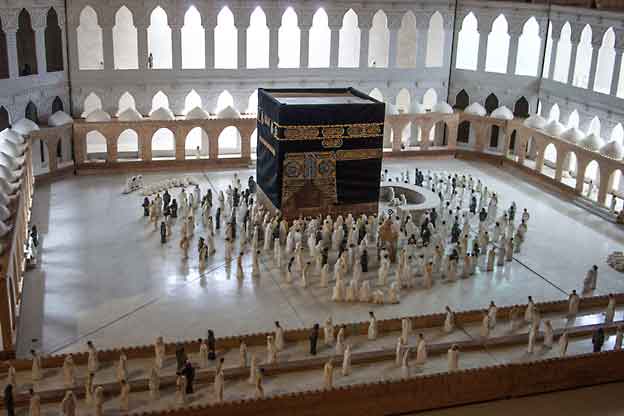
Mekka med Kaba
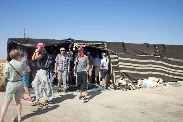
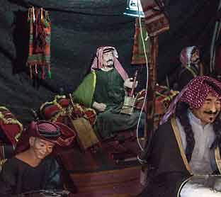
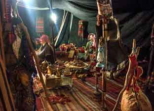 I beduinerteltet |
 |
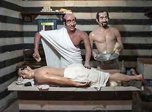 Massasje |
 Oppned gryte. Jordansk rett. |
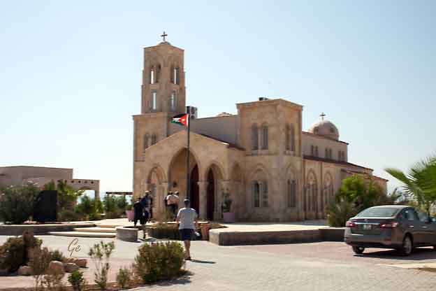
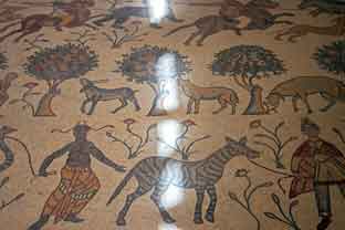
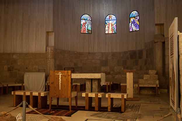
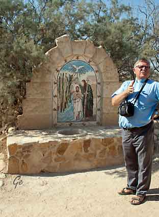
Den tyske evangelisk Lutherske kirken ved Jordan-elva.
Presten der var guiden vår på turen ned til elva.
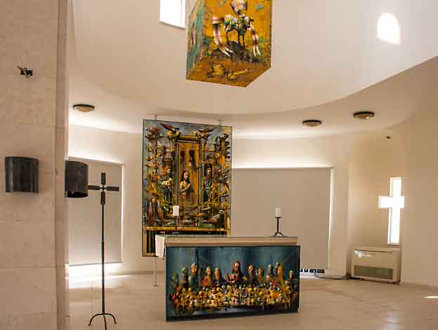
Kirken er utsmykket av Håkon Gullvåg
 |
 |
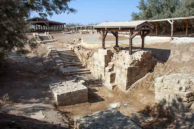
Dette kan være Jesu døpested
Håkon Gullvåg has decorated the altarpiece for Evangelical
Lutheran Church in Jordan and The Holy Land.
Håkon Gullvåg har laget alterutsmykkning til The Evangelical
Lutheran Church in Jordan and The Holy Land.
http://haakon-gullvaag.no/en-kunst-utsmykning-alterutsmykkning_i_jordan
(14. november 2019)
 |
 |
 |
 Then Jesus came from Galilee to the Jordan to be baptized by John. But John tried to deter him, saying, “I need to be baptized by you, and do you come to me?” Jesus replied, “Let it be so now; it is proper for us to do this to fulfill all righteousness.” |
At that moment heaven was opened, and he saw the Spirit of God descending like
a dove and alighting on him. 17 And a voice from heaven said, “This is my Son,
whom I love; with him I am well pleased.”
Matthew 3:13-17
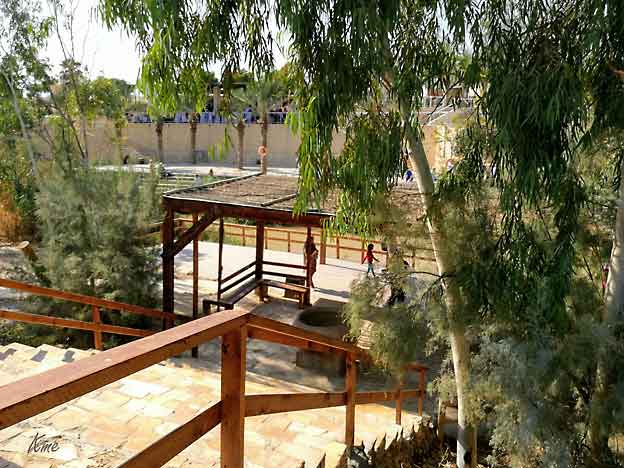
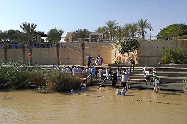
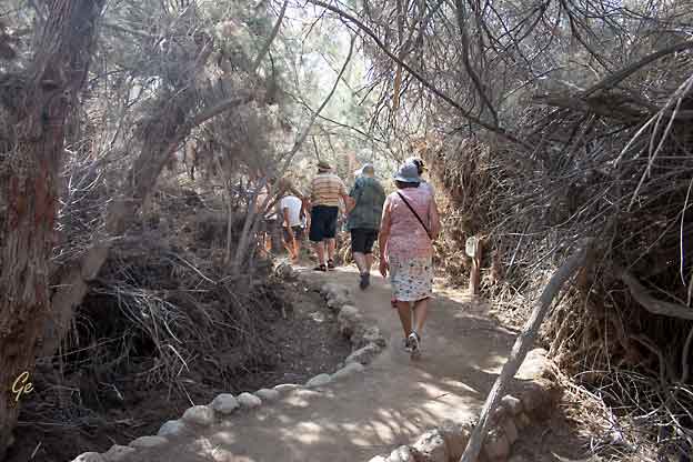
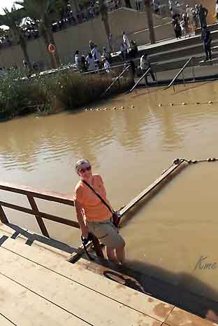
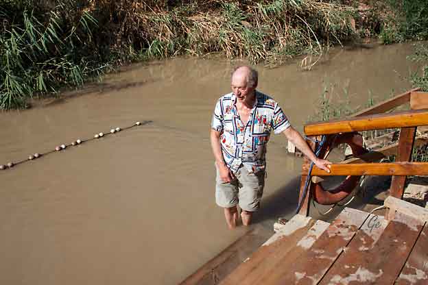
Her er vi kommet helt ned til elva.
På Israelsk side ser det ut til å foregå en dåpssermoni.
På Jordansk side er det rolig, bare noen turister som kjenner på vannet.
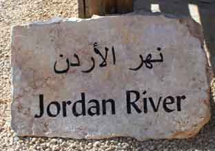
| The Jordan
River or River
Jordan (Hebrew: נְהַר
הַיַּרְדֵּן, Nahar
ha-Yarden; Classical Syriac: ܢܗܪܐ
ܕܝܘܪܕܢܢ, Arabic: نَهْر
الْأُرْدُنّ, Nahr al-Urdunn) is a 251-kilometre-long (156 mi) river in the Middle East that flows roughly north to south through the Sea of Galilee (Hebrew: כנרת Kinneret, Arabic: Bohayrat Tabaraya, meaning Lake of Tiberias) and on tothe Dead Sea. Jordan and the Golan Heights border the river to the east, while the West Bank and Israel lie to its west. Both Jordan and the West Bank take their names from the river. The river holds major significance in Judaism and Christianity sincethe Bible says that the Israelites crossed it into the Promised Land and that Jesus of Nazareth was baptized by John the Baptist in it. https://en.wikipedia.org/wiki/Jordan_River |
 |
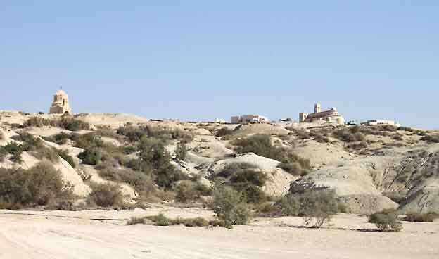
Mange kirkesamfunn har bygget kirker langs elva.
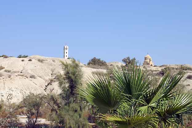
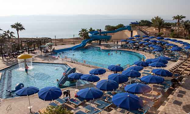
Dead Sea Spa Hotel
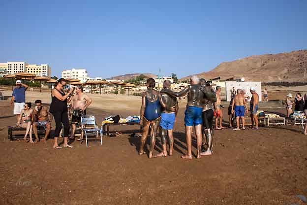
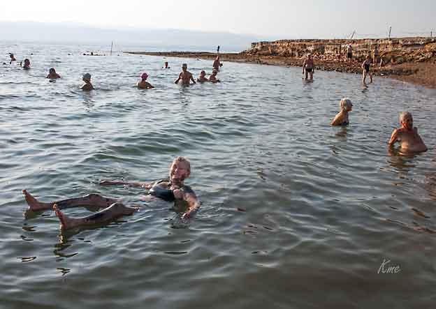
Floating on the Dead Sea is one of those experiences that seems almost too
surreal. The water is milky blue and almost completely devoid of life. Except,
of course, for the tourists that flock to the region to float on one of saltiest,
and most incredible bodies of water in the world. With legends of the
near-magical healing properties of the mineral-rich mud found in the Jordan
Dead Sea, it’s no surprise that countless resorts and spas have found their
home along this legendary waterfront. While most people associate the Dead
Sea with Israel, the Dead Sea is actually situated between Jordan and Israel.
And if you’re looking for the perfect place to float in the Dead Sea, I think
Jordan is where you should go!
The Dead Sea is the lowest point on the surface of the Earth. The Dead Sea is
situated at 429 m (1,407 ft) below sea level. It is 304 m (997 ft) deep, 50 km
(31 mi) long and 15 km (9 mi) wide at its widest point. The Dead Sea water
has a density of 1.24 kg/l, which makes floating a breeze. In fact, it’s almost
impossible to sink in the Dead Sea.
But what is the process for getting the baby soft skin promised by floating on the
Dead Sea and Bathing in the Dead Sea mud and minerals? Well, thankfully there
are signs posted near most of the resorts and public areas breaking down the
guide to maximizing the benefits of Dead Sea Mud.
2. After swimming, apply the Dead Sea mud directly on to your body
conservatively. You can get the mud either from the bottom of the
Dead Sea in the public areas, or, at the resorts there are usually
buckets of the mud placed in sheltered areas near the shore.
3. Wait 15 – 20 minutes until the Dead Sea mud has caked dry on
your body.
4. Return to the Dead Sea and wash off the mud by floating on the
Dead See some more.
5. Take a shower after you exit the Dead Sea.
6. You can do this once or twice daily
It sounded simple enough, so off we went to accomplish Step 1.
But that is where we learned one of the biggest lessons about the Dead
Sea.
Bathing in the Dead Sea means subjecting any cuts and scratches you
may have received on your travels to salt. Lots of salt. And if you’ve ever
heard the term “pouring salt on a wound”, a swim in the Dead Sea will
remind you just how poignant that statement is! Any scratches or cuts
will hurt. It is also very important to keep the salt water away from your
eyes, as it will make for a very uncomfortable burning sensation. You also
need to make sure that the salt water doesn’t go into your mouth,
because it tastes terrible. Trust me on that one!
https://wanderingwagars.com/floating-on-the-dead-sea/
 |
 |
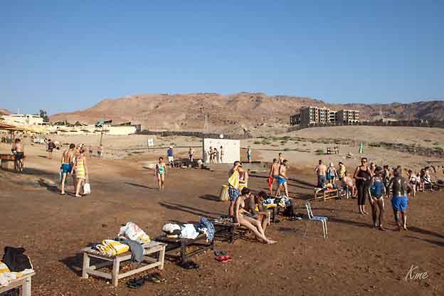
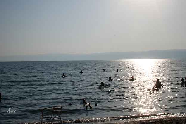
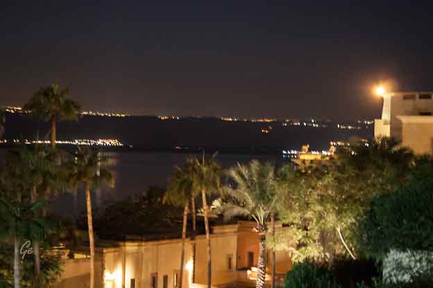
Etter badet i Dødehavet var det ganske godt å
svømme i ganske alminnelig bassengvann.
Til høyre: Natt ved Dødehavet.
Lysene på den andre siden er fra Israel.
På høyden ser vi lysene fra Jerusalem.
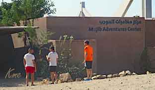
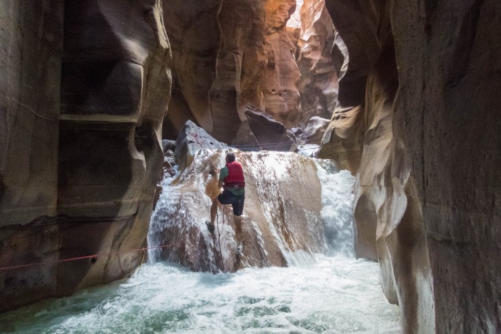
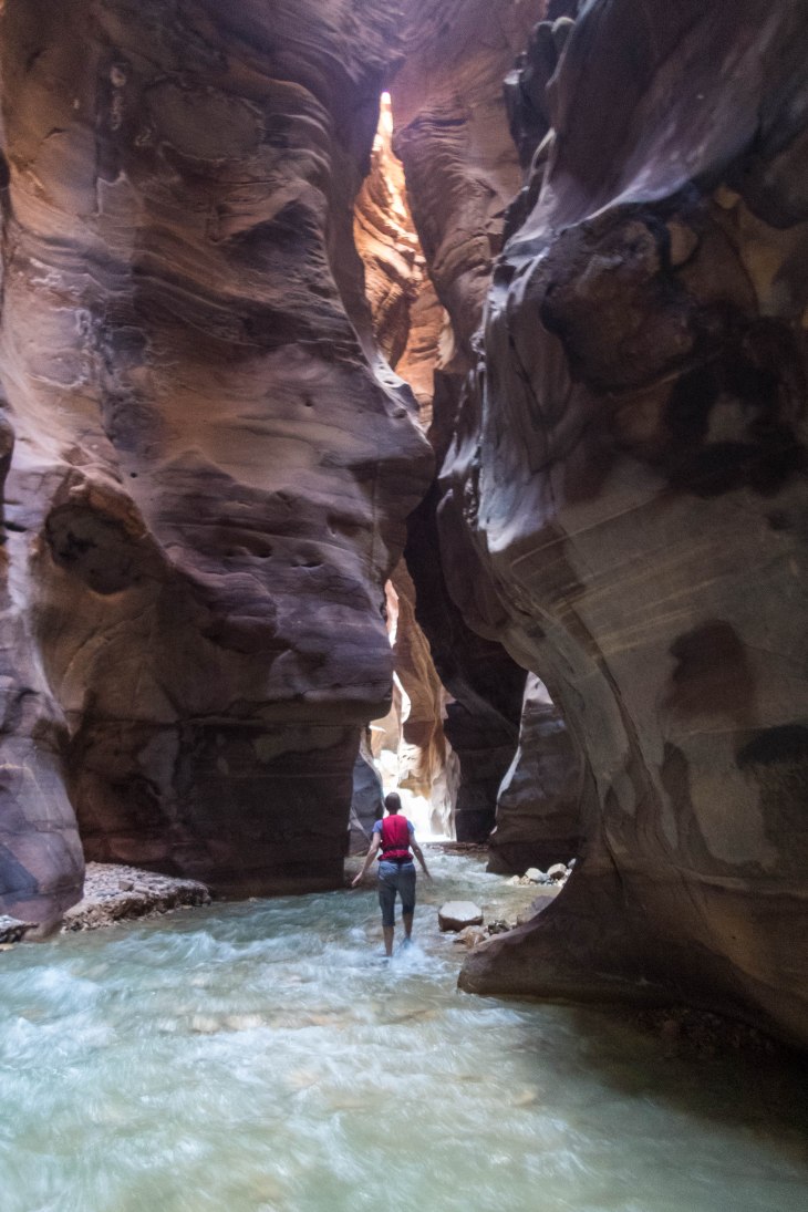
Programmet: Dødehavet - Wadi Muijib - Kerak - Petra
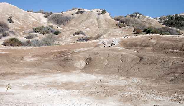
Vi begynner dagen med å utforske det spennende ørkenlandskapet til fots,
enten i Wadi Muijib-kløften eller i Dana Nasjonalpark, avhengig av
vannstanden i ørkenelvene. Akkurat så lett eller krevende som hver især
ønsker, landskapet er vakkert.
Veien fra Dødehavet slynger seg i hårnålsvinger opp til Kerak, en småby
som har en fin korsfarerfestning. Her er det historie og historier å fortelle.
Det var en gang et bryllup. Herfra fortsetter vi ad den brede Desert Highway, Ørkenveien, og så inn på smalere veier til Wadi Musa, rett utenfor Petra.
(fra reiseprogrammet)
Det ble en tur til Wadi Muijib-kløfta for oss.
Det ble en fantastisk opplevelse.
Dessverre har vi ikke noen egne bilder fra kløfta.
Vi hadde ikke tatt med noe vanntett kamera.
Derfor har jeg "lånt" noen bilder fra internett.
Legger med lenke til en film også.
https://www.youtube.com/watch?v=lAX1tD4s-V0
 |
 |
hotellet for å skifte og hente bagasjen
vår.
Så fortsatte turen.
Vi skulle først innom Kerak,
før vi fortsatte mot Petra.
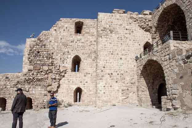
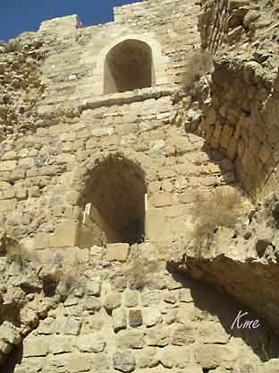
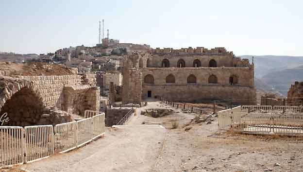
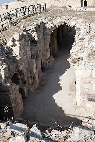
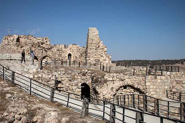
Kerak Festning.
De lille huset med skiltet main gate, er huset med sikkerhetskontrollen.
The city of Karak (locally known as Al-Karak) is famed for the significant role it
played during the Crusades. The city is located on the historic King’s Highway just under two hours away from Amman. It is best known for Karak Castle, one of the largest crusader castles in the Levant.
In ancient times the city of Karak was known as the Wall of Potsherds in Hebrew. It was a capital city of ancient Moabite, dating back to the 7th Century BCE. Today Karak is best known for its relevance in the Crusades of the 12th Century. Karak
Castle was the stronghold for crusades between the Crusaders and the army of Saladin; the first sultan of Egypt and Syria. After many years of battles, the castle
was eventually overthrown by Saladin’s army.
main reason for taking a trip to this ancient city. Karak Castle is perhaps the most legendary of the crusader castles in Jordan due to its significant role in Nabataean history. Karak Castle was built in the 12th Century and is believed to have been
designed by the king of Israel at the time. The castle is located around
124 kilometers from the capital city of Amman and visitors can get there by car,
taxi, or an organized tour. The castle is split over seven levels of passageways,
dungeons, kitchens, and a chapel.
There is also a museum with artifacts and historical information about the castle.
On a clear day, visitors can see as far as the Dead Sea from the top of the castle.
More recently this castle has been involved in the conflict with ISIS and visitors
should check local travel advice before visiting.
Karak | Tourist Jordan (24. mars 2022)
 |
 |
 |
 |
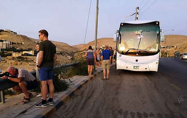
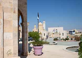
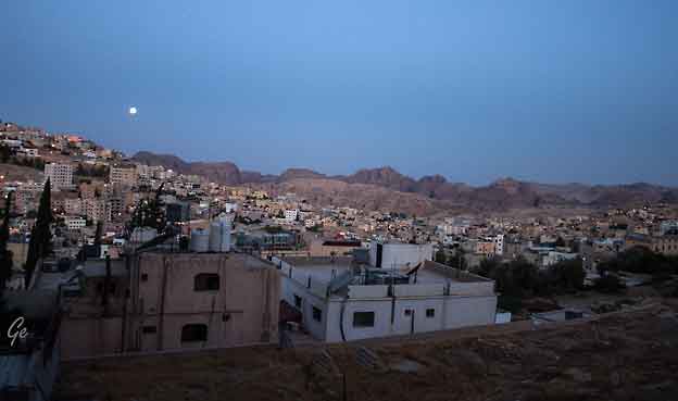
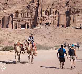
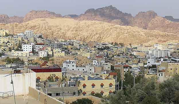
Vi er nesten i Wadi Musa, byen like utenfor Petra.
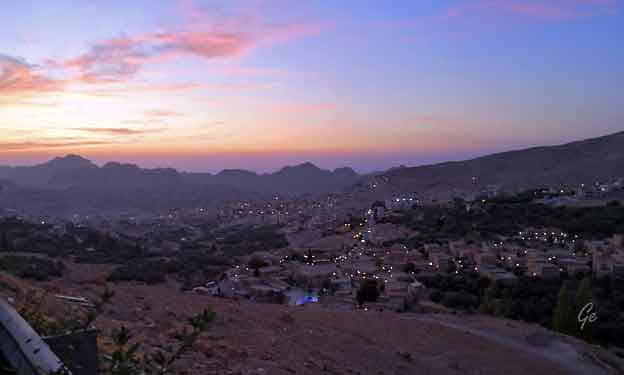
Fin solnedgang over Petra-fjellene
Eventyret Petra
Petra er et av verdens merkeligste steder. En rosenrød by, halvt så gammel
som tiden. Det siste hundreår før Jesu fødsel var dette en by med flere
titusener innbyggere. Deres teater rommet 8000 mennesker. Nabateer-folket kontrollerte den gang karavaneveier og handel i området, og fra den tiden
stammer mesteparten av Petras praktfulle graver, som ble hugget inn i de
røde klippene.
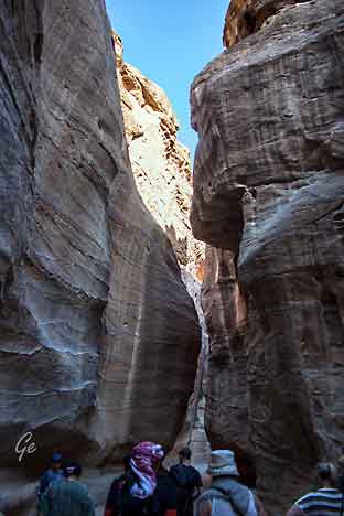
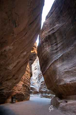
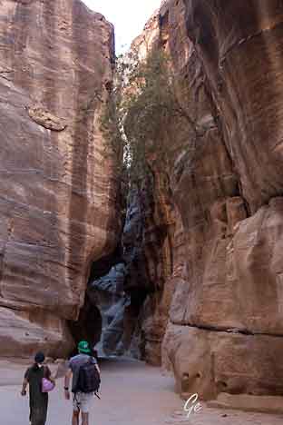
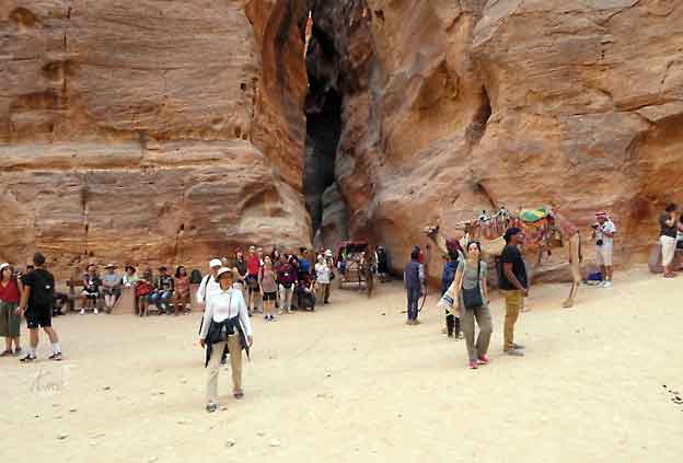
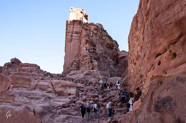
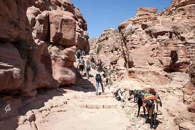
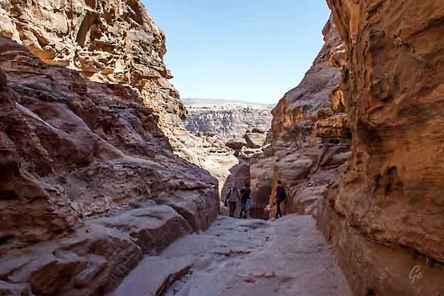
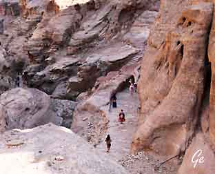
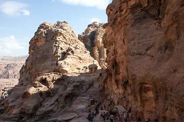
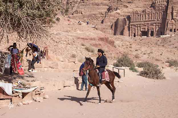
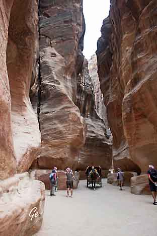
Den eneste måten å ta seg inn i Petra på, er til fots eller med hest og vogn
gjennom en 200 meter dyp og knapt to kilometer lang kløft.
Denne kløften har med sine stupbratte vegger bevoktet og ofte reddet
byens innbyggere fra fiendtlige tokt. Petra er en hel by hugget inn i
massive sandstensklipper for mer enn 2000 år siden.
Arkeologiske funn viser at man allerede 7000 år før Kristus drev jordbruk
i området, men det var i løpet av de siste århundrene før Kristus at Petra
hadde sin blomstringstid. Fra den tiden stammer mesteparten av Petras
praktfulle gravgrotter, bosteder og palasser som ble hugget ut i de
rosenrøde klippeveggene.
Står naturligvis på UNESCOs verdensarvliste.
Petra er utrolig, må oppleves! Vi gir oss god tid til å oppleve Petra.
(Fra reiseprogrammet)
En fin morgen med fullmåne.
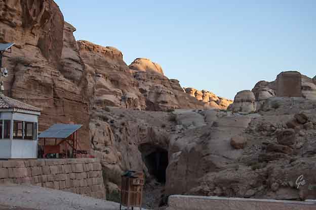
Klokka er 0630 og vi er klare til å kjøre de siste 10 minuttene inn til Petra.
Solhatten er på plass,
selv om sola ikke har stått opp så tidlig på dagen.
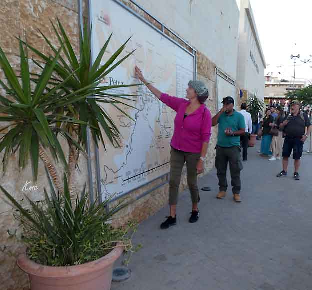
Først litt orientering om byen Petra.
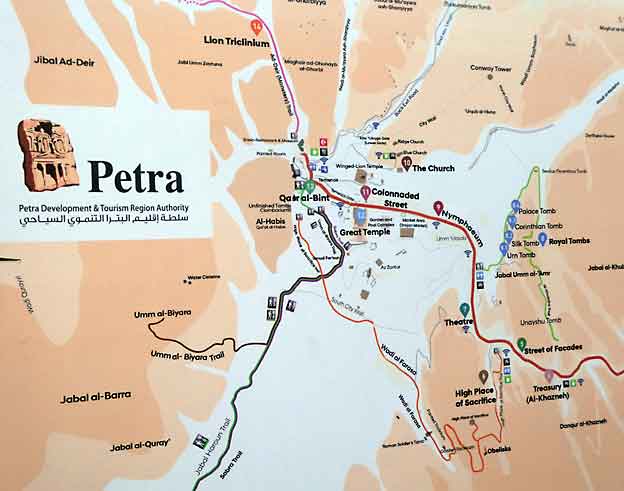
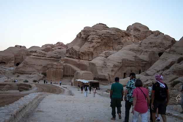
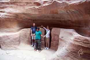
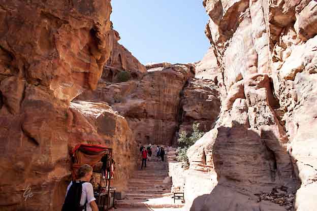
Så begynner vandringen. Det er ca 2 km å gå fra inngangen og inn til byen.
Det første stykket er det ganske åpent landskap.
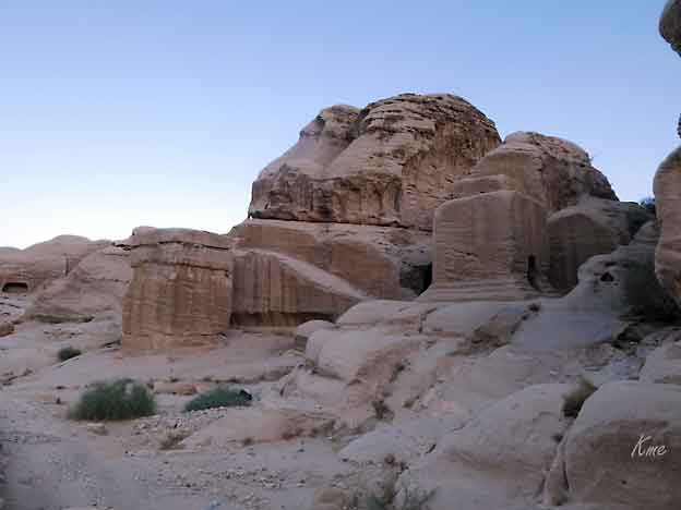
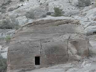
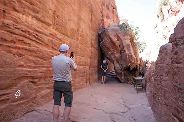
Djinn Blocks
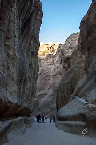 |
 Etter en stund kommer man inn i kløfta som fører inn til Petra. |
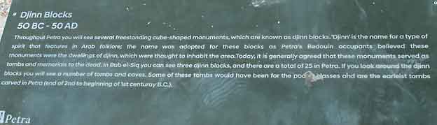
Djinn Blocks
Throughout Petra you will see several freestanding cube-shaped
monuments, which are known as djinn blocks. "Djinn" is the name
for a type of spirit that features in Arab folklore; the name was
adopted for these blocks as Petras Bedouin occupants believed
these monuments were dwellings of djinn, which were thought to
inhabit the area. Today it is generally agreed that these monuments
served as tombs and memorials to the dead. In Bab el-Siq you can
see three djinn blocks, and there are a total of 25 in Petra. If you look
around the djinn blocks you will see a number af tombs and caves.
Some of these tombs would have been for the poorer classes and are
the earleist tombs carved in Petra.
(end of 2nd to beginning of 1st centuray B.C.).
The Dam
When the Nabataean first settled in Petra and started building houses, they found
that they needed to protect themselves from the flash floods in the area. They also
needed a year-round supply of water for their own use. Therefore, to control
floodwaters, the Nabateans built a dam at the entrance of the Siq and cut a tunnel
in the rock to divert flood waters away from the Siq. The rock-cut tunnel is 88 meters
long, and 12.8 meters high and redirects water through Wadi Mudhlim to reservoirs, water cisterns, and dams inside and outside Petra. As a consequence of the cessation
of maintenance and cleaning operations, the dam at the Siq entrance has gradually deteriorated over time, resulting in floodwaters entering through the Siq instead of
being diverted through the tunnel of Wadi Al-Mudhlim. The dam you see today was constructed in 1964 over the original Nabataean one, which was larger, to prevent
a recurrence of a tragic flash flood that had earlier swept through the Siq. Towards
the end of Wadi Mudhlim, there are niches that probably held baetyls, or god blocks,
to protect the water, which was sacred to the Nabataean .
Al Mudhlim Tunnel and Bab as Siq Dam (2. april 2025)
Among Petra`s marvels are the Obelisk Tomb and Bab el-Siq Triclinium, two
remarkable rock-cut structures that offer insights into the Nabataean culture
and its blen of indigenous traditions with external influences.
The obelisk Tomb9 and Bab el-Siq Triclinium, two distinct rock-cut structures
carved into the sandstone cliffs, are positioned one above the other.
The upper monument, known as the "Obelisk Tomb", features four elongated
pyramids symbolizing Nefesh, Nabataen symbols representing the deceased,
with a central niche behind it holding a worn sculpture of a cloaked male
figure, representing the thomb`spatriarch, overseeing five burial niches beneath.
Below the tomb, a gabled facade indicates the location of a triclinium, a dining
hall where funerary banquets were held in honor of gods or ancestors. Across from the trivlinium, an ancient inscription in Nabataean and Greek commemorates a burial
minument erected by Abdmanku, son of Akayus, son of Shulla, for himself and for his children and their heirs during the time of Maliku (AD 40-70). This reflects Petra`s
cosmopolitan nature, influenced by Hellenic culture.
Obelisk Tomb and Bab el-Siq Triclinium (2. april 2025)
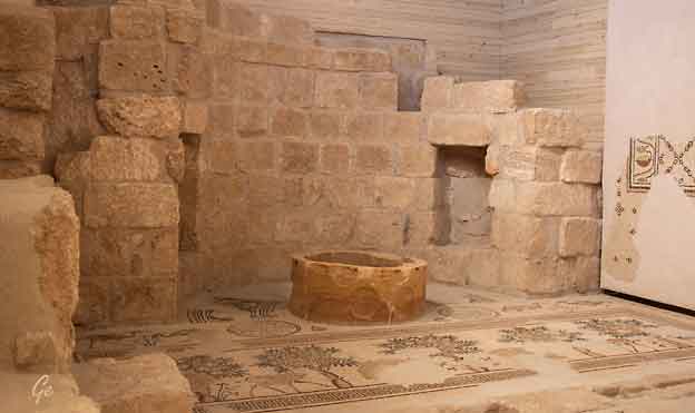
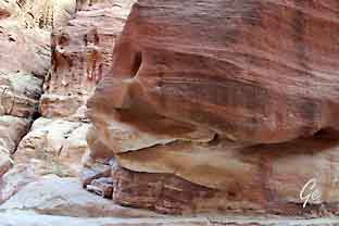
 Det går vannkanaler i fjellsidene. Noen steder er det laget kummer. Sand og småstein blir liggende der, og det rene vannet renner videre. |
 |
 |
 |
|
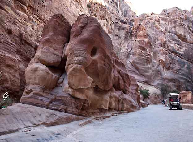
På denne linja er det to bilder av den samme stenen. Fra den ene siden ser den ut som en fisk (litt dårlig bilde, det ligner mer i virkeligheten) og fra den andre siden er det to elefanter. |
 |
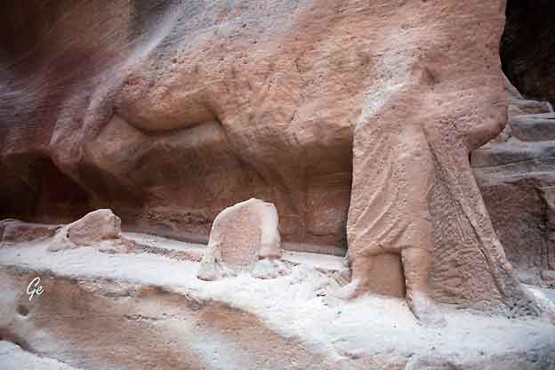
Under:
En mann og fire kamelføtter.
Hvor er resten av kamelen?
 |
 |
Vielse etter skikken i Petra.
Det er guiden vår Ramie som "vier" et av parene i gruppa vår.
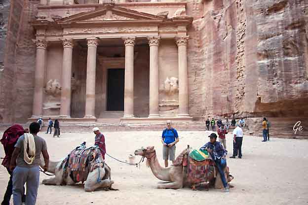
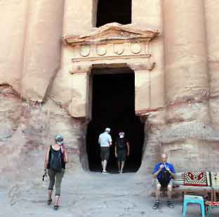
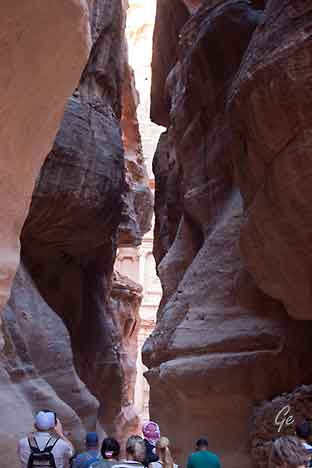 Her får vi det første glimtet av Skattkammeret. |
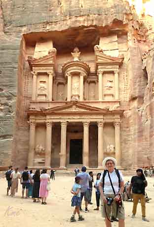 Grete foran Skattkammeret. |
Her kommer kløfta ut i byen Petra, akkurat ved skattkammeret.
 |
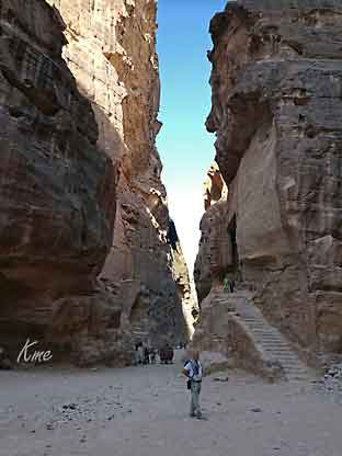 |
Denne kløfta går videre inn i byen Petra.
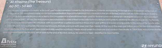
The Treasury, or "Al Khazna" in Arabic, is the most spectacular monument
carved by the Nabataeans. It stands an imposing 39,5 m high and is impressively
carved out of a single block. The monuments name comes from a local Bedouin
legend that pharaoh hid a treasury in the urn at the top, and you can see bullet
holes from shooting at the urn yo try to retrieve this treasure. In reality it is a
mausoleum and would have been used for funerary purposes; many
archaeologists believe it is the mausoleum of king Aretas (9 BC - 40 AD),
The Nabataeans decorated the facades of their tombs with funerary designs
and symbols related to the afterlife and death. The facade of the treasury reveals
a Hellenistic influence, with six Corinthian capitals topped by a frieze of winged
griffins and vases among scrolls. In the center of the facade is the goddes Isis,
and she is surrounded by dancing Amazons (female warriors) with axes over
their heads. At the top of the steps just before you enter the chamber, there are
circular holes in the floor which were most probably used for sacrifices.
Priests would enter the chamber and conduct their rituals.
In 2004 three Nabataeans tombs were uncovered below the Khazna, which date
to the end of the first century BC and have been identified as royal tombs.
Her åpner byen seg
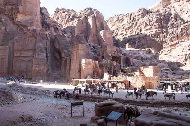
Vi tar en annen vei enn de fleste andre turistene.
En gruppe italienere har også funnet denne veien,
men Ramie mente vi bare skulle få følge med dem et lite stykke.
Petra var hjembyen hans, så her var han kjent.
 |
 |
Petra Theater (Arabic: مسرح البتراء) is a first century AD Nabataean theatre
situated 600 m from the centre of Petra. Substantial part of the theater was carved
out of solid rock, while the scaena and exterior wall were constructed. The theater's auditorium consists of three horizontal sections of seats separated by passageways
and seven stairways to ascend. The theater could accommodate a number of approximately 8500 people, more than the estimated number of Amman theater.
Petra Theater follows similar architectural patterns of Roman theaters, which e
nhances superior acoustics
Petra Theater - Wikipedia (2. april 2025)
 |
 |
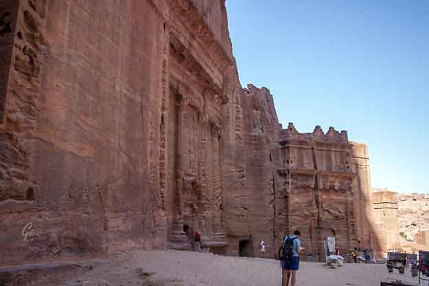
 The Royal Tomb of Malchus / Urn Tomb |
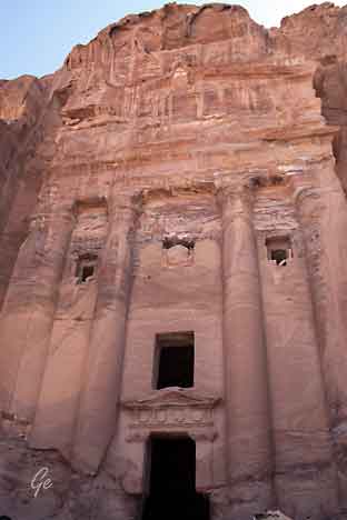 |
The most distinctive of the Royal Tombs is the Urn Tomb, recognisable
by the enormous urn on top of the pediment. It was built in about
AD 70 for King Malichos II (AD 40–70) or Aretas IV (8 BC–AD 40).
The naturally patterned interior of the Urn Tomb measures
a vast 18m by 20m.
Part of what makes the Urn Tomb such a grand structure is the
flanking Doric portico cut into the rock face on the left of the tomb,
and the huge open terrace in front of it – a feature that encouraged its
use, according to a Greek inscription inside the tomb, as a cathedral in
AD 447. The double layer of vaults was added at a later date by the
Byzantines. Look towards the top of the building and you’ll see three
inaccessible openings carved between the pillars. These are also tombs,
the central one of which still has the closing stone intact, depicting the
king dressed in a toga.
https://www.lonelyplanet.com/jordan/attractions/urn-tomb/a/poi-sig/1501794/361067
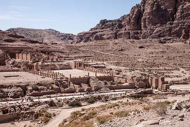
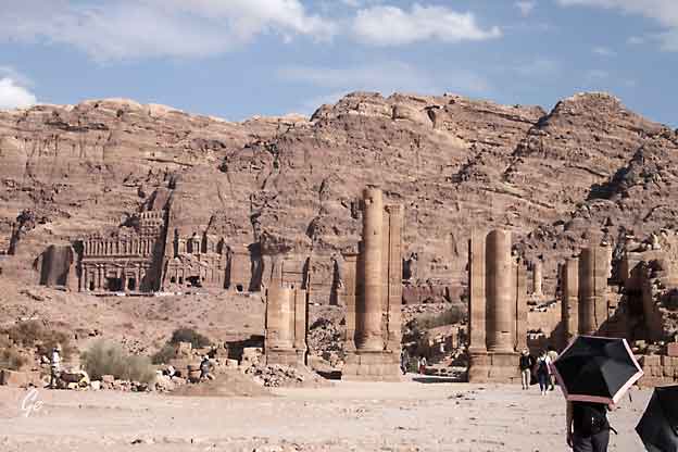
The 'Great Temple' complex, which covers 7560 square meters, is by far Petra's
largest building. It is accessed via a monumental entryway, or propylaeum, and
has two successive open-air sections at varying elevations. The lower precinct
consisted of a large paved courtyard flanked on each side by triple colonnades.
Each housed 60 columns made of carved drums, with imported limestone capitals adorned with carved elephant heads, exotic symbols of power. A number have been partially re-erected. Excavations have revealed that the upper precinct, accessed
by a pair of monumental stairways, featured a small open-air theater with semi-circular tiered seating. Its small size and layout suggest that it may have been
designed as a council chamber or a judicial
assembly hall. The presence of this theater and the adjoining columned courtyard suggests that the building served primarily as a civic complex under the patronage
of the Nabataean royal house. The structure’s downtown location outside the Qasr
al-Bint temple precinct points strongly to its secular function, although religious activities may also have taken place in this grand complex. The Great Temple Complex also includes a subterranean drainage system, baths discovered in the temple's west, and a workshop for producing plaster molds was discovered at the south end.
The ‘Great Temple’ Complex (2. april 2025)
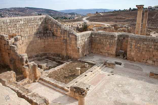
The Petra Church
Archaeologists have concluded that the Church was originally built in the second
half of the fifth century CE. It continued to be used as a religious structure until
about the early seventh century CE, when it was destroyed by fire.
Zbigniew Fiema notes that scholars distinguish “early” and “late” phases of
construction. The early phase designates the church as originally built in the
fifth century CE. The late phase corresponds to modifications carried out in the
later sixth century CE.
In the sixth century, the atrium of the church was built to connect the cathedral
portion of the church to the baptismal complex, joining them into one building.
After the fire, materials from the Church were reused, including the glass tesserae
(small cubes that make up mosaics) from the mosaics.
Mosaics are also found on some portions of the church's walls. The floors of the
nave are decorated with opus sectile floors, while the two smaller side aisles are decorated with colorful figurative mosaics. These are one of the most well-known features of the Church.
The mosaics in the aisles depict the seasons, animals, people, pottery, and plants.
The mosaic's style is very similar to that of the Gaza school, and also shares
similarities with Hellenistic and Roman iconography. This helps us to situate
Nabataean architecture, and Petra, in its global context.
Conservation work has been done to preserve the mosaics. Conservators list the following as challenges they encountered throughout restoration: the detachment between mosaic layers, swelling, deterioration of the preparatory layers, the efflorescence of soluble salts to the surface, and the poor condition of tesserae due
to fracturing, exfoliating, and erosion.
Byzantine Church (Petra) - Wikipedia (24. mars 2022)
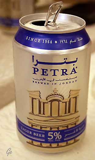 |
In 1964, GIC introduced Petra, the oldest local brew of Jordan. It is available in 3 different varieties—Lager, Weizen and Amber—and is brewed in Zarqa. https://en.wikipedia.org/wiki/Beer_in_Jordan |
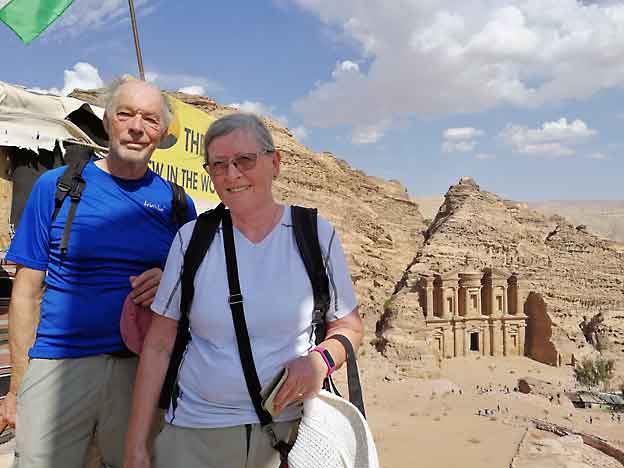
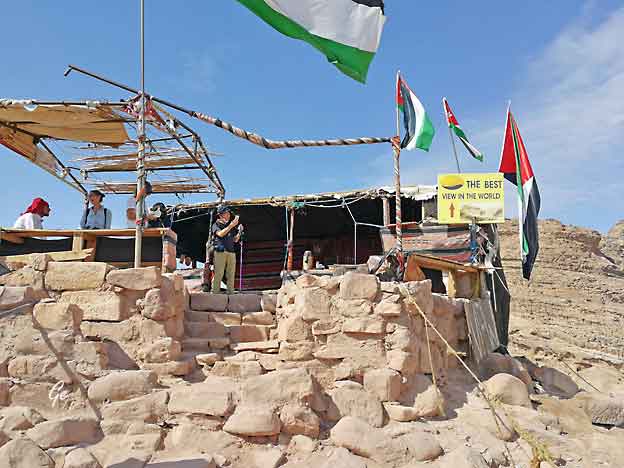
Vi begynner på de 800 trappetrinna opp til Klosteret.
En nedrast steinblokk lager en tunnel.
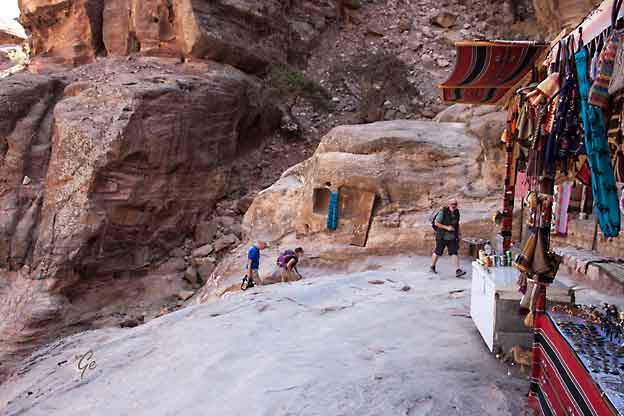
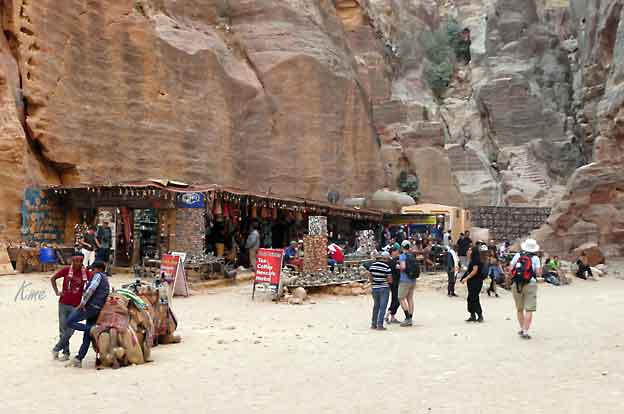
Mange muligheter til å kjøpe souvenirer eller drikke på veien opp.
(40 minute walking time) from the Basin. The Wadi Kharrubeh, the
Lion's tomb, and small biclinia and grottos can be seen en-route to
the Monastery.
Wadi Araba and the gorges along with the semi-arid
territory immediately around Petra.
https://en.wikipedia.org/wiki/Ad_Deir
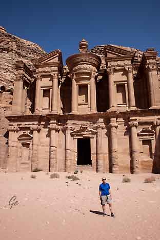 |
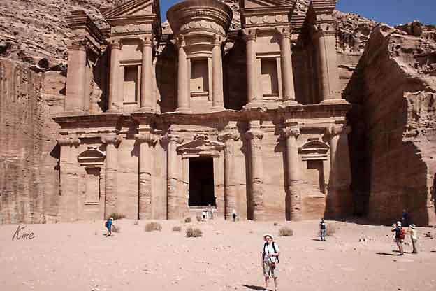
 Det var godt å sette seg ned i skyggen med noe kaldt å drikke. 800 trappetrinn i 35 varmegrader er slitsomt. |
monumental building carved out of rock in the ancient Jordanian city
of Petra.
Arguably one of the most iconic monuments in the Petra Archaeological Park,
the Monastery (ad-Dayr) is located high in the hills northwest of the Petra
city center.
It is the second most commonly visited monument in Petra, after the Treasury.
The rock-cut facade of the Monastery is 45 meters high and 50 meters wide.
The structure was first constructed in 3 BCE as a monumental Nabataean tomb.
was being cleaned in 1991, read "the symposium of Obodas, the god".
This inscription indicates that the building may originally have been
dedicated to the Nabataean king, Obodas I, who was likely deified
posthumously.
The tomb has several incised crosses carved into the wall, which may
indicate that the structure was reused as a church during the Byzantine
period.
https://en.wikipedia.org/wiki/Ad_Deir
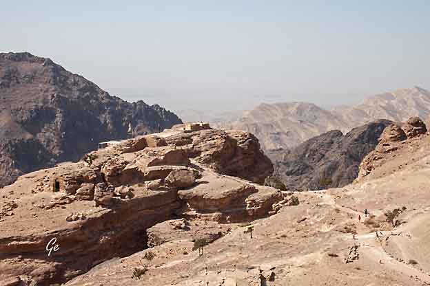
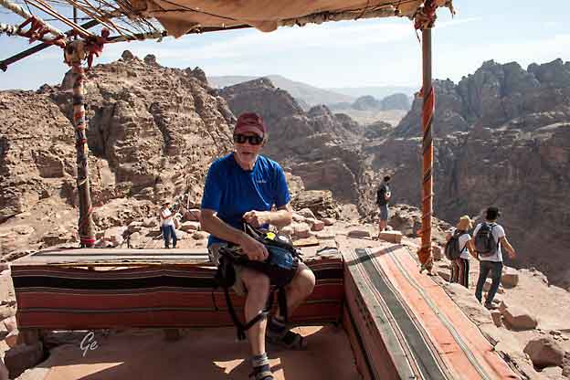
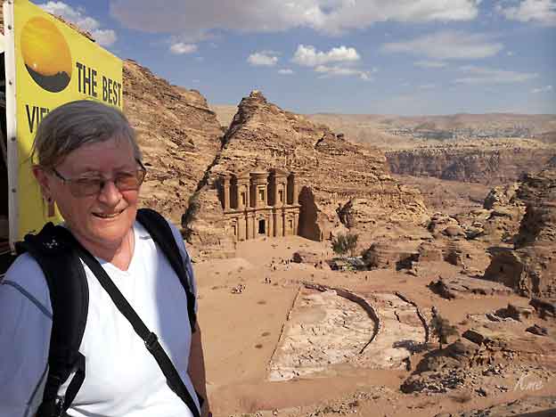
Fin utsikt mot Klosteret her oppe fra.
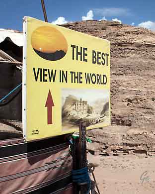 |
 "The best view in the world" er kanskje noe overdrevet, men utsikten var fin den. |
Så var det like mange trinn ned igjen til byen. Skitsomt for dårlige knær.
Palace Tomb
Located to the north of the Corinthian tomb, the Palace Tomb
measures 49 meters in width and 46 meters in height.
 Palace Tomb The Palace Tomb is a Nabataean tomb in the Petra Archaeological Park. It is situated among the Royal Tombs, a line of prominent monumental facades on the east cliffs flanking the valley in which the city lies. At 49 meters wide and 46 meters tall, its rock-hewn façade is one of the largest in Petra. Palace Tomb - Wikipedia (2. april 2025) |
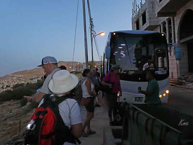
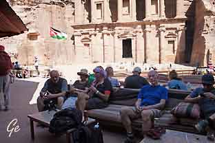
 Samme vei tilbake. Vi dro fra hotellet kl 0630 og skulle møtes ved bussen igjen kl 1700, så vi fikk mange timer i Petra. Guide Ramie og skritt-teller er enige om at vi gikk 16 km denne dagen. |
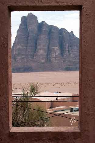
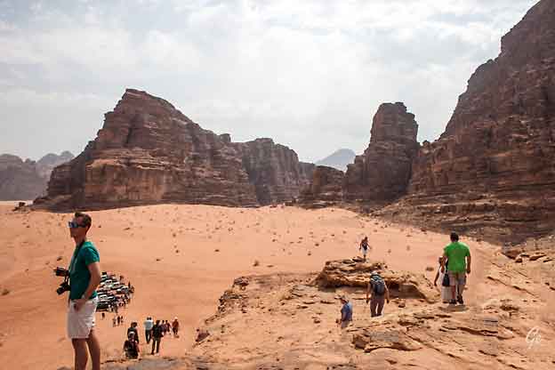
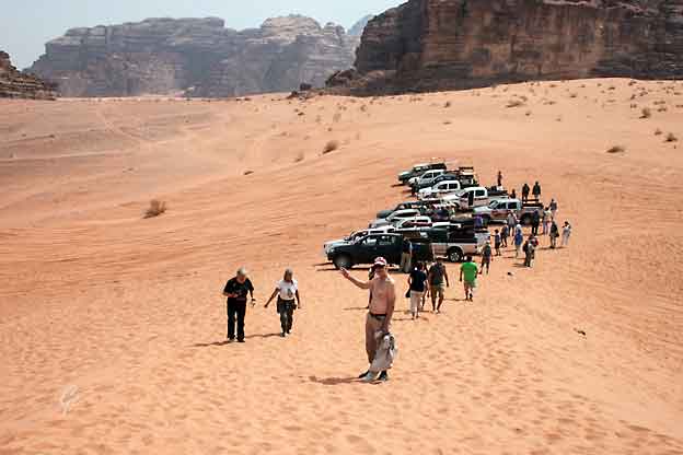
Tilbake til ørkenveien, hårnålsvinger ned en forkastning, og så er vi snart inne i
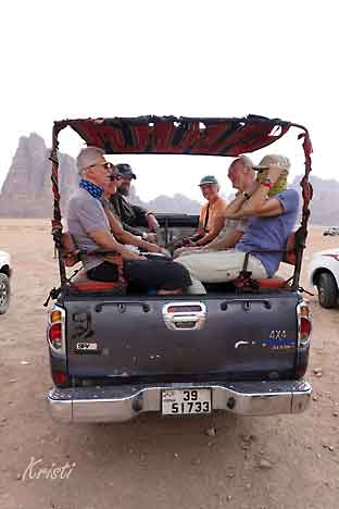
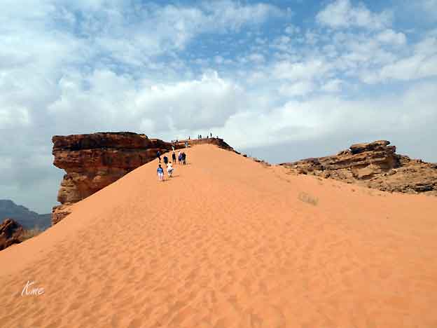
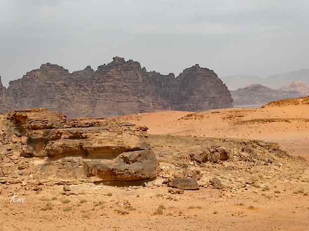
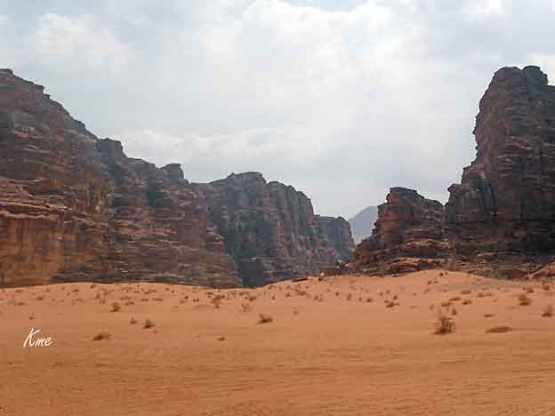
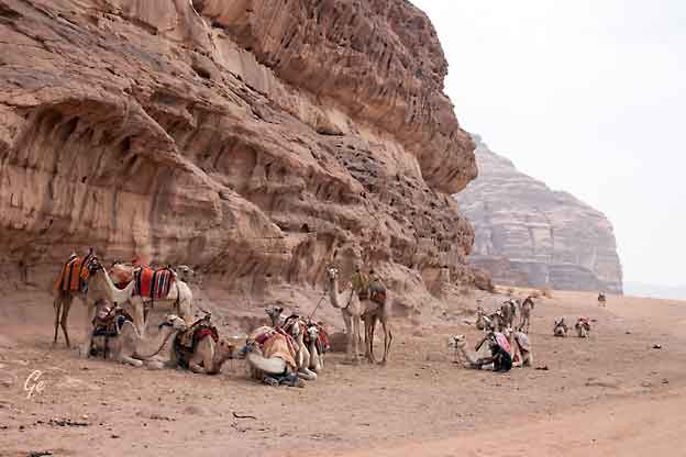
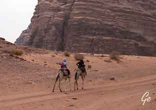
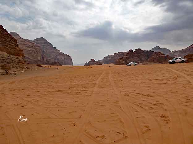
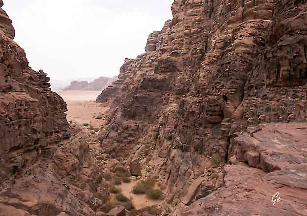
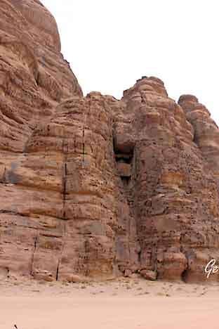
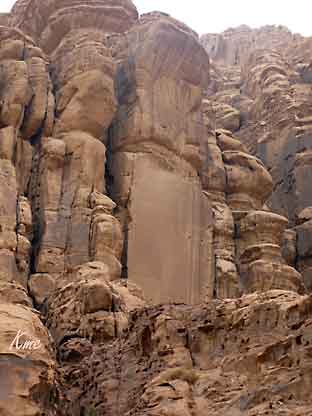
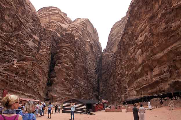
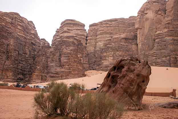
Wadi Rum, et av verdens mest fascinerende landskaper, helt og holdent
naturskapt, kanskje verdens vakreste ørken!
Steinformasjoner og sand i alle regnbuens farger. Her kjører vi i gjennom
ørkenen i Lawrence of Arabias land. Her lekte han katt og mus med tyrkerne, og
herfra foretok han sine raid. Vi har beduiner som vertskap, og de tar oss med firehjulsdrevne biler, med god fjæring, et par timer ut i drømmelandskapene, som
står på UNESCOs verdensarvliste.
Ved foten av røde sandfjell ligger Jordans eneste havneby, Aqaba. Hit kom Moses
etter flukten fra Egypt. Her holdt kong Salomos flåte til, og her hentet han gull fra eventyrlandet Ofir. I Aqaba steg dronningen av Saba i land når hun skulle besøke
kong Salomo. I korsfarertiden under ridder Reinold, "Ulven fra Kerak", het byen
Aila. Han lot reise en borg på faraoenes koralløy Geziret Firuna, døpte den til Ile
de Graye og holdt hoff der. (fra reiseprogrammet)
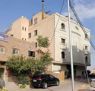
| Tetre
Tree hotel i Wadi Musa sentrum, ikke langt fra inngangen til Petra. |
 |
 |
 |
The Seven Pillars of Wisdom is
a stunningly shaped mountain opposite of the Wadi Rum
visitor centre. If you look carefully, you will see
that there are only six pillars.
In fact, the mountain is named after the famous book
of T.E. Lawrence back in the 1980’s. Before, it was
known as Jabal Al-Mazmar. We still refer to it by its
original name. Some believe Lawrence named his book
after seeing the mountain in combination with a verse
in the Bible that says ‘Wisdom has build her house,
she
hath hewn out her seven pillars’.
http://desertmelody.com/seven-pillars-of-wisdom-jabal-al-mazmar/
 |
 |
Wadi Rum is a protected area covering 720 square kilometers of dramatic
desert wilderness in the south of Jordan. Huge mountains of sandstone and
granite emerge, sheer-sided, from wide sandy valleys to reach heights of
1700 meters and more. Narrow canyons and fissures cut deep into the
mountains and many conceal ancient rock drawings etched by the peoples
of the desert over millennia. Bedouin tribes still live among the mountains
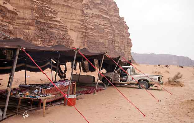
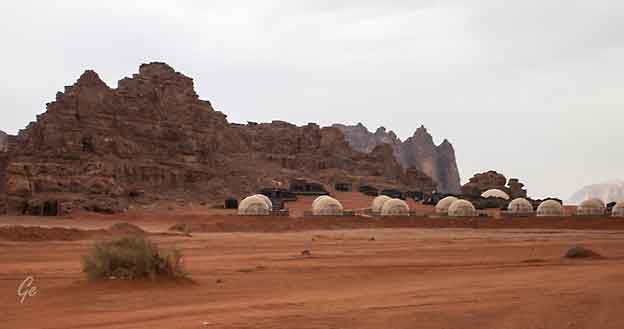
of Rum and their large goat-hair tents are a special feature of the landscape.
There are many ways to enjoy the attractions of Rum, including jeep, camel
and hiking tours and you can stay overnight in a Bedouin tent and gaze at
the amazing panoply of stars.
To safeguard its unique desert landscape, Wadi Rum was declared a protected
area in1998 and an intensive conservation programme is now underway.
http://wadirum.jo/about-wadi-rum/
 |
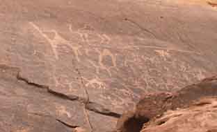 |
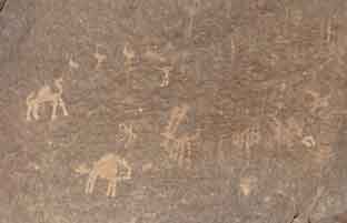
in Wadi Rum desert. They tell us stories about the history and evolution of human activity in the Arabian Peninsula. With 25,000 petroglyphs and 20,000 inscriptions, mostly Thamudic, Wadi Rum desert is a truly unique place on earth. This was one
of the reasons for UNESCO to put our desert on the World Heritage List.
The petroglyphs are drawings of humans and animals. They show human figures holding bows and arrows. Other figures are the ones of animals like camel, ibex
and horse. And alongside these figures are symbols like lines and circles.
 |
 |
for one another.
They are believed to be about showing hidden springs. And about updating
each other on things like who visited the area last. All together these
engravings give an insight on the development of human thought.
They show pattern of pastoral, agricultural and urban human activity.
And they tell us more about the climatically change. From the mildly
humid climate to the semi-arid climate we have today.
https://www.wadirumnomads.com/the-petroglyphs-and-inscriptions-of-wadi-rum/
 |
 |

 |
 |
 |
Over: Kong Abdullah |
Space Village
 |
 |
The area has been used as a background setting in a number of films. Filmmakers
are particularly drawn to it for science fiction films set on Mars.
The Location Managers Guild recognized the Jordanian Royal Film Commissionwith its LMGI Award for Outstanding Film Commission in 2017 for its work on Rogue
One, which was filmed at Wadi Rum. The RFC was previously nominated for its work with The Martian.
- Lawrence of Arabia – David Lean filmed much of this 1962 film on location in Wadi Rum.
- Prometheus – scenes for the Alien Planet
- The Last Days on Mars – filmed for exterior shots representing the surface of the titular planet for this 2013 film.
- The Martian – filming for the Ridley Scott film began in March 2015, for shots that stood in for the surface of Mars. Matt Damon on Wadi Rum:
- Theeb – Filmed mostly in Wadi Rum, as well as Wadi Araba.
- Rogue One: A Star Wars Story, used for scenes set on Jedha.
- Aladdin, 2019 live action remake of the 1992 Disney animated film of the same name.
- Star Wars: The Rise of Skywalker, used for the desert planet Pasaana.[32]
- Dune (2021), used as a location for the desert planet Arrakis. Timothée Chalamet on Wadi Rum:
- Dune: Part Two, used as a location for filming the upcoming movie.
- Aadujeevitham – The desert scenes of the 2020 Malayalam film were mostly shot on locations in Wadi Rum.
- Moon Knight (2022), used for the scenes outside Ammit's tomb.
- The Amazing Race 34
- Wadi
Rum - Wikipedia
(1. februar 2023)
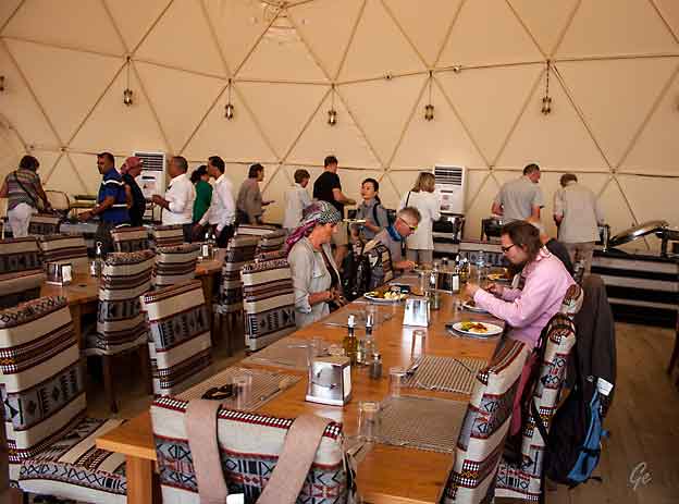
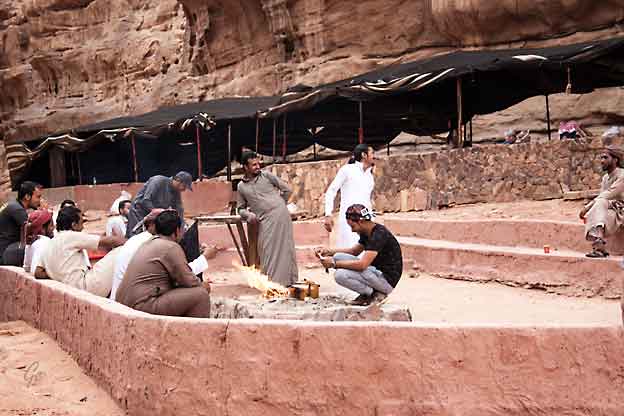
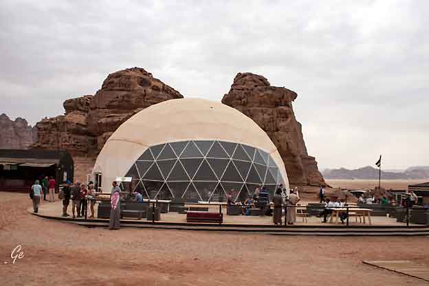
Lunsj i Space Village
Uværet kommer!!
Sandstorm i Wadi Rum.
Det begynte like etter vi hadde
satt oss i bussen for å kjøre videre mot Aqaba.
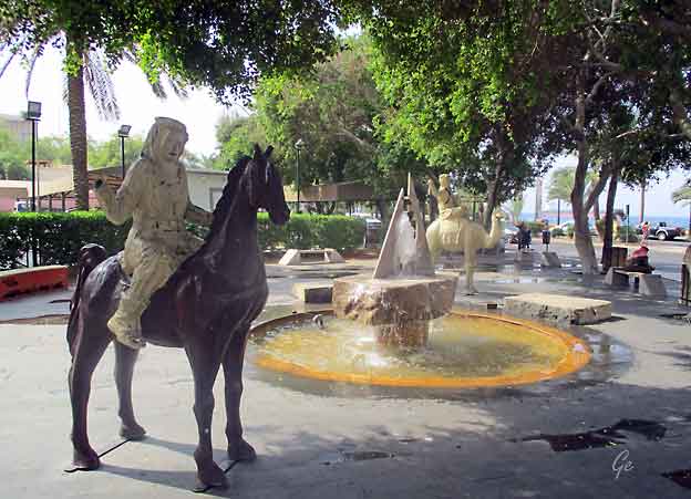
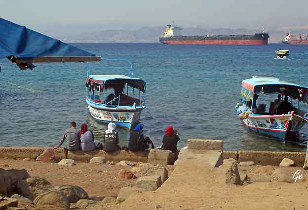
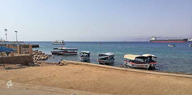
Aqaba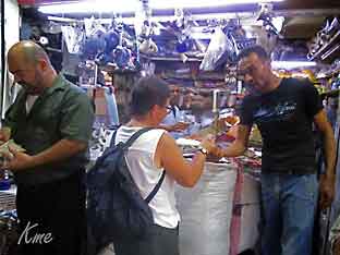 På marked i Aqaba |
 |
Solnedgang i Aqaba
Dagen fri til disposisjon. Hotellet har strand og svømmebasseng.
Utenfor havegjerdet ligger byen med levninger av tidligere bosetninger,
butikker, kafeer og en liten basar. Aqaba er ganske hyggelig!
Muligheter for en båttur til egyptisk side om politiske forhold tillater det,
eller en tur i båt med glassbunn for å nyte solen og havbrisen og kikke
etter mulig fisk. Ikke allverdens liv i havet lenger.
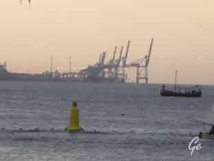
Aqaba er en havneby og industriby, på god avstand fra strendene,
ingen fare, og det er Eilat, vegg i vegg også.
(fra reiseprogrammet)
 |
 |
Aqaba (English: /ˈækəbə/, also US: /ˈɑːk-/; Arabic: العقبة, romanized:
al-ʿAqaba, al-ʿAgaba, pronounced [æl ˈʕæqaba, alˈʕagaba]) is the only
coastal city in Jordan and the largest and most populous city on the Gulf of
Aqaba. Situated in southernmost Jordan, Aqaba is the administrative centre
of the Aqaba Governorate. The city had a population of 148,398 in 2015 and
a land area of 375 square kilometres (144.8 sq mi). Today, Aqaba plays a major
role in the development of the Jordanian economy, through the vibrant trade
and tourism sectors. The Port of Aqaba also serves other countries in the region.
Aqaba's strategic location at the northeastern tip of the Red Sea between the continents of Asia and Africa, has made its port important over the course of thousands of years.
The ancient city was called Elath, adopted in Latin as Aela and in Arabic as Ayla.
Its strategic location and proximity to copper mines made it a regional hub for
copper production and trade in the Chalcolithic period.
titular see after Islamic conquest around AD 650, when it became known as Ayla;
the name Aqaba is late medieval. The Great Arab Revolt's Battle of Aqaba,
depicted in the film Lawrence of Arabia, resulted in victory for Arab forces
over the Ottoman defenders.
Aqaba's location next to Wadi Rum and Petra has placed it in Jordan's golden
triangle of tourism, which strengthened the city's location on the world map
and made it one of the major tourist attractions in Jordan.
The city is administered by the Aqaba Special Economic Zone Authority, which
has turned Aqaba into a low-tax, duty-free city, attracting several mega
projects like Ayla Oasis, Saraya Aqaba, Marsa Zayed and expansion of the Port
of Aqaba. They are expected to turn the city into a major tourism hub in the
region. However, industrial and commercial activities remain important, due
to the strategic location of the city as the country's only seaport.
https://en.wikipedia.org/wiki/Aqaba
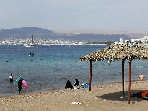
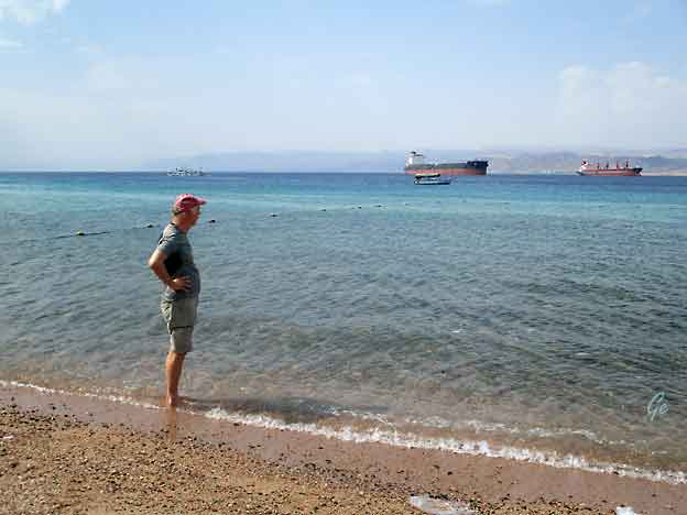
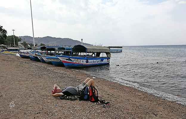
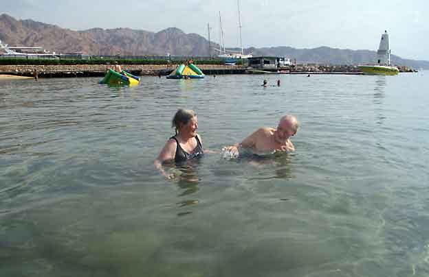
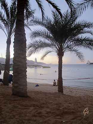
Den offentlige stranda i Aqaba
The Red Sea has a surface area of roughly 438,000 km2 (169,100 mi2), is about 2250 km (1398 mi) long and, at its widest point, 355 km (220.6 mi) wide. It has a maximum depth of 3,040 m (9,970 ft) in the central Suakin Trough, and an average depth of 490 m (1,608 ft). However, there are also extensive shallow shelves, noted for their marine life and corals. The sea is the habitat of over 1,000 invertebrate species, and 200 soft and hard corals. It is the world's northernmost tropical sea.
The earliest known exploration of the Red Sea was conducted by ancient
Egyptians, as they attempted to establish commercial routes to Punt. One
such expedition took place around 2500 BCE, and another around
1500 BCE (by Hatshepsut). Both involved long voyages down the Red Sea.
The biblical Book of Exodus tells the account of the Israelites' crossing of a
body of water, which the Hebrew text calls Yam Suph (Hebrew: יַם סוּף).
Yam Suph was traditionally identified as the Red Sea. Rabbi Saadia Gaon
(882‒942), in his Judeo-Arabic translation of the Pentateuch, identifies the
crossing place of the Red Sea as Baḥar al-Qulzum, meaning the Gulf of Suez.
https://en.wikipedia.org/wiki/Red_Sea
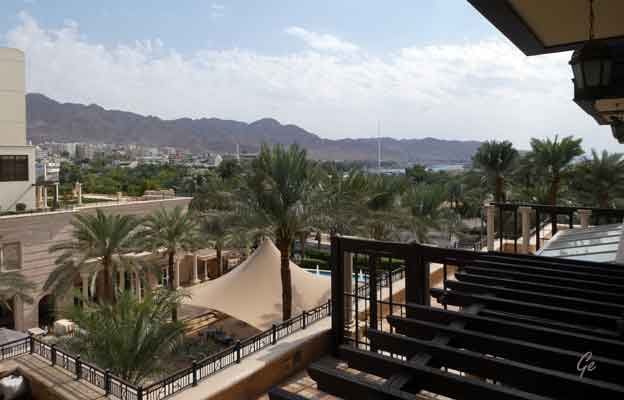
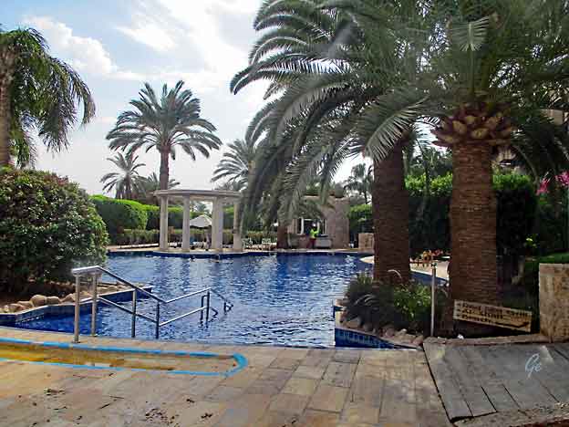
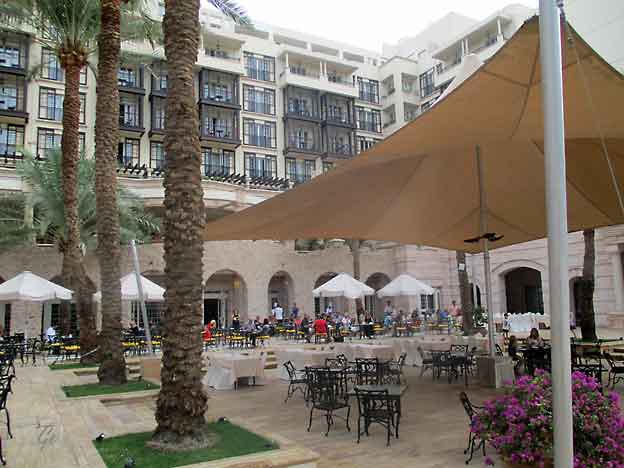
Hotel Mövenpick
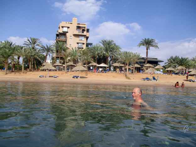
Stranda på hotel Mövenpick
Det er uvær over Egypt og Israel.
Vi fikk bare noen få dråper regn.
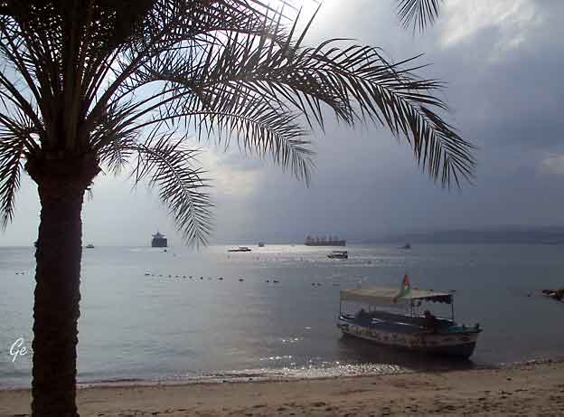
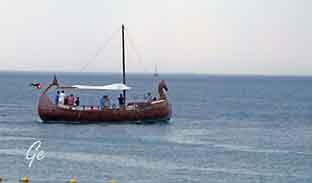 Et vikingskip er ankommet Akababukta |
 |
Lengde på stranda er 132 m
 |
 |
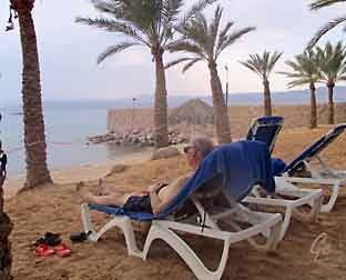
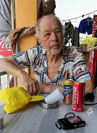
Dagen til disposisjon.
Vi avslutter med middag på en
"orientalsk sjømatrestaurant",
og har rommene til midnatt.
(fra reiseprogrammet)
Vi brukte første del av dagen til en bytur og
en ny tur til den offentlige stranda.
Ettermiddagen var vi på stranda til hotellet.
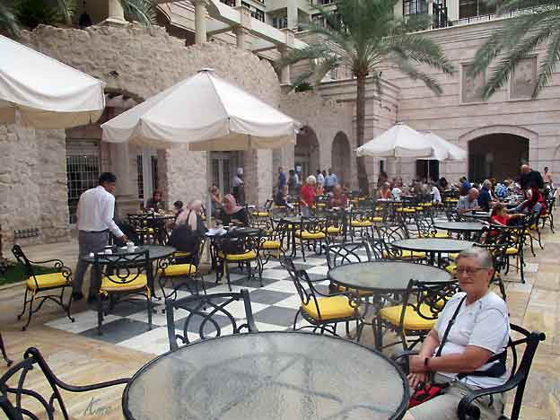
Den utendørs delen av spisesalen på hotellet.
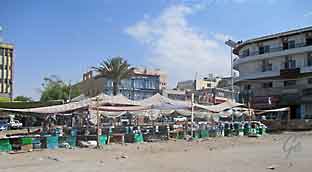
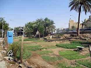
En park i Aqaba
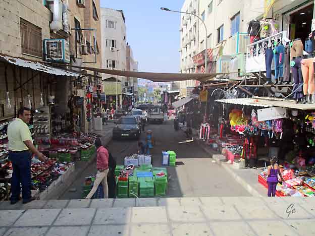
En av basargatene
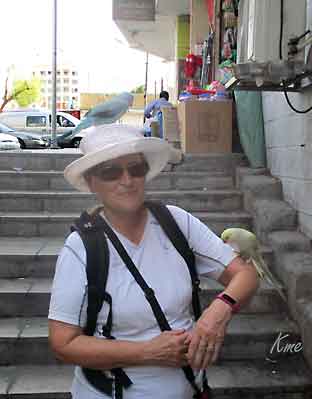 |
 Over litt av basaren Til venstre: Grete med undulater |
 |
 Cola og brus på en strandrestaurant |
Trim på stranda
And the Lord hardened the heart of Pharaoh king of Egypt, and he pursued
the children of Israel; and the children of Israel went out with boldness.
9 So the Egyptians pursued them, all the horses and chariots of Pharaoh,
his horsemen and his army, and overtook them camping by the sea beside
Pi Hahiroth, before Baal Zephon.
10 And when Pharaoh drew near, the children of Israel lifted their eyes, and
behold, the Egyptians marched after them. So they were very afraid, and the
children of Israel cried out to the Lord. 11 Then they said to Moses, “Because
there were no graves in Egypt, have you taken us away to die in the
wilderness? Why have you so dealt with us, to bring us up out of Egypt?
12 Is this not the word that we told you in Egypt, saying, ‘Let us alone that
we may serve the Egyptians’? For it would have been better for us to serve
the Egyptians than that we should die in the wilderness.”
13 And Moses said to the people, “Do not be afraid. Stand still, and see the salvation of the Lord, which He will accomplish for you today. For the
Egyptians whom you see today, you shall see again no more forever. 14 The
Lord will fight for you, and you shall hold[c] your peace.”
15 And the Lord said to Moses, “Why do you cry to Me? Tell the children of
Israel to go forward. 16 But lift up your rod, and stretch out your hand over
the sea and divide it. And the children of Israel shall go on dry ground
through the midst of the sea. 17 And I indeed will harden the hearts of the
Egyptians, and they shall follow them. So I will gain honor over Pharaoh
and over all his army, his chariots, and his horsemen. 18 Then the
Egyptians shall know that I am the Lord, when I have gained honor for
Myself over Pharaoh, his chariots, and his horsemen.”
19 And the Angel of God, who went before the camp of Israel, moved and
went behind them; and the pillar of cloud went from before them and stood
behind them.
was a cloud and darkness to the one, and it gave light by night to the other, so
that the one did not come near the other all that night.
21 Then Moses stretched out his hand over the sea; and the Lord caused the sea
to go back by a strong east wind all that night, and made the sea into dry land,
and the waters were divided. 22 So the children of Israel went into the midst of
the sea on the dry ground, and the waters were a wall to them on their right
hand and on their left. 23 And the Egyptians pursued and went after them into
the midst of the sea, all Pharaoh’s horses, his chariots, and his horsemen.
24 Now it came to pass, in the morning watch, that the Lord looked down upon
the army of the Egyptians through the pillar of fire and cloud, and He [d]troubled
the army of the Egyptians. 25 And He [e]took off their chariot wheels, so that they
drove them with difficulty; and the Egyptians said, “Let us flee from the face of
Israel, for the Lord fights for them against the Egyptians.”
26 Then the Lord said to Moses, “Stretch out your hand over the sea, that
the waters may come back upon the Egyptians, on their chariots, and on
their horsemen.” 27 And Moses stretched out his hand over the sea; and when
the morning appeared, the sea returned to its full depth, while the Egyptians
were fleeing into it. So the Lord overthrew[f] the Egyptians in the midst of the
sea.
28 Then the waters returned and covered the chariots, the horsemen, and
all the army of Pharaoh that came into the sea after them. Not so much as
one of them remained. 29 But the children of Israel had walked on dry land
in the midst of the sea, and the waters were a wall to them on their right
hand and on their left.
30 So the Lord saved[g] Israel that day out of the hand of the Egyptians, and
Israel saw the Egyptians dead on the seashore. 31 Thus Israel saw the great [h]
work which the Lord had done in Egypt; so the people feared the Lord, and
believed the Lord and His servant Moses.
https://www.biblegateway.com/passage/?search=Exodus+14&version=NKJV
Kort innen midnatt bryter vi opp, blir kjørt til lufthavnen for å sjekke
inn på Turkish nattfly til Istanbul.
Flybytte før siste etappe til Oslo, der vi ankommer på formiddagen.
(fra reiseprogrammet)
tilbake til 1. side