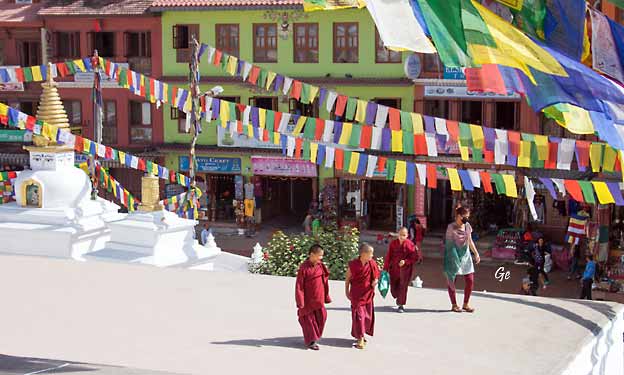
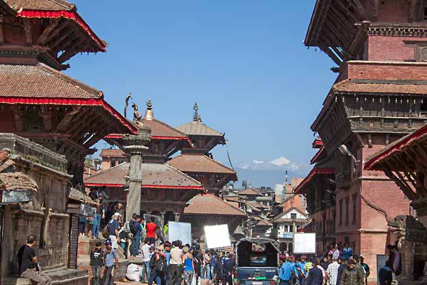
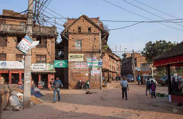
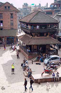
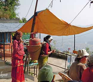
Tirsdag 11. november 2014
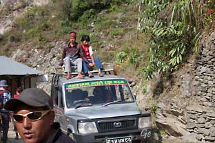
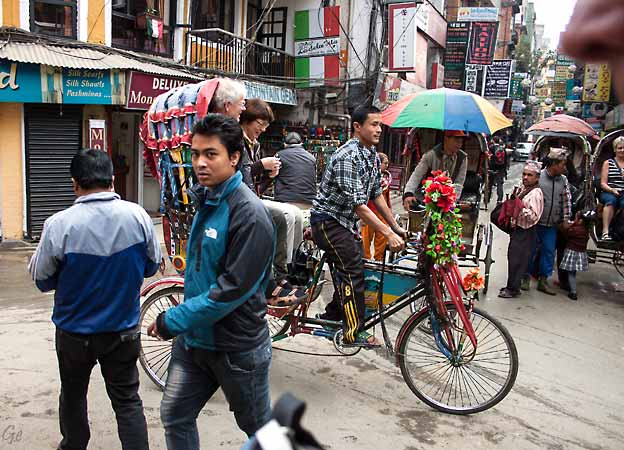
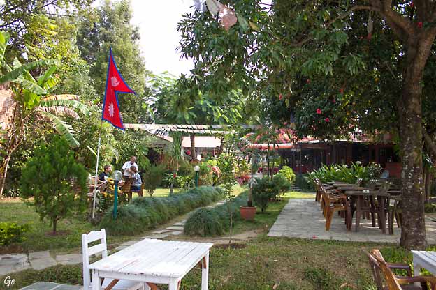
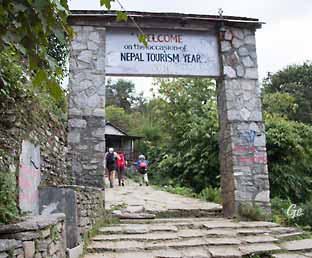
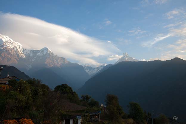
Etter frokost ble vi kjørt til
Durbar Square med rickshaw.
Etter lunsj på
Festive Fare Restaurant
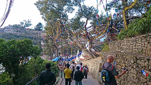
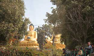
dro vi videre til Monkey
Temple (Swayambunath)
med minibuss.
|
|
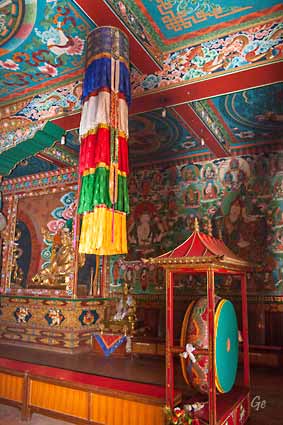
Kathmandu,
officially the Kathmandu Metropolitan
City (Nepali:
काठमाडौं महानगरपालिका), is the capital and
most populous city of Nepal with
975,453 inhabitants in 2011. It is located in
the Kathmandu Valley, a large
valley in the high plateaus in central
Nepal, at an altitude of 1,400 metres
(4,600 feet).
The valley was historically called the "Nepal Mandala"
and has been the home
of the Newar people, a cosmopolitan urban
civilization in the Himalayan foothills.
The city was the royal capital of the Kingdom of
Nepal and hosts palaces,
mansions, and gardens of the Nepalese aristocracy. It
has been home to the
headquarters of the South Asian Association for
Regional Cooperation (SAARC)
since 1985. Today, it is the seat of government of the
Nepalese republic,
established in 2008, and is part of the Bagmati
Province.
Kathmandu is and has been for many years the centre of
Nepal's history, art,
culture, and economy. It has a multi-ethnic
population within
a Hindu and Buddhist majority.
Religious and cultural festivities form a major
part of the lives of people residing in Kathmandu.
Tourism is an important part
of the economy in the city. In 2013, Kathmandu was
ranked third among the
top ten upcoming travel destinations in the world
by TripAdvisor, and ranked
first in Asia. The city is considered the gateway to
the Nepalese Himalayas and
is home to several World Heritage Sites:
the Durbar
Square, Swayambhunath, Boudhanath and Pashupatinath.
|
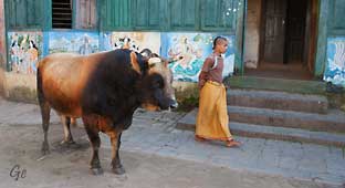
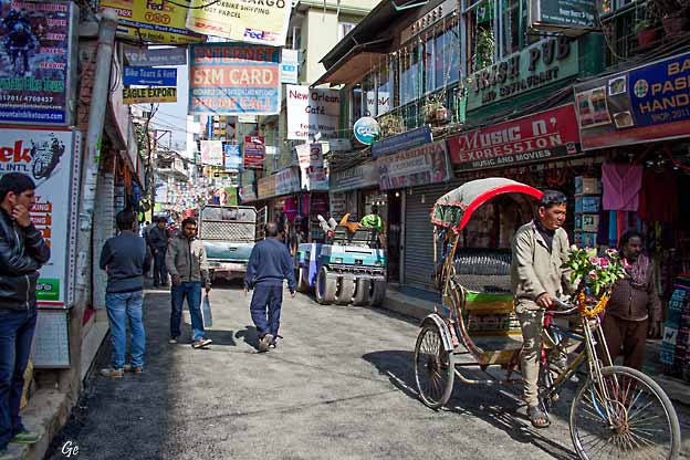
Egil og Ellen på vei til Durbar Square med rickshaw.
Kathmandu
valley is growing at 4 percent per year according to
the World
Bank in 2010, making it one of the
fastest-growing metropolitan areas in
South Asia, and the first region in Nepal to face the
unprecedented challenges
of rapid urbanization and modernization at a
metropolitan scale.
Historic areas of Kathmandu were severely damaged by
a 7.8 magnitude
earthquake in April 2015. Some of the buildings
have been restored while
some remain in the process of reconstruction.
Kathmandu -
Wikipedia (6. januar 2022)
|
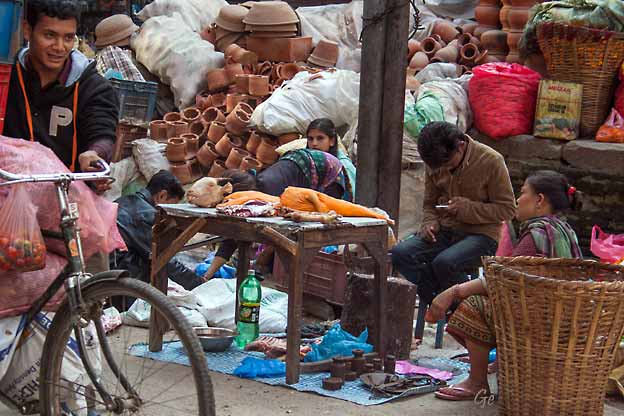
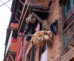
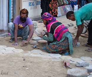
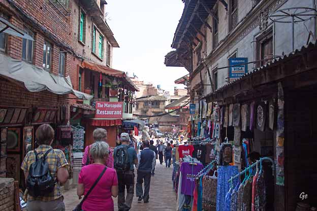
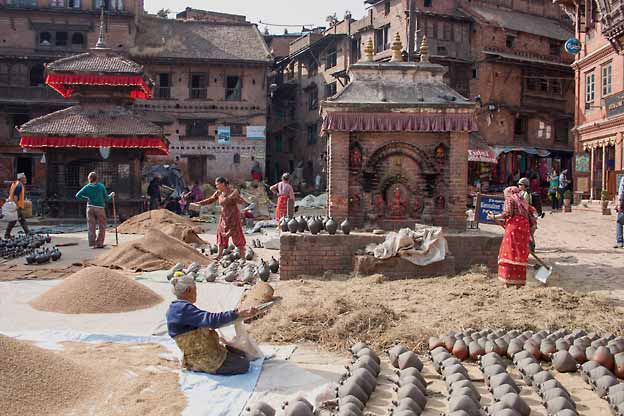
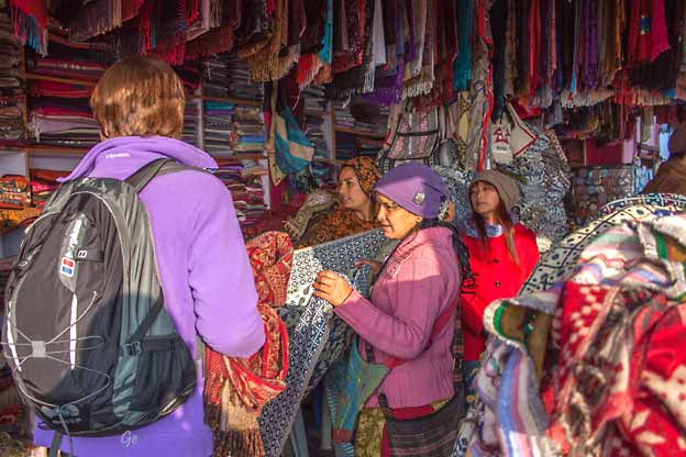
Her holder slaktern og pottemakern til.
|
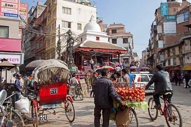
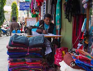
Stor teppebutikk, og frukt solgt fra syklende butikk.
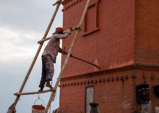
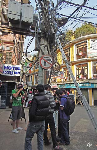
Det elektriske anlegget er typisk for byen.
|
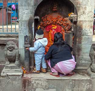
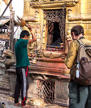
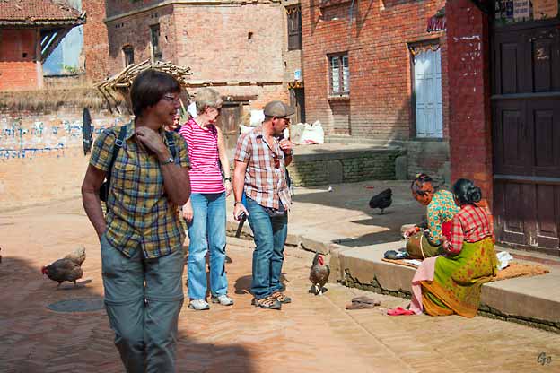
Bønnestund. Det er små alter overalt.
|
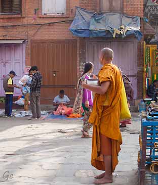
Munk
|
|
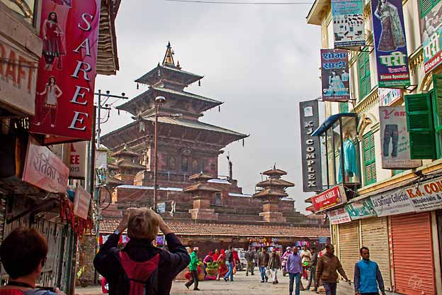
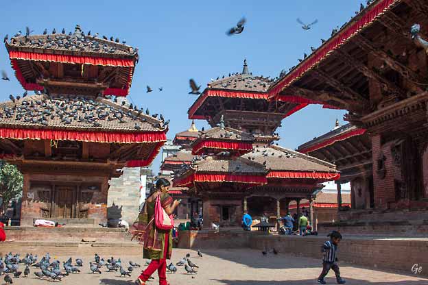
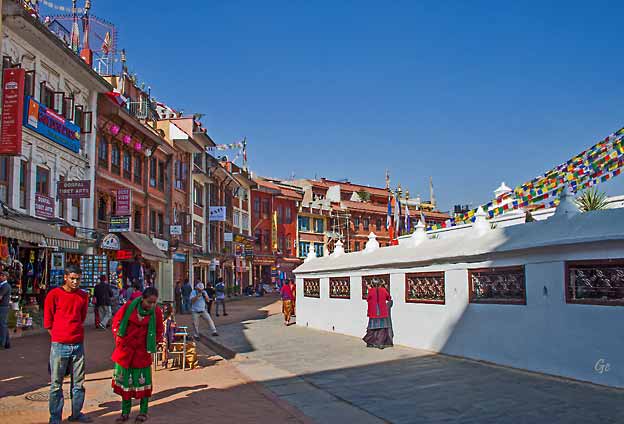
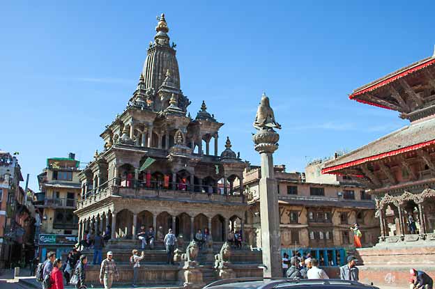
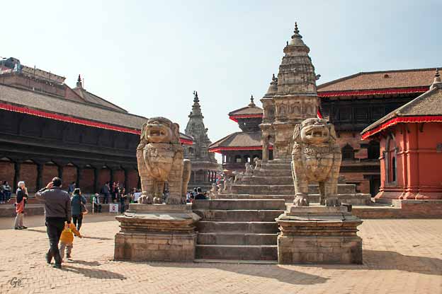
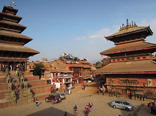
Durbar Square
|
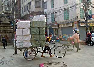
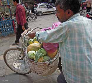
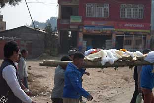
Tung bør på sykkelen
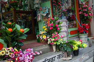
Fin blomsterbutikk
|
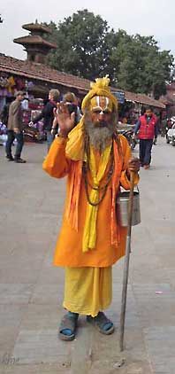
Enda en munk
|
|
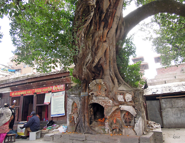
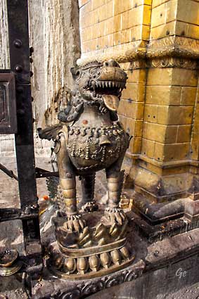
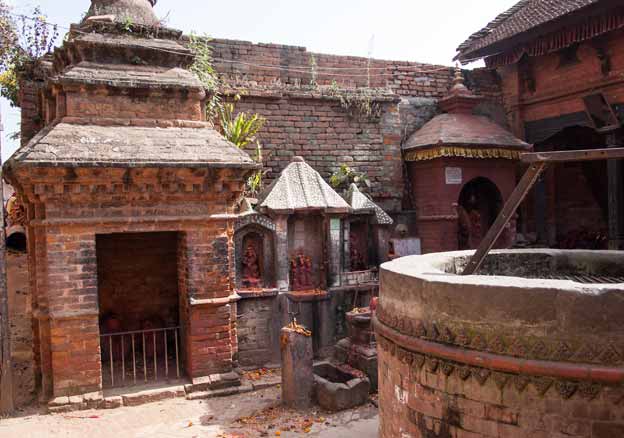
Alter i stammen på et tre.
|
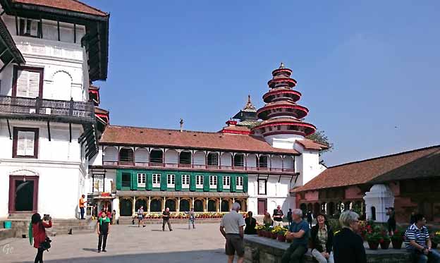
Durbar museum
Kathmandu
Durbar Square (Basantapur Durbar Kshetra)
in front of the old
royal palace of the former Kathmandu Kingdom is one of
three Durbar
(royal palace) Squares in the Kathmandu
Valley in Nepal, all of which are
UNESCO World Heritage Sites.
Several buildings in the Square collapsed due
to a major earthquake on
25 April 2015. Durbar Square was surrounded with
spectacular architecture
and vividly showcases the skills of
the Newar artists and craftsmen over several
centuries. The Royal Palace was originally at
Dattaraya square and was later
moved to the Durbar square.
The Kathmandu Durbar Square held the palaces
of the Malla and Shah kings
who ruled over the city. Along with these palaces, the
square surrounds
quadrangles, revealing courtyards and temples. It is
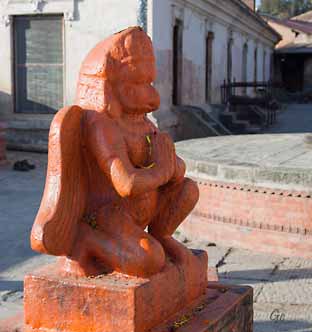
known as Hanuman Dhoka
Durbar Square, a name derived from a statue
of Hanuman, the monkey devotee
of Lord Ram, at the entrance of the palace.
Kathmandu Durbar Square -
Wikipedia (6. januar 2022)
|
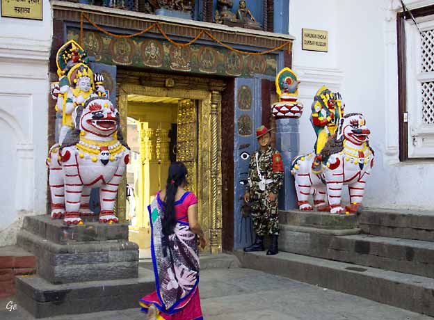
Inngangen til Hanuman Dhoka Palace
Kathmandu's
Durbar Square is the site of the Hanuman Dhoka
Palace Complex,
which was the royal Nepalese residence until the 19th
century and where important ceremonies, such as the
coronation of the Nepalese monarch, took place. The
palace
is decorated with elaborately-carved wooden windows
and panels and houses the
King Tribhuwan Memorial Museum and the Mahendra
Museum. It is possible to visit
the state rooms inside the palace.
Time and again the temples and the palaces in the
square have gone through reconstruction after being
damaged by natural causes or neglect. Presently there
are
less than ten quadrangles in the square. The temples
are being preserved as national heritage sites and the
palace is being used as a museum. Only a few
parts of the palace
are open for visitors and the Taleju temples are only
open for people of Hindu and
Buddhist faiths.
Kathmandu
Durbar Square - Wikipedia (6. januar
2022)
|
Flere templer på Durbar Square
Kumari,
or Kumari Devi, or Living Durga –
Nepal, is the tradition of worshipping
young prepubescent girls as manifestations of the
divine female energy or devi in
Asian religious traditions. The
word Kumari is derived from Sanskrit.
In Nepal, a Kumari is a prepubescent girl
selected from the Shakya caste of the
Nepalese Newari Buddhist community. The
Kumari is revered and worshiped by
some of the country's Hindus too. While
there are several Kumaris throughout
Nepal, with some cities having several, the best known
is the Royal Kumari of Kathmandu, and
she lives in the Kumari Ghar, a palace in the center
of the city. The selection process for her is
especially rigorous.
|
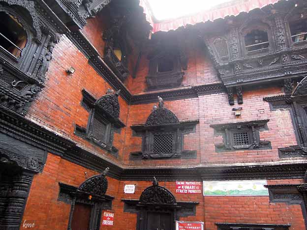
Her bor Kumari
As of 2017, the
Royal Kumari is Trishna Shakya, aged three, installed
in September
2017 by the Maoist government that replaced the
monarchy. Unika Bajracharya,
selected in April 2014 as the Kumari of Patan, is
the second most important living
goddess.
In Kathmandu Valley, this is a particularly
prevalent practice. It is believed to be
the incarnation of Taleju, a manifestation of the
goddess Durga.
When her first menstruation begins, it is believed
that the deity vacates her body.
Serious illness or a major loss of blood from an
injury also causes loss of deity.
The Kumari tradition is only followed in a few cities
in Nepal, which
are Kathmandu, Lalitpur, Bhaktapur, Sankhu and Bungamati.
The selection
process and roles of the Kumari vary between the
different towns.
Kumari
(goddess) - Wikipedia (6. januar 2022)
|
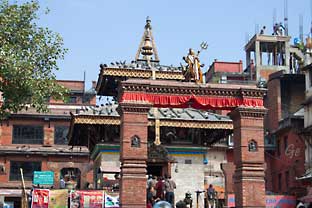
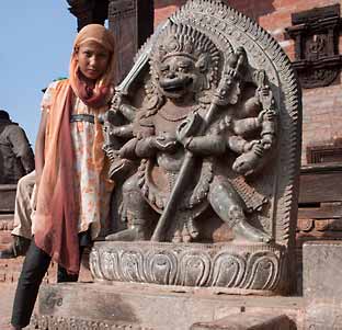
Durbar Square
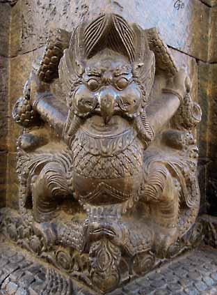
Til høyre: The "Hanuman Dhoka" proper,
or Hanuman Gate, is located on the west side
of Durbar Square. It is the entry gate
to the palace, where a standing statue
of Hanuman (monkey god), dated to
1672, guards the palace. Hanuman is decked
with a red cloth and an umbrella.
The face is
smeared with a red paste. On the left is a
stone sculpture dated to 1673 of
Lord Narasimha (the half-man, half
lion incarnation of Lord Vishnu), |
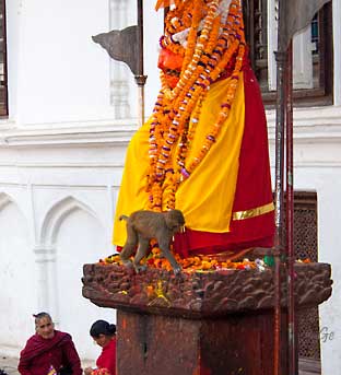
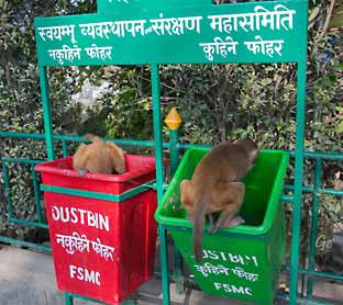
Folk legger blomster på alteret,
apene fjerner dem igjen.
devouring the demon Hiranyakashipu, which
is credited to Pratap Malla period according
to an inscription on the
pedestal of the image.
Hanuman Dhoka -
Wikipedia (6. januar 2022)
|
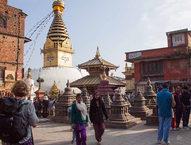
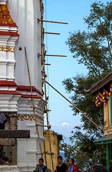
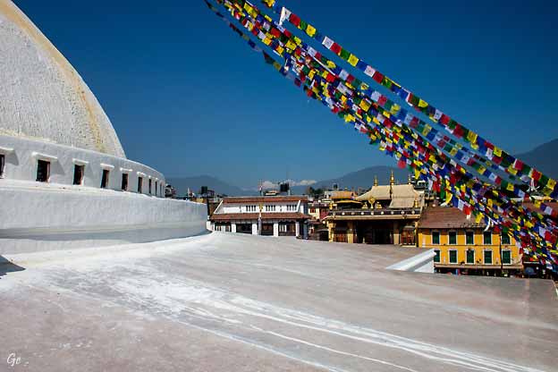
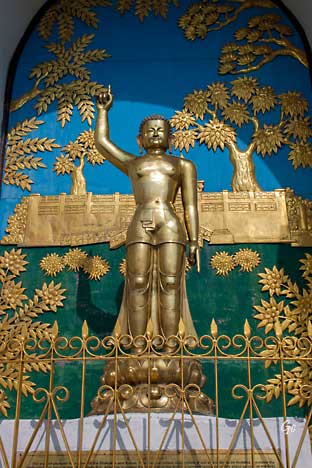
|
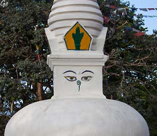
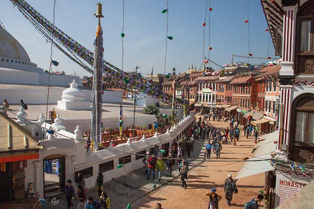
Monkey
Temple (Swayambunath)
Swayambhu
Mahachaitya (Devanagari: स्वयम्भू स्तूप; Nepal
Bhasa: स्वयंभू; sometimes Swayambu or Swoyambhu)
is an ancient religious complex atop a hill in the Kathmandu
Valley, west of Kathmandu city. The Tibetan
name for the site means 'Sublime Trees' (Wylie: Phags.pa
Shing.kun), for the many varieties of trees found on
the hill. However, Shingun may be of in
Nepal Bhasa name for the complex, Swayambhu,
meaning 'self-sprung'. For the Buddhist Newars,
in whose mythological history and
origin myth as well as day-to-day religious practice
Swayambhu occupies a central
position, it is the most sacred among Buddhist
pilgrimage sites. For Tibetans and
followers of Tibetan Buddhism, it is second only
to Boudha. Swayambhu is the Hindu
name.
Swayambhunath
- Wikipedia (1. november 2024)
|
Oṃ maṇi padme hūṃ
(Sanskrit: ॐ मणि पद्मे हूँ, IPA: [õːː
mɐɳɪ pɐdmeː ɦũː])
is the
six-syllabled Sanskrit mantra particularly
associated with the
four-armed Shadakshari form
of Avalokiteshvara, the bodhisattva of
compassion.
It first appeared in
the Mahayana Kāraṇḍavyūhasūtra where it
is also referred
to as the sadaksara (six syllabled) and
the paramahrdaya, or “innermost heart”
of Avalokiteshvara. In this text the mantra is
seen as the condensed form of
all Buddhist teachings.
The first word Aum/Om is a sacred syllable
in various Indian religions, and
Hum represents the spirit of enlightenment.
|
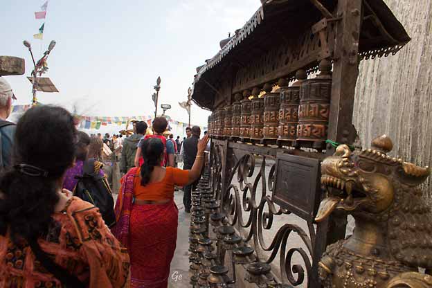
Bønnehjul (ofte høres ordene: Om mani padme hum)
In Tibetan Buddhism, this is the most ubiquitous
mantra and the most popular
form of religious practice, performed by laypersons
and monastics alike. It is
also an ever present feature of the landscape,
commonly carved onto rocks,
known as mani stones, painted into the sides of
hills or else it is written on
prayer flags and prayer wheels.
Due to the increased interactions between Chinese
Buddhists and Tibetans and
Mongolians during the 11th century, the mantra also
entered Chinese Buddhism.
The mantra has also been adapted into
Chinese Taoism.
Om
mani padme hum - Wikipedia (6. januar
2022)
|
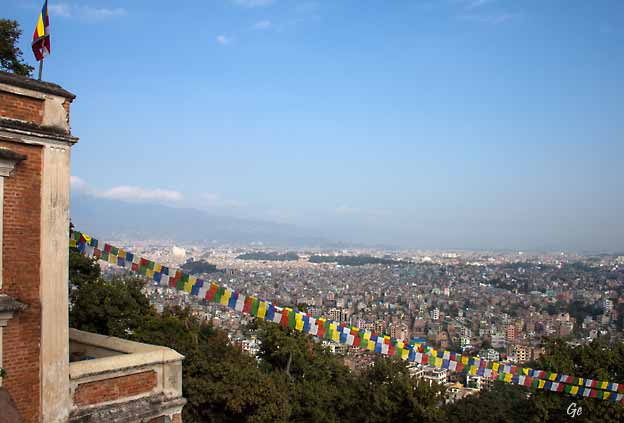
Katmandu sett fra Monkey Temple
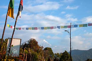
Et tibetansk bønneflagg er en fargefull
rektangulær tekstil, ofte blir funnet strekt
langs stier og fjelltopper høyt i Himalaya. De
brukes til å velsigne den omgivende landsbygda og
brukes også til andre hensikter. Bønneflagg har sin
opprinnelse i
den sjamanistiske tradisjonen Bøn;
Bønpo brukte tidligere primærfargene i
Tibets flagg. Tradisjonelle bønneflagg
inkluderer blokktrykte tekst og bilder.
Bønneflagg
– Wikipedia (1. november 2024)
|
Utøvelse av religion
|
|
Traditionally,
prayer flags come in sets of five. The five colors
represent the five
elements and the Five Pure Lights. Different
elements are asociated with different
colors for specific traditions, purposes
and sadhana. Blue symbolizes the sky and
space, white symbolizes the air and wind, red
symbolizes fire, green symbolizes
water, and yellow symbolizes earth.
According to Traditional Tibetan medicine, health
and harmony are produced
through the balance of the five elements.
Prayer
flag - Wikipedia (6. januar
2022)
|
Hva med HMS
|
|
|
Flagg overalt
|
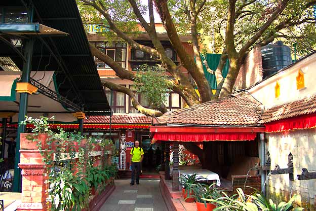
Inngangspartiet til
Katmandu Guest House
|
|
|
Onsdag 12.
november 2014
Først så vi Boudhanath,
deretter reiste vi til Patan Durbar Square.
Etter lunsj fortsatte vi til den hellige elva Bagmati
med templet
Pashupatinath.
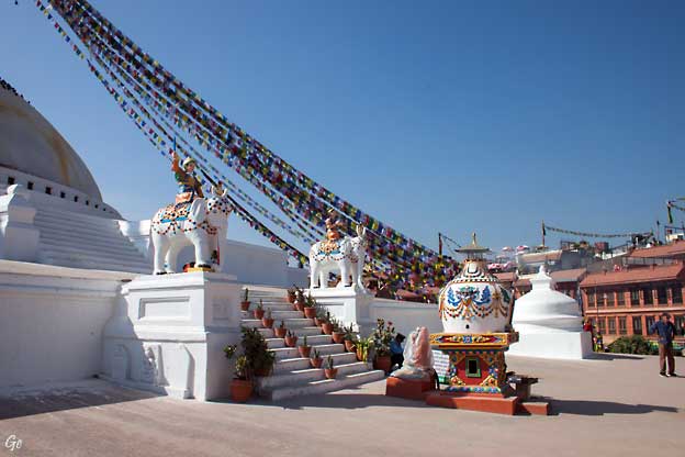
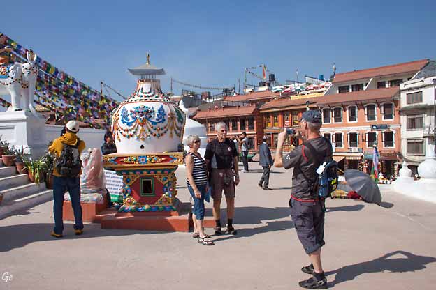
Boudhanath Stupa (or Bodnath Stupa)
One of many
world heritage sights which can be found in Nepal, the
Boudhanath Stupa, is not only impressive but also
interesting. Located roughly
7 kilometers to the east of Kathmandu, the stupa
is similar in many ways to
the much older and more cherished Swayambhunath.
According to legend the Boudhanath Stupa in
Bodnath was built during the 5th century AD.
It is notable as a place of worship and pilgrimage and
the dome is said to
contain the remains of a Kasyap sage, which is
important to both Buddhists
and Hindus.
The Boudhanath
Temple is the center of Tibetan culture in
Nepal and the
stupa measures an impressive 36 meters in height. This
makes it one of the
largest stupas in South Asia. The stupa has been built
on a massive three
level mandala style platform.
Boudhanath Stupa, Kathmandu -
Nepal.com (7. januar 2022)
|
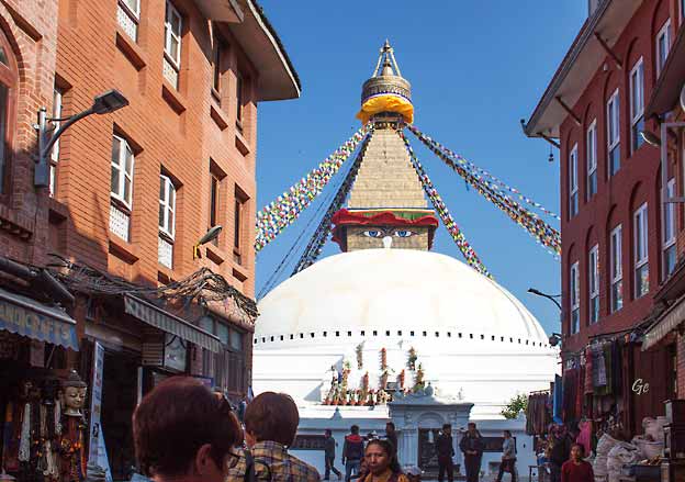
Boudhanath Stupa
|
|
|
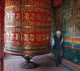
Bønnehjul (Prayer wheel)
|
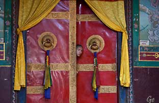
En ung munk titter ut.
|
A prayer wheel is
a cylindrical wheel (Tibetan:
འཁོར་ལོ།, Wylie: 'khor lo) on a spindle
made from metal, wood, stone, leather, or
coarse cotton, widely used in Tibet and
areas where Tibetan culture is predominant.
Traditionally, a mantra is written
in Tibetan language, on the outside of the wheel.
The mantra Om mani padme hum is most commonly
used, but other mantras may
be used as well.
Also sometimes depicted are dakinis, Protectors and
very often the eight auspicious
symbols (ashtamangala). At the core of the cylinder is a
"life tree" often made of
wood or metal with certain mantras written on or wrapped
around it.
Many thousands (or in the case of larger prayer wheels,
millions) of mantras are
then wrapped around this life tree.
|
According to
the Tibetan Buddhist tradition based on the
lineage texts regarding
prayer wheels, spinning such a wheel will have much the
same meritorious effect
as orally reciting the prayers.
Prayer
wheel - Wikipedia (7. januar 2022)
|
|
|
A thangka,
variously spelt as thangka, tangka,
thanka, or tanka (Nepali
pronunciation: [ˈt̪ʰaŋka]; Tibetan:
ཐང་ཀ་; Nepal
Bhasa: पौभा), is a Tibetan
Buddhist painting
on cotton, silk appliqué,
usually depicting a
Buddhist deity, scene, or mandala.
Thangkas
are traditionally kept unframed and
rolled up
when not on display, mounted on a textile
backing somewhat in the style of Chinese
scroll
paintings, with a further silk cover on the
front.
|
So treated, thangkas
can last a long time, but because of their delicate
nature,
they have to be kept in dry places where moisture will
not affect the quality of the silk.
Thangka
- Wikipedia (7. januar 2022)
|
På taket av stupaen
|
Karl Martin tar bilde av Lise og Per
|
Unge munker på taket
|
Fra taket er det utsikt mot snøfjellene
|
Thankamaleri
|
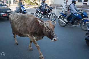
Kuer i gatene er helt
normalt
|
Patan er den eldste
buddhistiske byen i Nepal og har gjennom flere
hundrede år vært hjemstedet for et mindre kongerike.
Patan omtales også som "byen med de 1000 gyldne tak".
Patan Durbar Square har flere templer enn noe annet
sted i Nepal. Det har en selvfølgelig plass på UNESCOs
verdensarvliste. (Smartreiser)
|
Patan, Lalitpur Metropolitan
City (Nepali: ललितपुर महानगरपालिका),
historically Patan (Sanskrit: पाटन Pātan, Newar
language: 𑐫𑐮 Yela, Nepali:
पाटन [paʈʌn]), is the third
largest city of Nepal after Kathmandu and Pokhara,
and it is located in the south-central part
of Kathmandu Valley, a new
metropolitan city of Nepal. Lalitpur is also known as
Manigal.
It is best known for its rich cultural heritage,
particularly its tradition of arts
and crafts. It is city renowned for its festival and
feast, fine ancient art, and the
making of metallic and stone carved statues. At the
time of the 2011 Nepal
census it had a population of 226,728 in 54,748
individual households.
The city received extensive damage from an
earthquake on 25 April 2015.
Lalitpur is believed to have been
founded in the third century BC by the Kirat
dynasty and later expanded
by Licchavis in the sixth century. It was
further
expanded by the Mallas during the medieval
period.
There are many legends about its name. The most
popular one is the legend of
the god Rato Machhindranath, who was brought to
the valley from Kamaru
Kamachhya, located in Assam, India, by a
group of three people representing
the three kingdoms centered in the Kathmandu
Valley.
Lalitpur,
Nepal - Wikipedia (7. januar 2022)
|
Filminnspilling på Durbar Square i Patan
|
Durbar Square, Patan
|
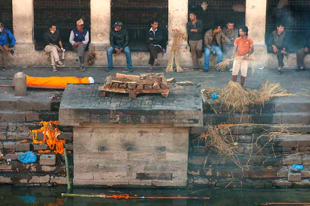
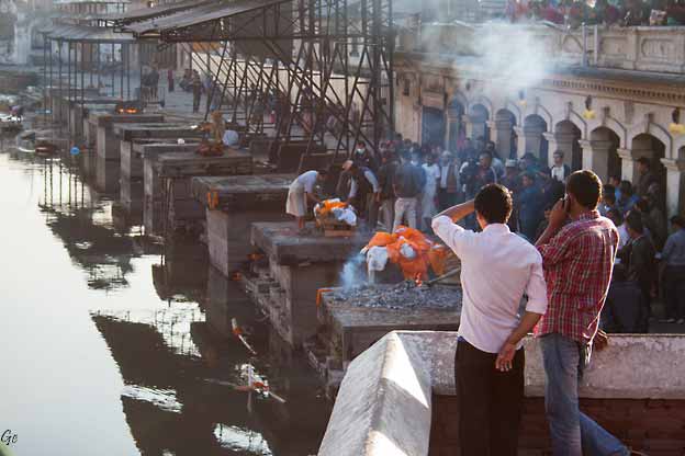
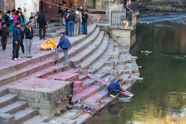
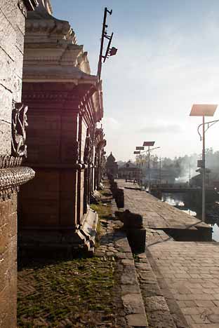
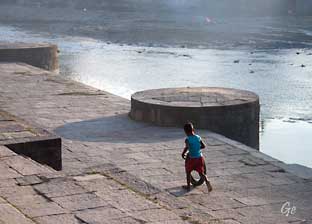
Ved Bagmati
elva
Den
hellige elven Bagmati ved Pashupatinath Temple.
Det er det helligst stedet for hinduer i
Nepal. Hit valfarter
flere hundre tusen hvert år fra India.
Her kommer de for å dø og bli kremert.
(Smartreiser)
|
|
The Bagmati River runs through
the Kathmandu valley of Nepal,
separating
the cities of Kathmandu from Patan,
before flowing through Province No. 2 of
southern Nepal and finally joing the Koshi
River in the Indian state
of Bihar.
It is considered holy by
both Hindus and Buddhists. A number
of Hindu temples
are located on its banks.
The importance of Bagmati also lies in the fact that
Hindus are cremated on
the banks of this holy river,
and Kirants are buried in the hills by its
side.
According to the Nepalese Hindu tradition, the dead
body must be dipped three
times into the Bagmati river before cremation, so that
the reincarnation cycle
may be ended.
The chief mourner (usually the first son) who lights
the funeral pyre must take
a holy river-water bath immediately after cremation.
Many relatives who join
the funeral procession also take a bath in the river
or sprinkle the holy water on
their bodies at the end of cremation. It is believed
the Bagmati river purifies
people spiritually.
Bagmati
River - Wikipedia (7. januar 2022)
|
|
Likbrenning for de fattigste.
|
Likbrenning for de som har bedre råd.
|
|
Etter likbrenningen blir alt feid ned i elva.
|
|
For noen er dette en
lekeplass
|
|
For andre et sted for avslapping
|
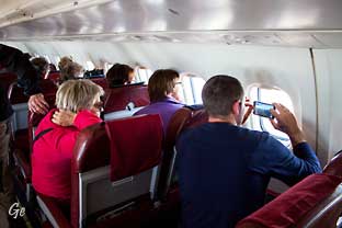
Torsdag 13.
november 2014
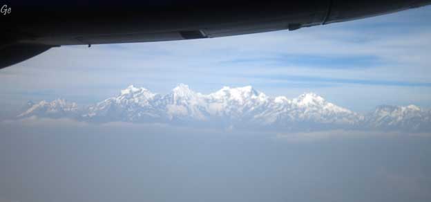
Vi starter tidlig for å få en flytur
østover for å se
Mont Everest på relativt nært hold.
Etter flyturen spiser vi frokost på hotellet før vi
reiser til byen Bhaktapur.
Denne byen stammer fra de tre kongedømmene
som ble styrt av Mallakongene.
|
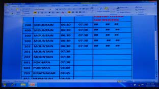
Det var morgentåke på flyplassen og alle
mountain-flyvningene ble forsinka.
Men vi kom avgårde og fikk en fantastisk tur.
|
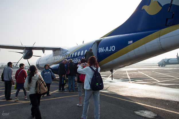
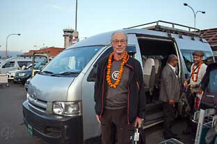
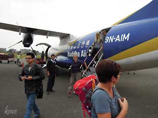
Vi går ombord i et fly fra Buddha Air. På
mountainflyvningen
hadde alle vindusplass. Den andre halvparten av setene
sto tomme.
|
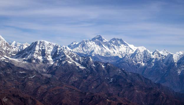
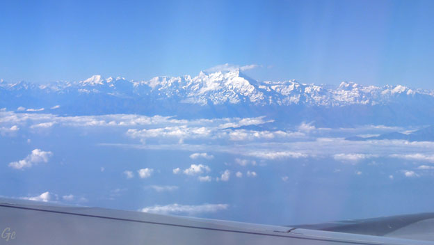
Mount Everest 8848 moh
Mount
Everest (Nepali: सगरमाथा, romanized: Sagarmāthā; Tibetan: Chomolungma
ཇོ་མོ་གླང་མ; Chinese: 珠穆朗玛峰,
Pinyin: zhūmùlǎngmǎ fēng) is Earth's highest
mountain above sea level, located in
the Mahalangur Himal sub-range of the
Himalayas. The China–Nepal border runs across
its summit point. Its elevation
(snow height) of 8,848.86 m (29,031.7 ft) was
most recently established in 2020 by
the Chinese and Nepali authorities.
Mount Everest attracts many climbers, including highly
experienced mountaineers.
There are two main climbing routes, one approaching the
summit from the southeast
in Nepal (known as the "standard route") and the other
from the north in Tibet.
Mount
Everest - Wikipedia (7. januar 2022)
|
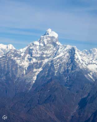
Choba-Bhamre
(?) 5970 moh
|
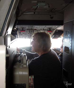
På denne flyvningen fikk
vi også komme en tur i cockpiten for å se
fjellene derfra.
|
|
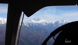
Himalaya fra cockpiten
|
Alle vil sitte på den
siden
hvor man ser fjellene.
|
The Himalayas,or Himalaya
, are a mountain range in Asia separating
the plains of the Indian subcontinent from
the Tibetan Plateau. The range has some of the
planet's highest peaks, including the
highest, Mount Everest. Over 100
peaks exceeding
7,200 m (23,600 ft) in elevation lie in the
Himalayas. By contrast, the highest peak
outside Asia (Aconcagua, in the Andes) is
6,961 m (22,838 ft) tall.
The Himalayas abut or cross five
countries: Bhutan, India, Nepal, China, and
Pakistan.
The sovereignty of the range in
the Kashmir region is disputed among India,
Pakistan,
and China.
Many Himalayan peaks are sacred
in Hinduism and Buddhism; the summits
of several—Kangchenjunga (from the Indian
side), Gangkhar
Puensum, Machapuchare, Nanda
Devi and Kailas in the
Tibetan Transhimalaya—are off-limits to climbers.
Himalayas
- Wikipedia (7. januar 2022)
|
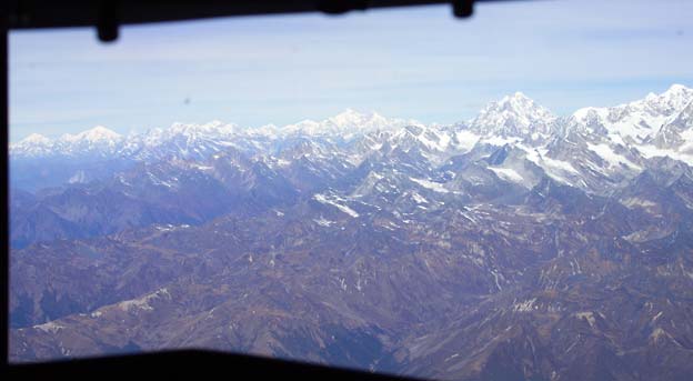
Himalaya fra cockpiten
|
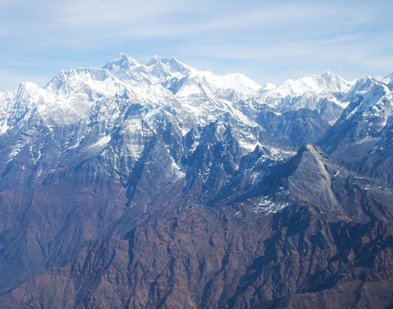
Mount Everest
|
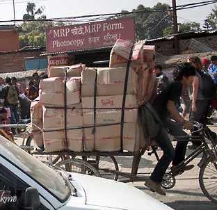
Tungt
|
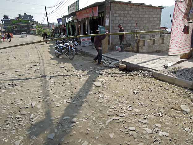
Her blir det nytt, fint
fortau.
|
|
Fra flyplassen reiste vi tilbake til hotellet for å
spise frokost.
Da vi kom dit var veien utenfor hotellet nesten ferdig
asfaltert. |
Hotel Kathmandu
Guesthouse (KGH)
|
Bhaktapur
Denne byen stammer fra de tre kongedømmene som ble
styrt av Mallakongene.
Vi skal gjøre en rundvandring i byen, hvor vi
blant annet
skal besøke det fem etasjer høye tempelet Nyatapola.
Bhaktapur er også kjent for sine fine
tredekorasjoenr.
Vi stopper også på Durbar Square, med det
kongelige
palasset.
Husene er dekorert med imponerende
utskjæringer.
Opplev også Pottery Square, og se hvordan all
den fine
keramikken blir til.
Bhaktapur er et fantastisk pustehull tett på den
pulserende
hovedstaden.
(Smartreiser)
|
Bhaktapur,
known locally as Khwopa (Nepal
Bhasa:𑐏𑑂𑐰𑐥 𑐡𑐾𑐫𑑂, Khwopa De),
is a city in the east corner of the Kathmandu
Valley in Nepal located about
13 kilometres (8.1 mi) from the capital
city, Kathmandu. It is located in and serves
as the headquarters of Bhaktapur
District in Bagmati Province of Nepal.
In terms of area, Bhaktapur is the smallest city of
Nepal.
Founded in the 12th century by King Ananda Deva,
Bhaktapur served as the capital
of Nepal during the first half of Malla
Dynasty until the Kingdom split into three in
the 15th century.
Bhaktapur was a powerful and wealthy
independent Newar kingdom under the
Malla kings who ruled Bhaktapur from the 15th
century to late 18th century before
it was annexed into the Gorkha Kingdom.
The Malla era was a golden one for Bhaktapur as it was
during their reign
that art and architecture flourished
in Bhaktapur.
|
After
its annexation, Bhaktapur lost most of its importance
with a halt in
development of arts and Bhaktapur remained isolated
form the now capital city
of Kathmandu and Patan allowing it
to remain a homogeneous Newar city.
Bhaktapur speaks a distinct dialect of Nepal
Bhasa that is closer to the Classical
Newar language than the standard form of Nepal
Bhasa.
Bhaktapur is one of the most visited tourist
destination of Nepal. As such it is an
important tourist
destination in Nepal with the medieval
city attracting 301,012
tourists in 2014.
Bhaktapur is also notable for its pottery and
handicraft industries, and for its
rich culture.
Due to it's well preserved medieval
nature, UNESCO inscribed Bhaktapur as a
World Heritage Site since 1979.
Bhaktapur
- Wikipedia (7. januar 2022)
|
Bhaktapur
|
Så langt kom bussen. Herfra måtte vi gå.
Det er (nesten) ikke biler inne i Bhaktapur.
|
På vandring i gatene i Bhaktapur
|
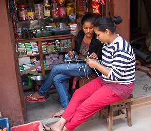
Damene strikker blant frittgående høner.
|
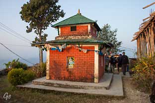
Små altere
|
|
Kongens badekar
|
|
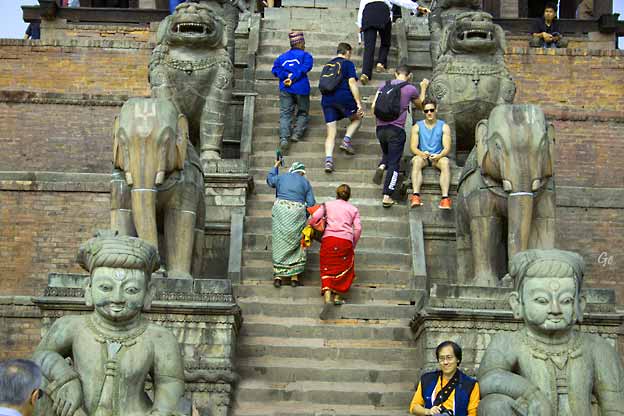
Nyatapola
Temple
Nyatapola
Temple is a five-stories Pagoda temple, located
in Bhaktapur, Nepal.
It is bejewelled with characteristic stone, metal and
wood craftsmanship, has
survived at least four major earthquakes. The temple was
made during the reign
of the Newari King Bhupatindra Malla(𑐖𑐸𑐖𑐸
𑐨𑐸𑐥𑐟𑐶𑐣𑑂𑐡𑑂𑐬 𑐩𑐮𑑂𑐮)
during a 7-month period in 822NS (late1702AD to
1703AD).
The temple is dedicated to Siddhi Lakshmi(not to be
confused with Lakshmi),
the Tantric Goddess who bestows
auspiciousness.
The Nyatapola temple dominates the skyline
of Bhaktapur and is the tallest
monument there. The locals of Bhaktapur believe that no
other monument in the
town shall be taller than the Nyatapola and any building
taller than it will be
continuously struck by lightning. As such this
temple is of a great cultural
importance to the people of Bhaktapur as
numerous other folklore of the city is
based on the monument. The Nyatapola Square also divides
the town of
Bhaktapur into two parts:Thane(lit. 'Upper one')
and Konhe(lit. 'Lower one').
Nyatapola
Temple - Wikipedia (7. januar 2022)
|
|
|
Nyatapola Templet til
venstre,
Bhairavnath templet
til høyre
|
Bhairavanath temple is
one sacred
temple of Bhaktapur that lies at the
central square of Bhaktapur, Taumadhi Square.
This temple devoted to lord
bhairava is one of the rectangular
based temples of Bhaktapur.
One could easily recognize this temple
as it lies right behind the giant
Nyatapola temple.
The Bhairavanath established in this
temple is a formidable incarnation of
lord shiva, who also prefers to name
Kasi Vishwanath and Aakash bhairava.
He is somehow famous for his
obstreperous and stubborn character.
Bhairavnath
temple; one most reputable and darkest
temple
(bhaktapur.com) (7.
januar 2022)
|
|
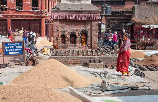
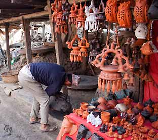
Pottery
Square
|
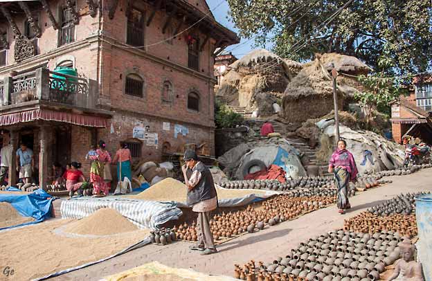
Pottery Square
|
Pottery Square
|
Bhaktapur is all about pottery.
You will see it everywhere, drying in the sun,
displayed on tables and shelves in front of shops and
homes alike.
The town is equally famous for artistic mask made up of
black clay and
colorful painting on it.
The masks portray various gods and deities and carry
special significance in festivals.
http://wikitravel.org/en/Bhaktapur
|
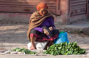
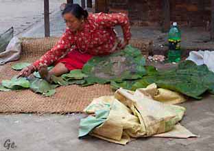
Grønnsakselgere
|
|
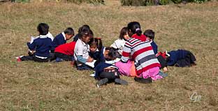
Fredag 14.
november 2014
Vi reiser
ca 3 timer vestover fra Kathmandu, til Nuwacot
distrikt.
Litt ovenfor Nuwacot Fort ligger landsbyen
Mahamandal,
uberørt og utenfor turistenes
allfarvei.
Her vil landsbydamene ta i mot
oss i sine fargerike klær.
Vi får oppleve lokal mat og
tradisjon.
Om kvelden blir det fest til
ære for oss.
Vi besøker også en av
skolene i området.
Vi overnatter i Mahamandal. |
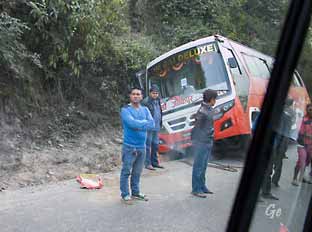
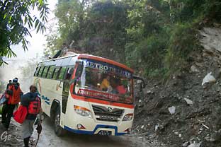
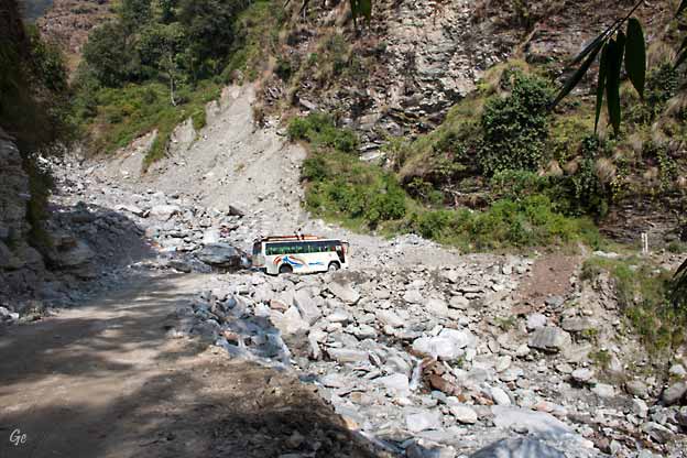
En buss har kjørt i
grøfta.
Det var ikke den bussen vi kjørte med.
|
|
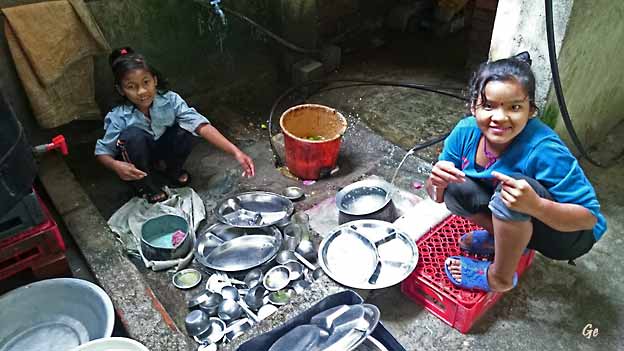
Oppvaskhjelpen på restaurant i Nepal.
|
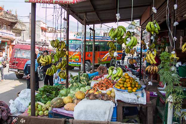
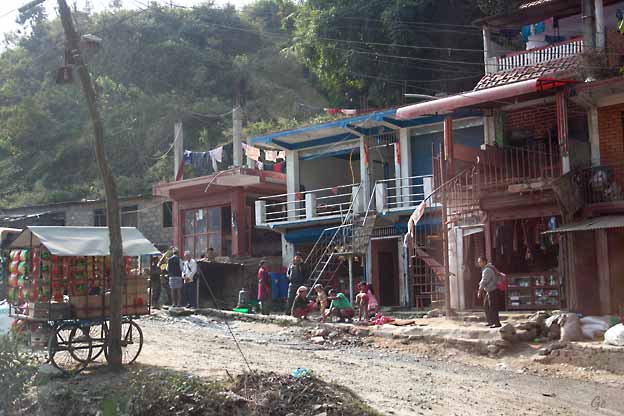
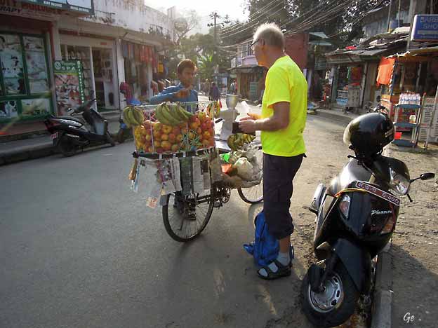
Godt utvalg i frukt og grønnsaksbutikkene
|
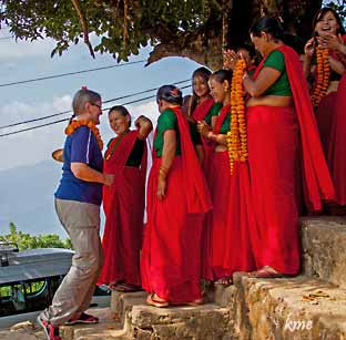
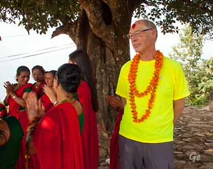
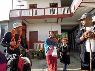
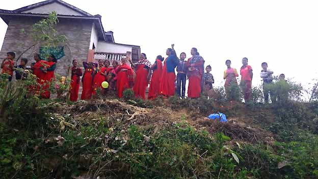
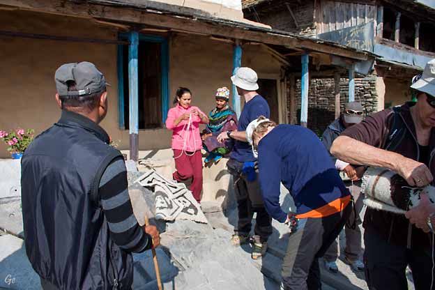
Mahamandal
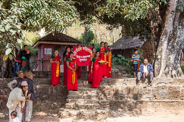
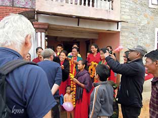
Fin mottagelse i Mahamandal
|
Grete og Karl Martin for
blomsterkranser og merke i panna.
|
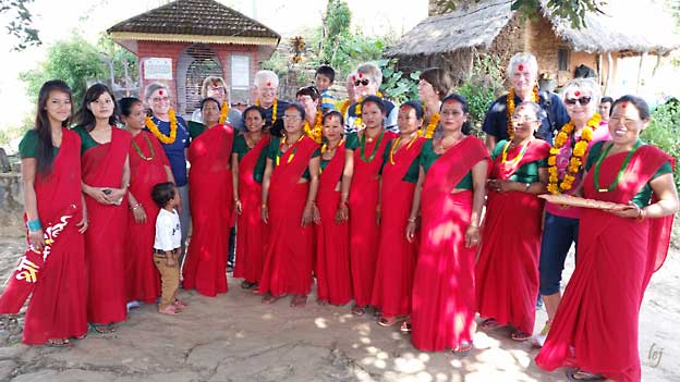
Foran: alle damene som tok i mot oss, bak står
gjestene.
Foto Lars Espolin Johnson
|
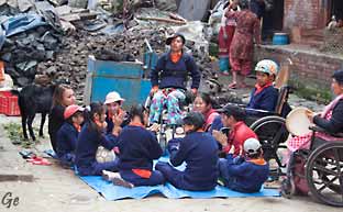
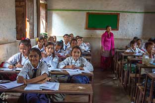
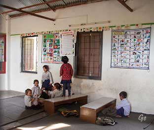
På besøk på Shree Bhairabi Higher Sec. School, Ashok
Batika, Nuwakot
|
|
Nuwakot
Nuwakot Fort var hovedkvarter for kong Pritvi
Narayan Shah,
grunnlegeren av det moderne Nepal (år 1769),
under hans felttog for å erobre Kathmandudalen.
|
|
Nuwakot
Palace |
Bhairabi
Temple |
is a palace
built by Nepal's first king Prithvi Narayan
Shah in the 18th century and
is located in Nuwakot, Bidur Municipality.
The palace is currently being restored after
the April 2015 Nepal earthquake which
devastated the complex. Nuwakot Palace is currently
listed as a UNESCO tentative
site since 2008.
Main palace
The current main palace was built after Prithivi Narayan
Shah conquered Nuwakot
in 1801 BS (1744-1745). After the victory of
Nuwakot, he relocated the capital from
Gorkha to Nuwakot considering it to an appropriate
location for the continuation of unification
campaign.
The palace has seven stories and thus is also called
'Sat-talle-durbar' (lit. seven
storied palace) by locals. The ground floor was built to
keep courtiers and guards.
The main meeting room (Baitakh), prayer room and living
room (called Shrinagar kakshya) is located in the first
floor. The room for the king and queen is in the
second floor. Third floor has a prayer room. Fourth
floor was used to station
armies and guards. Fifth and sixth floors were used as
prison. King of Tanahu,
Tri Bikaram Sen and Bal Narsingh of Kirtipir were
imprisoned here. And the
seventh floor was used as Burja. The roof uses glazed
tile.
The plinth area of the place is 84 feet by 36 feet. The
main door of the palace faces
towards east. The palace and is build in the form of
fort with wall thicknes of 6 feet
wide. Carved windows (Aankhi jhyal) is placed in various
floors. The palace
imitates the architecture style of Kathmandu. Craftsmen
from Lalitpur were used
to construct the palace.
Nuwakot
Palace - Wikipedia (1. oktober 2023)
|
|
|
|
|
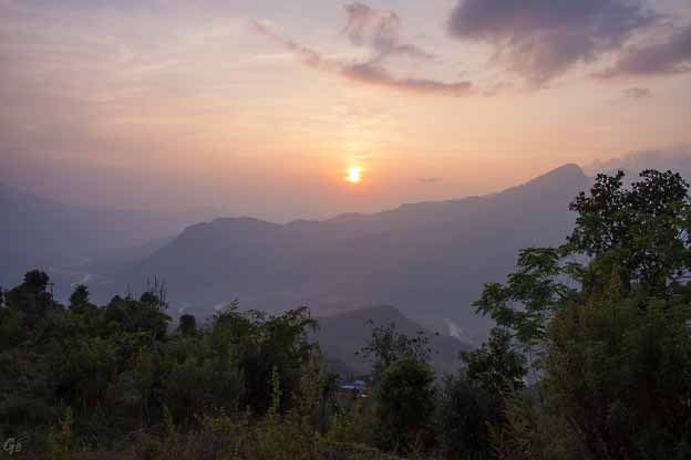
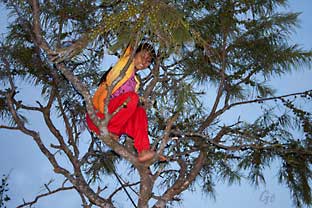
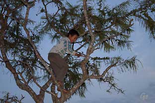
På
kveldstur for å se solnedgangen.
Barna klatrer i trærne for å ta ned
frukt til oss.
|
|
|
|
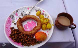
Kveldens
middag.
Tradisjonsmaten Dalbat.
Vi fikk også smake det lokalet,
hjemmelagede brennevinet.
|
|
|
|
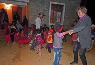
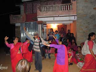
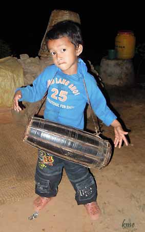
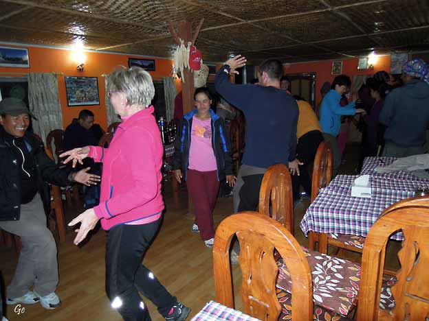
Etter middagen ble det dans.
|
|
|
Lørdag 15.
november 2014
Vi spiser en
lett frokost, så kjører vi tilbake til Kathmandu
og tidlig på ettermiddagen flyr vi østover til trivelige
Pokhara.
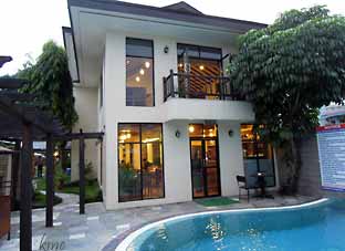
Vi legger oss inn på Atithi Resort.
|
Frokost i Mahamandal
|
|
|
Like fin seremoni da vi dro som da vi kom.
|
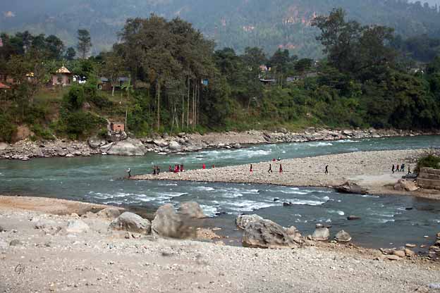
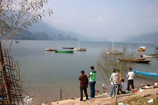
Fisking og morgentoalett ved elva. Bildet er tatt på
vei tilbake til Kathmandu.
|
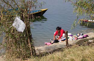
De som ikke bor ved elva tar morgenvasken utenfor
huset.
|
|
|
|
Bilder tatt
fra bussen på vei
tilbake til Kathmandu
|
|
Flyturen mellom
Kathmandu og Pokhara
|
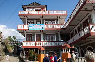
Buddha Air og hotel Atithi i Pokhara.
Vi bodde der før og etter fotturen.
|
Søndag 16.
november 2014
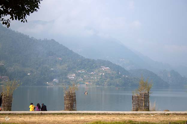
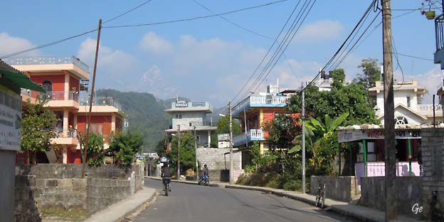
Hvis Kathmandu er kultur, religion og pulserende liv,
så er
Pokhara akkurat det motsatte.
Lake side delen av Pokhara ligger idyllisk til ved Lake
Fewa.
Dette er stedet for rekreasjon og meditasjon, både før
og etter
turer i fjellet, og her har vi en fantastisk utsikt over
Himalaya-fjellene.
Det mest spektakulære av dem alle, Machhapuchhre
(Fishtail),
ser vi også godt herfra.
|
|
|
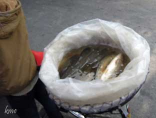
Levende fisk til salgs fra
kurv på sykkelen.
|
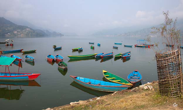
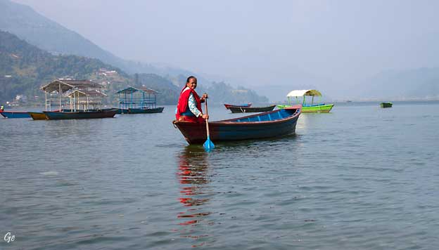
Pokhara
is a metropolitan city in Nepal, which
serves as the capital of Gandaki
Province. It is the country's largest metropolitan
city in terms of area and
second-largest in terms of population. The city also
serves as the headquarters of
Kaski District. Pokhara is located 200 kilometres (120
miles) west of the capital, Kathmandu. The city
is on the shore of Phewa Lake, and sits at an
elevation of approximately 822m.
The Annapurna Range, with three out of the ten highest
peaks in the world—Dhaulagiri, Annapurna
I and Manaslu—is within 15–35 mi
(24–56 km) of the
valley.
Pokhara is considered the tourism capital of Nepal,
being a base for trekkers
undertaking the Annapurna Circuit through
the Annapurna Conservation Area
region of the Annapurna ranges in
the Himalayas. The city is also home to many
of the elite Gurkha soldiers, soldiers
native to South Asia of Nepalese
nationality
recruited for the British Army, Nepalese
Army, Indian Army,
Gurkha Contingent Singapore, Gurkha Reserve Unit
Brunei,
UN peacekeeping forces and in war zones around the
world
Pokhara -
Wikipedia (8. januar 2022)
|
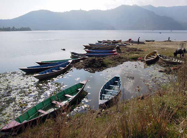
Phewa Lake, Phewa
Tal or Fewa Lake (Nepali: फेवा
ताल, [ˈpʰewa tal]) is a freshwater
lake in Nepal formerly called Baidam
Tal located in the south of the Pokhara
Valley
that includes Pokhara city; parts
of Sarangkot and Kaskikot. The lake is
stream-fed
but a dam regulates the water reserves, therefore, the
lake is classified as
semi-natural freshwater lake. It is the second largest
lake in Nepal; the largest in
Gandaki Province after the Rara lake in
the comparison to Nepal's water bodies.
It is the most popular and most visited lake of Nepal.
Phewa lake is located at an
altitude of 742 m (2,434 ft) and covers an
area of about
4.43 km2 (1.7 sq mi).
It has an average depth of about 8.6 m
(28 ft) and a maximum depth of 24 m
(79 ft).
Phewa
Lake - Wikipedia (8. januar
2022)
|
|
|
Hyggelige restauranter langs
Fewa-sjøen
|
|
|
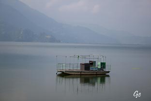
Gammel ferge. Trolig ikke
i bruk.
|
Fewa Hard Rock cafe
|
|
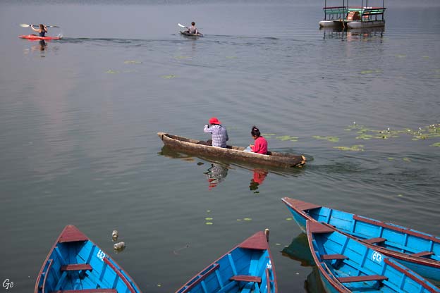
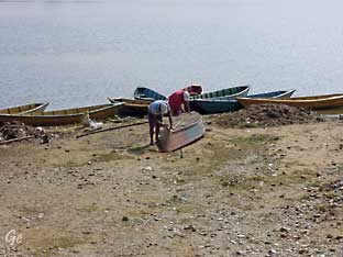
Stokkebåt
|
During the day
Boating, Paragliding and hiking are the main
activities that will
keep us engaged and enjoy the beautiful day in
Pokhara. The view of Pokhara city
and the Himalayan ranges while paragliding from
Sarangkot is a lifetime experience. Wheres boating in
Phewa lake is also an attraction of this tour.
Tripadvisor | Pokhara Paragliding Guided Private Day Tour provided by Altitude Himalaya |
Nepal (8. januar 2022)
|
|
|
|
|
Bilder fra
hovedgata i Pokhara
|
|
Mandag 17.
november 2014
Det blir en tidlig start på dagen. Vi reiser med
minivan
opp mot Sarangkottoppen,
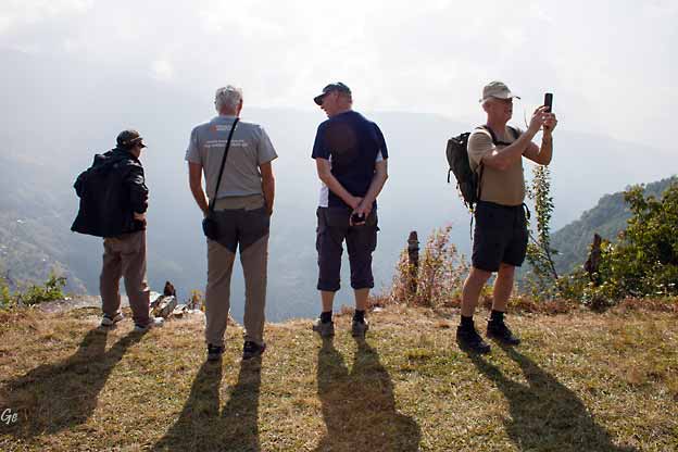
parkerer og spaserer gjennom en idyllisk landsby og opp
til et utsiktspunkt, som tilbyr utrolig utsyn mot
Himalaya.
Fishtail føles så nære at man kan ta på den.
Vi spiser frokost på hotellet ved tilbakekomst.
Etter frokost setter vi oss i en båt og blir rodd over
til andre
siden av innsjøen.Vi spaserer gjennom en liten jungel,
hilser
på apekatter på veien opp til World Peace Pagoda.
Utsikten mot Pokhara og de mektige Himalayafjellene som
speiler seg i vannet tar pusten fra enhver.
|
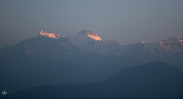
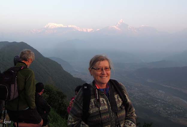
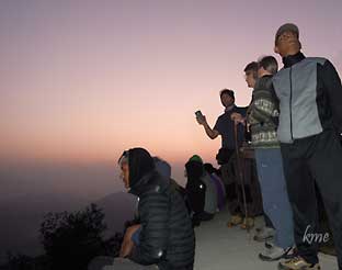
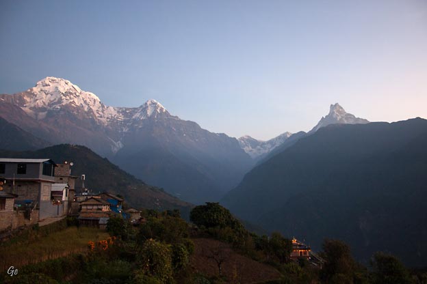
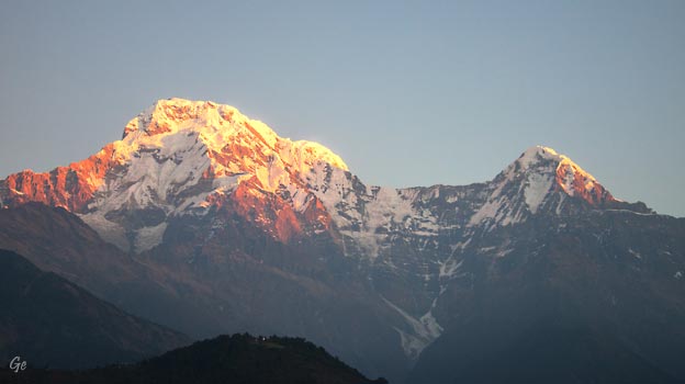
Soloppgang
|
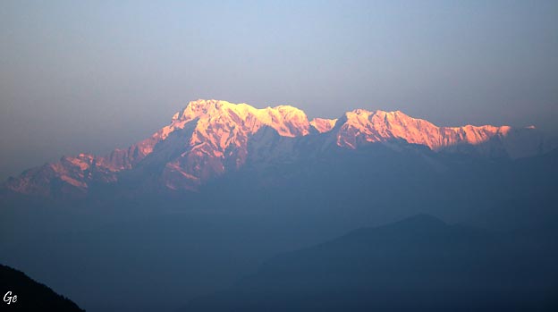
Soloppgang over Annapurna
Annapurna is
a mountain situated in the Annapurna
mountain range of Gandaki
Province, north-central Nepal. It is the tenth
highest mountain in the world at
8,091 metres (26,545 ft) above sea level.
Maurice Herzog led a French expedition to its
summit through the north face in
1950, making it the first eight-thousand meter
peak ever successfully climbed.
The entire massif and surrounding area are protected
within the
7,629-square-kilometre
(2,946 sq mi) Annapurna Conservation
Area, the first and
largest conservation area in Nepal. The Annapurna
Conservation Area is home to
several world-class treks, including Annapurna
Sanctuary and Annapurna Circuit. Historically,
the Annapurna peaks have been among the world's most
treacherous mountains to climb with the particular case
of the extremely steep south face of
Annapurna I Main – a wall of rock that rises 3,000
meters (9,800 feet) – making
it one of the most difficult climbs in the world. By
March 2012, there had been
191 summit ascents of Annapurna I Main, and 61 climbing
fatalities on the
mountain. This fatality-to-summit ratio (1:3.1, or 32%)
is the highest of any of the
eight-thousanders.
Annapurna
- Wikipedia (8. januar 2022)
|
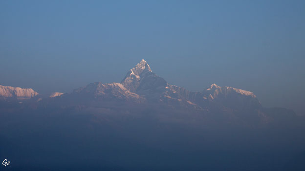
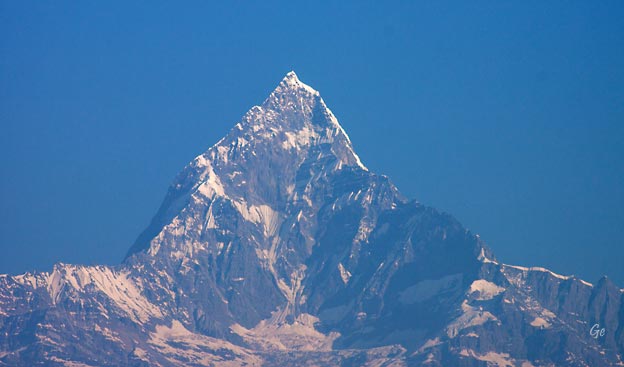
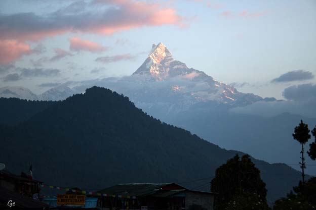
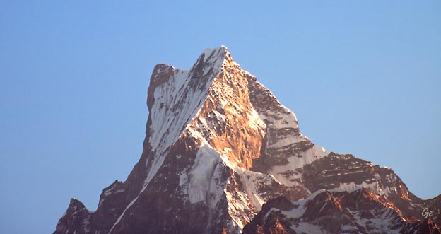
Soloppgang over Fishtail
(6993 moh)
Machhapuchchhre
or Machhapuchhre
is a mountain situated in
the Annapurna massif of Gandaki
Province, north-central Nepal. Its highest peak
has never been officially climbed due to the
impossibility of gaining a permit from
the government of Nepal.
It is believed that Machapuchare has never been
climbed to its summit. The only
confirmed attempt was in 1957 by a British team led by
Lieutenant Colonel Jimmy
Roberts. Climbers Wilfrid Noyce and A. D. M.
Cox climbed to within 150 m (492 ft)
of the summit via the north ridge, to an approximate
altitude of 22,793 ft (6,947 m). Adhering to
the word of honor given to the then King
Mahendra, Noyce and his
team descended without stepping on to the summit -
thus publishing the only
climbing record of the mountain a year later. No
permits to climb the mountain
have been issued ever after. The mountain is said to
be sacred as a home to the god
Shiva.
There have been reports of a New
Zealand climber, Bill Denz, making a
successful
yet illegal attempt to the summit in the early 1980s.
Machapuchare
- Wikipedia 8.1.2022)
|
Sarangkot is
Ward 18 of Pokhara, Kaski
District, Nepal, after it was
merged into the city in 2015. It is a popular tourist
destination for those
who arrive in Pokhara. At the 1991 Nepal
census it had a total
population of 5,060 with 1,010 individual households.
The Ward is located on Sarangkot, a hill on the western
side of Pokhara
with an altitude of 1600m. Sarangkot is known for
panoramic Himalayan
views
of Dhaulagiri, Annapurna and Manaslu.
|
It also provides an expansive view of
the city of Pokhara, from the extreme
north to the south including
the Phewa Lake.
Tourists drive up the hill to
watch the
sunrise from the view tower at the top.
In recent years,
Sarangkot has been
called one of the best paragliding
locations in the world.
|
Servering av te
The hike up from Pokhara Baglung
highway at Miruwa to
Sarangkot takes
90 minutes to 1.5hours.
Sarangkot
- Wikipedia
(9. desember 2022)
|
|
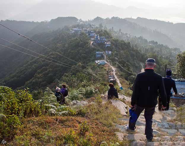
Vi har sett soloppgangen, og går
tilbake til bussen.
På veien gjennom landsbyen ble det en del handling.
|
Fishtail i nærbilde
|
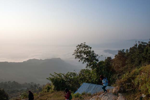
Tåka ligger tett over Pokhara
|
Veien ned fra utsiktspunktet
|
Dama serverte te og viste fram
varene sine. Her ble det storhandel. |
Fewa-sjøen
|
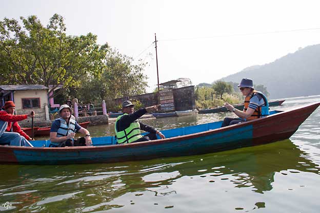
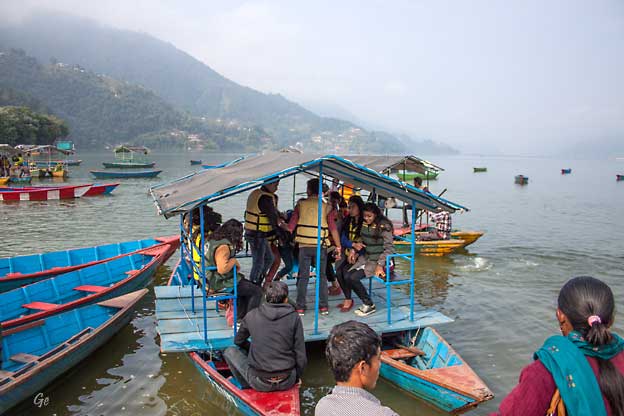
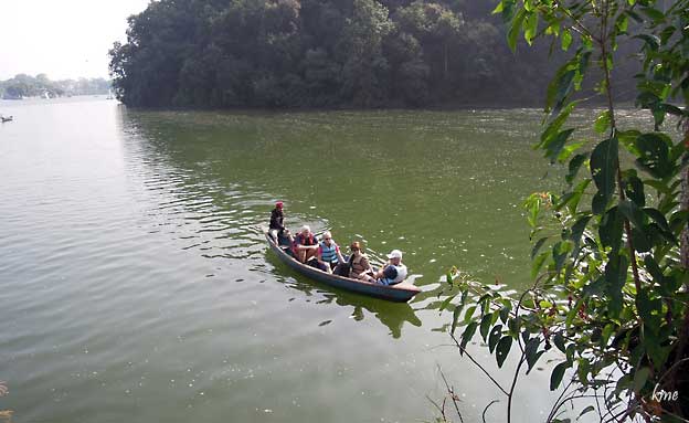
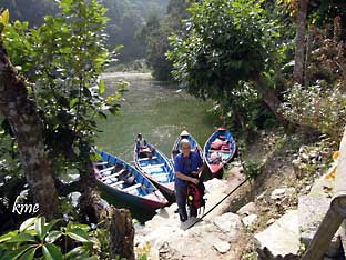
Vi skulle over sjøen for å se
Fredspagoden. Gruppa ble fordelt på tre båter.
|
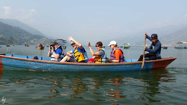
Grete foran i båten og bak henne
sitter Karl Martin.
Foto Lars Espolin Johnson
|
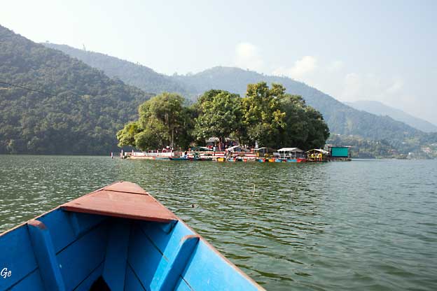
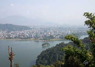
Øya i Fewa-sjøen
|
|
|
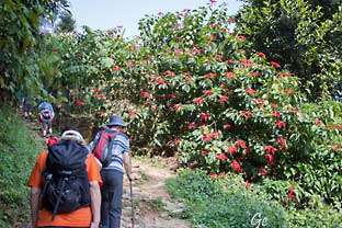
Det var bratt fra sjøen og
opp til pagoden.
|
|
|
Utsikt
over Fewa-sjøen
og Pokhara
|
|
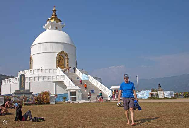
Pokhara Shanti Stupa is
a Buddhist pagoda-style monument on a hilltop
in Ananda hill of Pumdi Bhumdi Village Development Committee,
in the
district of Kaski,
Nepal.
Shanti Stupa in Pokhara was built by Nipponzan-Myōhōji monk
Morioka
Sonin with local supporters under the guidance of
Nichidatsu Fujii, a
Buddhist monk and the founder of Nipponzan-Myōhōji. Shanti is a Sanskrit
word meaning peace, also widely used in Nepali and
Hindi language, and
Shanti Stupa means Peace Pagoda.
Shanti Stupa is the shrine build as symbol of peace.
The spot situated at the
height of 1100 meters on the Ananda Hill was chosen by
Nichidatsu Fujii
and he laid the foundation stone as well with the
relics of Buddha on
the
hilltop on 12 September 1973.
Nepal has two of the eighty peace pagodas
in the world: Shanti Stupa in Lumbini, the birthplace
of Buddha and Shanti
Stupa in Pokhara. Shanti Stupa in Pokhara has also
become a tourist
attraction. It provides a panoramic view of the
Annapurna range,
Pokhara city and the Fewa
Lake.
http://en.wikipedia.org/wiki/Shanti_Stupa,_Pokhara
|
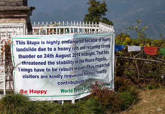
“We had erected an earthen wall near the pagoda.
We believe rainwater must have
loosen the wall and finally it fell,” added Gubhaju.
The space between the landslide and the pagoda is
only two meters wide.
The landslide is believed to be around 50 meters wide.
“The landslide has swept
away everything along the way.
The trees and rocks were no match for the force of
the landslide,” he further said.
http://www.myrepublica.com/portal/index.php?action=news_
details&news_id=81792
|
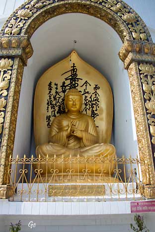
Buddha-statue på
Shanti Stupa
|
|
|
|
|
|
Veien går
ikke helt opp til pagoden,
så her må varene bæres.
Der veien tok slutt,
ventet en buss på oss,
så vi slapp å gå ned igjen.
|
|
|
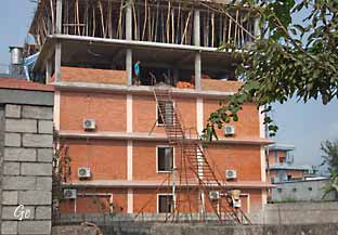
Byggeplass
i Pokhara
|
|
|
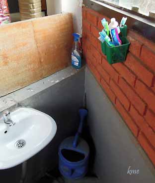
Tannbørste
på toalett på
restaurant i Pokhara.
|
|
Tirsdag 18.
november 2014
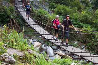
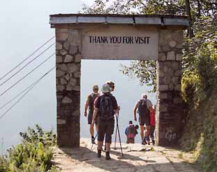
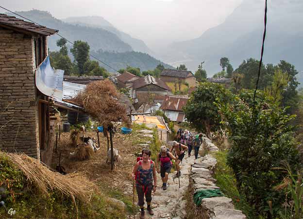
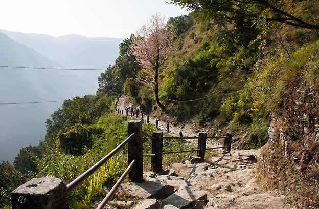
Trekking Annapurna: Pokhara - Dhampus - Pothana
Avreise med minivan fra Pokhara. Turen til Suikhet Phedi
tar
ca 45 minutter.
Herfra starter vi på en uforglemmelig vandretur hvor vi
bak hver sving
vil oppleve nye fjell, bortgjemte landsbyer, rismarker
og fossende elver.
Fra der vi går av bilen, starter stien som fører oss opp
til Dhampus
(1650 moh). Det tar et par timer, og er en jevn, bratt
stigning.
Her tar vi en velfortjent pause for å spise lunsj og
nyte fjellene, spesielt Machhapuchhre (Fishtail) som
står imponerende stort og mektig i nord.
Fra Dhampus tar det oss 2-3 timer før vi kommer fram til
dagens turmål.
Sent på ettermiddagen kommer vi fram til Pothana. (1900
moh).
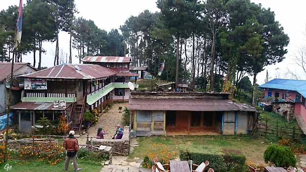
Her legger vi oss inn på et av gjestehusene for natten.
(Det ble gjestehuset "Heavens Gate" på denne turen.)
|
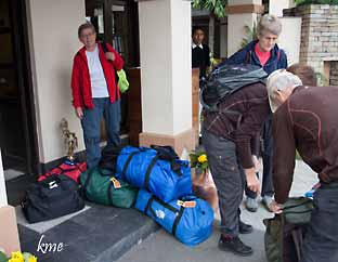
|
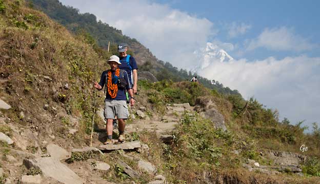
Vi er klare
for fotturen.
Første et stykke med buss,
så begynner alvoret.
|
|
Her begynner fotturen. Klokka er
09 00.
Veien fører til Annapurna Base camp,
men vi skulle bare gå en liten del av ruta.
|
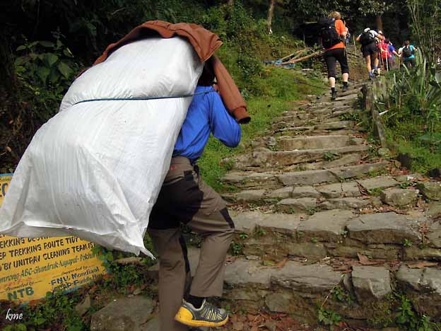
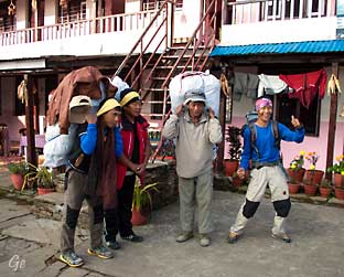
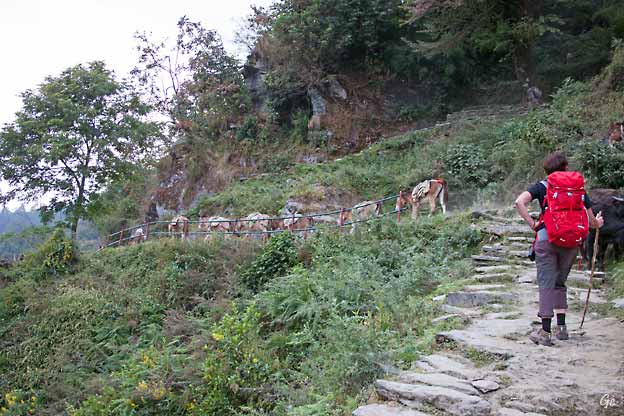
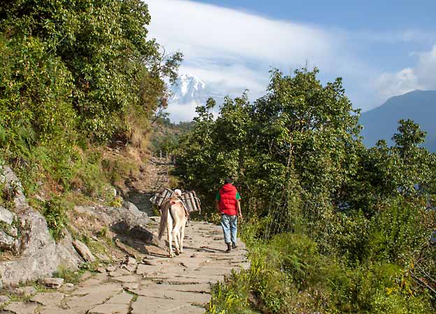
Porterne bærer tungt.
|
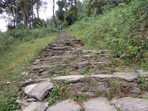
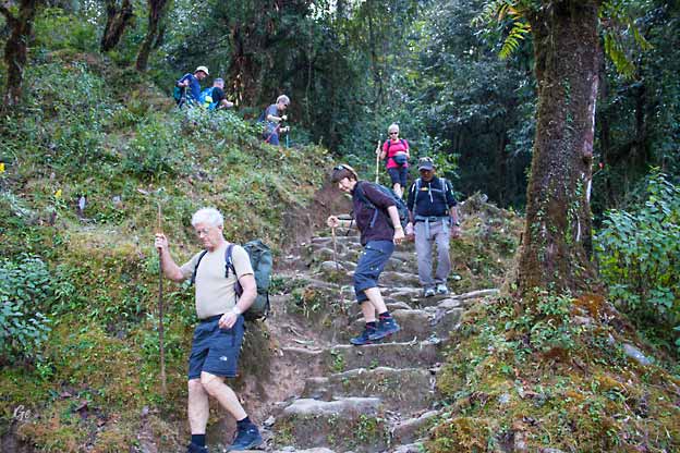
Nepaleserne er like glad i trapper
som inkaene i Peru.
|
Vi begynner å komme opp i høyden.
|
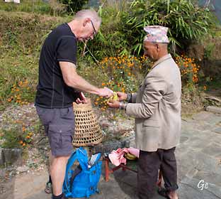
Karl Martin kjøper seg en
banan.
|
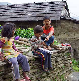
Her gjøres lekser
|
|
Stadig oppover
|
|
Endelig ferdig med det bratteste
partiet på turens første dag.
Ca 2 1/2 time brukte vi på trappene hit opp.
|
|
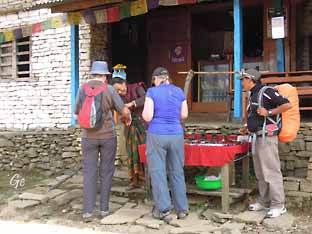
Lunsj på Greenland,
Dhampus ved 12-tida,
4 timer etter at vi begynte å gå.
|
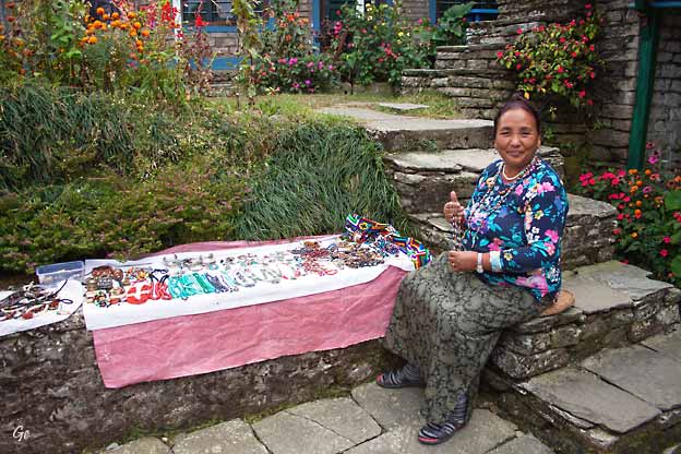
Da vi var ferdig med lunsjen hadde
smykkeselgeren rigget seg til utenfor.
|
|
|
|
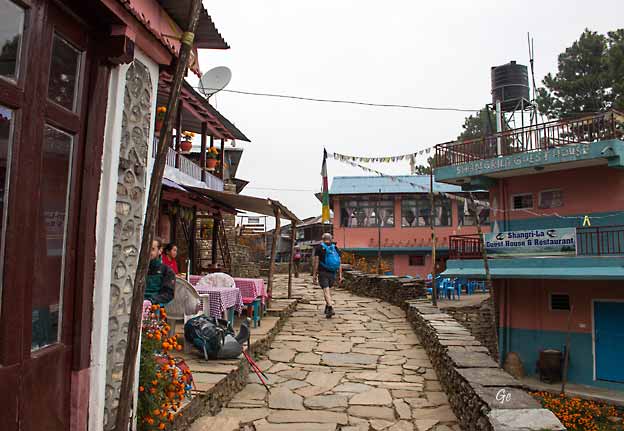
Framme i Pothana. Klokka er blitt
1435,
og vi har brukt 5 1/2 time på turen (inkludert lunsj og
pauser)
|
|
|
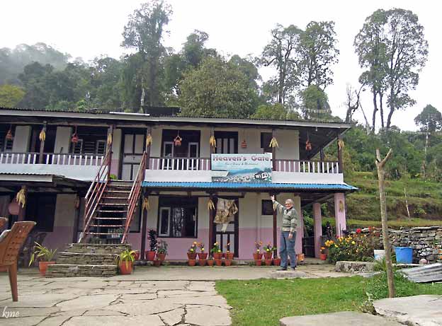
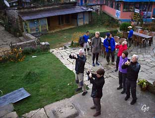
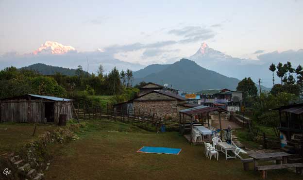
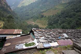
Vi bodde på Heavens Gate (til venstre).
Bildet over er tatt fra verandaen på Heavens Gate.
|
Onsdag 19.
november 2014
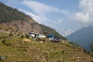
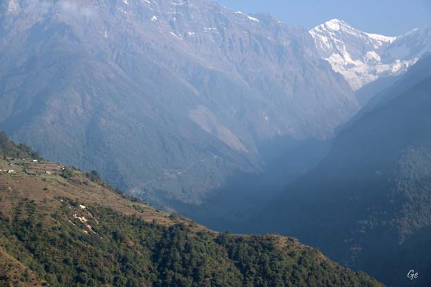
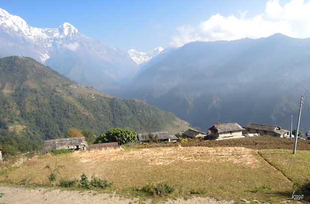
Pothana - Ghandruk
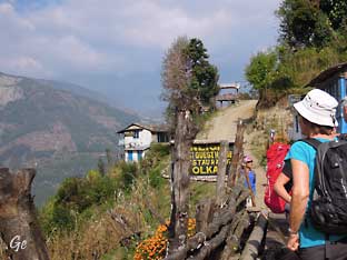
Vi fortsetter turen og skal i dag gå ca 7 - 8 timer.
Etter å ha gått i ca en
og en halv time kommer vi opp til Bhichok Deurali passet
(2100 moh),
som er det høyeste punktet på turen. Herfra går vi noe
nedover til den
pitoreske landsbyen Landruk (1650 moh). Vi spiser lunsj
i Landruk.
Etter lunsjen går vi bratt nedover til elva (ca 1100
moh). Derfra går det
bratt opp til Ghandruk (1939 moh).
I Ghandruk bor vi på hotel Mountain View.
|
|
Vi var
tidlig oppe hver morgen.
Soloppgangen over Himalaya måtte fotograferes.
|
|
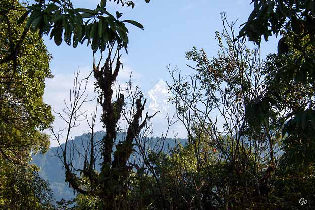
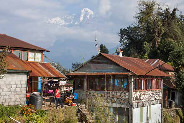
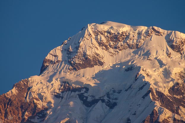
Annapurna og Fishtail
|
Fra Pothana ser man hvorfor
fjellet har fått navnet Fishtail.
|
|
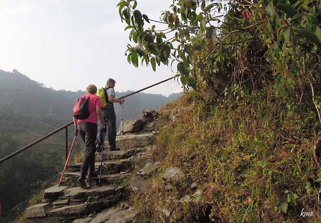
Porterne er klare
|
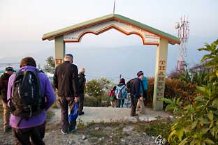
Ved turens høyeste
punkt 2100 noh.
|
Det var en lett tur opp til det høyeste
punktet på turen vår.
|
|
|
Mange trapper nedover på vei mot
Landruk
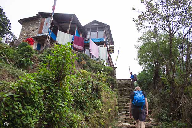
|
|
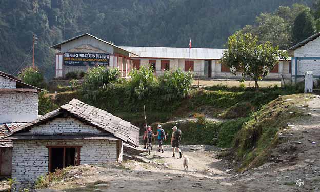
Etter mange trappetrinn kom vi ned
til en bilvei.
|
Men veien egner seg best for
turgåere. Vi så vel bare en bil på
strekningen.
|
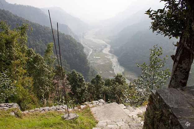
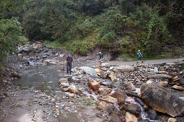
Det var ca 550 høydemeter fra Landruk til elva i
dalbunnen.
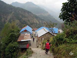
Ghandruk is
a Village Development Committee in
the Kaski District of the Gandaki
Province of Nepal. Situated at a distance of
32 km north-west to Pokhara, the
village is readily accessible by public buses and
private taxis from the provincial headquarter. At the
time of the 1991 Nepal census, it had a
population of 4,748
residing in 1,013 individual households.
Ghandruk is a common place for treks in
the Annapurna range of Nepal (Annapurna
Base camp and Annapurna Circuit treks, in
particular). The peaks of
Mt Annapurna, Mt
Machapuchare, Gangapurna and Mt
Hiunchuli can be seen
from the village, and it is also the gateway to
the Poon hill. Gurung communities
comprise the major inhabitants of the village.
Ghandruk
- Wikipedia (9. januar 2022)
|
|
Elva Modi Khola, helt ned
i dalbunnen.
|
Tørking på taket.
|
|
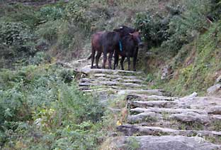
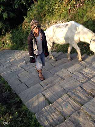
Kuer
sperrer trappa
(eller er det okser).
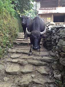
Tør vi gå forbi? |
|
Vi er nesten framme i Ghandruk, og
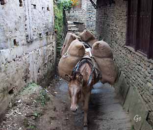
ser de første muldyrene.
|
Velkommen til Ghandruk
|
Hotel Mountain view.
Endelig oppe. Det ble en tung tur
fra elva og opp.
Ca 800 høydemeter. Trapper hele veien. Ingen av
oss klarte å telle trinnene,
men det var mange.
|
|
The Gurung
people, also called Tamu, are an ethnic
group in the hills and
mountains of central Nepal. They live
in Manang, Mustang, Kaski, Lamjung, Parbat and Syangja
Dhading Districts,
with a population of 522,641 people as of 2011. They
speak the Sino-Tibetan
Gurung language.
According to their legend, the Gurung were a
wandering tribe that traversed
west across Tibet prior to their entry into Mustang.
Their Tibetan Sojourn
pre-dates the introduction of Buddhism there in the
7th century as the Gurung
religious traditions are basically animistic. They
celebrate their feasts and festivals
and carry out the ceremonies and practices related to
worship, birth, death and
marriage in accordance with the Bon and Buddhist
religion.
Losar is the main and biggest festival of Gurung,
observed it as a New Year at the
end of December, according to the ancient calendar of
western Tibet. Their main
occupation is animal husbandry, including the raising
of sheep and hunting.
Lately they have a fame of joining British army and
renowned as Gorkha soldier.
Gurung
people - Wikipedia (8.
januar 2022)
|
Torsdag 20.
november 2014
Hviledag i Ghandruk til å
utforske omgivelsene i og rundt denne
gamle og typisk nepalesiske landsbyen. Det finnes både
et lite
museum og et kloster her.
Ghandruk er en stor Gurung landsby, og nesten uansett
hvor man får
bo vil man få en fantastisk utsikt til fjellene rundt.
Flere av de
verdenskjente Gurkhasoldatene er gurunger.
Gurkha-soldater
During the Gurkha War (1814–1816)
between the Gorkha Kingdom in
Nepal and the East India
Company the British were impressed by the
Gorkhali soldiers which they called Gurkhas.
Their war cry was and is
to this very day: Jaya Mahakali, Ayo Gorkhali
(Nepali: जय महाकाली,
आयो गोर्खाली) (Glory to Great Kali, Gorkhas
approach)! In the Peace Treaty it was agreed that
Gorkhalis could be
recruited to serve under contract in the East India
Company's army.
http://en.wikipedia.org/wiki/Gurkha (2014)
|
|
Enda en soloppgang over
Annapurna.....
|
|
... og soloppgang over Fishtail.
Herfra ser man fiskehalen enda bedre.
|
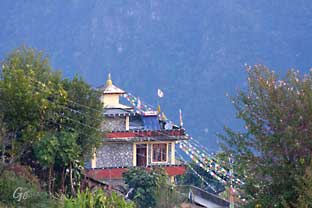
Tempel sett fra hotel
Mountain View.
|
|
|
|
Traditional Gurung Museum.
It displays the
local traditional
clothes and equipment used by
the Gurung people.
|
|
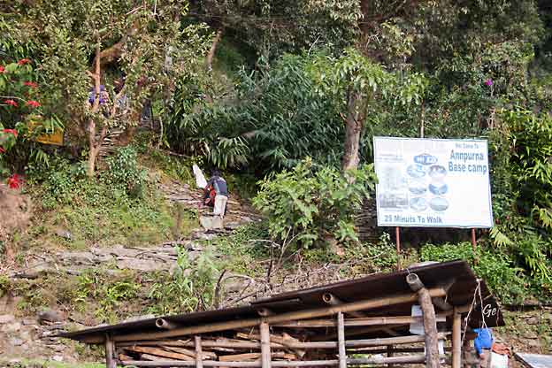
Her fortsetter veien mot Annapurna
basecamp.
|
Gamle Ghandruk
|
|
Salg av stolputer
|
Ved National Trust for Nature
Conservation i Ghandruk |
|
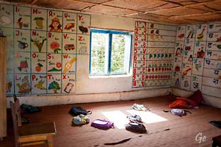
Nursery class
|
Meshram Baraha Sec. School
|
|
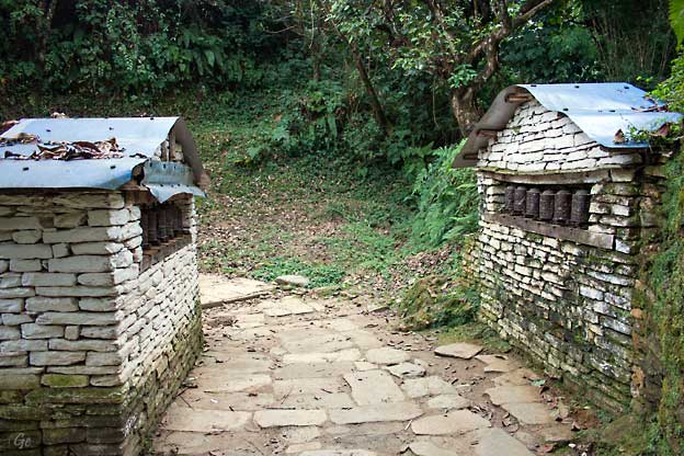
Bønnehjul på veien mot Annapurna
basecamp
|
Fra gamle Ghandruk
|
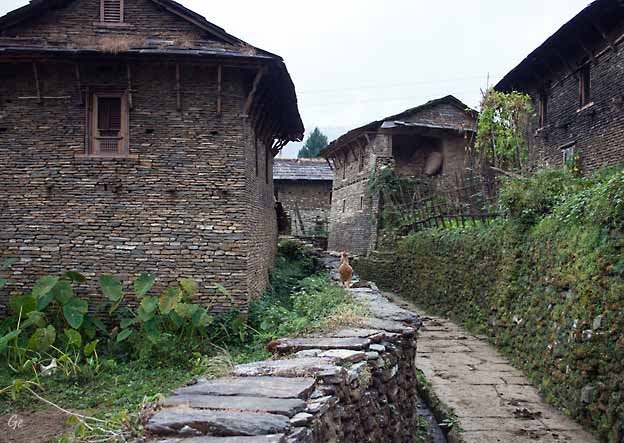
Gamle Ghandruk
|
|
|
Skolebarn på vei hjem
|
|
|
|
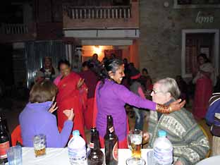
Om kvelden skulle det være en
folkedansoppvisning.
Men det ble i stedet dans for alle. Her var det liv.
|
Fredag 21.
november 2014
Ghandruk - Birethanti -
Pokhara
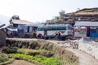
I dag er det bare en kort fottur tilbake til Nayapul
(1130 moh)
hvor bussen plukker oss opp. Vi passerer Chane og
Kimche
før vi kommer til Modi Khola (elva) og følger den
ned til Birethanti. Det tar oss ca 5 timer i rolig
tempo, inkl lunsj
og pauser. En times tid etterpå ankommer vi Nayapol.
Vi er tilbake i Pokhara sent på ettermiddagen.
|
|
Avskjed med Ghandruk. Vi fikk
blomsterkranser igjen.
|
Vi skulle helt ned til elva igjen.
|
|
Vi har kommet til bilvei igjen,
men valgte å gå trappene et stykke til.
|
Siste glimt av snøfjellene på
fotturen.
|
Bussen skal fram
|
|
Vi er framme ved lunsjstedet,
Birethanti
|
|
Fra Birethanti var det ikke langt
å gå til der bussen hentet oss.
Så fulgte en humpete busstur tilbake til Pokhara.
|
Lørdag 22.
november 2014
Pokhara
Dette er dagen for avslapping etter fotturen I dag kan
man slappe av på
bassengkanten eller nyte den spesielle atmosfæren i Lake
Side |
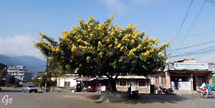
Det gule
treet står i et veikryss,
som en naturlig rundkjøring.
Når vi så treet visste vi at vi var
på rett vei til hotellet.
Fra treet var det ikke langt igjen
til hotel Atithi
|
|
|
|
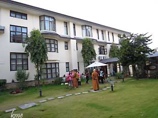
Før fotturen bodde vi i 3.
etasjen i denne fløyen av hotel Atithi.
|
|
|
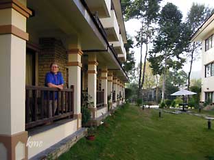
Grete på
balkongen
på hotel Atithi.
Da vi kom tilbake etter
fotturen bodde vi her i
første etasje med fin
balkong.
|
|
Søndag 23.
november 2014
Avreise fra Pokhara midt på dagen.
Om kvelden blir det felles middag
hvor vi spiser god mat og
oppsummerer Nepaloppholdet
|
|
Vi gikk en
tur til sentrum av
Lakeside.
Vi hadde enda noen innkjøp
som måtte ordnes.
Etter handlingen gikk vi en
tur langs innsjøen.
Der var det en fin turvei .
|
|
Ikke alle trenger en god
seng for å sove.
|
Har man båt har man alltid
noe å gjøre.
|
|
|
Hovedgata i Lakeside, Pokhara, men
litt vekk fra der turistene er.
|
Karl Martin har lyst på en banan.
Vi er i en av gatene mellom hotellet og
hovedgata i Lakeside, Pokhara.
|
Lakeside, Pokhara
|
Gamle flasker kan brukes
til mye.
Her som beskyttelse over en ledningskobling.
|
|
Gate i Lakeside, Pokhara. I
bakgrunnen ser vi Fishtail.
|
Hovedgata inn til Pokhara.
Stille og rolig her, men lenger framme var det fullt av
butikker, restauranter og folk.
|
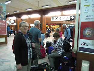
Det ble noe ventetid på
grunn av
SAARC- konferansen i Kathmandu.
|
Bagasjesjauerne slapper av
i
påvente av neste fly.
|
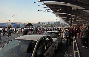
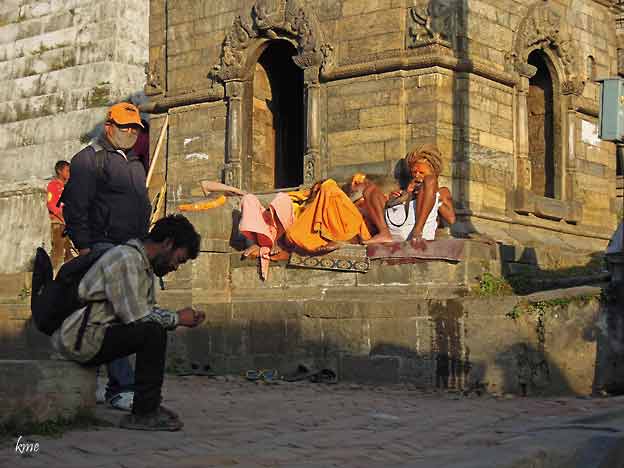
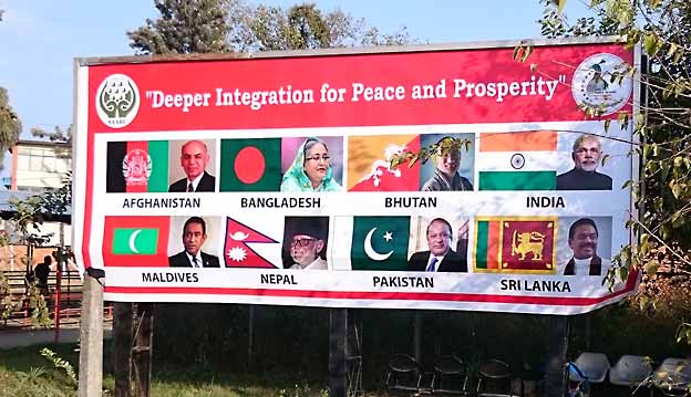 SAARC SAARC
|
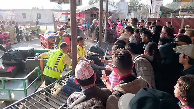
Lettere kaos for å få bagasjen sin
på innenriksflyplassen i Kathmandu.
Vis fram bagasjekvitteringen og sjauerne finner bagasjen
på trallene.
|
Saarc
The South Asian
Association for Regional Cooperation (SAARC) is the
regional
intergovernmental
organization and geopolitical union of
states in South Asia. Its member
states
are Afghanistan, Bangladesh, Bhutan, India,
the Maldives, Nepal, Pakistan and
Sri Lanka. SAARC comprises 3% of the world's area, 21%
of the world's population and
4.21% (US$3.67 trillion) of the global economy, as of
2019. SAARC was
founded in Dhaka on
8 December 1985. Its secretariat is based
in Kathmandu, Nepal. The organization promotes
development of economic and regional integration.
It launched the South Asian Free Trade
Area in 2006. SAARC maintains permanent
diplomatic relations at the United Nations as
an
observer and has developed links with multilateral
entities, including the European Union.
The idea of co-operation among South Asian Countries was
discussed in three conferences:
the Asian Relations Conference held
in New Delhi in April 1947; the Baguio
Conference in the Philippines in May 1950; and
the Colombo Powers Conference held in Sri
Lanka in April
1954.
In the ending years of the 1970s, the seven inner South
Asian nations that
included Bangladesh, Bhutan, India,
the Maldives, Nepal, Pakistan,
and Sri Lanka agreed
upon the creation of a trade bloc and to provide a
platform for the people of South Asia to
work together in a spirit of friendship, trust, and
understanding. President Ziaur Rahman
later addressed official letters to the leaders of the
countries of the South Asia, presenting
his vision for the future of the region and the
compelling arguments for region. During his
visit to India in December 1977, Rahman discussed the
issue of regional cooperation with
the Indian Prime Minister, Morarji Desai. In the
inaugural speech to the Colombo Plan
Consultative Committee which met in Kathmandu also in
1977, King Birendra of Nepal
gave a call for close regional cooperation among South
Asian countries in sharing river
waters.
South
Asian Association for Regional Cooperation -
Wikipedia (8. janar 2022)
|
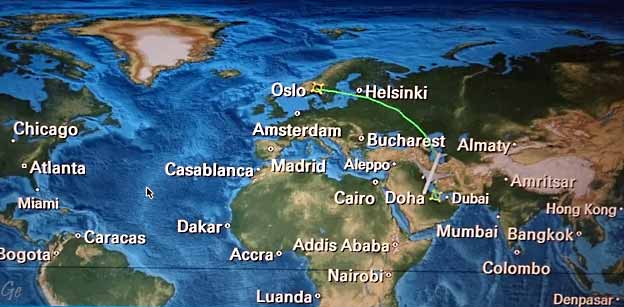
Mandag 24.
november 2014
Avreise fra
Kathmandu
ca kl 2050
og vi lander i Doha
rundt
midnatt. |
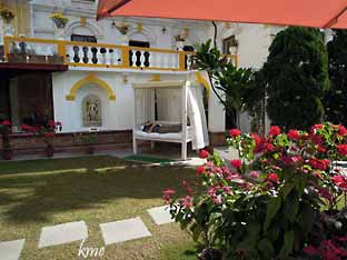
Senga i hagen på hotellet
i
Kathmandu var populær
|
|
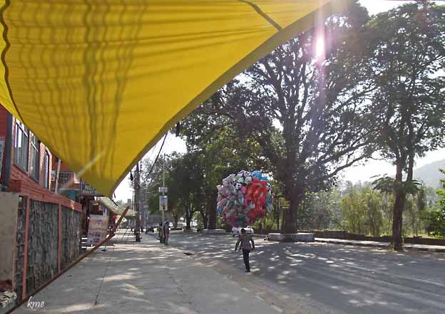
Salg av varer laget av søppel.
Søppelet er grundig vasket før det blir laget mange fine
ting av det.
|
Elektrikere i arbeid
|
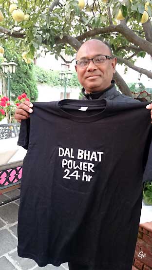
Mitra fikk Dal bhat t-skjorte
som avskjedsgave
|
|
Det var strenge
sikkerhetskontoller på og rundt flyplassen på grunn av
Saarc konferansen. Avreisen fra hotellet ble derfor noen
timer tidligere
enn planlagt.
Til venstre venter vi på avreise fra hotellet.
Til høyre er vi framme på flyplassen, i veldig
god tid. Halvparten av bilene
byen hadde kjøreforbud. Registreringsnummer med oddetall
den ene
dagen, med partall den andre. Dermed ble det mye bedre
flyt i trafikken en
vanlig.
Det var heller ikke så strenge sikkerhetstiltak som da
vi kom fra Pokhara
dagen før.
|
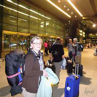
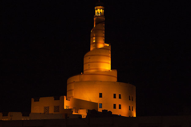
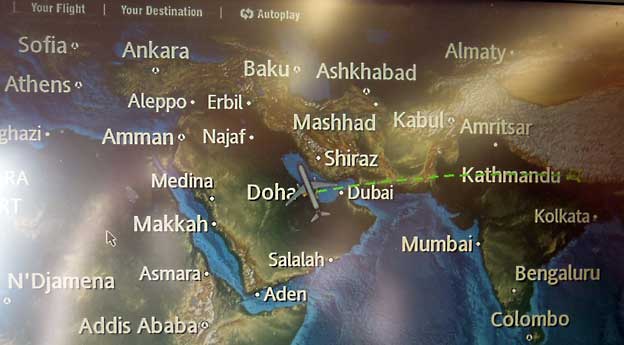
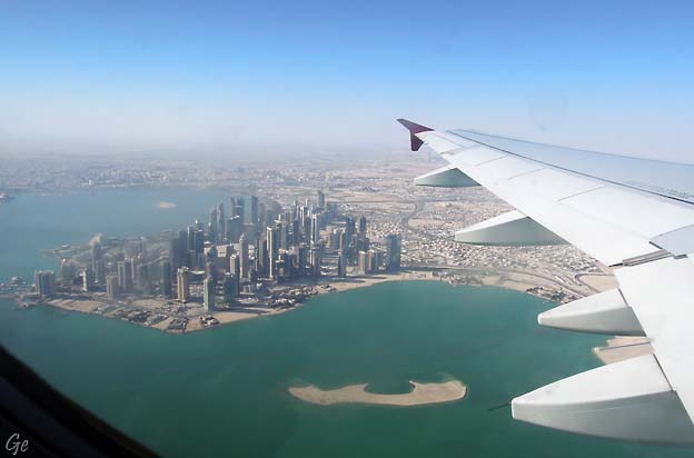
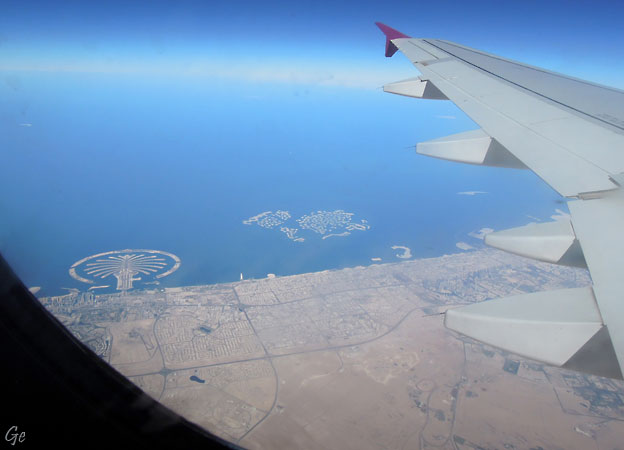
Tirsdag 25.
november 2014
Avreise Doha ca kl 0245 til København.
Derfra kl til Oslo (5 personer) og Trondheim (5
personer)
For oss (Karl Martin og Grete) fortsatte reise med
flytog til Lysaker,
buss til Slemmestad og derfra de siste ti minuttene til
fots.
Deilig å være hjemme,
men det hadde vært en fantastisk tur.
|
Tilbake til
1.side
|