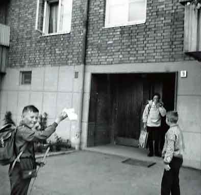
Vi reiser fra Lilleberg.
På bildet ser vi Jan Erik, mor Selma og Jans kamerat Ottar.
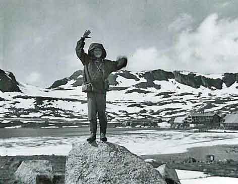
På Finse.
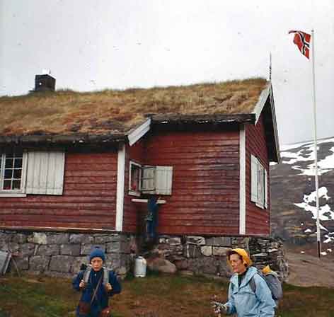
Overnatting på Finsehytta.
Finsehytta i bakgrunnen
Finsehytta er et fantastisk utgangspunkt for turer
både sørover på Hardangervidda og videre inn i S
karvheimen. Hytta ligger sentralt plassert midt
imellom Hardangerjøkulen og Hallingskarvet.
https://finsehytta.dnt.no/
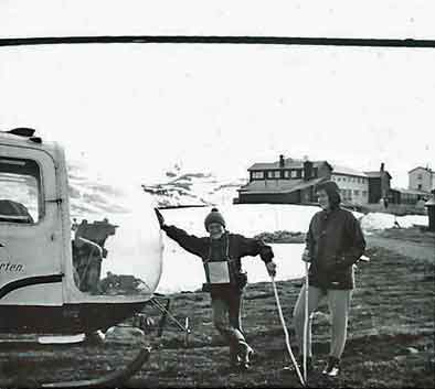
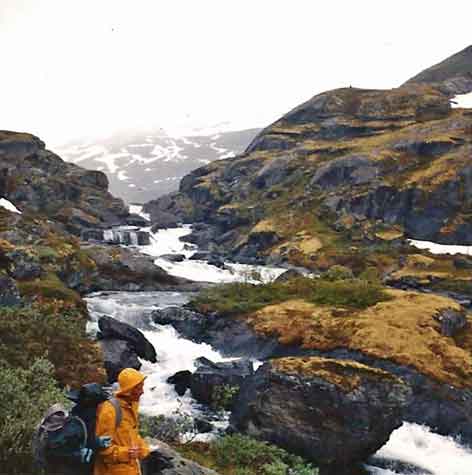
Fra Finse gikk vi til Geiterygghytta
Det var dårlig vær, og dårlig værmelding da vi
gikk fra Finse. Heldigvis tok meteorologene feil.
Været ble etterhvert ganske bra.
https://geiterygghytta.dnt.no/
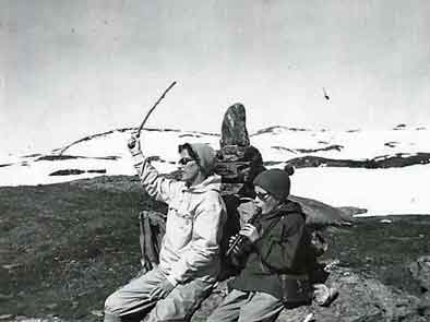
Jan Erik sørger for litt musikk i fjellheimen.
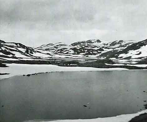
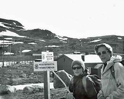
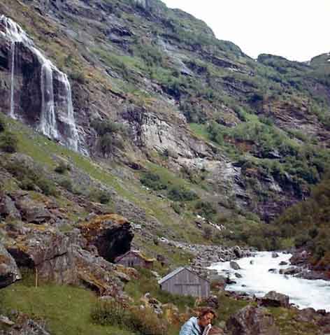
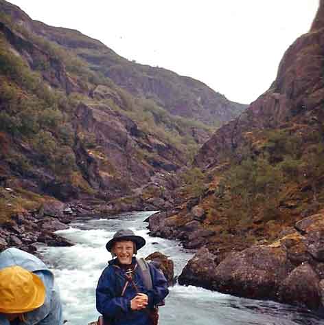
Fra Geiterygghytta til Steinbergdalen Turisthytte.
once one of the main routes between the eastern and western parts of Norway. The area known as Norway's Grand Canyon,
is wild and breathtaking, rich in plant and animal life, cultural treasures, history and geological features.
You can hike through the valley and stay overnight in the mountain lodges along the way, or come by bus or private car for shorter trips.
Each section is also suitable as a single day tour.
Finse - Geiteryggshytta - 5 hours - from July -18 km
Cross the railway at the station, continue along the western
side of Jomfrunut and over the Finseåni river bridge. A short detour to St. Pål (named by Lord Garvagh) is a must.
Spectacular views over Gausta, Hardangerjøkulen and parts
of Jotunheimen. The route continues towards Bakkaheleren.
On the way you pass an old animals hunting pit. Continue
along the south bank of the river to
Geiterygghytta - Mountain lodge.
Geiterygghytta - Stemmerdalen - 3 hours -10,2 km
Follow the path up from the construction road north of the
lodge and ascend the west side of Sundellerskarvet.
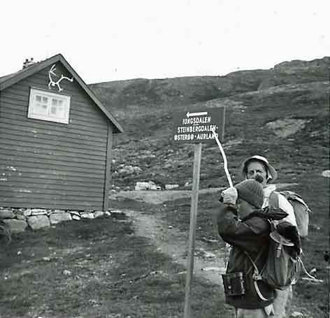
Here the path forks off to Kongshelleren and Iungsdalen.
The path to Steinbergdalhytta continues northwards and
cross Rausdalen. Another climb west of Bolhovd to Breibakka. Magnificent view over Stemmerdalen. The path descends diagonally along the mountain side to Steinbergdalen.
Rejoin the path up the slope north of the lodge and continue
the ascent. Fine view over Stemmerdalen.
The path joins an old route by Grøna-dam. Continue over the Grøna river bridge, up past Grønestølen and down to Østerbø Fjellstove and Østerbø Turisthytte.
Østerbø - Vassbygdi - 6 hours -20 km
This section of the valley is famous. Past the old cemetery and over the Langdøla bridge; continue past Viki to the once notorious Nesbøgalden (this was a system of ramshackle
vertical and horizontal ladders fastened to cracks in the rock). Now a wide pathway has been blased into the cliff face along
the Nesbø-vatnet. The path continues past picturesque
Nesbø to a fork at Tirtesva. The orginal route is now restored, and it provides much better views than the path along the
river. The steep descent from Bjønnstigvarden is assisted by handrails and steps.
The walk continues past Svartatjødn. We recommend a visit
to the "Vetlahelvete" cave to the west of the path. Descend
once again to the river, and walk to the bridge over the Veiverdalselvi river. Ascend to Sinjarheim farm (now fully restored having been closed since 1921). On the way you pass
the tiny Almen farm situated beneath a towering rock
overhang. Continue along the river to Belle in Vassbygdi.
Bus-connection several times a day -
www.ruteinfo.net. - ph. 177
https://www.fjordnorway.com/things-to-do/aurlandsdalen-p1034333
(1.9.2019)
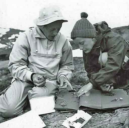
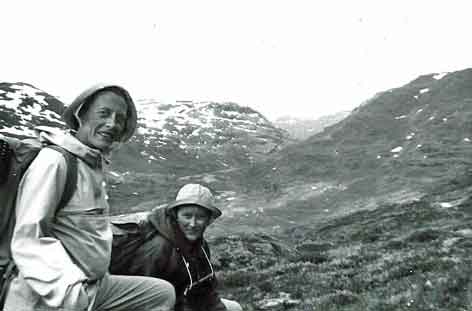
Jan Erik presser planter til herbariet sitt.
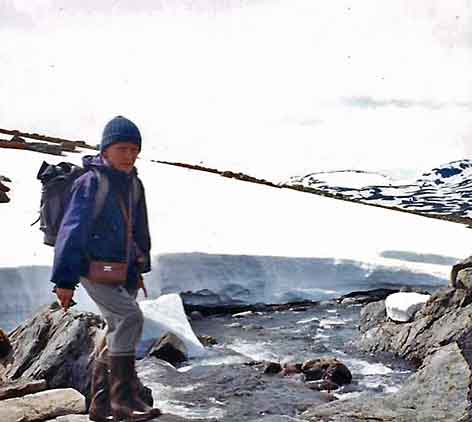
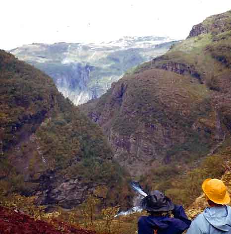
Fortsatt mye snø i fjellet.
Steinbergdalen Turisthytte
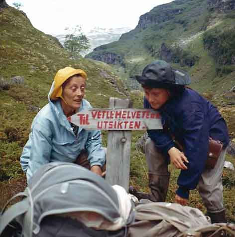
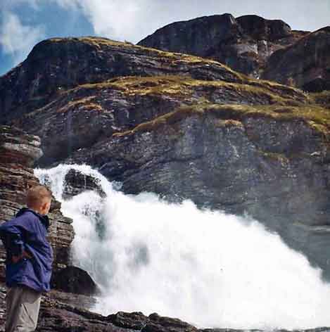
Avstikker til Vetlehalvete
Vetlahelvete Cave
Vetla is the local dialect for “little” while helvete means “Hell.”
Monolithic rocks sculpted by glaciers formed the walls, which resembled rows of giant molars. In the center, a big sheet of
ice floated in a pool of meltwater that had collected. Several chunks had broken off to hunker like icebergs in the puddle.
We tested the acoustics and listened to echoes rebound
around the space, then we plopped ourselves down on a log bench and ate our lunch, listening to the drip, drip, drip
from the cave walls.
Vetlahelvete Cave | A Newbie in Norway (13. juni 2022)
Utsikt fra Sinjarheim
In the valley of Aurlandsdalen there are many deserted farms,
and Sinjarhiem is one of these. The farm has a high location
on a hill with gorges, canyons and waterfalls on all sides.
In spite of the dramatic countryside people have made a living
there for centuries.
The farm was deserted in 1922 and decay gradually set in.
In 1988, however, the buildings at Sinjarheim were
restored by the Society for the Preservation of Norwegian
Ancient Monuments and the farm is now used as a mountain
farm by the Sogn Agricultural and Horticultural College in
Aurland.
The high farm of Sinjarheim in the valley of Aurlandsdalen - Encyclopedia (fylkesarkivet.no) 10. mars 2024
Almen gård
Fra Sinjarheim går stien bratt nedover mot Almen,
som er den nederste garden i Aurlandsdalen.
Det sies at de som bodde her snakket så høyt, dette for å overdøve elvesuset fra elven som går like ved huset.
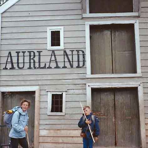
Framme i Aurland
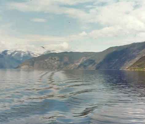
Sognefjorden
Norges lengste og verdens nest lengste fjord, 205 km
inklusive Sognesjøen målt fra Ytre Sula til Skjolden ved botnen av Lustrafjorden. Sognefjorden er 1308 m dyp utenfor Vadheimsfjorden og med det Norges dypeste fjord. Det er høy terskel ved munningen, som er 100–200 m dyp. Sognefjorden er også verdens lengste åpne fjord.
https://snl.no/Sognefjorden
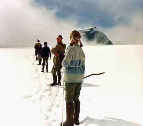
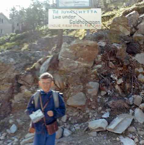
Fra Aurland reiste vi til Galdesand, hvor vi overnatta på Galdhøpiggherberget. Neste morgen forsatte vi til Juvasshytta. Derfra skulle vi gå til Galdhøpiggen.
På Juvasshytta fikk vi beskjed om at tåka lå tett på
Galdhøpiggen, og at det derfor mest sannsynlig ikke ble noen tur opp denne dagen. Men ny værmelding sa at
tåka kom til å lette og så ble det tur likevel.
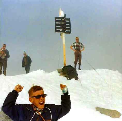
Galdhøpiggen er en av Norges store klassikere og ligger i Jotunheimen nasjonalpark. Omgivelsene er fantastiske
og fra toppen kan du se både Rondane, Glittertind,
Snøhetta og store deler av fjellnorge. Turen kan startes
fra Juvasshytta eller Spiterstulen og er en høyst over
kommelig tur de aller fleste klarer.
Fra Juvasshytta: Turen tar ca. 5 timer. Distansen er på
ca. 11 kilometer og det skal klatres 650 høydemeter fra
Juvasshytta. Deler av turen går over Juvassbreen, der
man må ha brefører og gå i taulag. Dette må du bestille
før du starter å gå. Breen er slak og har ikke de store
bresprekkene, så stegjern er ikke nødvendig. Men det
kan være skjulte sprekker og snøbrorer som gjør det
farlig å gå uten taulag.
https://www.nasjonalparkriket.no/inspirasjon/fjelltur-
og-vandring/galdhopiggen (1.9.2019)
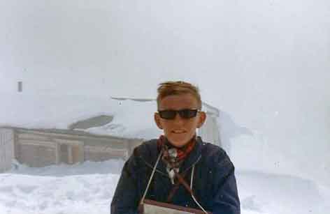
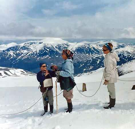
Det var tett tåke om formiddagen,
men tåka forsvant mens vi var på toppen.
The first element in the name of the mountain is gald (m.)
"steep mountain road", the last element is hø (f.) "(big and) rounded mountain."
An old road between Gudbrandsdalen and Sogn passes
beneath the mountain.
Geologically Galdhøpiggen, like most of Southern Norway's mountain ranges, belongs to the Caledonian folding. The peak
is made of gabbro, a hard but rather coarse-grained rock
which is found in most of the Jotunheimen range. During the
ice ages it was heavily glaciated and got its present form. The theory that the highest summits in Norway stayed above the
ice as nunataks has been abandoned by most geologists. It fits
well with the present flora in the area, but it does not fit well with the present knowledge of ice thickness and the results of glaciation.
https://en.wikipedia.org/wiki/Galdh%C3%B8piggen (1.9.2019)
Bare sol og sommer
Strålende vær på turen ned igjen
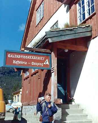
Overnatting i Galdesand