Tirsdag 14. mars 2017 Først buss og tog til Gardermoen. Så med SAS til London, Heathrow, så videre til Johannesburg med South African Airways, så fra Johannesburg til Cape Town med South African Airways. Fra Cape town kjørte vi buss til Franschhoek og var der den første natta i Sør-Afrika. |
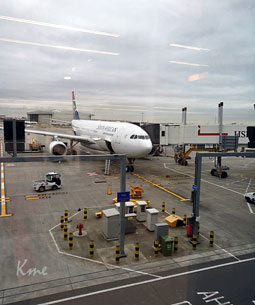 Flyet vi skulle ha fra Heathrow til Johannesburg |
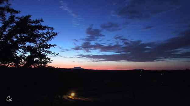
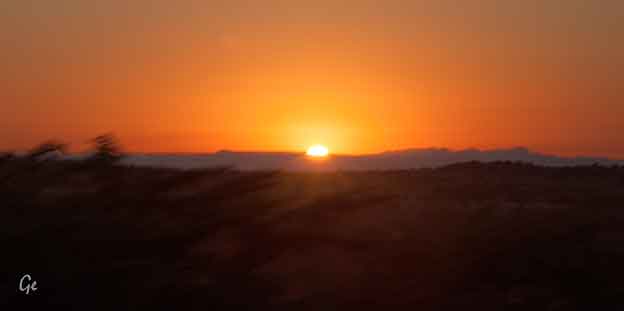
Onsdag 15. mars 2017
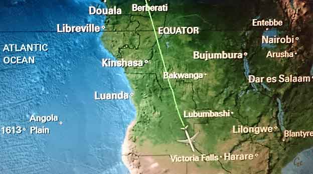
Etter en lang natt er vi over Victoriafallene. Heldigvis ikke så langt igjen
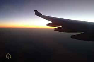 Soloppgang over sørlige Afrika |
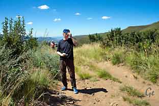
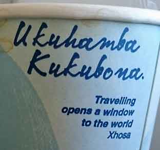 Ukuhamba Kukubona |
Vi lander ca kl 1115 og blir møtt av våre sørafrikanske medhjelpere
og setter kursen direkte mot vinland og Franschhoek - opprinnelig
kjent som "Olivants Hoek" etter elefantene som slo seg ned her.
Mellom 1688 og 1690 ble området gitt til 200 hugenotter som hadde
flyktet fra forfølgelse i Frankrike.
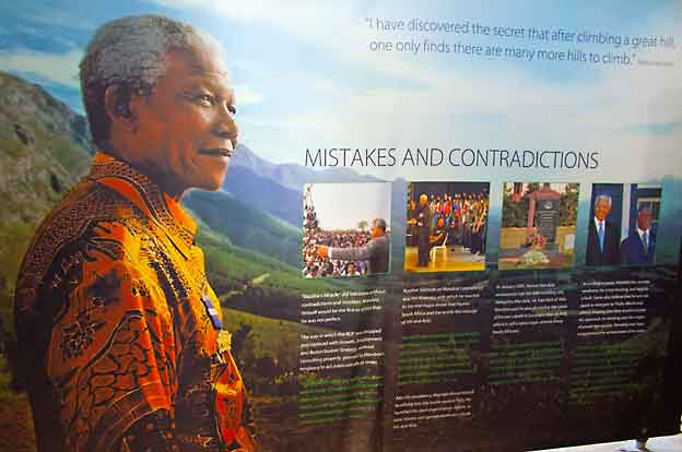
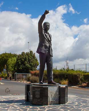 Nelson Mandela |
Første
stopp på turen var ved Nelson Mandelastatuen
utenfor Franschhoek The Drakenstein Correctional Centre, just outside Franschhoek, is where former President Nelson Mandela walked out a free man in 1990, after spending 27 years behind bars. The entrance to the correctional centre, marked by a bronze statue of Mandela with his fist aloft, has become a tourist spot, as has the house in which he spent the last few months of his time in prison. Most of Mandela’s incarceration was spent on Robben Island, from 1964 until he was transferred to Pollsmoor prison in 1982. In 1998 he was sent to Victor Verster Prison, now named the Drakenstein Correctional Centre. https://franschhoek.org.za/nelson-mandela-and- franschhoek-visit-the-drakenstein-correctional-centre/ (19.8.2019) |
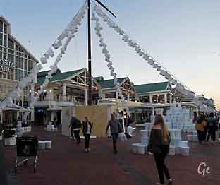
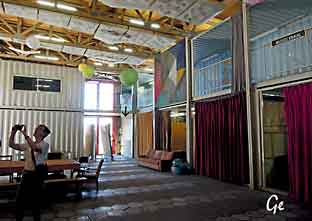
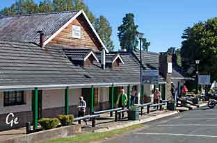
Franschhoek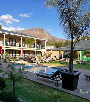 |
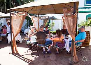
I Franschhoek bodde vi på Protea hotel. Vi spiste lunsj der før vi gikk ut for å se på byen. Til høyre: Hugenottminnesmerket, hugenottene var de første europeerne som slo seg ned. |
dedicated to the cultural influences that Huguenots have brought to the Cape Colony (and ultimately the whole of South Africa) after their immigration
during the 17th and 18th centuries. The French and Belgian Protestants were
fleeing religious persecution, especially in Catholic France.
The monument was designed by J.C. Jongens, completed in 1945 and inaugurated
by Dr. A.J. van der Merwe on 17 April 1948.
The three high arches symbolize the Holy Trinity: the Father, Son and Holy Spirit.
On top of the arches is the sun of righteousness and above that, the Huguenot
cross of their Christian faith.
The central female figure, created by Coert Steynberg, personifies religious
freedom, holding a bible in one hand and a broken chain in the other. She is
casting off her cloak of oppression. Her position on top of the globe shows her
spiritual freedom.
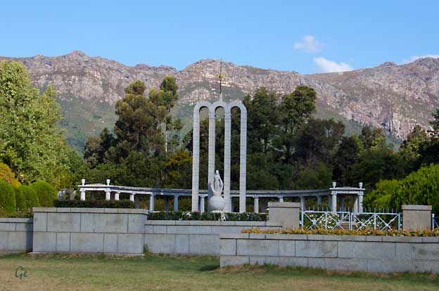
It also refers to representations of the figure of the Virgin Mary of Catholicism,
who may be shown with one foot resting on the globe. The fleur-de-lis on this
woman's robe represents noble spirit and character. It was long the symbol of
the French monarchy, still in power at the time of the Huguenot exile.
The southern tip of the globe shows the symbols of their religion: the Bible;
art and culture: the harp; agriculture and viticulture: a sheaf of corn and
grape vine; and industry: spinning wheel for silk and cloth weavers.
The water pond, reflecting the colonnade behind it, expresses the undisturbed
tranquility of mind and spiritual peace which the Huguenots refugees gained
in South Africa after dealing with violent religious persecution in France
experienced after much conflict and strife.
Huguenot Monument - Wikipedia (22. februar 2022)
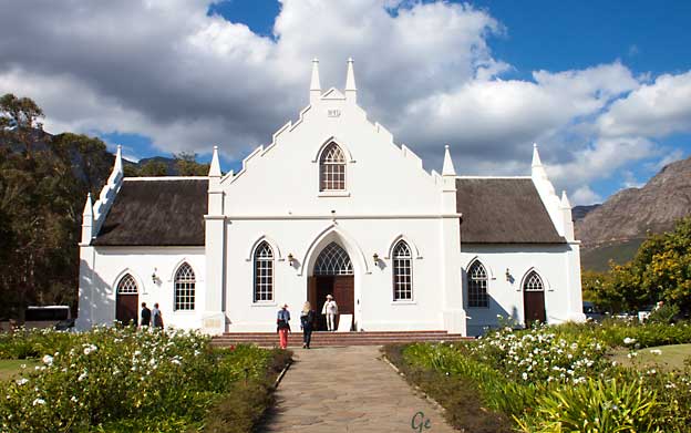
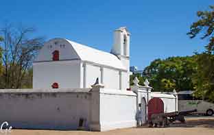
Hugenottenes, og områdets første kirke. Ganske enkel i eksteriør og interiør
| Vi spiste
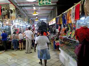
lunsj på hotellet. Etterpå tok vi en tur i byen Franschhoek. In the village you will find wonderful crafts, art and antique shops and galleries. The main street is lined with coffee shops and restaurants. Only 45 minutes from Cape Town Franschhoek is the ideal base while you explore the entire Cape winelands. http://franschhoek.org.za/about-franschhoek/ |
 Han personlig |
The oldes portion of this church was erected in 1846 - 1847
and inaugurated on 18. april 1847. The northern and southern wings
were added in 1883.
National Monuments Council 1978
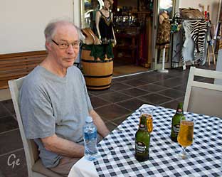 Vi tester det lokale ølet. |
 |
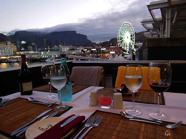
Utsikt fra Haute Cabriere
Dagen ble avsluttet med god mat og godt drikke
på restauranten Haute Cabriere.
Franschhoek’s iconic Haute Cabrière Restaurant & Terrace is well known for
its unique location and breathtaking views. Set into the Franschhoek
Mountain and overlooking the Valley, the soaring arches and the view over the cathedral-like Pinot Noir Barrel Maturation Cellar below offer an experience
which is not to be missed. On sunny days, guests can enjoy the beautiful vistas
over Franschhoek from the terrace, while on cool days a roaring fire creates
a cosy atmosphere.
(Haute Cabriere 2017)
(While our Restaurant and Tasting Room are closed for renovations, we will be
taking a presence with a pop-up Tasting Room at The Franschhoek Beer Co.
https://www.cabriere.co.za/restaurant/) (19.8.2019)
| Fra
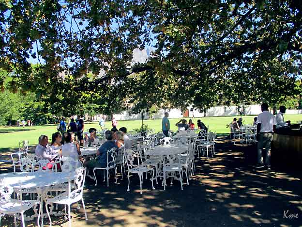
dagsprogrammet: Vi blir hentet på hotellet og tatt med på besøk til en vingård hvor vi får innføring i Sør-Afrikansk vin. Vin er en av Sør-Afrikas stoltheter og landet har sin egen drue, pinotage, som benyttes av mange vingårder. |
 |
avslutter oppholdet i vinland med utsøkt lunsj på en av gårdene.
Ut på formiddagen kjører vi inn til Cape Town, en kort tur på bare ca 80 km.
Vi avslutter dagen med fantastisk utsikt over byen på toppen av det
1000 meter høye Table Mountain, Cape Towns landemerke.
Table Mountain er oppført på UNESCOs verdensarvliste
og er hjem til 1470 ulike plantearter.
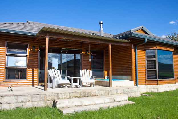
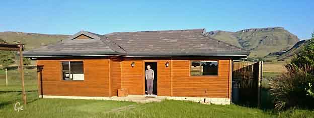
Vi overnatter på City Lodge Hotel (16-20 mars)
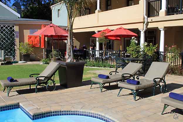
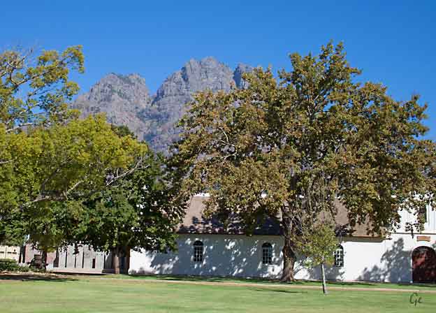
Protea hotel Franschhoek
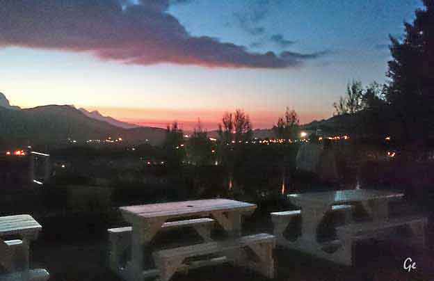
Hagen er gjort klar for en ny dag.
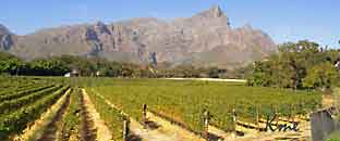
Ankomst vingården Boschendal
Agriculture and a simple farm lifestyle is at the heart of Boschendal.
One of the oldest farms in South Africa, founded 1685, the farm has grown
with the passing centuries into a cherished source of wholesome produce,
great wines and happy memories.
http://www.boschendal.com/
Fra vingården der vi fikk smake, og handle
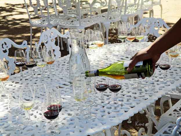
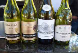 Vi fikk smake fem viner Blanc de Noir, le Bouquet, Shiraz og Chardonnay, Sommelier Selection Pinotage |
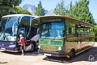 Den grønne bussen: www.winetram.co.za. den andre bussen er vår. |
| Stellenbosch The Kruithuis with its barrel vault was built as arsenal for the Council of Policy by the mason Michael Rambusch in 1777. It is the only monument in Stellenbosch bearing the monogram of The Dutch East India Company: VGOC (Vereenighde Geoctroijeerde Oostindische Compagnie), reminding "us of the long uninterrupted period of 116 years during which Stellenbosch fell under the control of the Chartered East India Company. |
 For years after it had stopped fulfilling its original function, the Kruithuis was used as a market building. It is said that even slaves were sold by auction here." Ters van Huyssteen, Footloose in Stellenbosch. It is now a museum. |
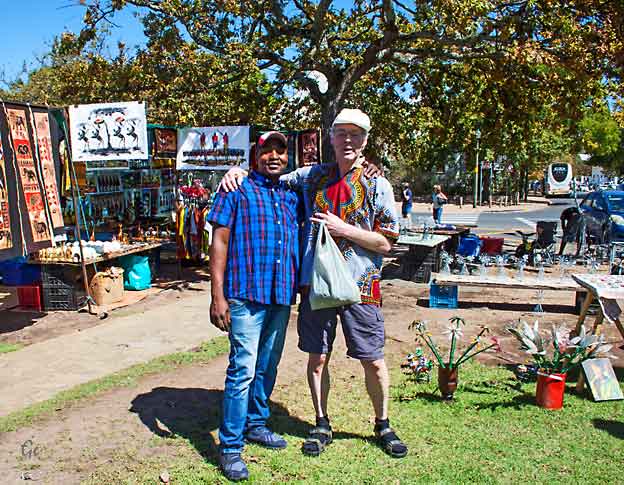
Markedet der Karl Martin ble fristet til å kjøpe skjorten.
Til over dobbel pris av det en annen i følget betale på et annet marked,
men skitt au, det var billigere enn det ville kostet i en norsk butikk.
 |
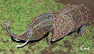 Laget av slike perler som brukes i barnehaver |
Stellenbosch (/ˈstɛlənbɒʃ/; Afrikaans: [ˈstɛlənbɔs])is a town in the Western Cape
province of South Africa, situated about 50 kilometres (31 miles) east of Cape
Town, along the banks of the Eerste River. It is the second oldest European
settlement in the province, after Cape Town.
The town became known as the City of Oaks or Eikestad in Afrikaans and Dutch
due to the large number of oak trees that were planted by its founder, Simon van
der Stel, to grace the streets and homesteads.
https://en.wikipedia.org/wiki/Stellenbosch
Universitetet i Stellenbosch regnes som et av de beste i Afrika.
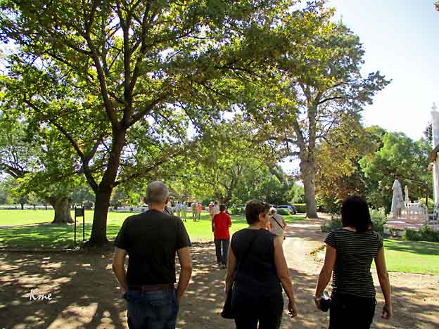
Avontuur Estate
Her spiste vi først lunsj. Etterpå ble det mer vinsmaking.
 |
flaskekosttre
|
 |
 |
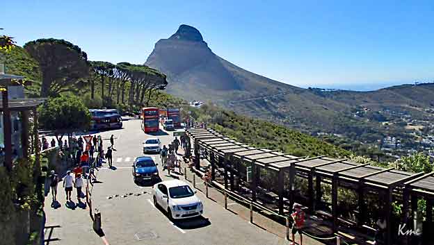
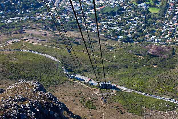
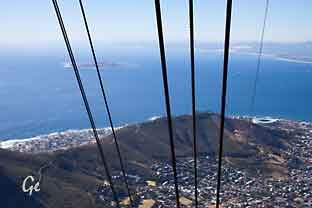
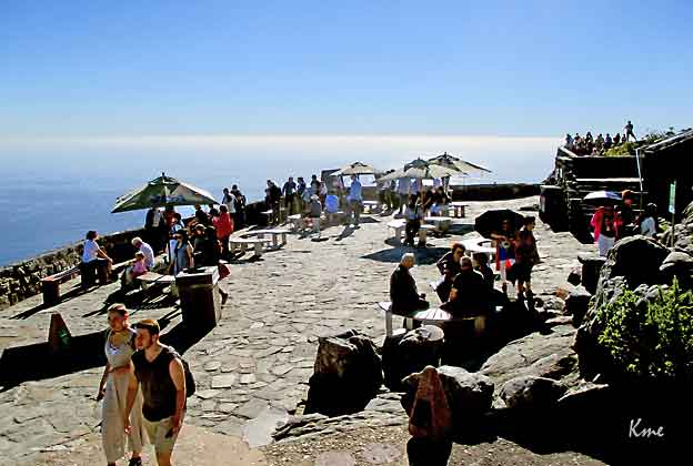
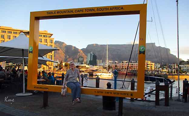
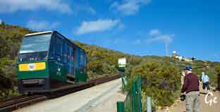
Startpunkt for gondolheisen til Table Mountain
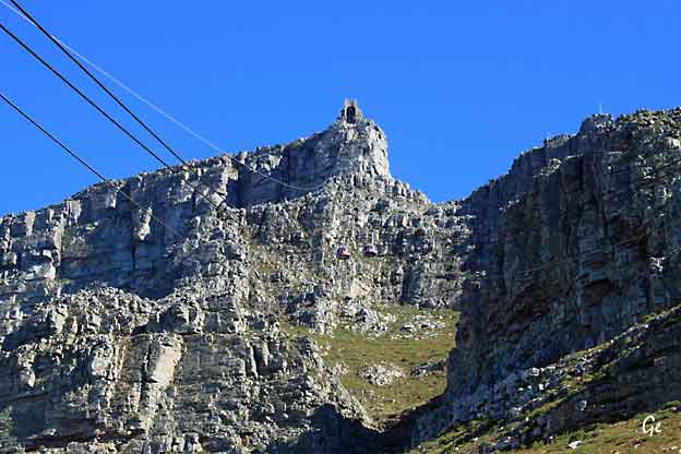
Table Mountain
Whether it is covered in a blanket of moody clouds or showing off
against a crisp cloudless blue sky, Table Mountain is always
spectacular.Cape Town locals are pretty fond of the mountain that
looms over their city… and with good reason! Table Mountain,
which is home to the richest, yet smallest floral kingdom on earth,
was voted one of the New Seven Wonders of the World in 2011.
Flanked by Devil’s Peak and Lion’s Head, Table Mountain makes up
the northern end of the Cape Fold Mountain range. It’s hard to
imagine, but the mountain’s distinctive flat top – a three-kilometre
level plateau – was once the bottom of a valley! The mountain was
given its name — Taboa do Cabo (Table of the Cape) — by Antonio
de Saldahna after he climbed up Platteklip Gorge in 1503.
Legend has it that the tablecloth of clouds that pours over the
mountain when the southeaster blows is the result of a smoking
contest between the devil and a retired sea captain called
Jan van Hunks.
https://www.capetown.travel/explore-cape-towns-iconic-table-mountain/(20.8.2019)
attracted a whopping 24 million visitors since it first opened in 1929.
Significantly revamped in 1997, the cable-cars now carry up to 65 passengers per trip.
The journey up the mountain takes about five minutes and the cars rotate through
360 degrees during the trip, giving you spectacular views of the mountain below.
Cars depart from the lower cable station on Tafelberg Road every 10 to 15 minutes,
but you can expect to spend a fair amount of time in the queue during peak season.
The cableway doesn’t operate if the wind is too strong or the visibility too poor, so
check in advance if the conditions seem unfavourable.
While the cableway is convenient and fun, you’ll get a much richer experience by
hiking up or down yourself. Platteklip Gorge, a prominent gorge up the centre of the
main table, is one of the most popular routes up the mountain. While quite steep, the ascent is pretty straightforward and should take between one and three hours
depending on your fitness level. A trickier route starting on that side of the mountain
is India Venster, which requires you to do a fair bit of scrambling. This route can take between two and four hours and should only be tackled by those who are fit and are familiar with the route. On the Atlantic side of the mountain, Kasteelspoort, which
offers incredible views of Camps Bay, is the easiest route.
https://www.capetown.travel/explore-cape-towns-iconic-table-mountain/(20.8.2019)
 |
By
the 1870s, Capetonians had proposed a railway to
the top of Table Mountain, but plans were halted
by the Anglo-Boer War. The City Council began investigating the options again in 1912, but this was in turn halted by the First World War. Despite initial cost estimates of GB£100,000 (equivalent to £38,800,000 in 2011 pounds) to build the cableway the city's population was |
A Norwegian engineer, Trygve Stromsoe, presented plans for a cableway in 1926, and construction began soon after with the formation of the Table Mountain Aerial
Cableway Company (TMACC). Former world leading wire ropeway company Adolf Bleichert & Co. from Leipzig (Germany) was awarded the contract for the construction. It was completed in 1929 at a cost of GB£60,000 (equivalent to
£11,400,000 in 2011 pounds) and the cableway was opened on October 4, 1929, by the Mayor of Cape Town AJS Lewis. The cableway has been upgraded three times since then. Sir David Graaff, a leading industrialist, former mayor of Cape Town and
government minister, also invested heavily in the project.
In 1993, the son of one of the founders sold the TMACC and the new owners took
charge of upgrading the cableway. In 1997, the cableway was reopened after
extensive renovations, and new cars were introduced.
https://en.wikipedia.org/wiki/Table_Mountain_Aerial_Cableway(20.8.2019)
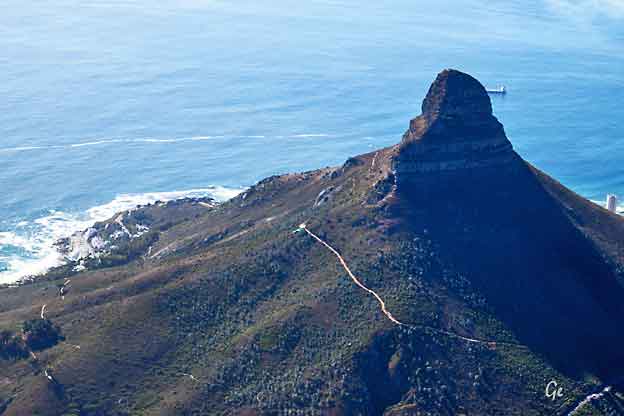
Lion's Head is a mountain in Cape Town, South Africa, between Table Mountain and Signal Hill. Lion's Head peaks at 669 metres (2,195 ft) above
sea level. The peak forms part of a dramatic backdrop to the city of Cape Town and is part of the Table Mountain National Park.
https://en.wikipedia.org/wiki/Lion%27s_Head_(Cape_Town)
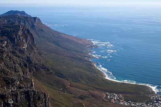
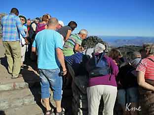
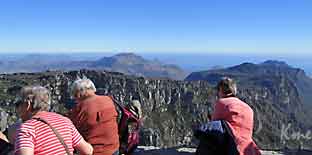
Utsikt fra Table Mountain
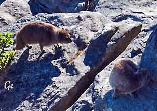
| Klippegrevling The rock hyrax (/ˈhaɪ.ræks/; Procavia capensis), also called dassie, Cape hyrax, rock rabbit, and (in the King James Bible) coney, is a medium-sized terrestrial mammal native to Africa and the Middle East. Commonly referred to in South Africa as the dassie (IPA: [dasiː]; Afrikaans: klipdassie), it is one of the five living species of the order Hyracoidea, and the only one in the genus Procavia. Rock hyraxes weigh 4–5 kg (8.8–11.0 lb) and have short ears and tails Rock hyrax - Wikipedia (16. januar 2023) |
 |
 |
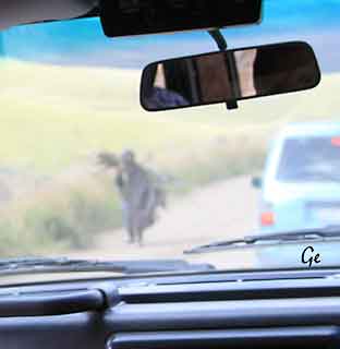
 Undres hva de ser, over de høye kanter? Jeg tror det er en kappgrevling. |
Many locals and overseas visitors
take the challenge of hiking up the mountain for
granted. On numerous occasions, I`ve come across
people wearing inappropriate
hiking gear such as, slippers and denim jeans.
Often people would start a hike,
late afternoon, on a windy day, and there`s no
guarantee that the Table Mountain
Aerial Cableway would be operating once they reach
the top.
unfortunate incidents over the years. In 2009 there were 15 reported
deaths on Table Mountain, and 9 reported so far during 2010.
Table Mountain is reportedly more dangerous than Mount Everest!
https://www.awoltours.co.za/blog/2010/07/14/table-mountain-the-worlds-most-
underestimated-mountain/
 |
Kappkråke The Cape crow or black crow (Corvus capensis) is slightly larger (48–50 cm in length) than the carrion crow and is completely black with a slight gloss of purple in its feathers. It has proportionately longer legs, wings and tail too and has a much longer, slimmer bill that seems to be adapted for probing into the ground for invertebrates. The head feathers have a coppery-purple gloss and the throat feathers are quite long and fluffed out in some calls and displays. https://en.wikipedia.org/wiki/Cape_crow |
 |
The
lizards most commonly spotted on Table Mountain are the southern rock agama, the black girdled lizard and the Cape skink. The male agama is a particularly interesting sight during mating season, when its head turns bright blue. http://www.tablemountain.net/ blog/entry/table-mountain-for- nature-lovers |
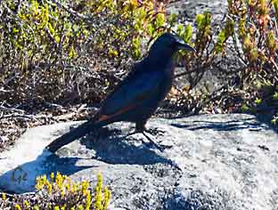 |
Rødvingestær The red-winged starling (Onychognathus morio) is a bird of the starling family Sturnidae native to eastern Africa from Ethiopia to the Cape in South Africa. It is known in Afrikaans as the rooivlerkspreeu, and as i Somi in Xhosa and Zulu. https://en.wikipedia.org/wiki/Red- winged_starling |
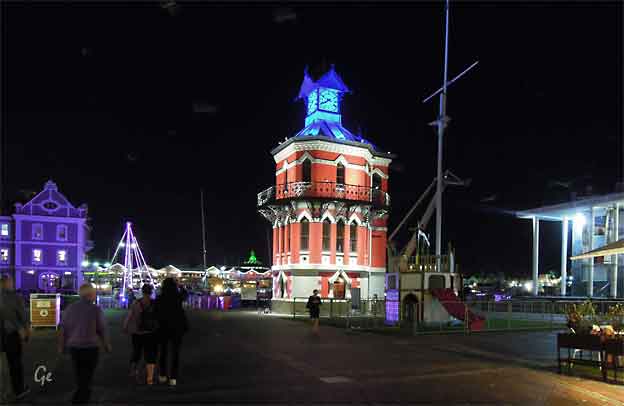
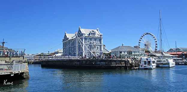
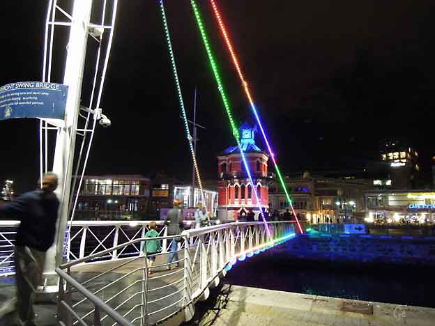
The Victorian Gothic-style Clock Tower is an icon of the old
Cape Town harbour.
It was the original Port Captain's Office built in 1882.
The pointed Gothic windows surrounds the structure with a clock,
imported from Edinburgh, as a main feature. The red walls are the
same colour as they were in the 1800's, having been carefully
matched to scrapings of the original paint.
On the second floor is a decorative mirror room which alowed the
captain an overall view of harbour activities.
On the ground floor is a tidal gauge mechanism which was used to
check the level of the tide for ships entering or leaving the docks.
The Clock Tower has begun to lean to one side, obout 50 mm.
This has since been arrested.
The tower has been a focal point in the Victoria & Alfred
Waterfronts urban renewal.
http://www.cape-town-heritage.co.za/heritage-site/clock-tower.html
The V&A Waterfront is situated in the oldest working harbour in South Africa.
With Table Mountain as its backdrop and extensive views of the ocean, the V&A
boasts 22 heritage sites across the property. The mixed-used property, at a size
of 123-hectares is home to different experiences which range from leisure and
shopping to family entertainment. In addition, the V&A also includes residential
and commercial property.
Developed in 1988 by the state owned Transnet, the V&A is now owned by
Growthpoint and the Government Employees Pension Fund (GEPF), represented
by the Public Investment Corporation Limited (PIC). Contributing R259.1 billion
in nominal terms to the South African economy over the last twelve years, the
V&A Waterfront’s cumulative contribution to the provincial GGP since 2002 was
over R227 billion. Total visitor numbers have grown to 24 million a year by 2014
(at year end). Although the V&A Waterfront remains South Africa’s favourite
tourist attraction for international tourists they account for only 23% of all
visitors. Visits by locals increased to 63%, while 14% of visitors were from
upcountry.
The V&A forms part of the Cape Town Big 7, one destination comprising of 7
memorable experiences. Other partners of the Cape Town Big 7 include Cape
Point, Groot Constantia, Kirstenbosch National Botanical Garden, Robben Island,
Table Mountain Cableway and City Walk.
http://www.waterfront.co.za/tourismtoolkit
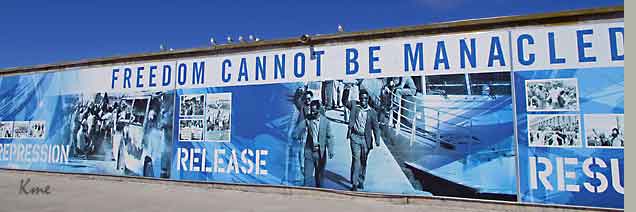
Fra dagsprogrammet: Vi starter dagen med båttur til den kjente fangeøya Robben Island, hvor Nelson Mandela sonet mesteparten av sin tid i fengsel.
Han ble løslatt i februar 1990 og i 1996 ble Robben Island museet
etablert som et nasjonalmonument og et nasjonalt museum.
Guidene på øya er tidligere politiske fanger og turen er derfor
garantert å gjøre et inntrykk på alle de besøkende.
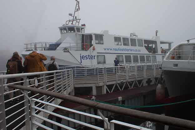
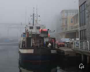
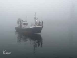
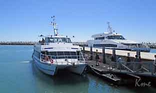
Dagen startet med tett tåke. Båtturen ut til Robben Island som skulle ta
30 minutter tok over dobbelt så lang tid.
 SeaPride |
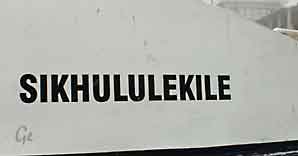 Sikhululekile, en av båtene som går til Robben Island |
 |
 |
"Berlevåg" bølgebryter
It takes its name from the Dutch word for seals (robben), hence the
Dutch/Afrikaans name Robbeneiland, which translates to Seal(s) Island.
Robben Island is roughly oval in shape, 3.3 kilometres (2 miles) long north–south, and 1.9 km (1+1⁄8 mi) wide, with an area of 5.08 km2 (1+31⁄32 sq mi). It is flat
and only a few metres above sea level, as a result of an ancient erosion event.
It was fortified and used as a prison from the late-seventeenth century until 1996, after the end of apartheid.
Robben Island - Wikipedia (16. januar 2023)
Now, Robben Island is a World Heritage Site and museum, offering daily tours.
The tour begins at the Nelson Mandela Gateway at the V&A Waterfront with a
multimedia exhibition, museum shop and restaurant, after which, guests hop
onto the ferry for a scenic trip to the island. Once on Robben Island itself, the
tour is guided by a former political prisoner of the island, for unique and
incomparable insights into the island’s history.
http://www.capetown.travel/products/robben-island-museum
 |
The
island was also used as a leper colony and animal quarantine station. Starting in 1845 lepers fromthe Hemelen-Aarde (heaven and earth) leper colon near Caledon were moved to Robben Island when Hemel-en-Aarde was found unsuitable as a leper colony. |
leave the island if they so wished. In April 1891 the cornerstones for 11
new buildings to house lepers were laid.
After the introduction of the Leprosy Repression Act in May 1892 admission
was no longer voluntary and the movement of the lepers was restricted.
Prior to 1892 an average of about 25 lepers a year were admitted to
Robben Island, but in 1892 that number rose to 338, and in 1893 a further
250 were admitted.
https://en.wikipedia.org/wiki/Robben_Island
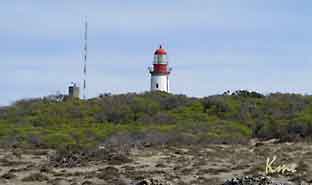 Due to the maritime danger that Robben Island presents to shipping, Jan van Riebeeck, the first Dutch colonial administrator in |
Cape Town in the 1650s, ordered that huge bonfires were to be lit at night on top of Fire Hill, the highest point on the island (now Minto Hill). These were to warn VOC ships approaching the island. In 1865 Robben Island lighthouse was completed on Minto Hill. https://en.wikipedia.org/wiki/Robben_Island |
Nobel Laureate and former President of South Africa Nelson Mandela was
imprisoned on Robben Island for 18 of the 27 years he served behind bars before
the fall of apartheid. To date, three of the former inmates of Robben Island
have gone on to become President of South Africa: Nelson Mandela,
Kgalema Motlanthe, and current President Jacob Zuma.
https://en.wikipedia.org/wiki/Robben_Island
 |
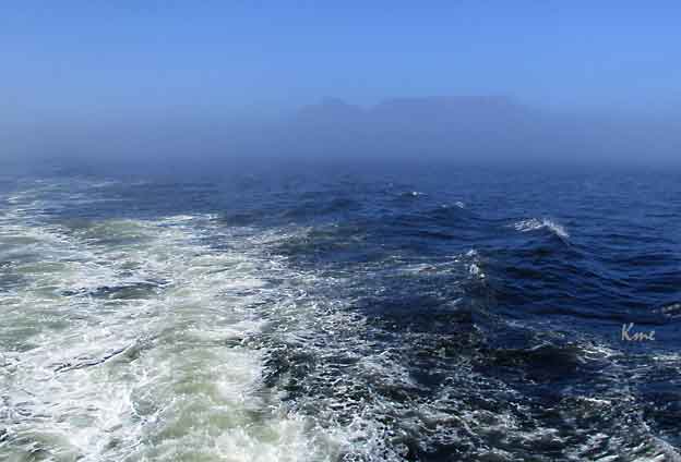
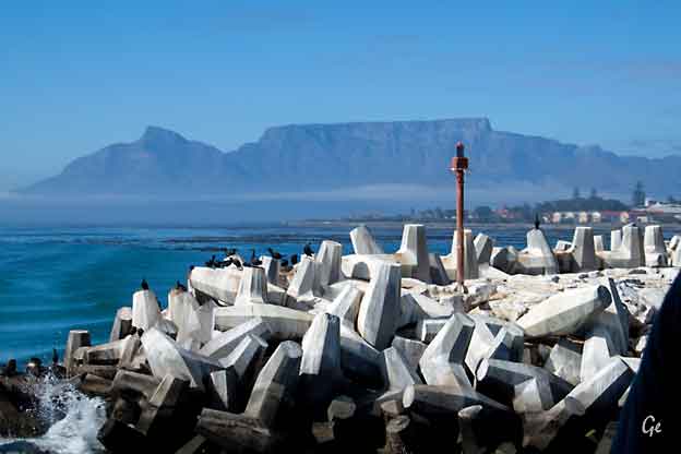
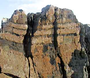 Lagdelte bergarter, det er det mye av |
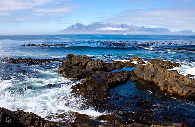
Vi ser fra Robben Island til Table Mountain. Tåka holder på å forsvinne.
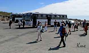 Fra ferga går man over i bussene og får en guida tur rundt på øye. |
With the end of apartheid, the
island has become a popular destination with global tourists. It is managed by Robben Island Museum (RIM); which operates the site as a living museum. In 1999 the island was declared a World Heritage Site. Every year thousands of visitors take the ferry from the Victoria & Alfred Waterfront in Cape Town for tours of the island and its former prison. Many of the guides are former prisoners. All land on the island is owned by the state of South Africa with the exception of the island church. It is open all year around, weather permitting. https://en.wikipedia.org/wiki/Robben_Island |
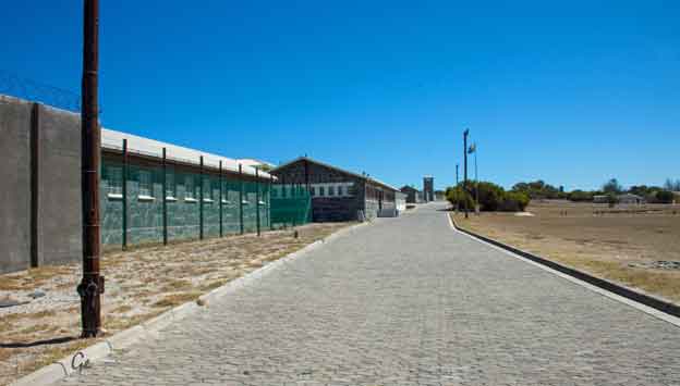
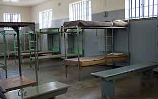 Celle i fenglet |
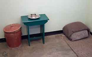 Mandelas celle |
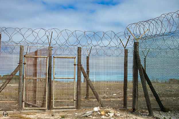
Mye piggtråd rundt fengselsområdet
 |
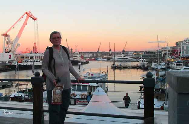
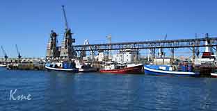 Fra havna i Water front |
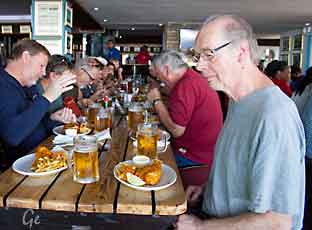 Lunsj i Waterfront |
 |
Cape Town (Afrikaans: Kaapstad [ˈkɑːpstat]; Xhosa: Ikapa) is a coastal city in
South Africa.
It is the second-most populous urban area in South Africa after Johannesburg.
It is also the capital and primate city of the Western Cape province.
As the seat of the Parliament of South Africa, it is also the legislative capital of
the country. It forms part of the City of Cape Town metropolitan municipality.
The city is famous for its harbour, for its natural setting in the Cape Floristic
Region, and for such well-known landmarks as Table Mountain and Cape Point.
The earliest known remnants in the region were found at Peers Cave in Fish
Hoek and date to between 15,000 and 12,000 years ago.
According to the South African National Census of 2011,
the population of the City of Cape Town metropolitan municipality –
an area that includes suburbs and exurbs not always considered
as part of Cape Town – is 3,740,026 people.
https://en.wikipedia.org/wiki/Cape_Town
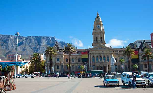
Built in 1905, Cape Town’s City Hall is the first place from where Nelson Mandela
spoke after his release from prison in 1990.
The honey-coloured City Hall in Cape Town has seen many changes in its years
of standing vigil on the Grand Parade. It has seen South Africa develop into the
multi-cultural melting pot that it is today, and played a very important role in
that change.
Addressing over 10 000 jubilant people just hours after his release, Mandela
famously had to borrow his wife’s reading glasses as he had left his in prison.
His speech, started with the words: "Comrades and fellow South Africans, I greet
you all in the name of peace, democracy and freedom. I stand here before you not
as a prophet, but as a humble servant of you the people."
https://www.southafrica.net/za/en/travel/article/cape-town-city-hall-a-grand-old-building (20.8.2019)
 |
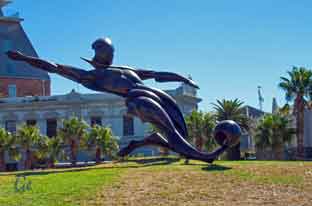
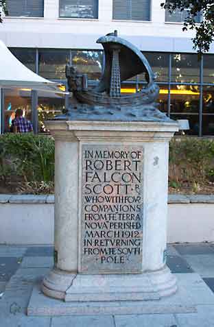 Monument to Robert Falcon Scott |
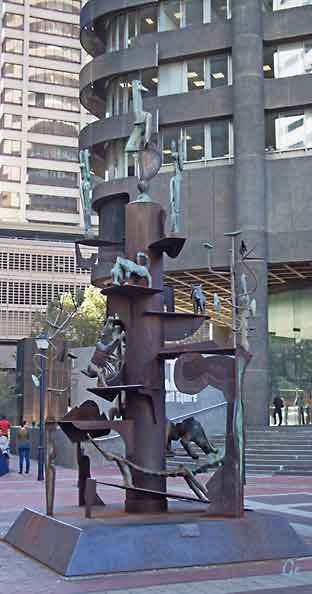
A celebration of diversity
Sculptured by: John Skotnes
 |
A story of joy, pain, tears, laughter, disappointment, fear, hope – and all the that characterize us as a nation. Opened in1679, the Castle is the oldest surviving building in South Africa and has been the centre of civilian, political and military life at the Cape and the nation since. https://castleofgoodhope.co.za/ (20.8.2019)
|
Captain Robert Falcon Scott, CVO, RN (6 June 1868 – c. 29 March 1912) was a
British Royal Navy officer and explorer who led two expeditions to the Antarctic
regions: the Discovery Expedition, 1901–04, and the ill-fated Terra Nova
Expedition, 1910–13.
(Wikipedia)
Transcription of inscription in V-cut letters on polished granite on front face of Memorial:
"HAD WE LIVED, I SHOULD HAVE HAD A TALE TO TELL OF THE HARDIHOOD, ENDURANCE, AND COURAGE OF MY COMPANIONS WHICH WOULD HAVE STIRRED THE HEART OF EVERY ENGLISHMAN. THESE ROUGH NOTES AND OUR DEAD BODIES MUST TELL THE TALE." SCOTT'S DIARY
Transcription of engraved rectangular bronze plaques on side of Memorial:English:
REPLICA
OF THE MEMORIAL UNVEILED NEAR
THIS SPOT ON 15TH MAY 1916
THE ORIGINAL MADE OF ELANDS RIVER STONE
WAS IRREPARABLY DAMAGED IN JUNE 1948
http://www.artefacts.co.za/main/Buildings/bldgframes.php?bldgid=6747
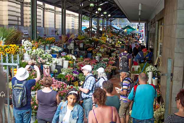
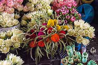
Blomstermarkedet i Cape Town
The Adderley Street Flower Market
Nestled in the heart of Cape Town, the Adderley Street Flower Market is a
vibrant and captivating destination for flower enthusiasts, locals, and
visitors alike. With its intoxicating scents, vivid colours, and bustling
atmosphere, this iconic market has been a cherished part of the city’s
landscape for decades. We will be exploring the Adderley Street Flower
Market, its history, the variety of flowers available, and the unique
experiences it offers to those who wander its city’s deep fragrant aisles.
Adderley Street Flower Market - Cape Tourism (23. november 2024)
 |
 Fra vm i fotball? |
Representations of the protea have become synonymous with South Africa, but
today these beauties are available all over the world. Here are ten facts to know
about this large genus of flowering plants.
Dating back approximately 300 million years, proteas are considered to be
among the oldest families of flowering plants on the planet.
Because of this, it is believed that the protea genus originated on the
super-continent Gondwana. When the continent eventually split, proteas were
spread across different continents and countries including Australia, New Zealand and South America.
The father of taxonomy and botanist, Swedish-born Carl Linnaeus, gave the protea (proteaceae) its name in 1735.
Proteas are named after Proteus, son of Poseidon and shape-shifter, highlighting
the variety of plants found within the large proteaceae family.
https://theculturetrip.com/africa/south-africa/articles/10-fascinating-facts-
to-know-about-the-protea-south-africas-national-flower/
(20.8.2019)
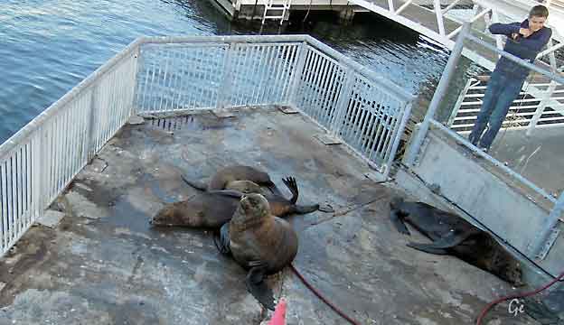
Selene har funnet seg en friplass midt i havna,
til glede for turister med kamera.
The seals of South Africa : Seals belong to the order Pinnipedia of which
there are 33 species worldwide. These fall into two categories.
Fur seals – Otariidae – or sea lions, have external ears and hind limbs
that can be rotated forward to allow them to walk and climb on land.
True seals – Phocidae – have hind limbs that cannot be rotated forward
and have no external ears. Only one species, the cape fur seal is
resident in South Africa. Other species occasionally occur as vagrants.
http://www.oceansafrica.com/seals-of-south-africa/
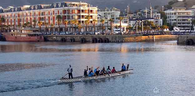
Over: kapproingstrening
Til venstre: et yndet fotopunkt, det var kø for å slippe til.
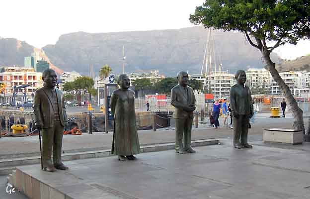
De 4 fredsprisvinnere fra Sør-Afrika.
Winners of Nobel Prizes resident in South Africa
The Nobel Peace Prize:
Albert Luthuli, 1960
Desmond Tutu, 1984
FW de Klerk, 1993
Nelson Mandela, 1993
The Nobel Prize in Chemistry:
Aaron Klug, 1982
The Nobel Prize in Literature:
Nadine Gordimer, 1991
JM Coetzee, 2003
The Nobel Prize in Physiology or medicine:
Max Theiler, 1951
Alan M. Cormack, 1979
Sydney Brenner, 2002
Nobel Prizes and South African Laureates | South African History Online (sahistory.org.za)
(22. februar 2022)
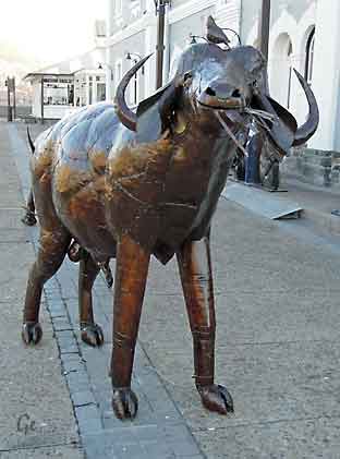 |
 Bøttekunst i Waterfront |
En bra middag på en pen og rolig restaurant med navnet Karibu
Kanalbruen, ble svingt til side når båter skulle passere
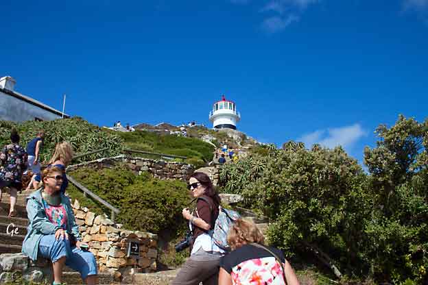
Busstur til Shipwrecktrail, Kapp det Gode håp,
Cape Point og Simonstown
Før vi startet bussturen fikk vi møte Christo Brand på hotellet vi bodde.
Han hadde vært fangevokter for Nelson Mandela.
Christo Brand hadde skrevet en bok om tiden med Mandela:
"Doing Life with Mandela".
Han hadde selvfølgelig med boka, og han fikk solgt en del eksemplarer.
which had created apartheid to persecute black people and claim superiority
for whites. Nelson Mandela, also raised in a rural village, was the black son of
a tribal chief. He trained as a lawyer to take up the fight against apartheid on
behalf of a whole nation. Their opposing worlds collided when Christo, a raw
recruit from the country's prison service, was sent to Robben Island to guard
the notoriously dangerous terrorists there. Mandela was their undisputed
leader. The two of them, a boy of 18 and a long-suffering freedom fighter
then aged 60, could well have become bitter enemies. Instead, they formed
an extraordinary friendship through small human kindnesses.
https://www.amazon.com/Mandela-My-Prisoner-Friend/dp/1782197435
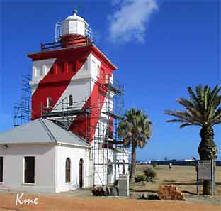 |
 The Green Point Lighthouse was first lit on 12 April 1824. It was the first solid lighthouse structure on the South African coast and is the oldest operational lighthouse in the country. |
Building commenced in 1821 and was completed in 1823.
In 1865 the building was extended to its present height.
Many locals mistakenly refer to the Green Point lighthouse as the Mouille Point lighthouse. There was indeed a Mouille Point lighthouse, built in 1842, but it
was dismantled sometime in the 1920's.The Green point lighthouse is a national heritage site and is open to the public for a fee.
https://www.cape-town-heritage.co.za/heritage-site/green-point-lighthouse.html (20.8.2019)
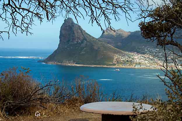
Chapmans Peak

Chapmans Peak Drive synes så vidt i fjellsida.
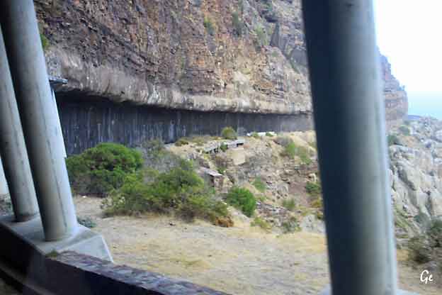
Denne snirkleveien, omtrent hugget ut i fjellsiden, knapt nok bred nok
for sykkel, og med meget løst og oppsprukket fjell over.
Ligger på 5 på topp over mine farligste bussturer
Chapman's Peak Drive
Chapman’s Peak Drive on the Atlantic Coast between Hout Bay and Noordhoek
in the Cape Peninsula is one of the most spectacular marine drives in the
world.
Chapman’s Peak Drive is affectionately known as “Chappies” and is a must for
anyone who is passionate about the majestic scenery of Cape Town.
skirts Chapman's Peak, the 593m high southerly extension of Constantia Berg,
and follows the rocky coastline to unfold breathtaking views in both directions.
The route starts at the picturesque fishing harbour of Hout Bay and the climb
winds steeply up to Chapman's Point, revealing breathtaking views of the sandy
bays down below, until the road reaches lower levels again at Noordhoek.
https://www.chapmanspeakdrive.co.za/the-drive.html (20.8.2019)
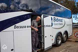 Karl Martin i døra på bussen Baboons are primates comprising the genus Papio, one of the 23 genera of Old World monkeys. There are six species of baboon: the hamadryas baboon, the Guinea baboon, the olive baboon, the yellow baboon, the Kinda baboon and the chacma baboon. Each species is native to one of six areas of Africa and the hamadryas baboon is also native to part of the Arabian Peninsula. |
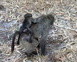 Baboons are among the largest non-hominoid primates and have existed for at least two million years. Baboons are diurnal and terrestrial, but sleep in trees, or on high cliffs or rocks at night, away from predators. They are found in open savannas and woodlands across Africa. They are omnivorous: common sources of food are grasses, seeds, roots, leaves, bark, various fruits, insects, fish, shellfish, rodents, birds, vervet monkeys and small antelopes. Baboon - Wikipedia (22. februar 2022) |
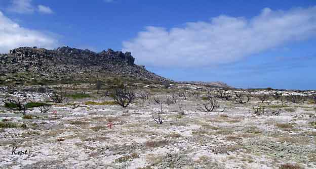
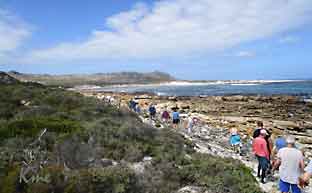
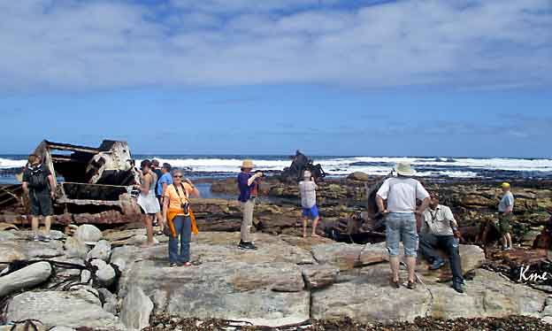
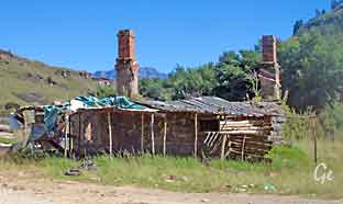
Et øde og kjedelig område, minnet mye om det ut mot kysten på Sunnmøre
 |
 |
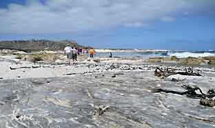 |
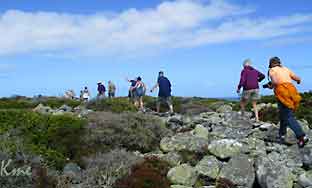
Vi gikk og
gikk. Både over steiner og langs fine strender. En fin tur, men vi skulle ha hatt litt bedre tid. |
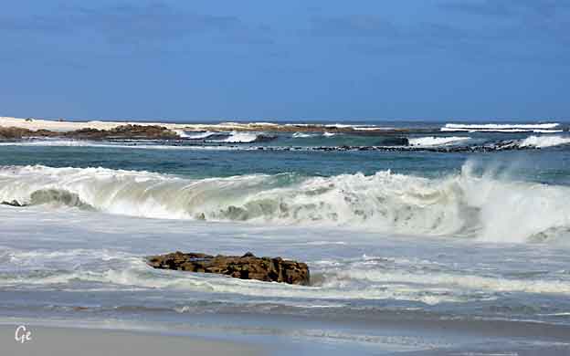
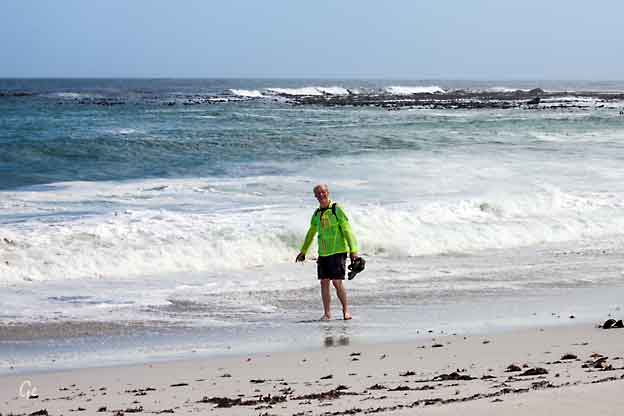
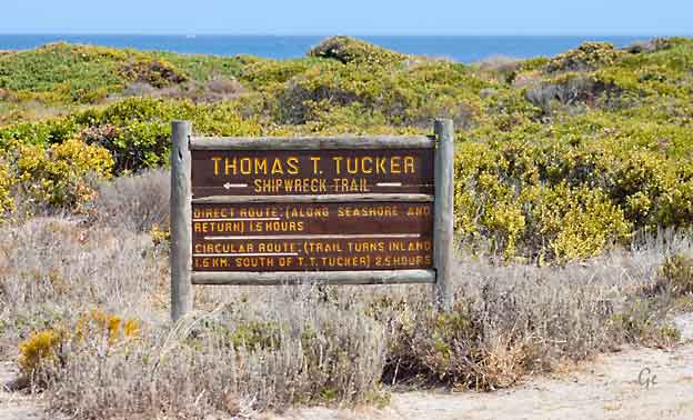
Jada, bølgen rakk opp i buksen, lærer aldri
Shipbuilding Corporation for service as a troop & weapons carrier.
Liberty ships were named after prominent (deceased) Americans, starting with
Patrick Henry and the signers of the Declaration of Independence.
She was named after Thomas Tudor Tucker, an American physician and politician
from Charleston, South Carolina.
She ran aground off Oliphantsbos Point, near Cape Point, on November 27, 1942
during heavy fog while on her maiden voyage from New Orleans to Suez.
German U-Boats actively patrolled the South African coast during
World War II.
This resulted in the Thomas T. Tucker sailing close to the coast when the sea was
rough. The captain misjudged the ship´s location because of the heavy fog,
assuming they were close to Robben Island. Thinking they were not far from Cape
Town, her crew relaxed and later the she ran aground. After an investigation it was discovered that the ship´s compass was out by 37°, although no conclusive reason
was found for the incident.
http://www.wrecksite.eu/wreck.aspx?136681
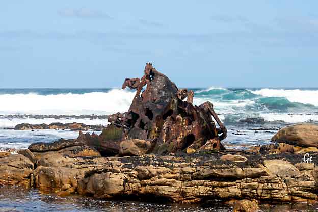
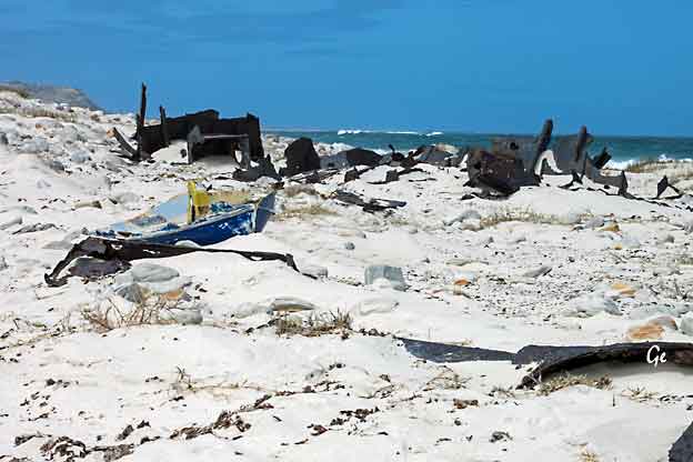
 (20.8.2019) |
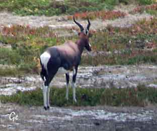
The Bontebok is a medium-sized, generally dark brown antelope with a prominent, wide white blaze on its face, with a pure white rump, belly and hocks, and black-tipped tail. Both sexes have horns, although the horns of rams are heavier and longer than those of ewes. http://www.krugerpark.co. za/africa_bontebok.html |
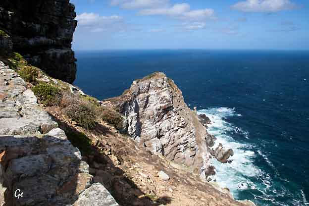
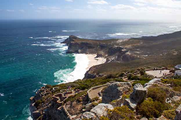
The Cape of Good Hope (Afrikaans: Kaap die Goeie Hoop
[ˌkɑːp di ˌχujə ˈɦʊəp], Dutch: Kaap de Goede Hoop [ˌkaːb də ˌɣudə ˈɦoːp]
Portuguese: Cabo da Boa Esperança [ˈkabu dɐ ˈboɐ ʃpɨˈɾɐ̃sɐ]) is a rocky
headland on the Atlantic coast of the Cape Peninsula, South Africa.
There is a common misconception that the Cape of Good Hope is the southern
tip of Africa, a misconception developed prior to contemporary scientific
knowledge that was based on the belief that the Cape was the dividing point
between that the Atlantic and Indian Oceans. In fact, the southernmost point
of Africa is Cape Agulhas, about 150 kilometres (90 mi) to the east-southeast.
point that fluctuates between Cape Agulhas and Cape Point (about 1.2 kilometres (0.75 mi) east of the Cape of Good Hope).
When following
the western side of the African coastline from the
equator, however, the Cape of Good Hope marks the
point where a ship begins to travel
more eastward than southward. Thus, the first modern
rounding of the cape in 1488
by Portuguese explorer Bartolomeu
Dias was a milestone in the
attempts by the Portuguese to establish direct trade
relations with the Far
East (although Herodotus mentioned a
claim that the Phoenicians had done so
far earlier). Dias called the cape Cabo das
Tormentas ("Cape of
Storms"; Dutch: Stormkaap), which was the
original name of the "Cape of Good Hope".
It was later renamed by John II of
Portugal as "Cape of Good Hope" (Cabo da Boa
Esperança) because of the great optimism engendered by
the opening of a
sea route to India and the East.
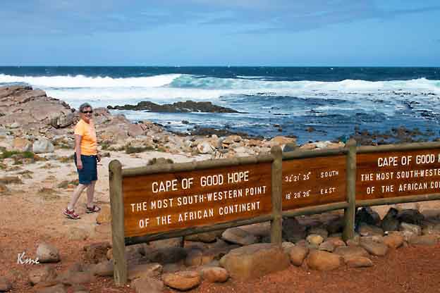
Grete på fotopunktet på Kapp det Gode Håp
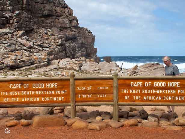
Karl Martin samme sted.
The Cape of Good Hope is at the southern tip of the Cape Peninsula, about 2.3 kilometres (1.4 mi) west and a little south of Cape Point on the south-east
corner.
Cape Town is about 50 kilometres to the north of the Cape, in Table Bay at the
north end of the peninsula.
The peninsula forms the western boundary of False Bay. Geologically, the rocks
found at the two capes, and indeed over much of the peninsula, are part of the
Cape Supergroup, and are formed of the same type of sandstones as Table Mountain itself. Both the Cape of Good Hope and Cape Point offer spectacular
scenery; the whole of the southernmost portion of the Cape Peninsula is a wild, rugged, scenic and generally unspoiled national park.
The
term the Cape has also been used in a
wider sense, to indicate the area of
the European colony centred on Cape Town, and the
later South African
province. Since 1994, it has been broken up into three smaller provinces: the
Western Cape, Eastern
Cape and Northern Cape; parts of the
province were
also absorbed into the North West.
- Legends
- Adamastor is a
Greek-type mythological character invented by the
Portuguese
- poet Luís de Camões in
his epic poem Os Lusíadas (first printed
in 1572), as a
- symbol of the forces of nature
Portuguese navigators had to overcome during
- their discoveries and more
specifically of the dangers Portuguese sailors
faced
- when trying to round the Cape of Storms.
- The Cape of Good Hope is the
legendary home of The Flying Dutchman.
- Crewed by tormented and
damned ghostly sailors, it is doomed forever to
- beat its way through the adjacent
waters without ever succeeding in
- rounding the headland.
https://en.wikipedia.org/wiki/Cape_of_Good_Hope
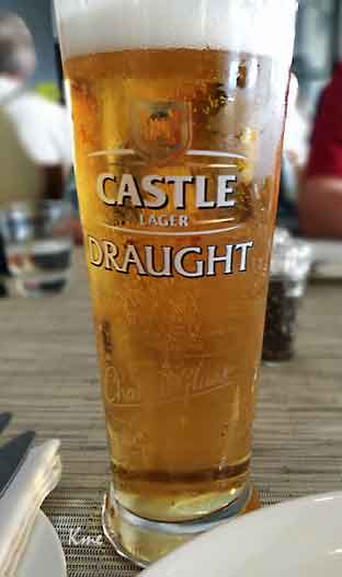 |
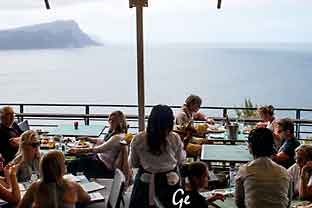 Over: Bra øl, elendig mat, men ligger man bra plassert er det greit, det er neppe noen som kommer flere ganger Til høyre: fin spasertur opp til fyret |
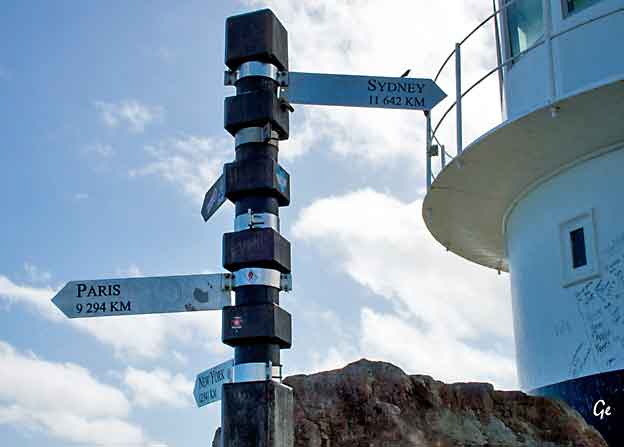
Sydpolen i det fjerne
the Cape Peninsula, a mountainous and scenic landform that runs north-south
for about thirty kilometres at the extreme southwestern tip of the African
continent in South Africa. Table Mountain and the city of Cape Town are close
to the northern extremity of the same peninsula. The cape is located at 34°21′26″S 18°29′51″ECoordinates: 34°21′26″S 18°29′51″E, about
 34°21′26″S 18°29′51″E,
about
34°21′26″S 18°29′51″E,
about 2.3 kilometres (1.4 mi) east and a little north of the Cape of Good Hope on the southwest corner. Although these two rocky capes are very well known, neither
cape is actually the southernmost point of the mainland of Africa; that is Cape Agulhas, approximately 150 kilometres (93 mi) to the east-southeast.
(22. februar 2022) Cape Point - Wikipedia
Flying Dutchman funicular saves visitors an uphill walk from the car park to
see the old lighthouse and enjoy the panoramic views.
The Flying Dutchman Funicular, also known as the Cape Point Funicular, is a
funicular railway located at Cape Point. It is believed to be the only commercial
funicular of its type in Africa, and takes its name from the local legend of the
Flying Dutchman ghost ship.
The line runs from a lower station at the Cape Point car park, up an incline
through dense fynbos to the upper lighthouse. The funicular leaves from the
lower station every three minutes, comfortably accommodates 40 passengers
per car, and can transport 450 persons to the upper lighthouse per hour,
making it the ideal way to whisk closer to the lighthouse even during peak times.
Facilities - Cape Point (20.10.2023)
Det blåser på Cape Point, selv om dette vel ble regnet som en fin og rolig dag.
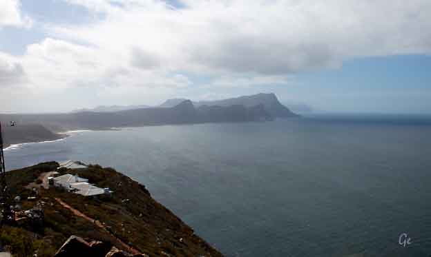
| False
Bay, dit mange skip ble "lurt" inn fordi skipperen trodde de hadde rundet Afrika. Pga av den fremherskende vind og strømretningen går det fort å seile inn, men det tok ofte ukevis å komme ut igjen. |
 |
The new lighthouse is at a lower elevation (87 meters; 285.5 feet above sea level),
for two reasons: the old lighthouse, located at 34°21′12″S 18°29′25.2″E
(262 meters; 859.6 feet above sea level), could be seen 'too early' by ships rounding
the point towards the east, causing them to approach too closely. Secondly, foggy conditions often prevail at the higher levels, making the older lighthouse invisible
to shipping. On 18 April 1911, the Portuguese liner Lusitania was wrecked just
south of Cape Point at 34°23′22″S 18°29′23″E on Bellows Rock for precisely this reason, prompting the relocation of the lighthouse.
The new lighthouse, located at 34°21′26″S 18°29′49″E, cannot be seen from the
West until ships are at a safe distance to the South. The light of the new Cape Point lighthouse is the most powerful on the South African coast, with a range of 63 kilometres (39 mi; 34 nmi) and an intensity of 10 megacandelas in each flash.
Cape Point - Wikipedia (22. februar 2022)
lavere høyde (nærmere havet), kun 87 moh, av to grunner. For det første
kunne det gamle fyrtårnet sees «for tidlig» av skip som rundet av mot øst,
noe som førte til at de kom for nær land. For det andre er tåkeforholdene
verre i større høyder, noe som gjør det gamle fyrtårnet usynlig for skipstrafikk.
Det gamle fyret var synlig bare i om lag 900 timer i året. Den 18. april 1911
forliste det portugisiske skipet «Lusitania» – med over 700 mennesker
ombord – på Bellows Rock like sør for Cape Point nettopp på grunn av at
fyret ikke var synlig, noe som viste at flytting av fyrtårnet var nødvendig.
Forøvrig må dette skipet ikke forveksles med RMS «Lusitania», som ble senket
av en tysk ubåt i 1915.


Det nye fyret kan ikke sees fra vest før skipene
er på trygg avstand i sør. Lyset i det nye fyret
på Cape Point er det kraftigste på den
sørafrikanske kysten, med en rekkevidde på
63 km og en intensitet på 10 megacandela i
hvert blink.
Cape Point blir ofte feilaktig hevdet å være
stedet hvor den kalde Benguelastrømmen i Atlanterhavet møter den varme
Agulhasstrømmen i Indiahavet. Faktisk ligger møtestedet langs den sørlige og sørvestlige Cape-kysten, vanligvis mellom Cape Agulhas
og Cape Point. De to kolliderende havstrømmene bidrar til å skape mikroklima i Cape Town og
omegn. I motsetning til hva kjent mytologi
hevder lager møtestedet for de strømmene ingen åpenbare visuelle effekter. Det er ingen «linje i havet» der havet endrer farge eller ser
annerledes på noen måte. Det oppstår imidlertid sterke og farlige dønninger, tidevann og strømme ved møtestedet og i tilstøtende farvann. Disse urolige farvannene har forårsaket utallige katastrofer til havs i århundrene siden skipene begynte å seile forbi her.
Det er godt fiske langs kysten, men
de uforutsigbare dønningene gjør fisking fra
svabergene svært farlig. Opp gjennom tiden har mange
fiskere blitt blåst til sine død
fra svabergene av store bølger. False Bay, som
åpner opp i øst og nord for Cape Point,
er stedet for den velkjente marinehavnen i
Simonstown. Bukta er også kjent – eller beryktet –
for sine store hvithaier, som jakter
på sørafrikansk pelsseler som lever i
området. Bukta som ligger øst for Cape Point, False
Bay, holder alltid en høyere vanntemperatur enn den
vestlige sjøsiden.
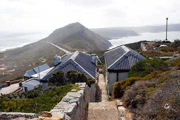
 The Flying Dutchman Funicular |
The Flying
Dutchman Funicular, also known as
the Cape Point Funicular, is
a funicular railway located
at Cape Point, near the Cape of Good
Hope in the Western Cape province
of South Africa. The route that the line follows was originally serviced by a 16-seater Flying Dutchman bus. |
out a call for proposals to replace the bus service in early 1995. The proposal by Concor
to install an electrically powered funicular was accepted as an environmentally friendly and novel means of transport. It was the first commercial funicular railway of its kind in Africa, and was produced entirely using South African resources. The diesel bus ran the route for the last time in December 1996, after which time the funicular replaced it. The funicular cars were refurbished in June 2010.
The name of the line comes from the legend of the Flying Dutchman ghost ship.
Flying Dutchman Funicular - Wikipedia (16. januar 2023)
 |
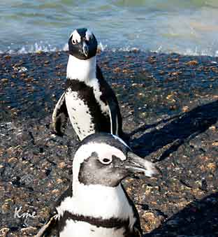
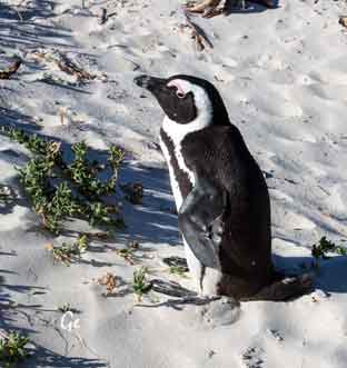 |
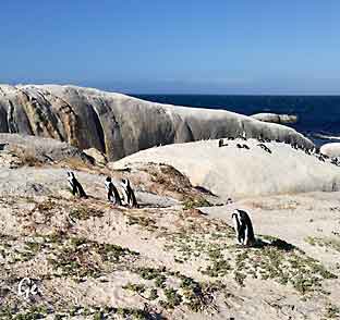
Simon's Town is a maritime naval town and home to the
African Penguin colony at Boulders Beach.
http://www.capepointroute.co.za/seeit-simonstown.php
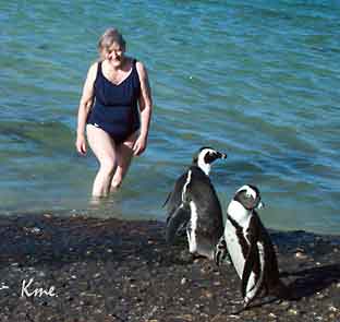 Grete bader med pingvinene på stranda i Simons Town |
 |
where you can view these flightless birds at close range. For a more intimate
experience, head to Boulders Beach where you can swim with the Penguins!
http://www.capepointroute.co.za/seeit-simonstown.php
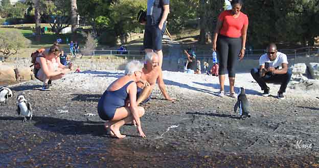
Do something really unique and swim with Penguins - there is only one place
in the world where this is possible! Boulders Beach in the Table Mountain
National Park, South Africa is the place to go. No visit to Cape Town is
complete without a chance to meet this famous colony of African Penguins.
Cape Town - Meet the Boulders Beach Penguins in Simon's Town (23. november 2024)
The African penguin is only found on the southwestern coast of Africa, living
in colonies on 24 islands between Namibia and Algoa Bay, near Port Elizabeth,
South Africa. It is the only penguin species that breeds in Africa and its presence
gave name to the Penguin Islands.
Two colonies were established by penguins in the 1980s on the mainland near
Cape Town, namely Boulders Beach near Simon's Town and Stony Point in
Betty's Bay. Mainland colonies likely became possible only in recent times due to
the reduction of predator numbers, although the Betty's Bay colony has been
attacked by leopards. The only other mainland colony is in Namibia, but it is not
known when it was established.
African penguin - Wikipedia (23. november 2024)
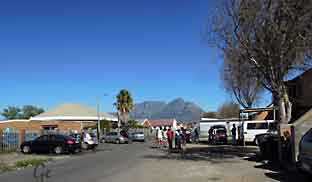
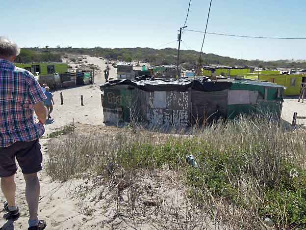
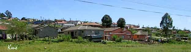
Fra dagsprogrammet:
Vi besøker townshipene Langa og Khayelitsha.
Vi har lunsj her hos en av damene som har startet egen bedrift.
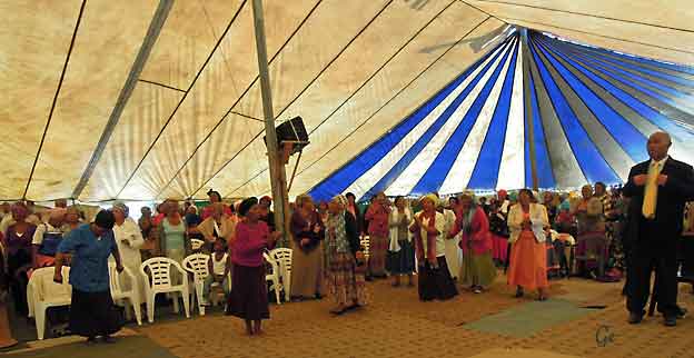
Det er søndag og vi blir med på en spennende gudstjeneste med
mye glede, gladsang og fengende rytmer.
Afrikanerne er gode på sang og dans, så kanskje vi
stive nordmenn også lar oss rive med??
Townshipene i Sør-Afrika ble etablert for å huse svarte, indiske
og fargede.
Disse bydelene var oftest plassert et godt stykke utenfor byene,
som var reservert bare for hvite. Gjerne i nærheten av
farmområder og industriområder, da innbyggerne ble brukt
som billig arbeidskraft.
I dag fungerer disse bydelene mer eller mindre som selvstendige
byer med både skoler, helsestasjoner, kafeer og restauranter,
butikker og mange andre servicebedrifter.
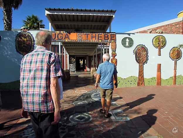
Guga Sthebe Arts & Cultural Centre
 Guga S’thebe Arts & Culture Centre is a must-visit while in Langa. Housed in a brightly coloured building, the centre, like many of the businesses in Langa, is dedicated to the empowerment of the local people. The centre has exhibition areas, where there are regular exhibitions, art studios and a resource centre.The name Guga S’thebe is appropriate and has a rich cultural meaning. It is derived from the name of the traditional Xhosa platter known as isithebe that is used to serve guests and family members. The word signifies a meeting place and ubuntu because during meal times |
 Guga Sthebe Arts & Cultural Centre people sit around the isithebe to share a meal. Fittingly, the precinct is a shared public space where communities can come together and share a meal or their stories. https://www.capetown.travel/travel-like-a-local-your-neighbourhood-guide-to-langa/ (20.8.2019) |
Location Act were expanded to create a more formal structure for
African Urban administration.
In 1923 the Urban Areas Act was passed to enforce the compulsory residence
of Africans in locations. Following the removal of Black people from Ndabeni
location, near Maitland, in the late 1920s, the authorities
established Langa location outside Cape Town. Although the name Langa
means Sun, the name is actually derived from the name of the Xhosa
chief Langalibalele, who was imprisoned on Robben Island in 1873 for
rebelling against the Natal government.
https://www.sahistory.org.za/place/langa-township (20.8.2019)
Guga Sthebe Arts & Cultural Centre
 |
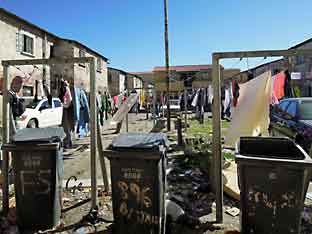 |
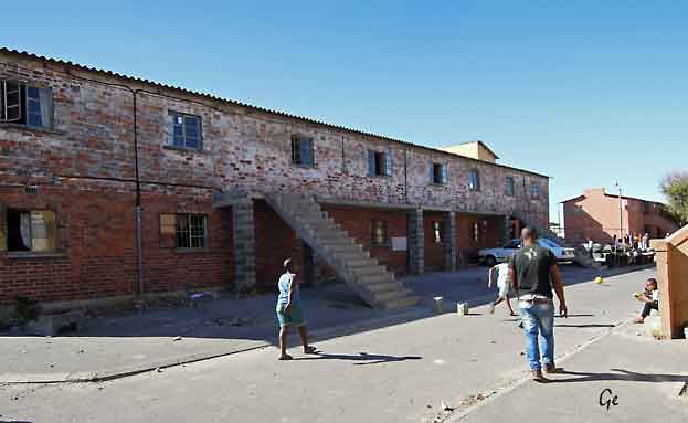
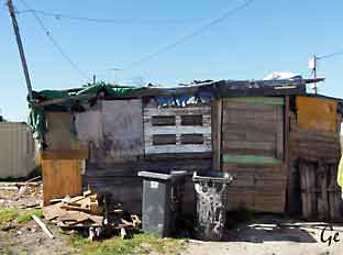
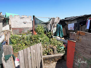
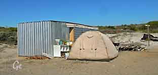
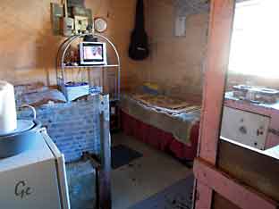 Soverom for 1 familie |
 En "finere" del av Langa |
De heldigste har eget soverom for familien,
men noen må ligge i det felles oppholdsrommet.
Familiene har ett felles kjøkken,
men det lages tydeligvis mat på soverommene også.
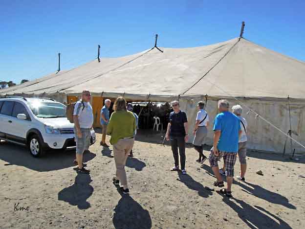
Det store teltet er kirken hvor vi skulle overvære søndagens gudstjeneste.
Khayelitsha /ˌkaɪ.əˈliːtʃə/ is a partially informal township in Western Cape,
South Africa, located on the Cape Flats in the City of Cape Town. The name is Xhosa for New Home.
It is reputed to be the largest and fastest growing township in South Africa.
https://en.wikipedia.org/wiki/Khayelitsha
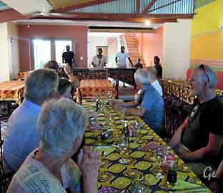 |
Vi spiste
lunsj på Lelapa i Langa. God mat og mye musikk. Etterpå på Karl Martin og Grete med hjelpearbeideren Marco og reiselederen til et mindre township der Marco drev hjelpearbeid |
Lelapa, which means ‘the home’ was established in October 1999 in Langa,
Cape Town’s oldest township (or informal settlement), when Sheila and
Monica Mahloane (mother and daughter) converted our home in order
to seize an entrepreneurial opportunity. We saw all the tourists’ buses
driving past our township on the way to the winelands and our idea was
to create a restaurant serving tradition township cuisine and invite guests
to experience a bit of township life.
http://www.lelapa.co.za/
 |
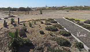 Grønnsakhager |
“Education is the strongest weapon to change the world” were the powerful
words of Nelson Mandela.
We fully agree and believe that education is a big factor in order to see
a new generation grow up i 7de Laan. But we cannot shoulder this huge
responsibility on our own – a network of partners and friends has developed
over the years.
Amongst those is the Freundeskreis Wakkerstroom e.V that we shared more
about in September 2016. The German NGO supports children and youth in
South Africa in their academic journey. Through their personal connection
with our staff Marco and Justine a partnership developed with HOSA too.
http://ho-sa.org/
 Skolen (ikke huset på bildet) hadde godt utstyr som måtte beskyttes. |
 |
for barn med forskjellige utviklingshemminger. Dette ble drevet av Marco og stab.
Dette stedet drives humanitært, og det ser ut til at de gjør en hederlig jobb
 |
At the time of its adoption,
the South African flag was the only national flag in the world to comprise six colours in its primary design. Three of the colours – black, green and yellow – are found in the banners of the African National Congress, the Pan Africanist Congress and the Inkatha |
The other three – red, white and blue – are displayed on the Dutch tricolour and
the British Union flag and are said represent the country's white population.
The green pall (the Y-shape) is commonly interpreted to mean the unification of
the various ethnic groups and the moving forward into a new united South Africa.
The design
therefore represents a converging of paths, the
merging of both the
past and the present.
Et penere strøk i Cape Town.
Durban, Umhlanga
Fra dagsprogrammet:
Etter frokost blir vi kjørt til Cape Town flyplass og flyr
nordøstover til Durban.
Fra flyplassem er det bare ca 20 minutter å kjøre til hotellet
som ligger i tettstedet Umhlanga Rocks, litt nord for Durban.
Hotellet ligger rett ved det store kjøpesenteret Gateway og
kort vei fra stranden.
Ettermiddagen kan brukes som du selv vil.
Om mange nok er interessert så hentes vi på hotellet og
tas med på en runde i Durban.
Overnatting City Lodge Umhlanga
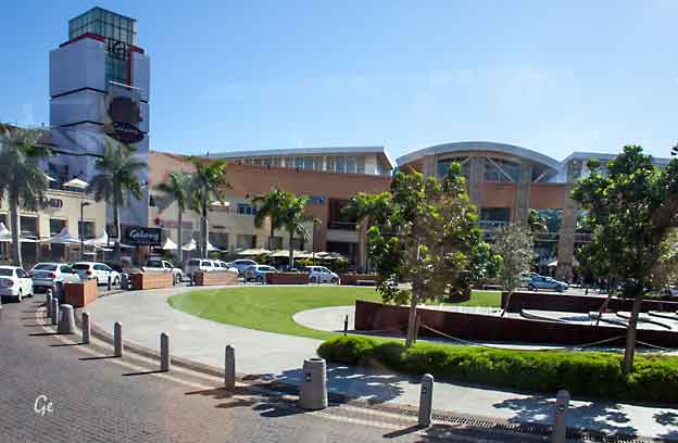
Bildet er tatt utenfor hotellet vårt i Umhlanga mot det store kjøpesenteret.
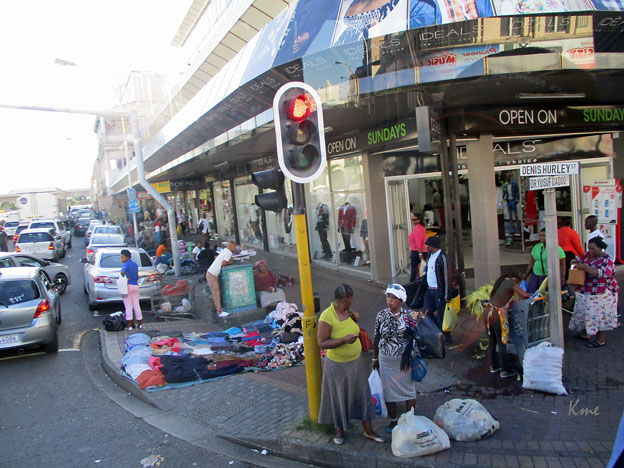
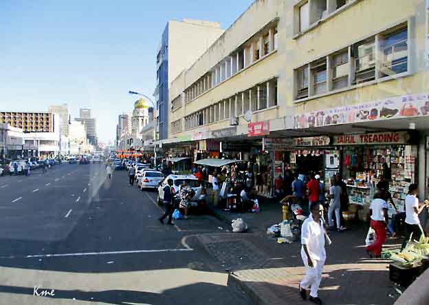
Gatebilde fra Durban
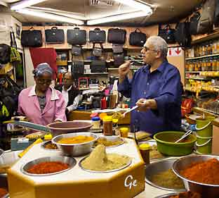
 Guiden har nok en viss kontakt med denne krydderselgeren, som for øvrig har et sjeldent selgertalent. |
 |
 |
 |
Du får mange slags krydder i Durban
Grete utenfor det store markedet
 |
 Ikke bare på Voss du får smalahove |
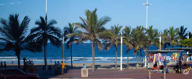
Fine strender, men vi rakk ikke å prøve dem.
 Beverly Hills hotel, Umhlanga |
 Fuglereder |
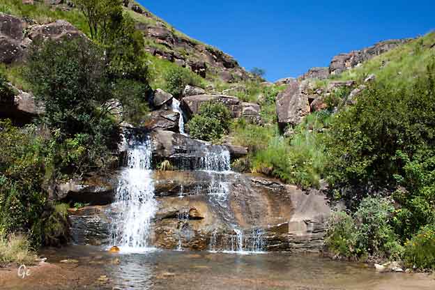
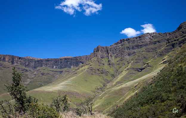
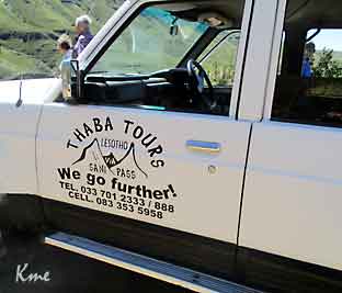
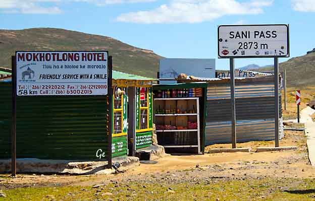
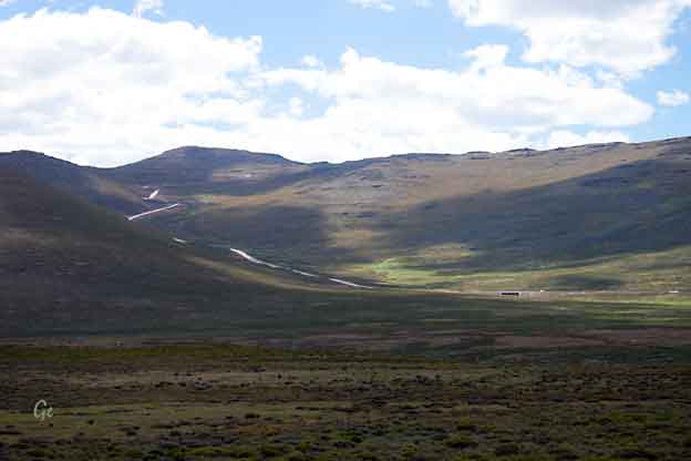
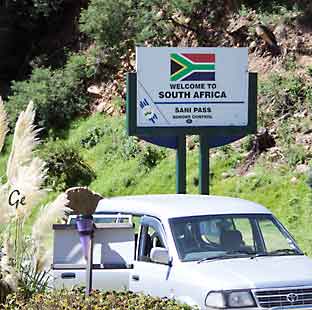
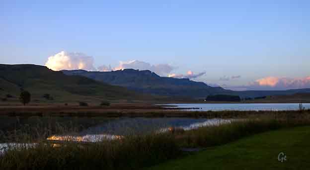
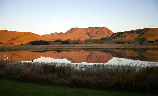
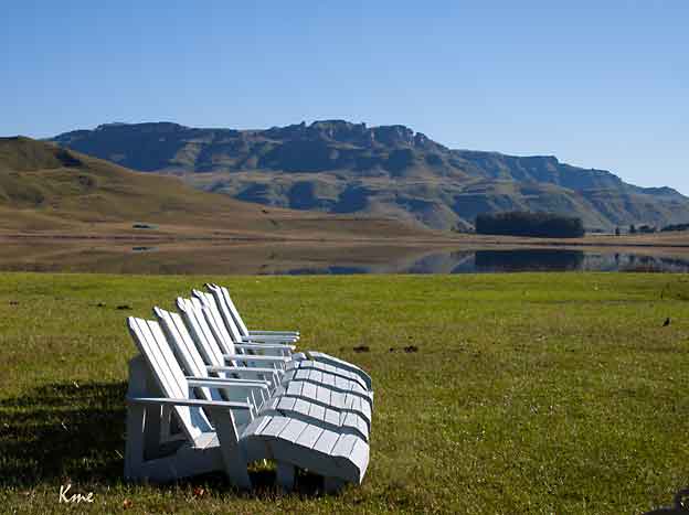
Sani Pass, Lesotho og Sani Valley, KwaZulu Natal,
Fra dagsprogrammet:
Turen fortsetter til Drakenberg, den høyeste fjellkjeden som går
gjennom hele Sør-Afrika. Her i KwaZulu-Natal, på grensen til fjellandet
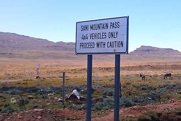
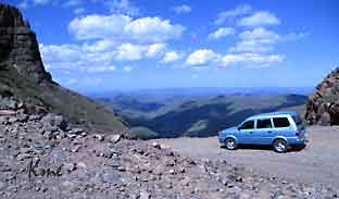
Lesotho, er fjellene i Sani passet oppe i en høyde av hele 3400 m.
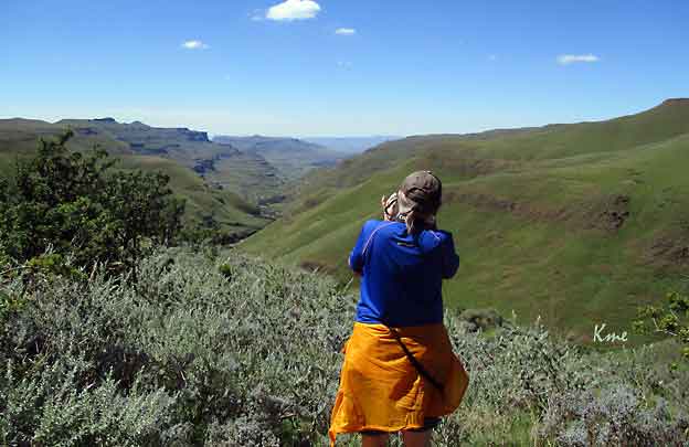
I dag skal vi kjøre opp gjennom
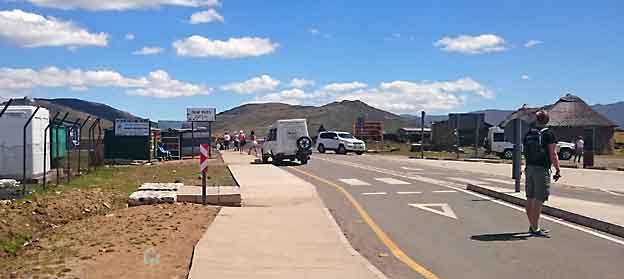
passet og inn i fjellandet Lesotho. Husk pass!
Når vi er framme ved foten av fjellovergangen, bytter vi over
til firehjulstrekkere.
Og går gjennom passkontrollen til Sør-Afrika.
Herfra snirkler vi oss opp hårnålssvingene til vi når 2873 m høyde.
Her oppe på toppen av "Afrikas tak" går vi gjennom passkontrollen
til Lesotho.
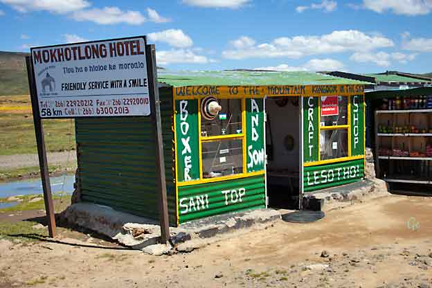
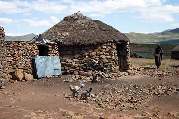
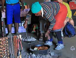
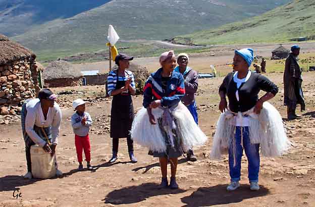
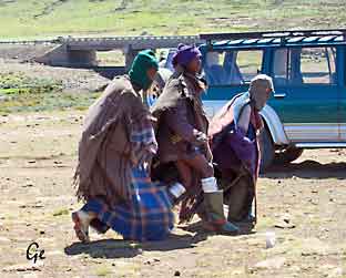
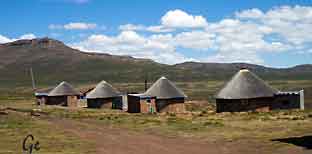
Vi fortsetter noen kilometer innover i Lesotho hvor vi besøker en lokal
Basotho landsby. Her viser de lokale innbyggerne sine tradisjoner,
de er bl.a. kjent for sine spesielle gresshatter, Basothohattene.
Vi bor på Sani Valley Lodge.
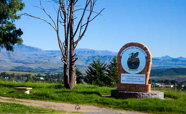
Kwasani Municipality
 |
 En rask stopp i Himeville |
The Zulu Kingdom, or the Province of KwaZulu-Natal (KZN) has a devout
following throughout continental Africa. And it is right up there on "must-see,
must- do" lists of discerning travelers around the world.These are all just some
of the reasons why KZN remains a firm leader in the South African tourism
space. The truth is; there IS just no comparison. Nowhere else in the world
will you find such a unique fusion of raw natural beauty, modern
sophistication, cultural diversity and pulsating energy – all in the most
breathtaking natural setting.
https://www.zulu.org.za/(20.8.2019)
| Pent lite
hus langs veien |
 |
The uKhahlamba-Drakensberg Park is a protected area in the KwaZulu-Natal province of South Africa, covering 2,428.13 km2 (938 sq mi), and is part of a world heritage site. The park includes Royal Natal National Park, a provincial park, and covers part of the Drakensberg, an escarpment formation with the highest elevations in southern
Africa.
The park and the adjoining Sehlabathebe National Park in the Kingdom of Lesotho are part of the Maloti-Drakensberg Park, which was first declared a World Heritage Site
on 30 November 2000. It is described by UNESCO as having "exceptional natural beauty
in its soaring basaltic buttresses, incisive dramatic cutbacks, and golden sandstone ramparts... the site’s diversity of habitats protects a high level of endemic and globally threatened species, especially birds and plants... [and it] also contains many caves and rock-shelters with the largest and most concentrated group of paintings in Africa south
of the Sahara". The paintings mentioned are parietal art, some of which may date to 40,000 or 100,000 years ago.
uKhahlamba-Drakensberg Park - Wikipedia (22. februr 2022)
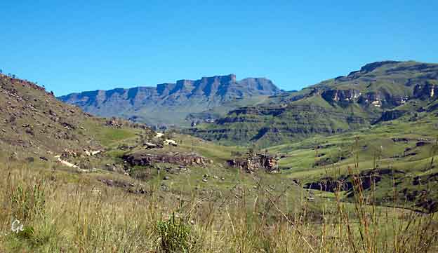
Drakensberg
| Hike the 60km National Hiking
Way in the foothills of the Drakenberg from
Sani Pass to Bushmans Nek. Self guided well marked trail with daily shuttles from the trail head to small hotels and lodges for overnight accommodation. The Giants Cup Hiking Trail is part of the National Hiking Way. The hike follows a well established and clearly marked trail that runs southwards from Sani Pass in the north to Bushmans Nek in the south, the full trail being approximately 60km in length. It falls within the Ukahlamba Wilderness Area (a World Heritage Site) and is administered by KZN Wildlife who provide 5 overnight huts along the route - at Pholela (Cobham valley), Mzimkhulwana, Winterhoek and Swimans (in the Drakensberg Gardens valley) |
 The Giants Cup Trail and at Bushmans Nek. https://www.trails.co.za/tours/drakensberg /slackpacking/giants-cup-trail/ (20.8.2019) |
Hun kjørte heller bil i området.
| Poker? |
 |
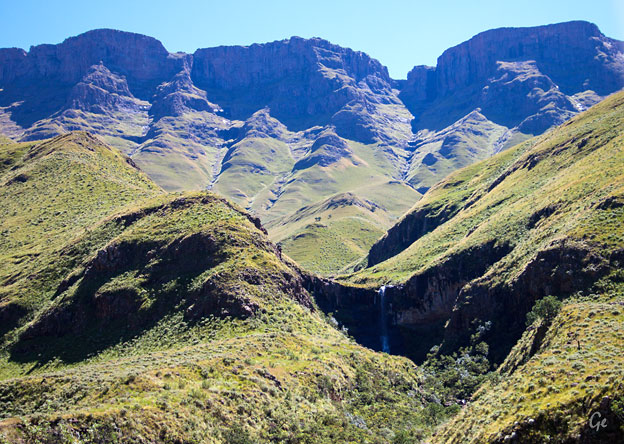
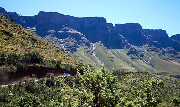
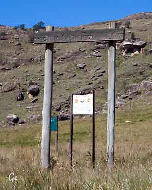
Drakensberg og litt av veien opp mot Sani Pass.
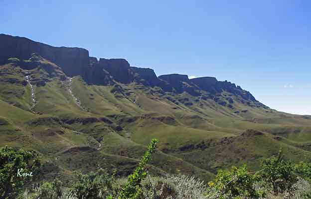
En stopp for å beundre utsikten, og for å fotografere.
Like etter denne pausen begynte hårnålsvingene opp Sani Pass.
 |
 |
in every sense, it out distances, out climbs, and out performs all it's competitors
with consummate ease to have become the most iconic gravel pass in SA.
Situated between KZN and Lesotho the pass was built circa 1950 and remains
a challenging drive in 4x4 vehicles with all the drama, scenery, bad weather
and treacherous conditions expected of a pass with a summit altitude of
2876m ASL.
That equates to 9400 feet and at 10,000 feet aircraft need pressurised cabins!
This is high altitude stuff. Go prepared for bad weather at any time and
expect snowfalls as late as October.
https://mountainpassessouthafrica.co.za/find-a-pass/kwazulu-natal/item/410-sani-pass.html
Heldigvis bare sol og sommer da vi var der.
Over Grete går veien vi skal kjøre.
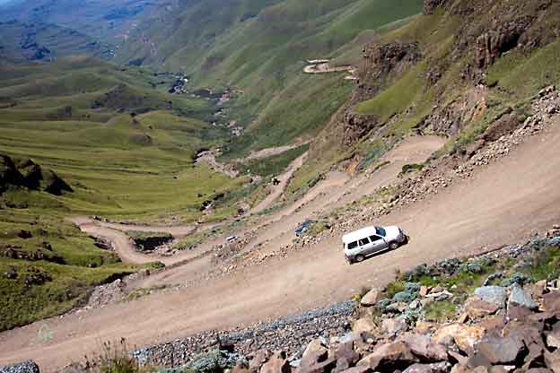
Ganske bratt
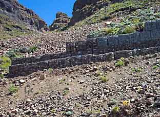 Noe er gjort for å hindre steinras. |
 Bilen vi kjørte i. |
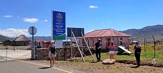
Vi er oppe. Her er grensen til Lesotho.
Vi kjørte ut fra Sør-Afrika før vi begynte på selve passet.
The country’s lowest point of 1,400 metres above sea level is the highest
lowest point of any country in the world. It has relatively very little forest,
covering only one per cent of the land area.
Through the Lesotho Highlands Water Project, Lesotho exports water to
South Africa, which completely surrounds it.
http://thecommonwealth.org/our-member-countries/lesotho
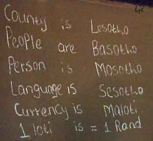
Joined Commonwealth: 1966, Population: 2.074.000 (2013)
GDP: 2,8% p.a. 1990-2013, UN HDI: world ranking 162,
Official language: Sesotho, English, Timezone: GMT plus 2hr,
Currenct: loti, plural maloti (M), Area: 30.355 sq km,
Coastline: none, Capital city: Maseru
|
Lesotho Flag - Colors
meaning & symbolism
Blue stands
for rain and water
White represents
peace
Green symbolizes
prosperity
Mokorotlo (the
traditional Basotho straw hat) represents the
indigenous Basotho (Southern Sotho) people
|
Lesotho adopted its current national flag on October 4th, 2006 which
coincided with the celebrations of the country’s 40th anniversary as an
independent nation.
https://www.worldatlas.com/articles/what-do-the-colors-and-symbols-of-the-flag-of-lesotho-mean.html
(20.8.2019)
The Prime Minister, Moeketsi Majoro, is the head of government and has executive authority. The King of Lesotho, Letsie III, is the head of state and serves a largely ceremonial function; he no longer possesses any executive authority and is
prohibited from actively participating in political initiatives.
The All Basotho Convention (ABC) leads a coalition government in the National
Assembly, the lower house of parliament.
The upper house of parliament, called the Senate, is composed of 22 principal
chiefs whose membership is hereditary, and 11 appointees of the king, acting on
the advice of the prime minister.
The constitution provides for an independent judicial system, made up of the
High Court, the Court of Appeal, Magistrate's Courts, and traditional courts that
exist predominantly in rural areas. All but one of the Justices on the Court of
Appeal are South African jurists. There is no trial by jury; rather, judges make
rulings alone or, in the case of criminal trials, with two other judges as observers.
The constitution also protects basic civil liberties, including freedom of speech,
freedom of association, freedom of the press, freedom of peaceful assembly and
freedom of religion. Lesotho was ranked 12th out of 48 sub-Saharan African
countries in the 2008 Ibrahim Index of African Governance.
Lesotho - Wikipedia (22. febrar 2022)
 |
 |
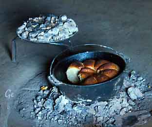
 Vi fikk smake brødet. Det var veldig godt. |
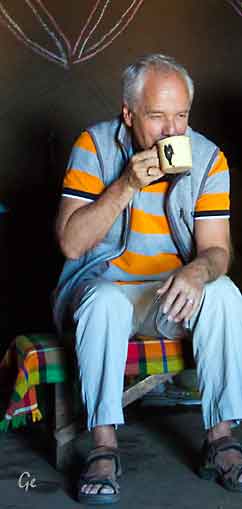 Hjemmelaget øl fikk vi også smake. Den samme koppen ble sendt rundt til alle. |
 |
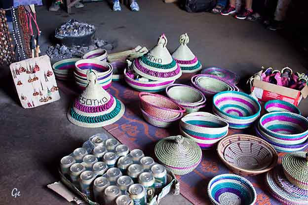
På veggen i huset står det litt om Lesotho. Selvfølgelig kunne vi få kjøpt noen souvenirer, blant annet den spesielle Lesothohatten. |
 |
 Hytter til leie. Vi spiste lunsj på restauranten her. Lasagne med salat. Godt, men ikke spesielt for stedet. |
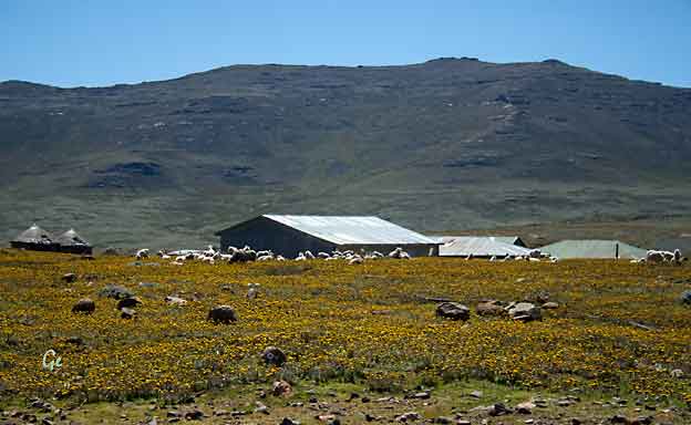
Ganske stusslig og trist område, brunsvidd og nakent.
Husdyrene må gjetes pga av rovdyrfaren, sjakaler og ??
Finnes ikke vegetasjon i området. Vi er på 2873 moh.
Vi er på 2873 moh, men veien fører videre oppover.
Vi skulle ikke høyere, nå ventet nedturen gjennom Sani Pass
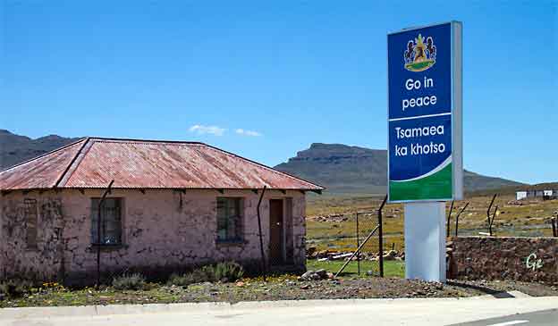
Go in Peace
 På kanten av stupet. Heldigvis hadde vi en god sjåfør. |
 Denne mannen gikk hver dag ned i dalen for å hente ved. |
 Sjåføren vår til høyre. Det var venstretrafikk i alle landene vi besøkte på turen. |
 |
Så er vi tilbake i Sør-Afrika. Ny passkontroll.
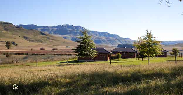
I hyttene på den andre siden av vannet skulle vi overnatte.
Hytta vår. Stor og velutstyrt, og med boblebad på terrassen.
Solnedgang i Sani Valley. Bildet er tatt fra hytta vår.
Nelson Mandela Capture Site og Springbok Lodge, Nambiti Game Reserve
Fra dagsprogrammet:
Det er tid for safari. På vei til Nambiti Game Reserve stopper vi på Mandelas
Capture Site. Her er det et unikt monument og det er så absolutt verdt et
besøk. Det var her Mandela ble tatt til fange 5. august 1962.
Vi spiser lunsj i de vakre omgivelsene.
Vi fortsetter så til Nambiti Game Reserve som er ca 2 timer unna.
En vakker kjøretur som går gjennom sletteområder med Drakensbergene
som bakgrunn. Et virkelig "Afrika landskap" med gress-stepper og
tornetrær.
Nambiti Game Reserve er et vernet område som tilbyr 22 000 mål med
uberørt, malariafri villmark. Reservatet er hjem til "The big five", løve,
leopard, bøffel, elefant og neshorn. Gepard, flodhest og over 30 andre
dyrearter holder også til her.
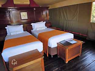
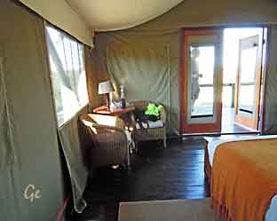
Overnatting på Springbok Lodge.
Lodgen har 15 luksustelt med air-condition, privat veranda og egen
dusj under stjernehimmelen
Og her er det soloppgang, også tatt fra hytta vår.
En fin morgen, 12 grader og strålende vær.
Nesten synd å forlate et så fint sted, men turen går videre.
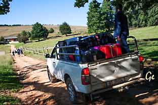
| Det er et
stykke å gå til resepsjonen. Men bagasjen ble hentet i bil, og fraktet til bussen. Bussen var parkert på den andre siden av vannet. For å komme dit måtte vi over i 4-hjulstrekkere. |
 |
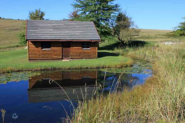
En liten hytte ved resepsjonen
Et bilde tatt fra bussen. Det er alltid et rundt hus sammen
med de vanlige husene.
Der bor bestemor. Det er hun som har kontakt med åndene.
I hus med hjørner er det fare for at åndene går seg fast.
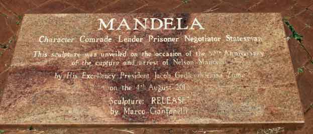
Mr Mandela had been travelling in disguise as the chauffeur of the car he drove, and
was on the R103 road between Durban and Johannesburg. Apartheid police had been hunting Nelson Mandela down for 17 months and, as he passed along this stretch of
road, they were finally able to capture and arrest him. This marked one of the most significant moments in the history of the Apartheid era, as well as the future of this country.
From the time of his incarceration, Nelson Mandela made great strides in awakening
the consciousness of South Africans, and the world, to the inequalities and unfair treatment that was carrying on within the borders of this great land.
https://www.sa-venues.com/attractionskzn/nelson-mandela-capture-site.php (20.8.2019)
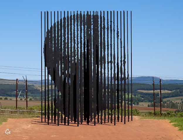
Bare fra den plassen vi står her kan man se portrettet av Mandela.
Står man andre steder ser monumentet ut som på bildet til høyre.
| If
you didn’t already know this former president of South Africa, Nelson Mandela, was arrested on 5 August 1962 when traveling illegally from Durban to Johannesburg where he had met with the then ANC leader Albert Luthuli. Mandela was dressed in disguise as a driver when the police found him, this arrest led to his 27 year incarceration. The spot where this occurred is on the R103 the old main road which is just 5km from Howick. This significant spot in South African history is now home to the breath taking Mandela Capture Monument. |
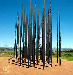 |
50 steel rods in varying lengths (between 5-10 metres in height). When you are
looking at the sculpture from a certain angle the face of Nelson Mandela comes
into focus. Marco Cianfanelli, the artist who created this work, explains that the
vertical rods reflect the prison bars of Mandela’s confinement, but you are able
to walk through these bars and you experience bursts of light in between which
is representative of the political uprising of the country.
Mandela Capture Monument in Howick, KwaZulu Natal (sa-venues.com) (22. feburar 2022)
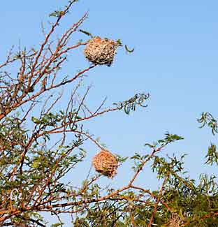 |
Reiret til
veverne henger i trærne. |
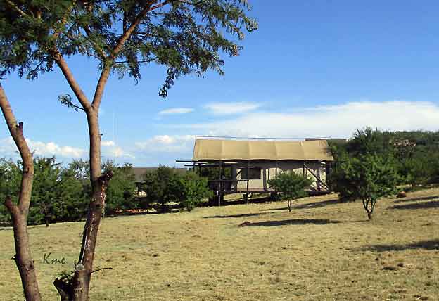
Vi er kommet fram til Nambiti Game Reserve.
Her skal vi bo to netter på Springbok Lodge.
På denne lodgen skal vi bo i "telt".
Naboteltet, akkurat maken til vårt
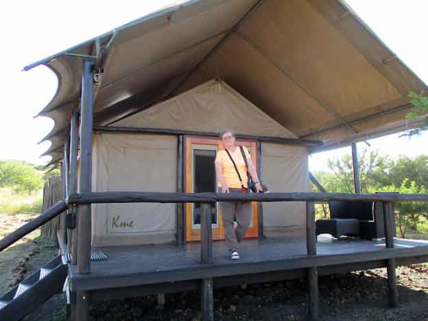
Grete på terrassen.
Vi skal på safari, og blir snart hentet av safaribilen.
  |
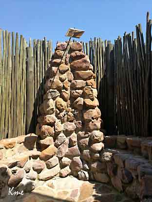 Friluftsdusj, fasjinerende å dusje i mørket, med en flott stjernehimmel som tak. |
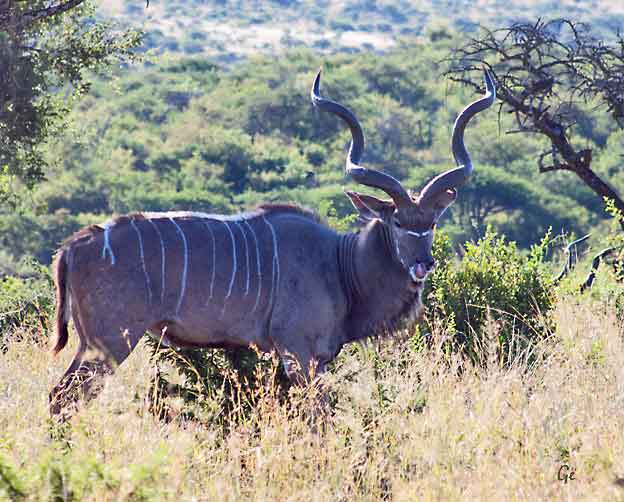
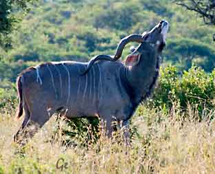
In Africa the Kudu is famous for its fence-jumping abilities.
They can jump a 3 meter fence easily and even 3,5 meters
when doing it under stress.
http://www.africa-wildlife-detective.com/kudu.html
The kudu is the world’s second largest antelope species
(behind the eland), reaching up to 1,2 m at shoulder height
and weighing as much as 270 kg. It is by far one of the
antelopes I admire the most, and always a delight to
watch in the wild!
http://africafreak.com/the-10-most-elegant-antelope-
species-of-the-african-bushveld/
 |
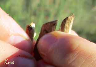 Guiden vår så med en gang hvilket dyr som hadde bitt over disse kvistene. |
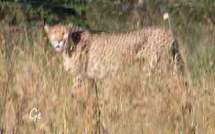 Gepard, litt langt unna til å få fint bilde. Cheetahs are active mainly during the day, with hunting their major activity. Adult males are sociable despite their territoriality, forming groups called "coalitions". Females are not territorial; they may be solitary or live with their offspring in home ranges. Carnivores, cheetah mainly prey upon antelopes and gazelles. They will stalk their prey to within 100–300 metres (330–980 ft), charge towards it and kill it by tripping it during the chase and biting its throat to suffocate it to death. The cheetah's body is specialised for speed; it is the fastest land animal. The speed of a hunting cheetah averages 64 km/h (40 mph) during a sprint; the chase is interspersed with a few short bursts of speed, when the animal can attain 112 km/h (70 mph), although this is disputed by more recent measurements. https://en.wikipedia.org/wiki/Cheetah |
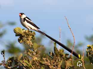 Pin-tailed whydah, dominikanerenke The species is a brood parasite which lays its eggs in the nests of estrildid finches, especially waxbills. Unlike the common cuckoo, it does not destroy the host's eggs. Typically, 2–4 eggs are added to those already present. The eggs of both the host and the firefinch are white, although the whydah's are slightly larger. The nestling whydahs mimic the gape pattern of the fledglings of the host species. https://en.wikipedia.org/wiki/Pin-tailed_whydah |
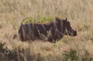 |
The common warthog is a medium-sized species, with a head-and-body length ranging from 0.9 to 1.5 m (3.0 to 4.9 ft), and shoulder height from 63.5 to 85 cm (25.0 to 33.5 in). Females, at 45 to 75 kg (99 to 165 lb), are typically a bit smaller and lighter in weight than males, at 60 to 150 kg |
from the mouth and curving upwards. The lower pair, which is far shorter
than the upper pair, becomes razor-sharp by rubbing against the upper pair
every time the mouth is opened and closed. The upper canine teeth can grow
to 25.5 cm (10.0 in) long and have a wide elliptical cross section, being about
4.5 cm (1.8 in) deep and 2.5 cm (0.98 in) wide. A tusk will curve 90° or more
from the root, and will not lie flat on a table, as it curves somewhat
backwards as it grows. The tusks are used for digging, for combat with
other hogs, and in defense against predators – the lower set can inflict
severe wounds.
https://en.wikipedia.org/wiki/Common_warthog
 bilde fra: https://en.wikipedia. org/wiki/Waterbuck |
Vannbukk, waterbuck The head-and-body length is typically between 177–235 cm (70–93 in) and the average height is between 120 and 136 cm (47 and 54 in). A sexually dimorphic antelope, males are taller as well as heavier than females. Males reach approximately 127 cm (50 in) at the shoulder, while females reach 119 cm (47 in). Males typically weigh 198–262 kg (437–578 lb) and females 161–214 kg (355–472 lb). The coat colour varies from brown to grey. The long, spiral horns, present only on males, curve backward, then forward and are 55–99 cm (22–39 in) long. https://en.wikipedia.org/wiki/Waterbuck |
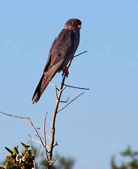 Amurfalk The Amur Falcon is a fascinating migratory raptor. Every year, the small, resilient birds make the daring voyage from breeding grounds in Russia and China to winter in southern Africa. It is supposed that the falcons cross the Arabian Sea during their migration, but much is still unknown about the patterns of their estimated 22,000 km migration. http://www.worldmigratory birdday.org/2017/species/ amur-falcon |
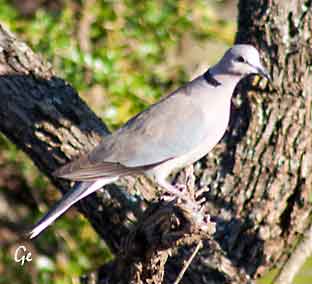 Kapp turteldue, Cape turtle dove The ring-necked dove (Streptopelia capicola), also known as the Cape turtle dove or half-collared dove, is a widespread and often abundant dove species in East and southern Africa. It is a mostly sedentary bird, found in a catholic variety of open habitats. Within range, its penetrating and rhythmic, three-syllabled crooning is a familiar sound at any time of the year. Its name is derived from the semi-collar of black feathers on the lower nape, a feature shared with a number of Streptopelia species. Like all doves they depend on surface water. They congregate in large flocks at waterholes in dry regions to drink and bathe. https://en.wikipedia.org/wiki/Ring-necked_dove |
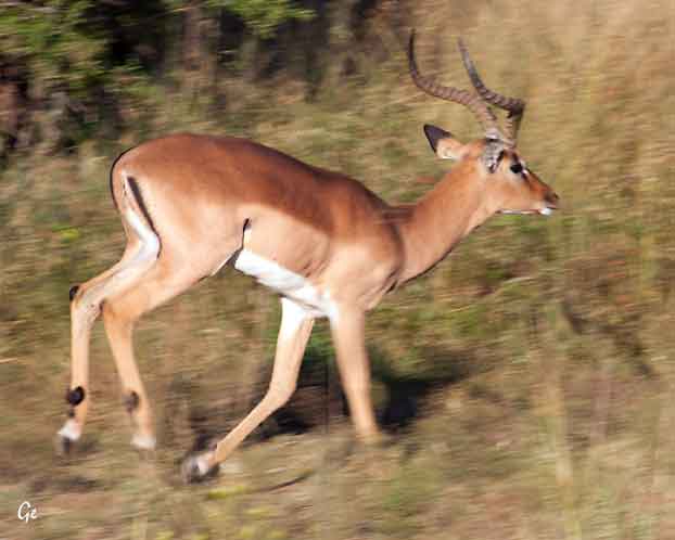
Impala
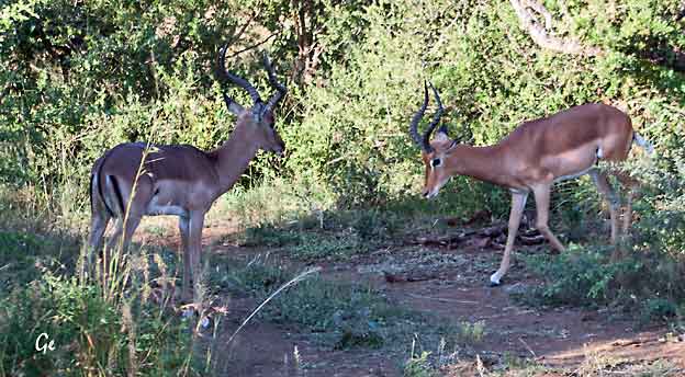
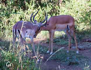 Impala |
Impala (Aepyceros
melampus) (fra
gresk aipos «høy» ceros «horn»+ melas
«sort» pous «fot») er en mellomstor afrikansk antilope. Navnet, Impala, kommer fra zulu-språket. Gjennomsnittsvekten til en impala er ca. 75 kilogram. De er gule og rød-brune i fargen, men lysere på sidene, og er hvite på undersiden av magen. Bukker har lyre-formede horn som kan bli opptil 90 centimeter lange. |
De kan hoppe lengre enn 9 meter langt og 2,5 meter høyt.
De er byttedyr for nesten alle store rovdyr. Den er en drøvtygger.
https://no.wikipedia.org/wiki/Impala
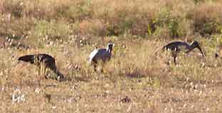 The hadeda is a large (about 76 cm long), grey-to-partly brown species of ibis. It has a narrow, white, roughly horizontal stripe across its cheeks. This is sometimes called the “moustache” though it does not reach the mouth corners. The plumage over the wings has an iridescent purple sheen. The bird has blackish legs and a large grey-to-black bill with a red stripe on the upper mandible. The upper surfaces of the toes are of a similar red. The wings are powerful and broad, enabling quick take-offs and easy manoeuvring through dense tree cover. https://www.simso.co.za/portfolio/ hadada-or-hadeda-ibis/ (20.8.2019) |
 Tasha viser navnet på en antilope |
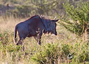 Gnus, or wildebeests, are large African antelopes. Gnus (pronounced like "news") are closely related to cattle, goats and sheep. These animals look like thin, muscular cows with large, sloping backs, curved horns and striped bodies. They also have manes and bushy beards. |
 Safariturister Wildebeest is an Afrikaans name that means "wild beast." Gnu is a derivation of the name used by native Africans. http://www.livescience.com/54421-gnus-wildebeests.html |
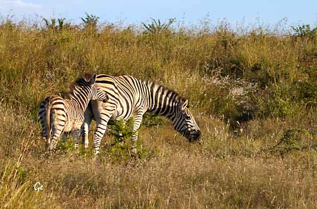
Sebra
and the Mountain Zebra. As the names suggest they occur in vastly differing
habitats, although they are known to occur together in places where plains
and mountains overlap. A third species, the Grevy's Zebra is found in East Africa.
The Burchell's Zebra is the most common across the African continent and has
been classified into seven sub-species across its range. The extinct Quagga
is a sub-species of the Plain's Zebra and biologists are attempting to bring
it back from extinction through a programme using the DNA of selected
Zebra. The programme has been very successful with a number of
Quagga-looking individuals roaming the plains again.
Western and Eastern Cape provinces of South Africa and the more arid
mountainous regions of Namibia.
Smaller than the Burchell's Zebra, Mountain Zebras are made up of two
sub-species: Cape Mountain Zebra and the Hartmann's Mountain Zebra.
No two Zebra have the same striping, as in fingerprints in humans the stripes
of Zebra are unique to an individual. The Burchell's Zebra is the national
animal of Botswana and is found on the coat of arms of the country.
http://www.krugerpark.co.za/africa_zebra.html (20.8.2019)
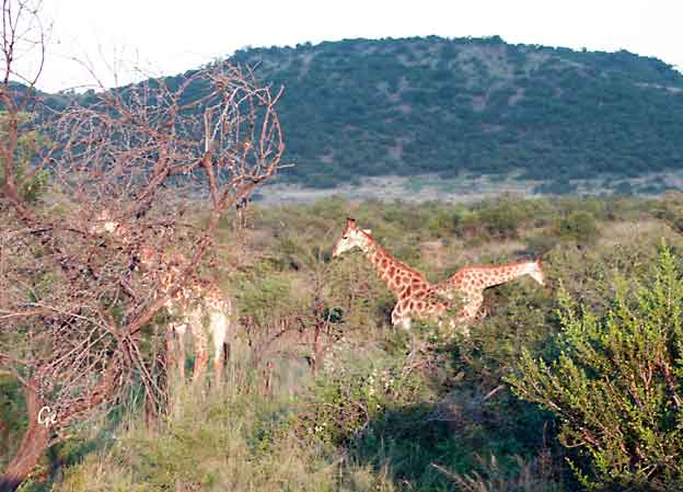
 Sjiraff The giraffe (Giraffa) is a genus of African even-toed ungulate mammals, the tallest living terrestrial animals and the largest ruminants. The giraffe's chief distinguishing characteristics are its extremely long neck and legs, its horn-like ossicones, and its distinctive |
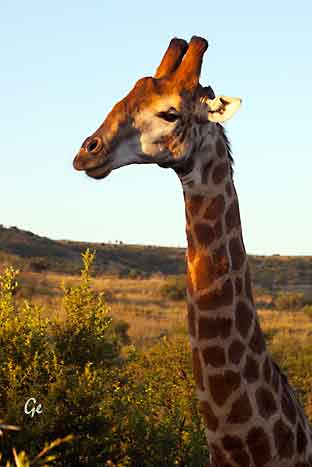 coat patterns. It is classified under the family Giraffidae, along with its closest extant relative, the okapi. https://en.wikipedia.org/wiki/Giraffe |
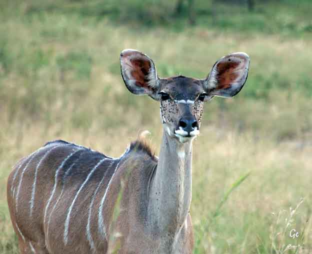
Nyala?
The handsome slate-brown shaggy coat is marked with white vertical stripes
and spots on the flanks. Rams appear more charcoal-grey in colour.
The rams have long inward curved horns (650 mm) and a white chevroned
face. They have a ridge of long hairs along the underparts, from behind the
chin to between the hind legs, they also have a mane of thick, black hair
from the head along the spine to the rump. Rams weigh 115 Kg and
measures 1.05 m at shoulders. Ewes are much smaller and do not have horns,
and weigh 59 Kg and stand 900mm at shoulders. Ewes are chestnut-coated
with even more prominent white stripes on the flanks.
http://www.krugerpark.co.za/africa_nyala.html
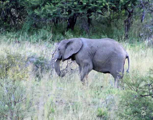
Elefant
The largest land mammal on earth, the African elephant weighs up to eight
tons. The elephant is distinguished by its massive body, large ears and a long
trunk, which has many uses ranging from using it as a hand to pick up objects,
as a horn to trumpet warnings, an arm raised in greeting to a hose for
drinking water or bathing.
https://www.worldwildlife.org/species/elephant
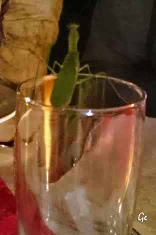 |
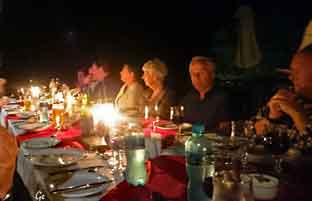 Middag under stjernehimmelen. Med besøk av en grønnkledd en. Det er nok en mantis (en type kneler) |
Vi så løver også. To hannløver spaserte ved siden av
bilen da vi skulle tilbake til lodgen.
Det var dessverre for mørkt til å ta bilder av dem.
Nambiti Game Reserve
Springbok Lodge, safari og avslapning
Dagen starter tidlig, det er da sjansen er størst for å se dyr.
Opp ca kl 5 00.
Te/kaffe og en enkel frokost serveres før safariavgang.
3-4 timers safari med innlagt pause, og tilbake til lodgen
for en helsebringende "brunch".
Om ettermiddagen drar vi igjen ut på safari til
solnedgangen over savannen.
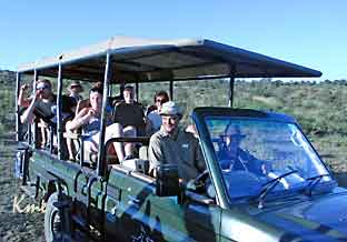
Safariturene kjøres i åpen landrover med egen
safariguide og "tracker" (sporleser).
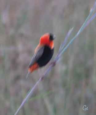 The genus name for the Southern Red Bishop, Euplectes, is from Greek, meaning ‘well-woven’, presumably referring to their nests, and the specific epithet, orix, is from Greek meaning ‘rice’, perhaps referring to the birds’ diet, which is mainly seeds. The Southern Red Bishop is 10–11 centimetres long and has a thick, conical bill. The breeding males are brightly coloured with red (occasionally orange) and black plumage. The forehead, face and throat are black and the rest of the head is red. The upperparts are red apart from the brown wings and tail. The upper breast and under tail coverts are red while the lower breast and belly are black. The non-breeding male and female have streaky brown plumage, paler below. |
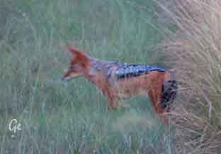 Svartrygget sjakal Compared to other members of the genus Canis, the black-backed jackal is a very ancient species, and has changed little since the Pleistocene, being the most basal canine alongside the closely related side-striped jackal. It is a fox-like canid with a reddish coat and a black saddle that extends from the shoulders to the base of the tail. It isa monogamous animal, whose young may remain with the family to help raise new generations of pups. The black-backed jackal is not a fussy eater, and will feed on small to medium-sized animals, as well as plant matter and human refuse. https://en.wikipedia.org/wiki/Black- backed_jackal ------------------------------------------------------------------------- Southern Red Bishop The females are smaller than the males, the bill, legs and feet are pale pinkish. The eyes are dark brown. Southern Red Bishops have various twitteringcalls and a nasal contact call; the male has a buzzing song. The Southern Red Bishop performs bumblebee-like flight with rapid wingbeats producing buzzy sounds during the breeding period. It flies airily about over the reed bed, with fluffed out plumage. https://www.sanbi.org/animal-of-the-week/southern-red-bishop/ |
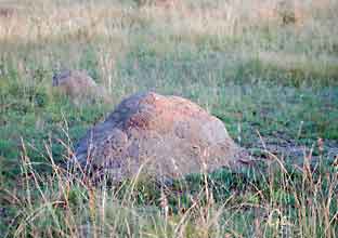 Termitt-tue |
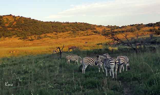
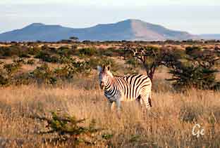 Sebra |
In a lot of ways, termites are a paradox. They're strong enough to eat a house,
but their bodies are soft, delicate and prone to drying out. Soldiers, whose sole
job is to defend the colony, can't even feed themselves. Adult termites develop
wings so they can leave the colony and find a new home, helping the termite
population grow. But winged termites are terrible flyers, and most don't
survive the journey.
At the same time, termites are survivors. They've existed for about 50 million
years, and today there are close to 3,000 termite species living in most
temperate parts of the world. In Africa and Australia, termites build enormous
mounds that can last longer than the colony itself can survive. There are plenty
of methods for discouraging termites from feasting on a person's home, but
many species have a knack for finding ways around them. Once a colony
moves in, it can be difficult to exterminate.
https://animals.howstuffworks.com/insects/termite.htm (20.8.2019)
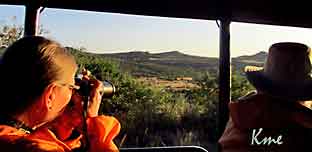 Grete fotograferer |
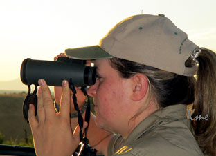 Tascha ser etter neshorn |
from the Afrikaan’s, a West Germanic language, word “weit” which means
wide and refers to the animal’s mouth. Also known as the square-lipped
rhinoceros, white rhinos have a square upper lip with almost no hair.
Two genetically different subspecies exist, the nothnern and southern white
rhino and are found in two different regions in Africa. As of March 2018,
there are only two rhinos of the northern white rhino left, both of which
are female. They live in the Ol Pejeta Conservancy in Kenya and are
protected round-the-clock by armed guards. Their near extinction is due
to decades of rampant poaching for rhino horn.
The majority (98.8%) of the southern white rhinos occur in just four countries:
South Africa, Namibia, Zimbabwe, and Kenya. Southern white rhinos were
thought to be extinct in the late 19th century, but in 1895 a small population
of less than 100 individuals was discovered in Kwazulu-Natal, South Africa.
After more than a century of protection and management, they are now
classified as Near Threatened and 19,600 – 21,000 animals exist in protected
areas and private game reserves. They are the only of the five rhino species
that are not endangered.
https://www.worldwildlife.org/species/white-rhino (20.8.2019)
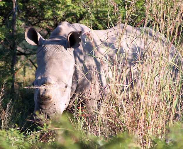
Neshorn
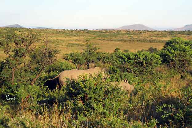
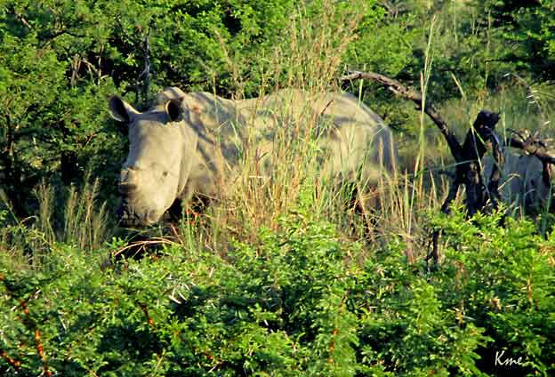
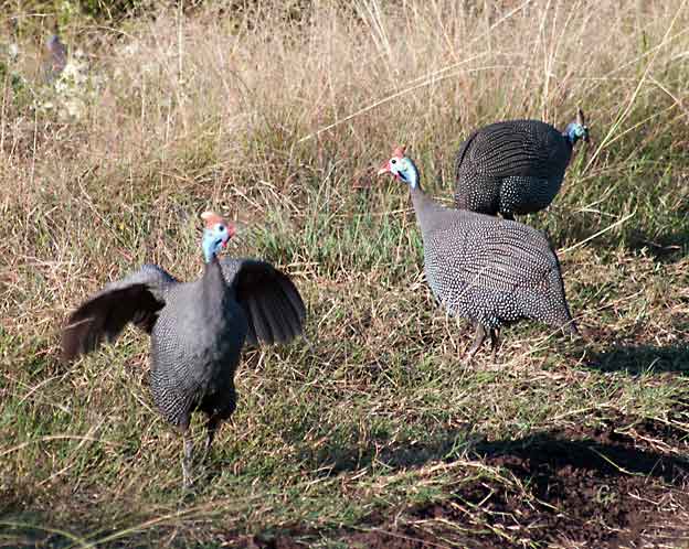
Perlehøns
Guineafowl (/ˈɡɪnifaʊl/; sometimes called "pet speckled hen", or "original
fowl") are birds of the family Numididae in the order Galliformes.
They are endemic to Africa and rank among the oldest of the
gallinaceous birds. Phylogenetically, they branch off from the core
Galliformes after the Cracidae and before the Odontophoridae. An Eocene fossil lineage, Telecrex, has been associated with guineafowl. Telecrex inhabited Mongolia, and may have given rise to
the oldest of the true Phasianids such as Ithaginis and Crossoptilon,
which evolved into high-altitude montane-adapted species with the
rise of the Tibetan Plateau. While modern guineafowl species are
endemic to Africa, the helmeted guineafowl has been introduced as a
domesticated bird widely elsewhere.
 Oppspist gnu |
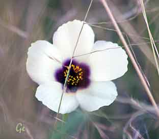 Wild Hibiscus Flower South Africa |
partridges, but with featherless heads, though both members of the genus
Guttera have a distinctive black crest, and the vulturine guineafowl has a
downy brown patch on the nape. Most species of guineafowl have a dark
grey or blackish plumage with dense white spots, but both members of
the genus Agelastes lack the spots. While several species are relatively well
known, the plumed guineafowl and the two members of the genus Agelastes
remain relatively poorly known. These large birds measure from 40–71 cm
(16–28 inches) in length, and weigh 700–1600 grams or 1.5-3.5 pounds.
Guinea hens weigh more than guinea cocks, possibly because of the larger
reproductive organs in the female compared to the male guinea fowl. Also,
the presence of relatively larger egg clusters in the dual purpose guinea
hens may be a factor that contributes to the higher body weight of the
guinea hens.
https://en.wikipedia.org/wiki/Guineafowl (20.8.2019)
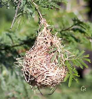 Redet til en vever |
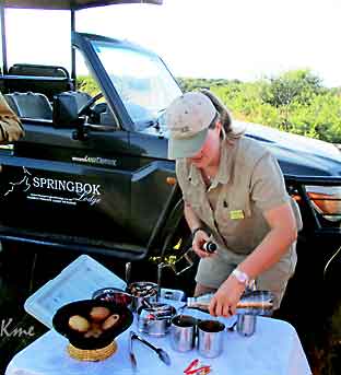 Tid for kaffe/te og muffens |
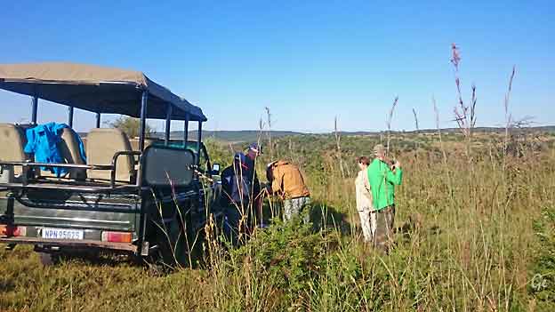
Kaffepause
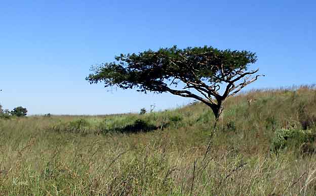
Paraplytre
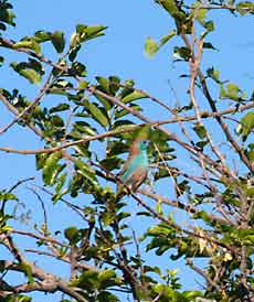 Blåastrild, blue wax bill The blue waxbill mainly eats grass seeds which are taken from the inflorescences, this is supplemented with termites and other insects. they have also been recorded eating the fallen fruits of Boscia albitrunca. It is normally seen in pairs or family parties but it does form larger flocks which often mix in with flocks of other estrildids. https://en.wikipedia.org/wiki/Blue_waxbill |
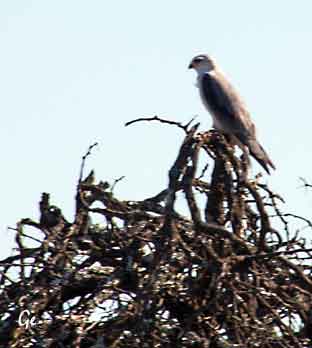 Amur falk |
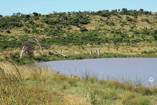
Andedam med skjeand
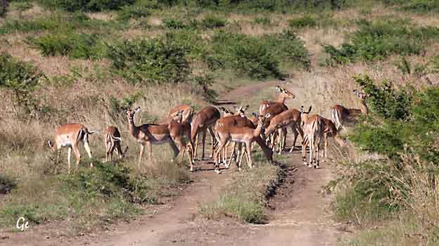
Impala
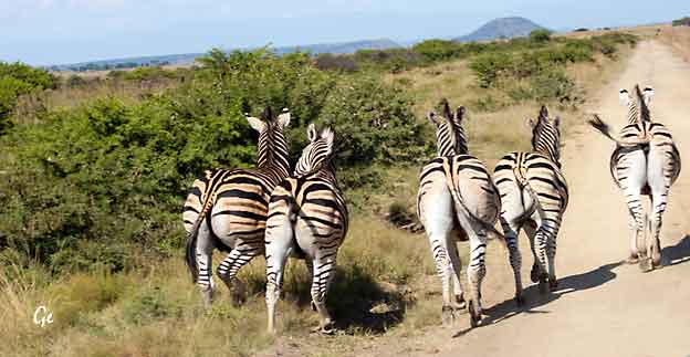
Sebraflokk
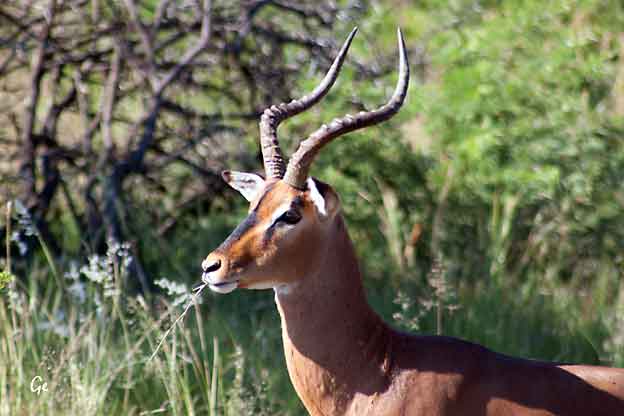
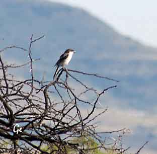 |
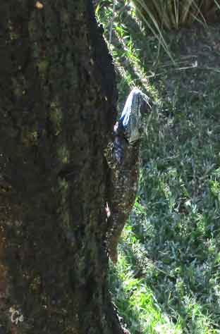 |
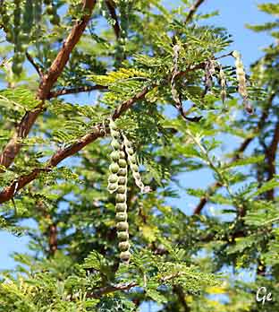 |
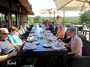 En sen, men god frokost. Solstolene venter, nå skjer det ikke noe før vi skal på ettermiddags-safari ved 4-tida |
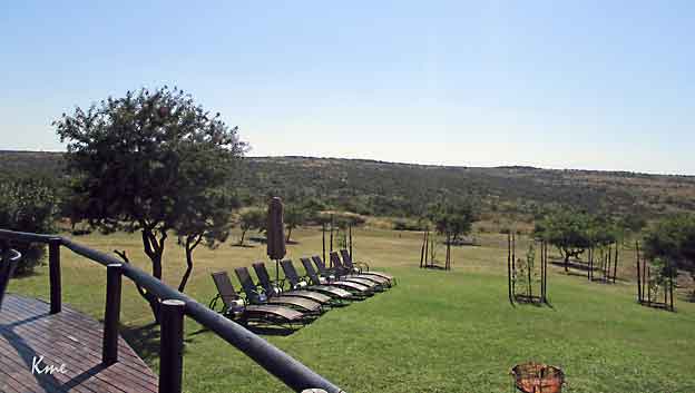
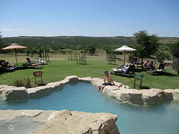
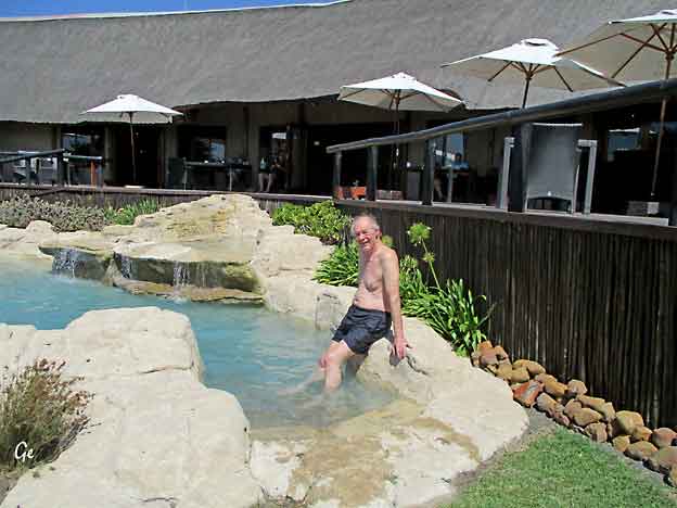
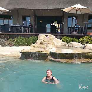 |
Deilig med en rolig formiddag. Det er godt og varmt, så bassenget var fint å ha. |
Til høyre er salongen på lodgen
og under noen nærbilder av ting fra salongen.
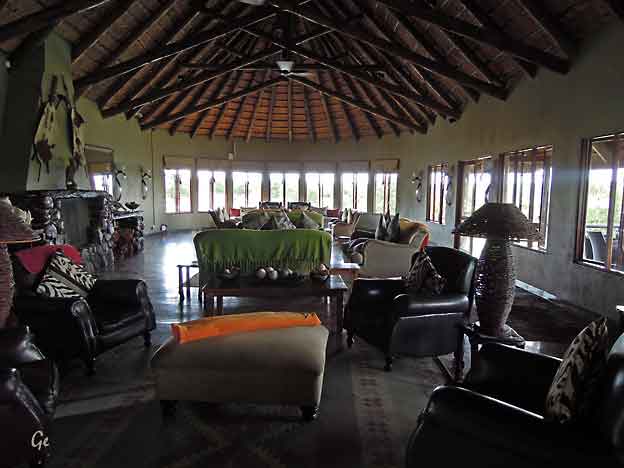
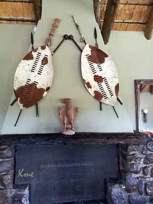 |
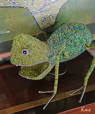 |
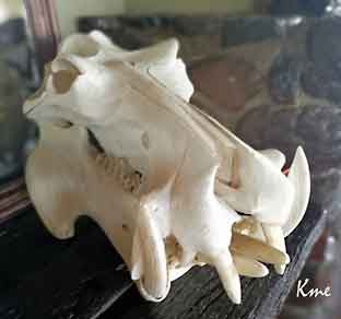 |
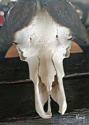 |
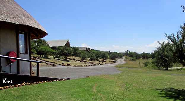
Rekka med "telt" sette fra hagen.
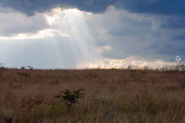
Vi dro på safari igjen kl 16 00.
Vi hadde ikke vært lenge på tur før vi så uværet nærme seg.
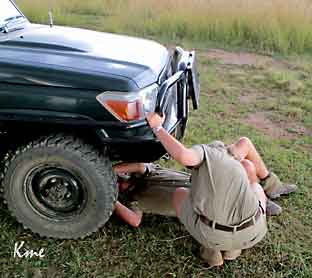 |
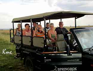 |
En av safaribilene fikk problemer.
Sjåføren i den bilen og Tascha måtte ut for å reparere.
Det gikk heldigvis greit,
og de rakk å bli ferdig før regnet pøste ned.
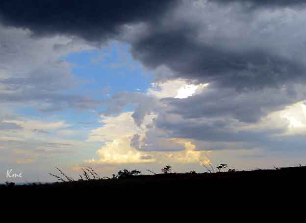
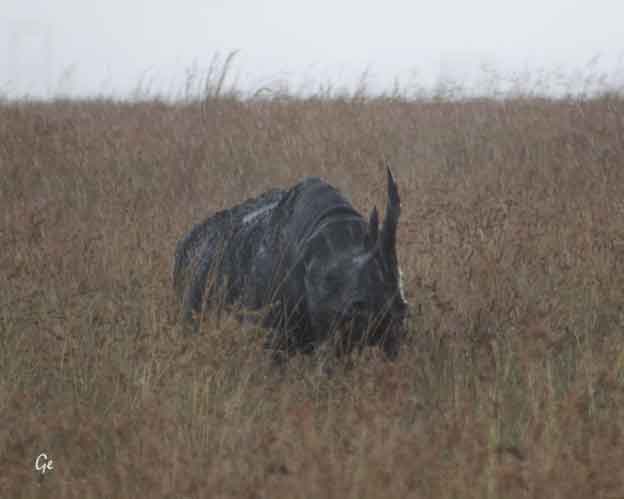
Svart neshorn
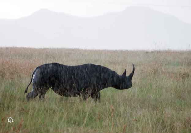
Midt under uværet møtte vi det svarte neshornet.
Both black and white rhinoceroses are actually gray. They are different not in
color but in lip shape. The black rhino has a pointed upper lip, while its white
relative has a squared lip. The difference in lip shape is related to the animals' diets.
Black rhinos are browsers that get most of their sustenance from eating trees and
bushes. They use their lips to pluck leaves and fruit from the branches. White rhinos
graze on grasses, walking with their enormous heads and squared lips lowered to the ground.
https://www.nationalgeographic.com/animals/mammals/b/black-rhinoceros/ (20.8.2019)
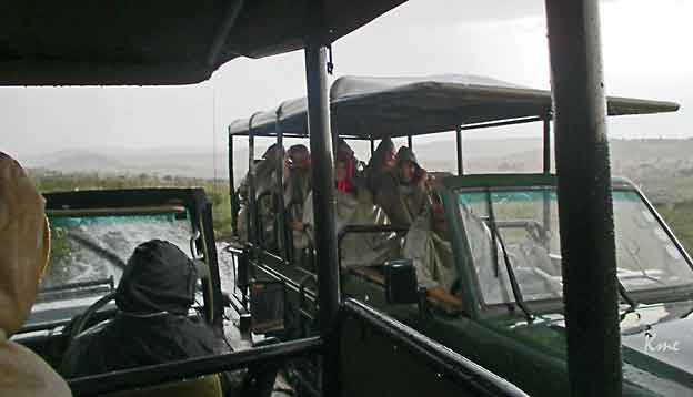
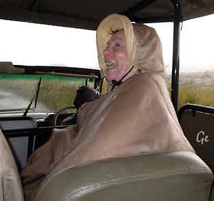 |
 |
Litt regn legger ingen demper på stemningen.
Det lå fora regncaper til alle i bilene, men våte ble vi likevel.
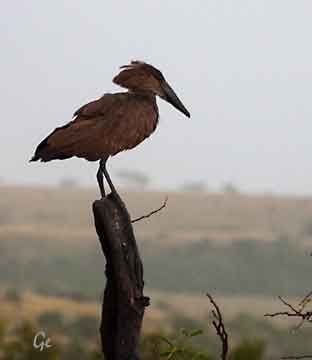 |
 |
If you are in Africa and see an unusual medium-sized creature with brown
plumage and hammer-shaped head then you have certainly spotted a
Hamerkop.
It is a distinctive and legendary mystery bird that is widespread in Africa.
Since ancient times, the people of this region have associated this bird to
lightning, leprosy and even death which did not only prevent Hamerkops
from getting killed by humans but has also turned it into some kind of
mysterious legend.
https://www.aboutanimals.com/bird/hamerkop/
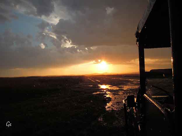
Det er ganske vått etter regnet. Her kjører vi bortover en flystripe.
Etter regnværet fikk sjåføren vår beskjed om hvor løvene var, og
kjørte rally dit på dårlige, og nå ganske gjørmete veier. Vi rakk så vidt å
se dem før det ble for mørkt.
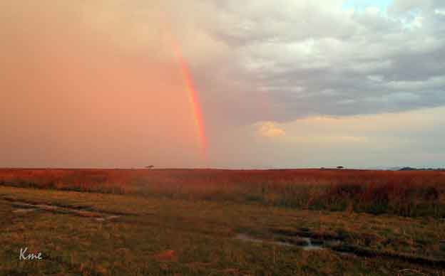
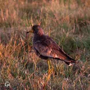 |
 Serviettfugler |
jordugle, vaktel, shelleys frankling, slakterfugl, kaite, champagnefugl og
blackbellied bustard.
Fredag 24. mars 2017
Noen valgte å bli med på morgensafari.
Andre ville heller ha en rolig morgen ved teltet.
Etter frokost ble vi kjørt i safaribussene
dit bussen vår sto parkert.
Vi skulle fortsette til Johannesburg.
Der var vi en tur i Soweto, en
kjempediger brakkeby (Township) før vi
kjørte til hotellet ved flyplassen.
Neste morgen skulle vi fly til Livingstone i Zambia.
Overnatting City Lodge OR Tambo,
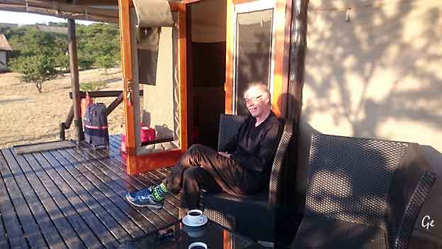
En rolig morgen på terrassen
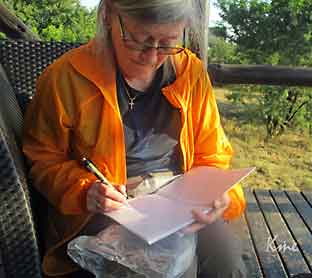 |
 |
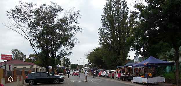
Soweto
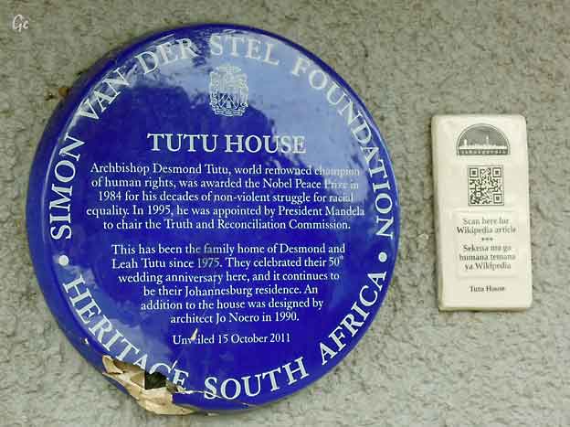
Tutu House
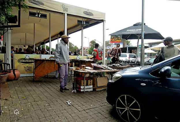
Gatesalg, gatemusikk og restauranten Zakhumzi der vi spiste lunsj
 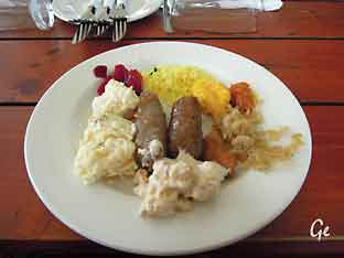 |
 Restauranten serverte typiske afrikanske retter, søndagsretter sa Soweto-guiden vår. |
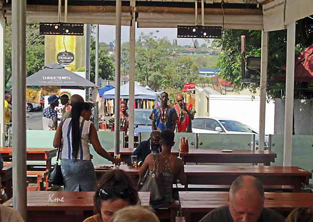
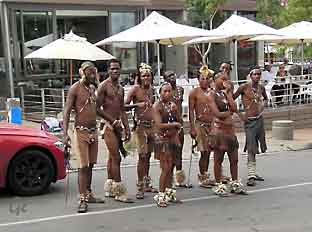 |
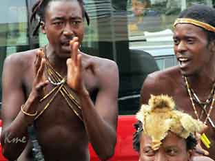 |
Sang og dans for turistene.
Det var tre stykker med en "akrobatisk dans",
der de vrengte armer og ben på en måte som
om de ikke hadde et ben i kroppen,
bare gummistrikker.
|
the City of Johannesburg Metropolitan Municipality in Gauteng, South Africa, bordering the city's mining belt in the south. Its name is an English syllabic abbreviation for South Western Townships. Formerly a separate municipality, it is now incorporated in the City of Johannesburg Metropolitan Municipality and is one of the suburbs of Johannesburg. Soweto - Wikipedia (23. november 2024) |
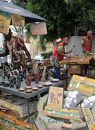 |
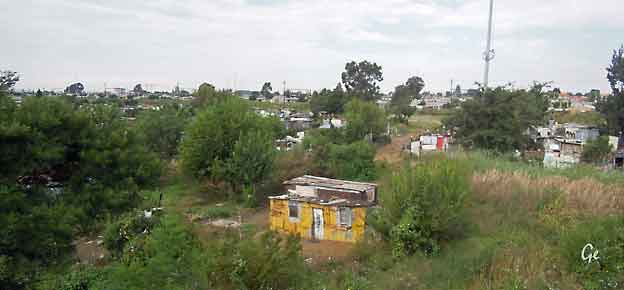
Små hjem, etter de vi så innvendig ser det ut til at det er en viss orden inne.
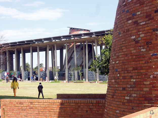
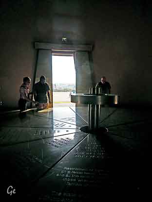 |
 Symbol for kristendom  symbol for ? Vi ble fortalt hva synbolet sto for, men jeg har dessverre glemt det. (GE) |
dedicated to Walter Sisulu, tells the story of the drafting of the Freedom Charter.
And it does so via photographs, art, song, news clipping and narration. It is a
thoroughly visual journey made by visitors to the museum, one that emphasises
the freedom South Africa fought so hard to achieve.It is not an original idea,
using multi-media to paint a story, neither is the concept of an open air
museum - the first was established in Scandinavia at the end of the nineteenth
century - but in this particular case, the story that it tells – the attainment of
freedom - gains an added dimension, unfettered by the walls of a building.
https://www.sa-venues.com/attractionsga/kliptown-open-air-museum.php (20.8.209)
I tårnet (bilde til venstre) finner man:
The Freedom Charter
Adopted at the Congress of the People, Kliptown, on 26 June 1955
• DAY 1: The congress of the people held over two days in the field in Kliptown.
• DAY 2: Sunday the 26th of June, the apartheid government sent its own
delegation in force to Kliptown and some of the Congress people were
charged with treason.
-----------------------------------------------------------------------------------------------------------
The Charter was officially adopted on Sunday 26 June 1955 at a gathering of
about 3,000 people, known as the Congress of the People in Kliptown, Soweto.
The meeting was broken up by police on the second day, although by then the
Charter had been read in full. The crowd had shouted its approval of each
section with cries of "Africa!" and "Mayibuye!" Nelson Mandela escaped the
police by disguising himself as a milkman, as his movements and interactions
were restricted by banning orders at the time,
Freedom Charter - Wikipedia (23. november 2024)
• The people shall govern
• All national groups shall have equal rights
• The people shall share in the country's wealth
• The land shall be shared among those who work it
• All shall be equal before the law
• All shall enjoy human rights
• There shall be work and security
• The doors of learning and culture shall be opened
• There shall be houses, security and comfort.
• There shall be peace and friendship
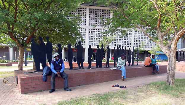
Waiting for å change, waiting for a miracle.
Gapp Architects and dream designers, june 2016
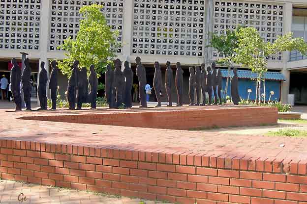
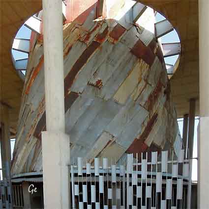
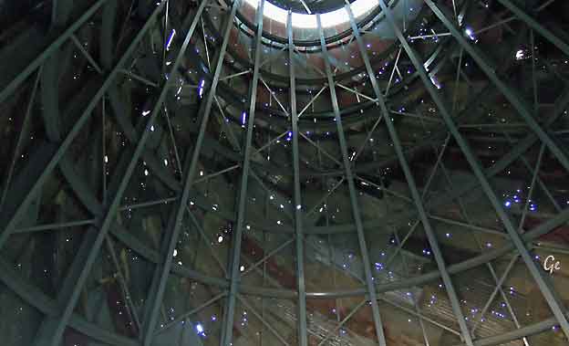
Det andre tårnet på Sisulu Square. Tårnet er tomt.
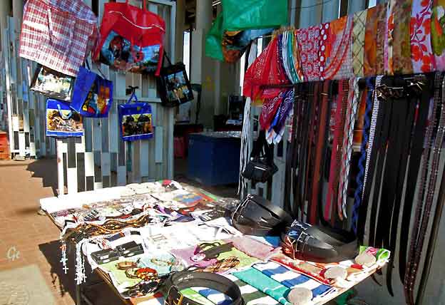
 Planten i esken til høyre er sunn og hjelper mot "alle" sykdommer. |
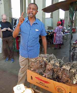 |
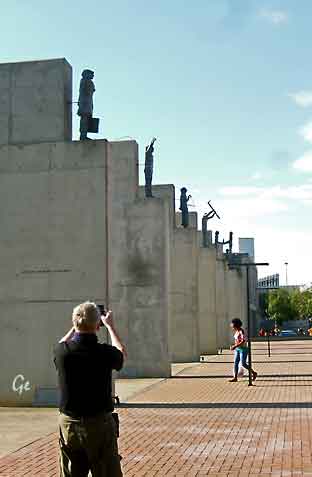 |
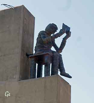 Symboler for "the freedom Charter." |
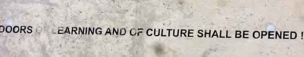
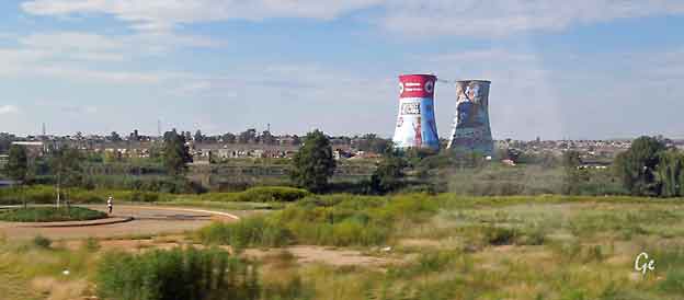
The Orlando Towers bungee in Soweto adds a whole new dimension to sightseeing
in this famous Johannesburg township. Bridging the gap between adventure and
township tourism, you can enjoy one of Johannesburg’s most vibrant landmarks
like never before. With a 100m drop to the ground, bungee jump, swing or free fall
your way to the bottom.
This is definitely one of the most exciting ways to see South Africa's biggest and most famous townships. Based around the Orlando Towers, part of the old Orlando Power Station and a major Soweto attraction, outdoor adventure activities are fast
changing the way visitors experience this already vibrant place.
https://www.southafrica.net/au/en/travel/article/add-some-adventure-to-your-township-tour-at-the-
orlando-towers (20.8.209)
Orlando Tower
Orlando Power Station is a decommissioned coal-fired power station in Soweto,
South Africa.
The power station was commissioned at the end of the Second World War and
served Johannesburg for over 50 years.
https://en.wikipedia.org/wiki/Orlando_Power_Station
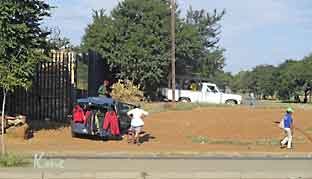 Bilskiltene i Johannesburg har bokstavene GP, står for gangster pilot mener mange. |
 |
 |
Guiden Ian
har fulgt oss fra Durban. Her hjelper han til med å ta ut koffertene fra bussen. Vi skal bo på flyplasshotell på OR Tambo, Johannesburg. Kjekt når vi skal videre med fly neste morgen. |
Fly Johannesburg - Livingstone
i Zambia.
Minibuss til hotellet.
Fra dagsprogrammet:
På ettermiddagen blir vi med på et cruise i solnedgangen på
Zambezi elven - en vakker avrunding på en avslappende dag.
Underveis serveres det drikke og snacks med varmrett
(lett middag).
Under toktet vil vi kunne se et rikt dyre- og fugleliv langs elva.
Fargespillet ved solnedgangen vil nok etterlate uforglemmelige
inntrykk hos oss alle.
Overnatting, Chrismar hotel, Livingstone
 |
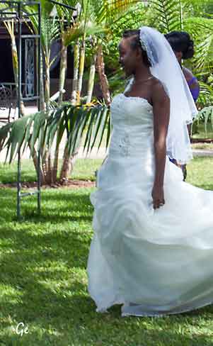 |
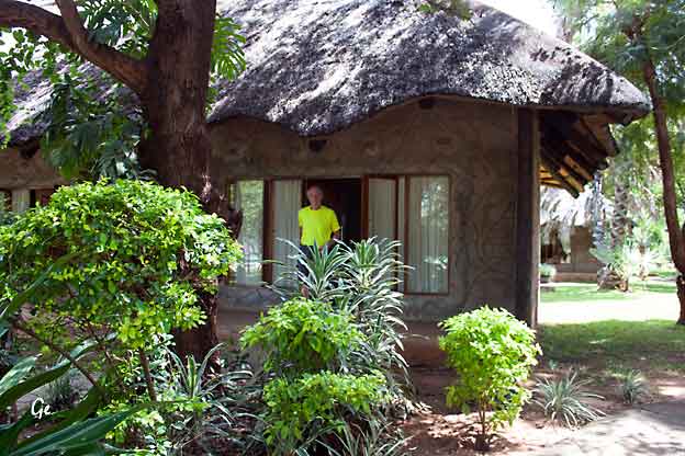
 Karl Martin hiver seg ut i bassenget, Grete er der allerede. |
 |
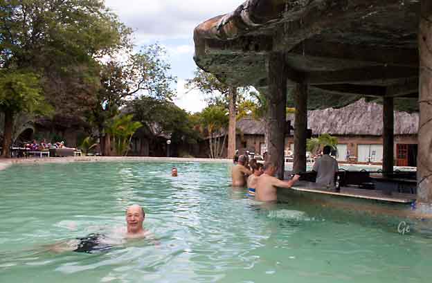
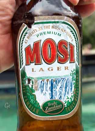 Zambisk øl servert fra bassengbaren. |
 |
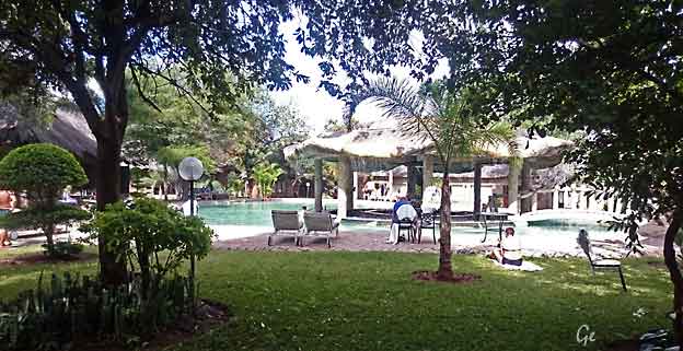
Et bilde tatt fra rommet vårt.
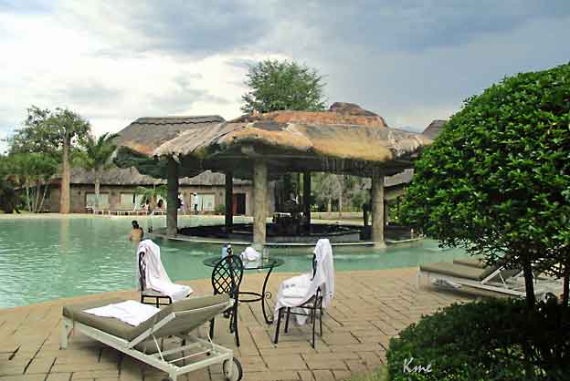
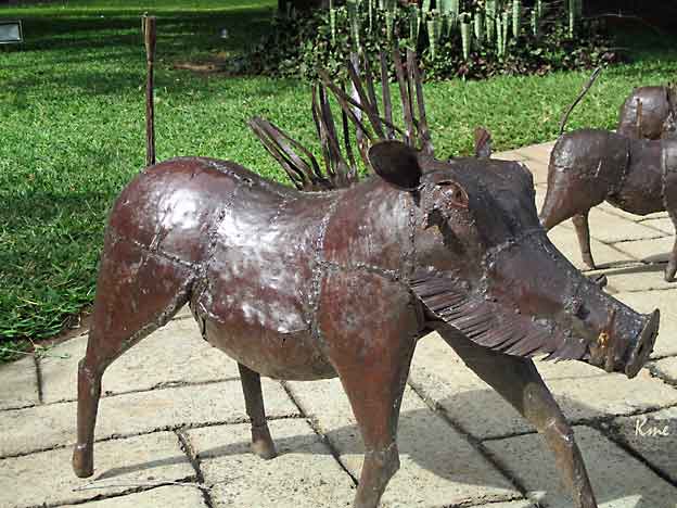
Vortesvin på hotellet.
På det neste hotellet vi kom til hadde vi levende vortesvin utenfor rommet.
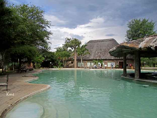
Restauranten er i huset på den andre siden av bassenget.
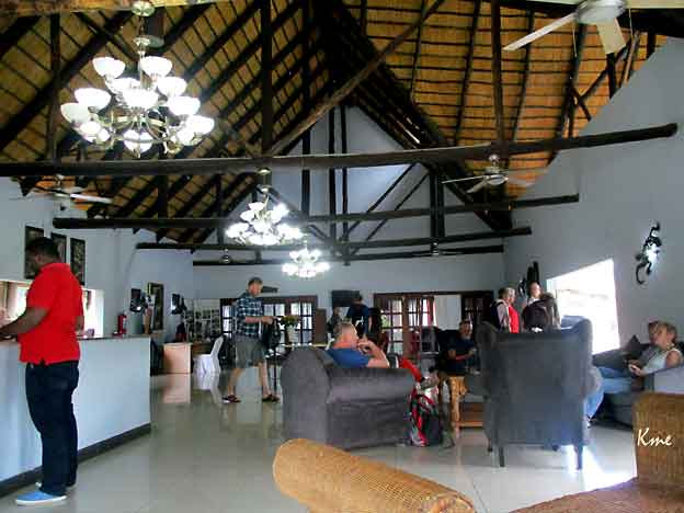
Salongen på Chrismar hotel
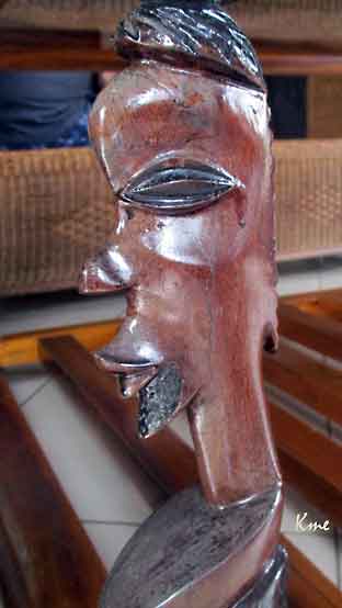 |
 Vi skal på cruise på Zambezi, men først må alle skrive under på at de drar på eget ansvar. Her skriver Karl Martin under. |
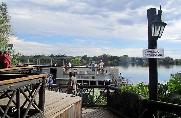
MV Makumbi ligger klar, men pass dere for krokodillene.
Makumbi
100 clients max, includes freshly baked snacks, light dinner,
local beverages, spirits and wine
http://safpar.com/activities/river-cruises/
Vi fotograferer og blir fotografert.
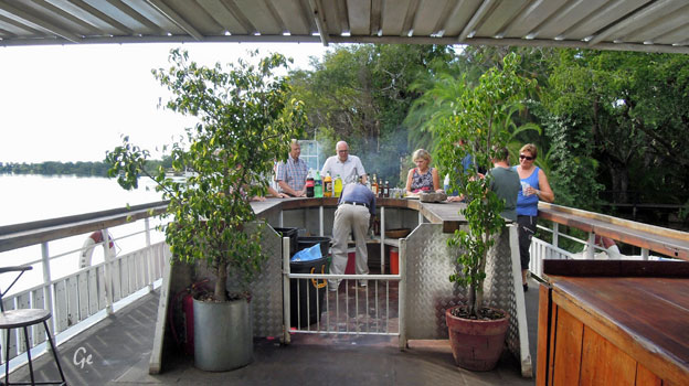
Baren er åpen og her er det fri drinker på hele turen.
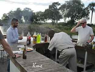 |
The
Zambezi is Africa’s fourth largest River system, after the Nile, Zaire and Niger Rivers. It runs through six countries on it’s journey from central Africa to the Indian Ocean. Its unique value is that it is less developed than others in terms of human settlement and many areas along it’s banks enjoy protected status. |
The Zambezi has been harnessed at various points along the way including
the massive Kariba Dam between Zambia and Zimbabwe and Cabora Bassa
Dam in Mozambique.
Plans for another dam at the Batoka gorge have fortunately been shelved.
The River’s beauty has attracted tourists from all over the world providing
opportunities for a myriad of water sports and game viewing.
Running for a length of 2700kms, it begins it’s journey as an insignificant little
spring in the corner of north-west Zambia in the Mwinilunga District.
It bubbles up between the roots of a tree, very close to the border where
Zambia, Angola and Zaire meet.
http://www.zambiatourism.com/destinations/rivers/zambezi
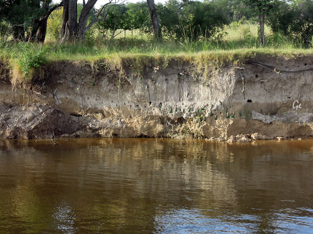
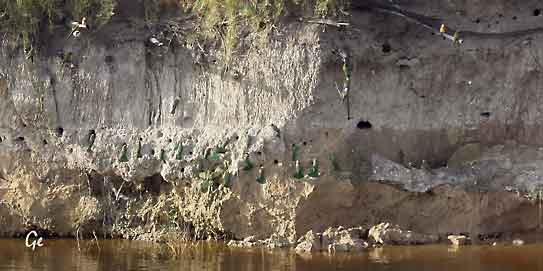
Clay licks put simply are exposed areas of clay where animals gather to eat
or lick clay. Over 50 different animals use clay licks to obtain clays or salts.
Light might be shed on this behaviour by looking at our own history and
medical treatments.
http://thinkjungle.com/articles/clay-licks/
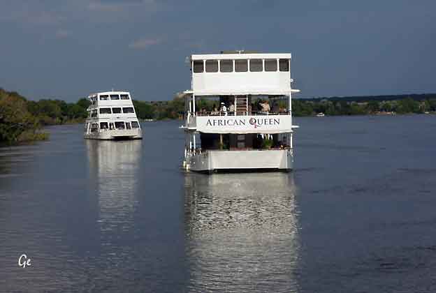
Det er flere cruisebåter på elva
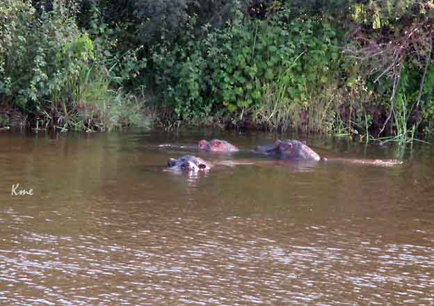
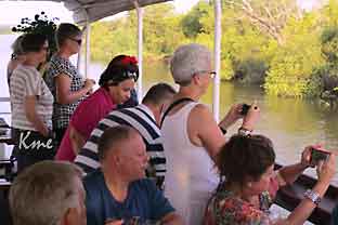 Flodhestene fotograferes |
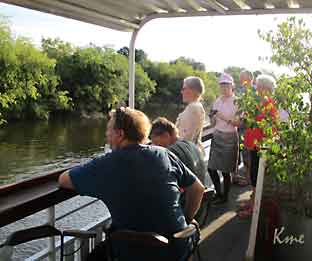 |
Hippopotamuses love water, which is why the Greeks named them the “river
horse.” Hippos spend up to 16 hours a day submerged in rivers and lakes to
keep their massive bodies cool under the hot African sun. Hippos are graceful
in water, good swimmers, and can hold their breath underwater for up to
five minutes. However, they are often large enough to simply walk or stand on
the lake floor, or lie in the shallows. Their eyes and nostrils are located high
on their heads, which allows them to see and breathe while mostly submerged.
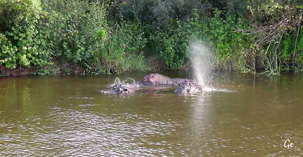
At sunset, hippopotamuses leave the water and travel overland to graze.
They may travel 6 miles in a night, along single-file pathways, to consume
some 80 pounds of grass.
Considering their enormous size, a hippo's food intake is relatively low.
If threatened on land hippos may run for the water—they can match a
human's speed for short distances.
http://www.nationalgeographic.com/animals/mammals/h/hippopotamus/
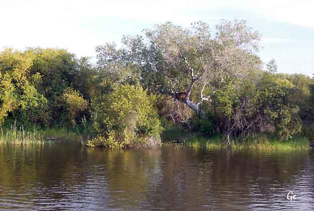
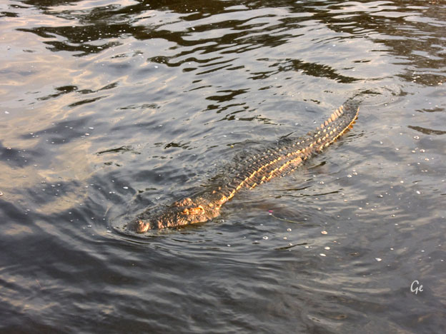
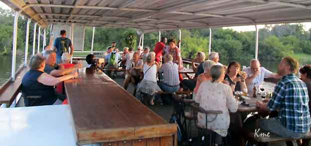
be considered the second largest extant reptile in the world, after the
saltwater crocodile (Crocodylus porosus).
The Nile crocodile is quite widespread throughout Sub-Saharan Africa,
occurring mostly in the central, eastern, and southern regions of the continent
and lives in different types of aquatic environments such as lakes, rivers
and marshlands. Although capable of living in saline environments, this
species is rarely found in saltwater, but occasionally inhabits deltas and
brackish lakes. The range of this species once stretched northward throughout
the Nile, as far north as the Nile delta. On average, the adult male Nile
crocodile is between 3.5 and 5 m (11 ft 6 in and 16 ft 5 in) in length and
weighs 225 to 750 kg (496 to 1,653 lb). However, specimens exceeding 6.1 m
(20 ft 0 in) in length and weighing up to 1,090 kg (2,400 lb) have been
recorded.Sexual dimorphism is prevalent, and females are usually about
30% smaller than males. They have thick scaly skin that is heavily armored.
https://en.wikipedia.org/wiki/Nile_crocodile
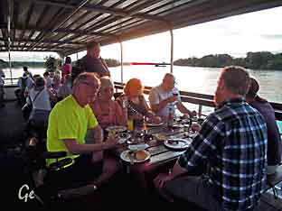 Middagen er servert |
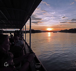 |
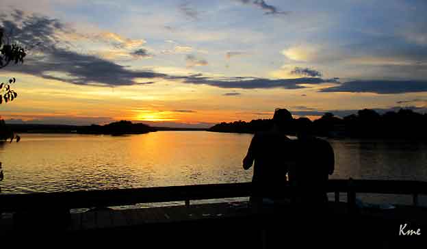
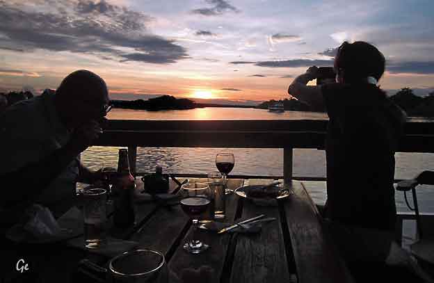
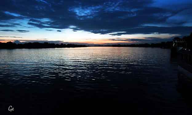
 |
Noen
fortsatte kvelden i baren på hotellet. |
 |
The colours used
in the flag of Zambia are rich in symbolism. Green stands for the nation's lush flora, red for the nation's struggle for freedom, black for the Zambian people, and orange for the land's natural resources and mineral wealth. Additionally, the eagle flying above the coloured stripes is intended to represent the people's ability to rise above the nation's problems. https://en.wikipedia.org/wiki/Flag_of_Zambia |
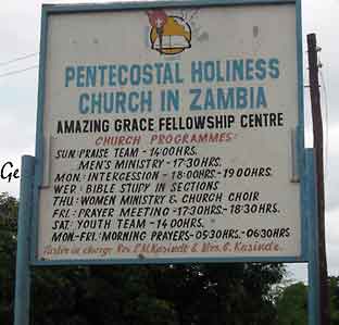
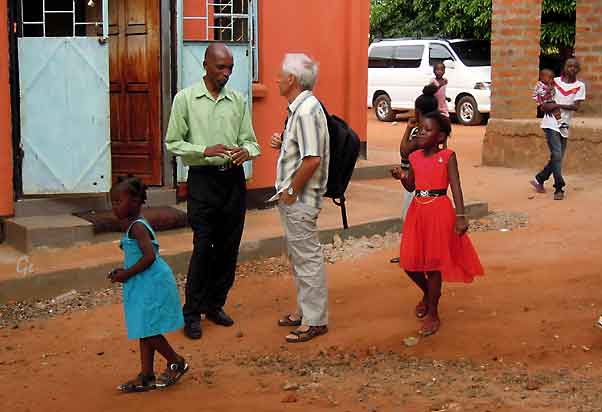
Dagens førse gudstjeneste var ikke slutt enda da vi kom til kirken.
Derfor ble det litt ventetid. Altså god tid til å ta bilder.
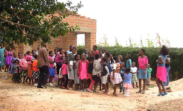
Til høyre:
Så kommer de ut fra den første gudstjenesten.
Alle tar hverandre i hendene ved utgangen.
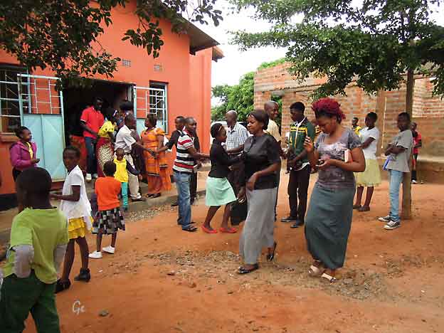
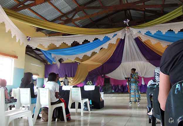
Først bibeltime.
Det gikk på engelsk og det lokale språket. Det ble litt vanskelig å følge med.
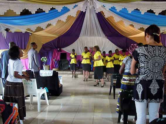
Så kom koret fram og det ble liv i forsamlingen.
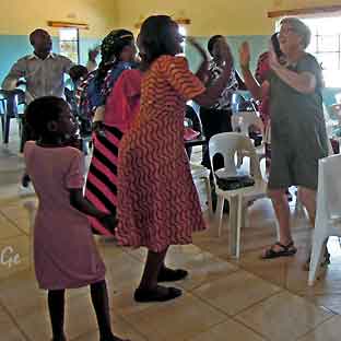 |
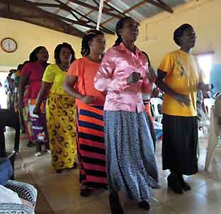 Alle ble dradd med i dansen, også vi nordboere. |
The Victoria Falls Bridge was the inspiration of Cecil Rhodes, who was
reported to have said: “build the Bridge across the Zambezi where the
trains, as they pass, will catch the spray of the Falls”.
This was part of Rhodes’ unfulfilled Cape to Cairo railway scheme.
He never actually visited the Victoria Falls, and died before construction
of the Bridge even began.
Constructed from steel, the Bridge is 198 metres (650 ft) long with the main
arch spanning 156.50 metres (513.5 ft) at a height of 128 metres (420 ft)
above the Zambezi River.
It is a road, a railway and a foot-bridge. The Bridge is the only rail link
between Zambia and Zimbabwe and one of only three road links between
the two countries.
http://www.zambiatourism.com/destinations/waterfalls/victoria-falls/victoria-falls-bridge
In more modern terms Victoria Falls is known as the greatest curtain of falling
water in the world.
Columns of spray can be seen from miles away as, at the height of the rainy
season, more than five hundred million cubic meters of water per minute
plummet over the edge, over a width of nearly two kilometers, into a gorge
over one hundred meters below.
The wide, basalt cliff over which the falls thunder, transforms the Zambezi
from a placid river into a ferocious torrent cutting through a series of
dramatic gorges.
Facing the Falls is another sheer wall of basalt, rising to the same height, and
capped by mist-soaked rain forest. A path along the edge of the forest provides
the visitor prepared to brave the tremendous spray, with an unparalleled series
of views of the Falls.
One special vantage point is across the Knife-edge Bridge, where visitors can
have the finest view of the Eastern Cataract and the Main Falls as well as the
Boiling Pot, where the river turns and heads down the Batoka Gorge.
http://www.zambiatourism.com/destinations/waterfalls/victoria-falls
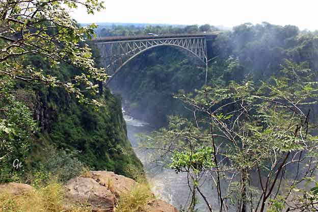
The Victoria Falls Bridge
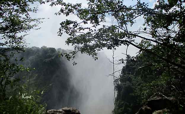
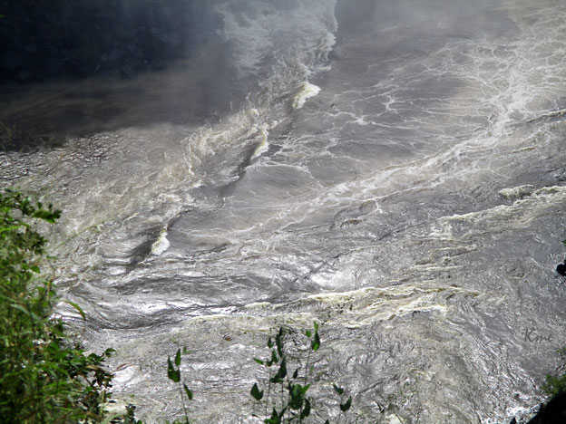
Boiling Pot
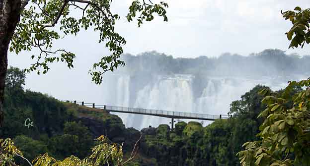
Knife Edge Bridge og Victoriafossen
The Knife Edge Bridge offers a view of the eastern cataract of Victoria Fallsand
the main gorge. Be prepared to get soaking wet if you walk the bridge without a
raincoat (and if you visit the falls at the end of the rainy season), which are
available for hire, as well as Crocs at the entrance to the falls. More often than
not, the bridge is where you’ll spot a rainbow.
https://theculturetrip.com/africa/zambia/articles/the-best-things-to-see-and-do-at-victoria-falls/
(20.8.2019)
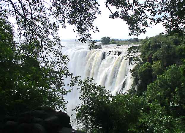
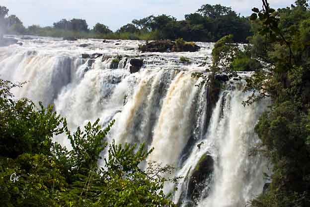
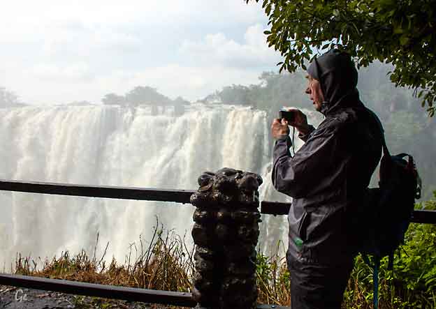
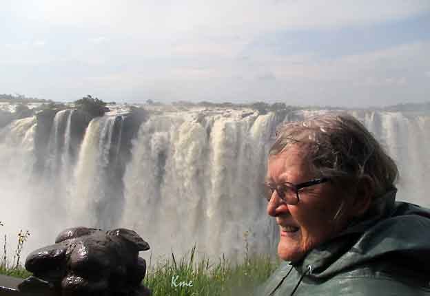
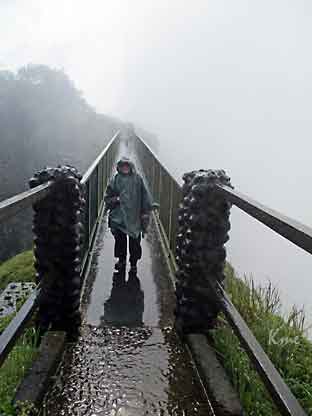 |
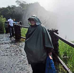 Grete på Knive Edge Bridge. |
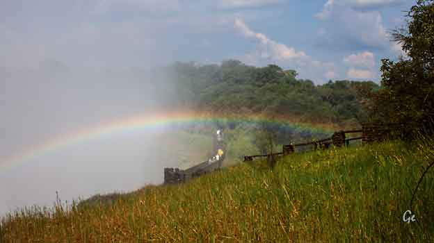
The best time to visit the spectacular Victoria Falls is from February to May,
directly after the region’s summer rains, when you’ll see the world’s largest sheet
of falling water flowing at its greatest volume. The green season usually kicks off
in about November with the first spring rains but it takes time for the water that
has fallen in the Angolan Highlands to wend its way down to a series of massive
gorges. It takes a few months for the Falls to almost literally gather steam after
a dry winter in mid-year. Visiting Vic Falls can be a sensory overload: the noise,
heat and moisture come to together in an unforgettable natural show-stopper.
https://www.go2africa.com/destinations/victoria-falls/when-to-go (20.8.2019)
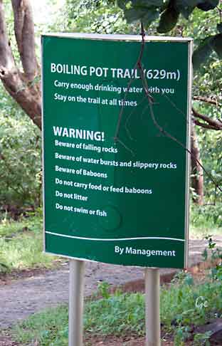 |
 Vi går ned til Boiling Pot. Det er mye å passe seg for på turen. |
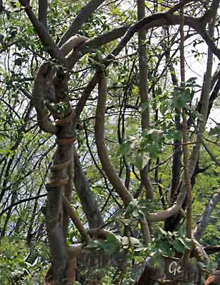 Regnskog |
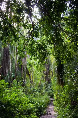 |
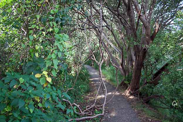
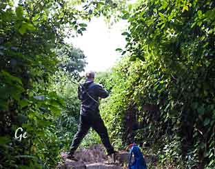 |
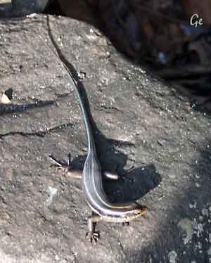 |
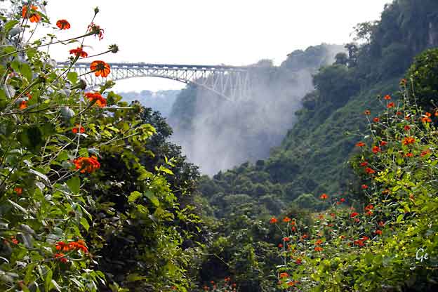
Broa over til Zimbabwe
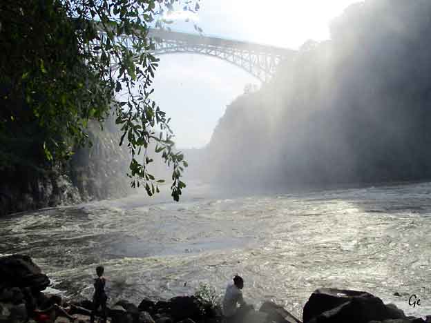
Boiling Pot
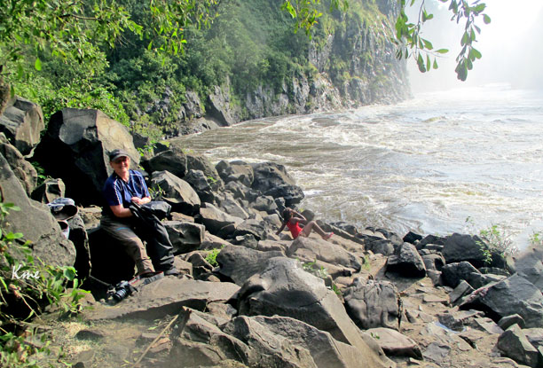
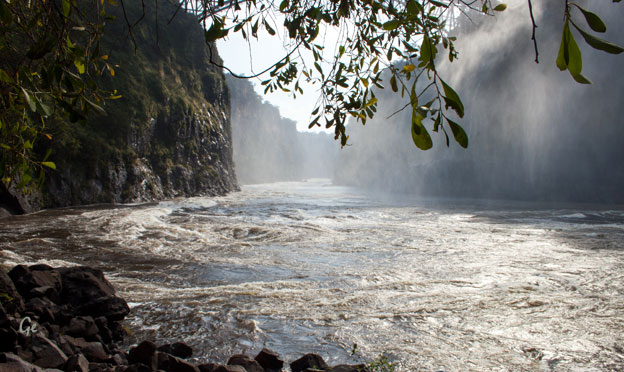
The two streams of the Zambezi meet below Danger Point in the Boiling Pot,
a permanent whirlpool, which is a deep and treacherous fissure. This is the
point where the current incarnation of the Victoria Falls was born - and the
equivalent of the Devil's Cataract of the preceding falls - the one that formed
Second Gorge over which the bridge has been built.
http://www.siyabona.com/explore-victoria-falls-boiling-pot.html
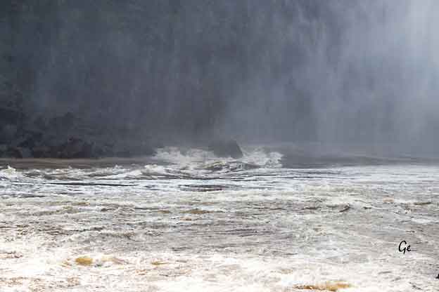
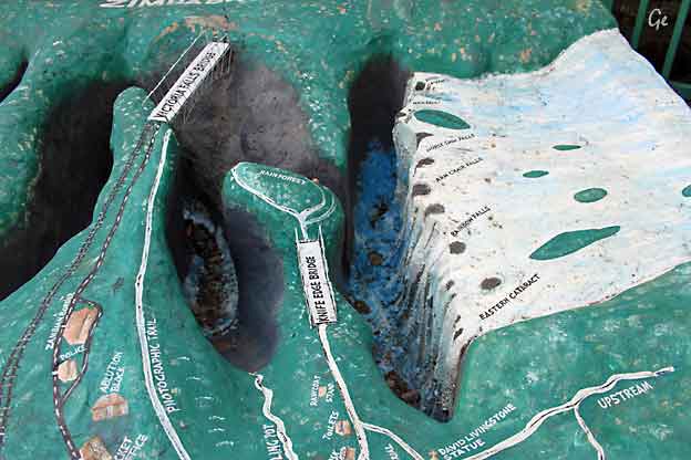 |
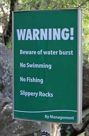 |
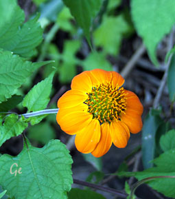 |
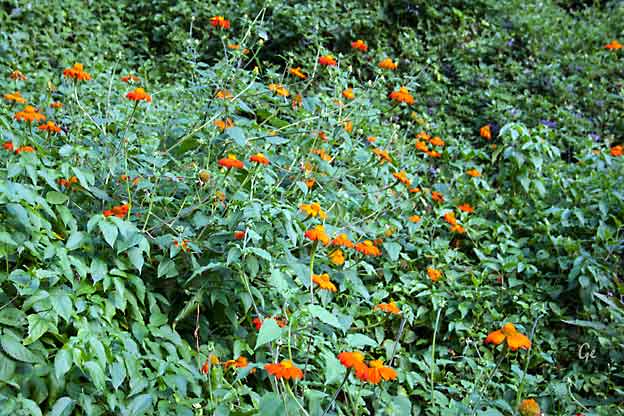
 |
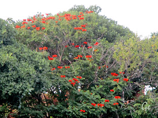 |
Vi gikk ikke samlet som en gruppe inne på området ved fossen.
Etter turen møttes vi ved denne baren for å bli kjørt tilbake til hotellet.
På veien var vi innom Royal Livingstone hotel for å ta en titt.
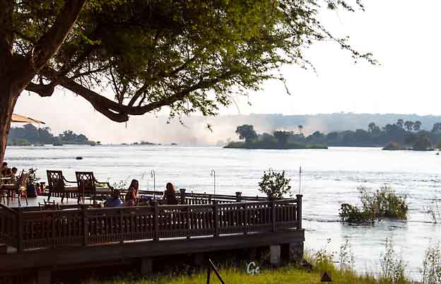
Royal Livingstone Hotel
Fra dagsprogrammet:
Vi kjører gjennom Livingstone og tar en seightseeingtur der.
Vi skal bl.a. besøke museet hvor den store oppdageren og misjonæren
David Livingstone har sin egen avdeling.
Byen Livingstone feiret sitt 110-års-jubileum i 2015.
Livingstone ble grunnlagt på restene etter den tidligere bebyggelsen,
"The Old Drift", som lå her ved Zambezi elven. I 1907 ble Livingstone
hovedstaden i Nordvest-Rhodesia og med etableringen av
Nord-Rhodesia i 1911, ble den hovedstad i hele territoriet frem til 1935.
Etter seightseeingturen fortsetter vi med buss til grensen Zambia - Botswana
Vi krysser Zambezi elven med båt og forsetter med buss til hotellet vårt:
Chobe Safari Lodge
Om ettermiddagen blir det safari i Chobe Safari Park
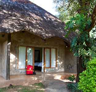 |
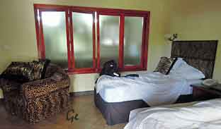 Chrismar hotel Litt spesielt med vindu til å åpne mellom soverom og bad. |
 David Livingstone, (born March 19, 1813, Blantyre, Lanarkshire, Scotland—died May 1, 1873, Chitambo [now in Zambia]), Scottish missionary and explorer who exercised a formative influence upon Western attitudes toward Africa. |
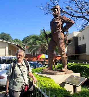 |
Southern Africa, neighbouring the Democratic Republic of the Congo to the north,
Tanzania to the north-east, Malawi to the east, Mozambique, Zimbabwe, Botswana
and Namibia to the south, and Angola to the west.
The capital city is Lusaka, in the south-central part of Zambia.
The population is concentrated mainly around Lusaka in the south and the
Copperbelt Province to the northwest, the core economic hubs of the country.
Politics
in Zambia take place in a framework of
a presidential representative
democratic republic, whereby the President
of Zambia is both head of state and
head of government in a
pluriform multi-party system. The government
exercises
executive power, while legislative power is vested
in both the government and
parliament.
Zambia became a
republic immediately upon attaining independence
in
October 1964.
https://en.wikipedia.org/wiki/Zambia
piety, poverty, hard work, zeal for education, and a sense of mission.
In 1834 an appeal by British and American churches for qualified
medical missionaries in China made Livingstone determined to
pursue that profession.
To prepare himself, while continuing to work part-time in the mill, he studied
Greek, theology, and medicine for two years in Glasgow.
On November 20, 1840, he was ordained as a missionary; he set sail for South
Africa at the end of the year and arrived at Cape Town on March 14, 1841.
For the next 15 years, Livingstone was constantly on the move into the African interior: strengthening his missionary determination; responding
wholeheartedly to the delights of geographic discovery; clashing with the
Boers and the Portuguese, whose treatment of the Africans he came to detest;
and building for himself a remarkable reputation as a dedicated Christian,
a courageous explorer, and a ferventantislavery advocate.
Yet so impassioned was his commitment to Africa that his duties as
husband and father were relegated to second place.
In May 1873, at Chitambo in what is now northern Zambia, Livingstone’s
African servants found him dead, kneeling by his bedside as if in prayer.
https://www.britannica.com/biography/David-Livingstone
Livingstone (town) was, until 2012, the capital of the Southern Province of
Zambia. Lying 10 km (6.2 mi) to the north of the Zambezi River, it is a
tourism centre for the Victoria Falls and a border town with road and rail
connections to Zimbabwe on the other side of the Victoria Falls. A historic
British colonial city, its present population was estimated at 136,897
inhabitants at the 2010 census. It is named after David Livingstone,
the British explorer who was the first European to explore the area.
https://en.wikipedia.org/wiki/Livingstone,_Zambia
Livingstone Museum
Established in 1934, the Livingstone Museum is the largest and oldest museumin Zambia. It is located in the heart of Livingstone, the home of the Victoria Falls.
It holds internationally significant collections in Zambian archaeology, history,
culture and natural history and provides an important insight into the natural and cultural heritage of Zambia. It is renowned for its important collection of
David Livingstone letters and memorabilia.
(20. oktober 2023)
Livingstone Museum. – Discover the history, culture and natural heritage of Zambia
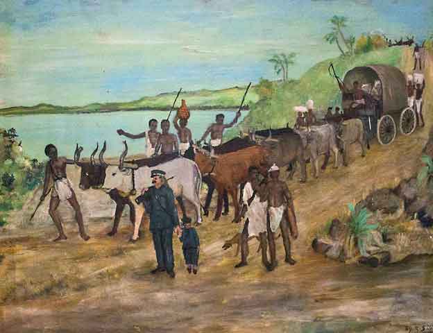
En vanlig reisemåte på Livingstones tid.
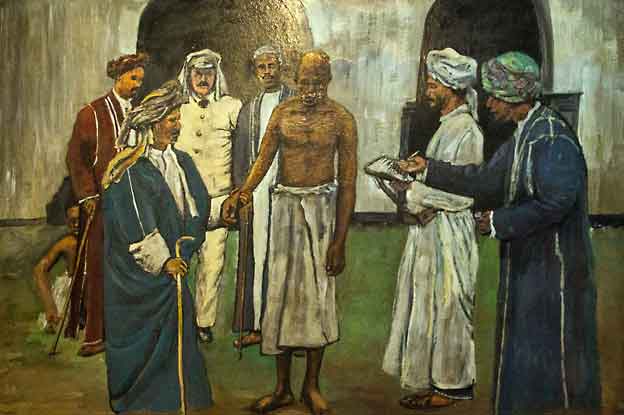
Slavemarkedet i Zanzibar
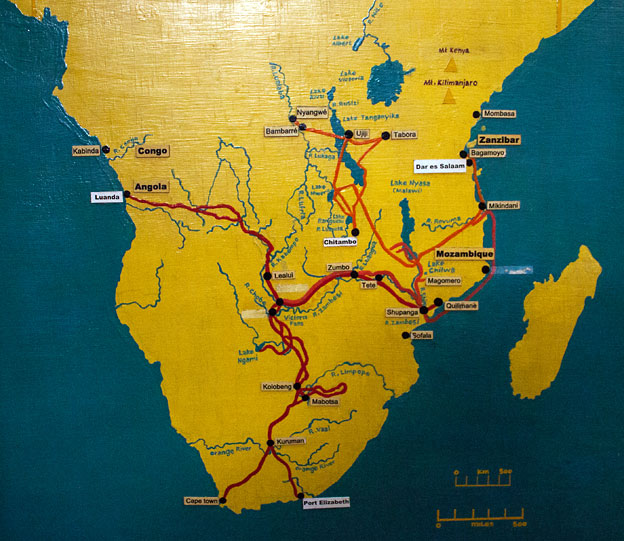
Kart over reisene til Livingstone
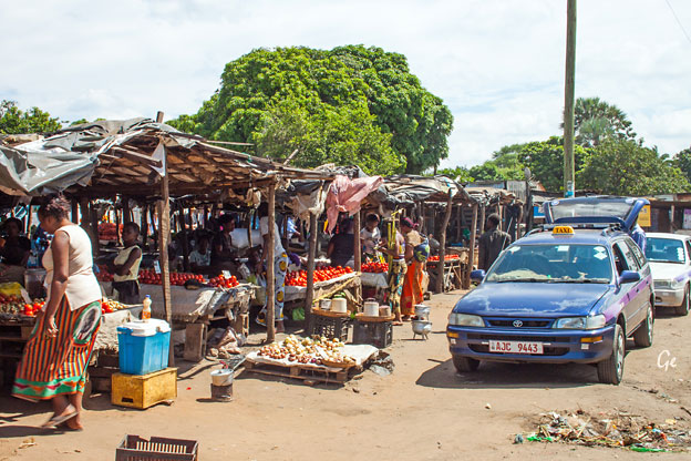
Etter museumsbesøket var vi på to markeder i Livingstone.
Her er grønsaksmarkedet.
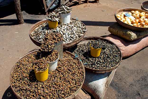
Småfisk og åmer
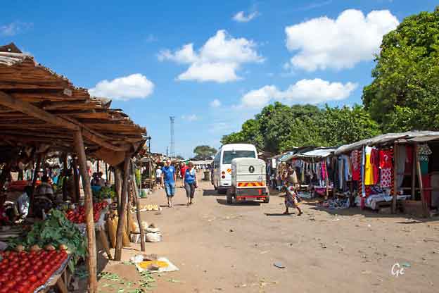
Bussen vår med bagasjehenger
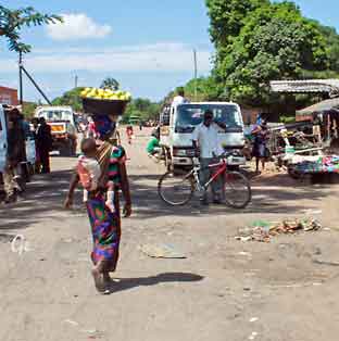
ferries in south-central Africa, having a capacity of 70 tonnes (69 long tons;
77 short tons).The service is provided by two motorised pontoons and
operates between border posts at Kazungula, Zambia and Kazungula, Botswana.
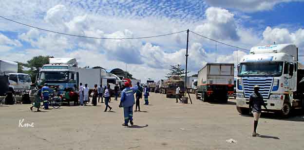
In 2003 the ferry was the site of a disaster when a severely overloaded Zambian
truck capsized one of the pontoons and 18 people drowned. The accident was
blamed on the lack of weighbridges in Zambia to check the weight of trucks.
https://en.wikipedia.org/wiki/Kazungula_Ferry
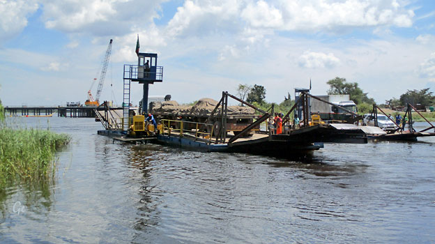
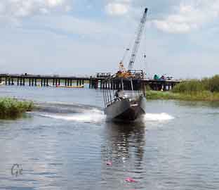 |
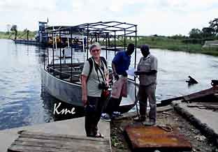 Båten vi skal ha er kommet til Kazungula. |
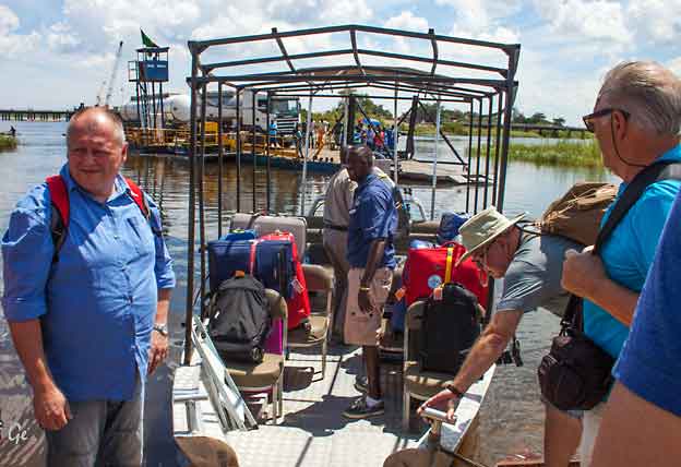
Først skulle bagasjen ombord.
Da det var gjort var det plass til noen passasjerer.
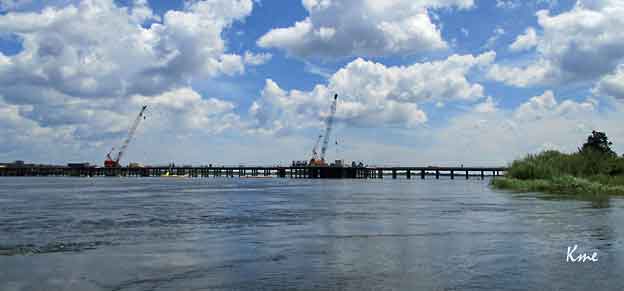
Kazungula Bridge is a road and rail bridge under construction over the Zambezi River between the countries of Zambia and Botswana at Kazungula.
In August 2007 the governments of Zambia and Botswana announced a deal to
construct a bridge to replace the existing ferry.Construction of the US$259.3 million project, which includes international border facilities in Zambia and Botswana
officially began on 12 October 2014 and is due to be completed by 2018.
The 923-metre-long (3,028 ft) by 18.5-metre-wide (61 ft) bridge links the town of Kazungula in Zambia with Botswana and is curved to avoid the nearby
borders of Zimbabwe and Namibia.
https://en.wikipedia.org/wiki/Kazungula_Bridge
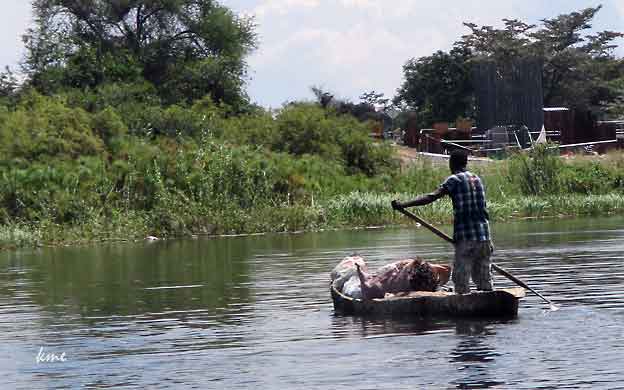
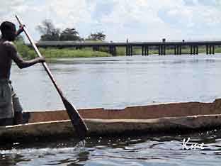 |
Det brukes
enda uthulte trestammer til å frakte varer med. Det virker ikke veldig trygt. Her er det både krokodiller, flodhester og sikkert andre ikke helt ufarlige dyr. |
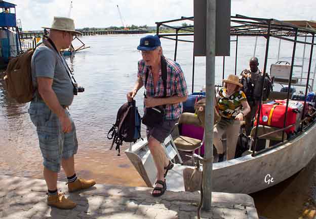
Karl Martin går i land i Botswana
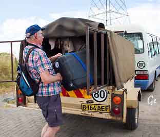 Koffertene skal over i ny bagasjehenger |
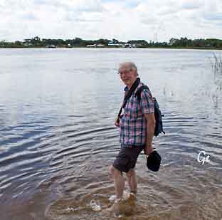 |
Mens vi ventet på resten av gruppa,
fikk Karl Martin sjansen til å vasse i Zambezi-elva.
Heldigvis kom ingen krokodiller krypende.
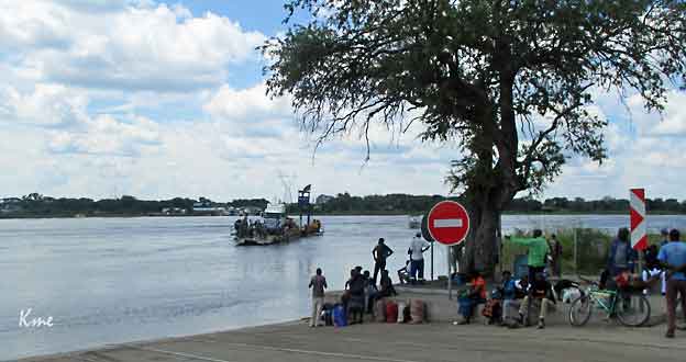
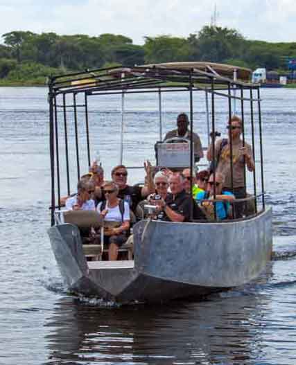
Resten av reisefølge vårt ankommer Kazungula i Botswana
Botswana is a land-locked country situated in southern Africa.
It borders South Africa, Namibia, Zambia and Zimbabwe. Approximately
two-thirds of the country lies within the Tropics.Country Size:
Botswana covers an area of 581 730 square kilometres – about the size
of France or Kenya..
Most of the country is flat, with some small hills in the eastern areas.
Kalahari sands cover 84 percent of the surface area. With the exception
of the northern areas, most of Botswana is without perennial surface water.
The Republic of Botswana Vi har vært gjennom passkontroll og har vasket skoa, så nå får vi reise videre inn til Kasane. Botswana is a rarity in our overpopulated, over-developed world. Untamed and untameable, it is one of the last great refuges for Nature’s magnificent pageantry of life. http://www.botswanatourism. co.bw/welcome (20.8.2019) |
 |
Government: Multi-party democracy
Head of State: His Excellency Lt. Gen. Dr Seretse Khama Ian Khama
Population: 1.85 million, with an average annual growth rate of 2.4 %
(2006 statistics)
National Language: Setswana
Official Language: English
Currency: Botswana Pula
Main Exports: Diamonds, copper nickel, beef, soda ash, tourism
Major Crops: Maize, sorghum, millet
Capital: Gaborone
Independence day: 30 September 1966
http://www.botswanatourism.co.bw/glance
(20.8.2019)
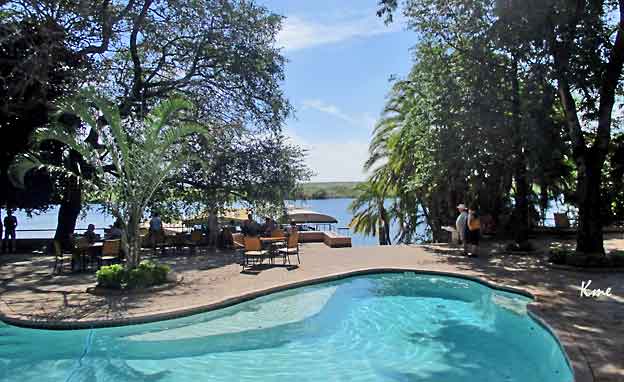
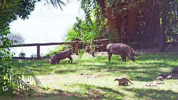
Bildet er tatt fra rommet vårt på Chobe Safari Lodge
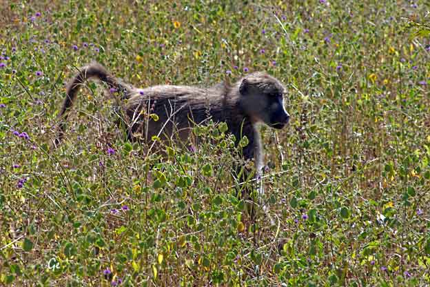
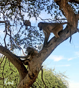 |
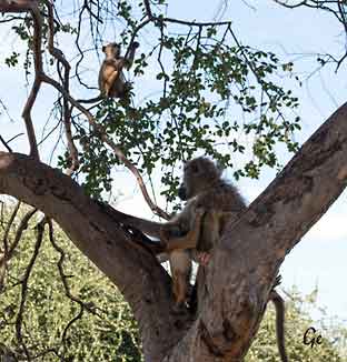 På Safari De første dyra vi så var disse bavianene |
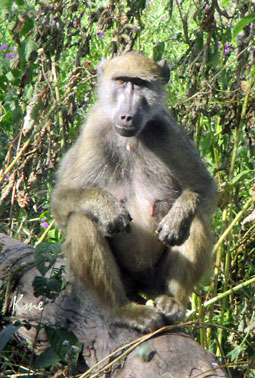 Bavian |
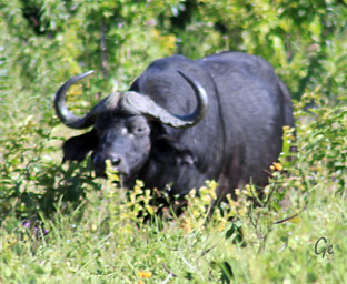 The African buffalo is not an ancestor of domestic cattle and is only distantly related to other larger bovines. Owing to its unpredictable nature, which makes i thighly dangerous to humans, the African buffalo has never been domesticated, unlike its Asian counterpart, the water buffalo. Other than humans, African Cape buffaloes have few predators aside from lions and large crocodiles, and are capable of defending themselves. Being a member of the big five game, the Cape buffalo is a sought-after trophy in hunting. https://en.wikipedia.org/wiki/African_buffalo |
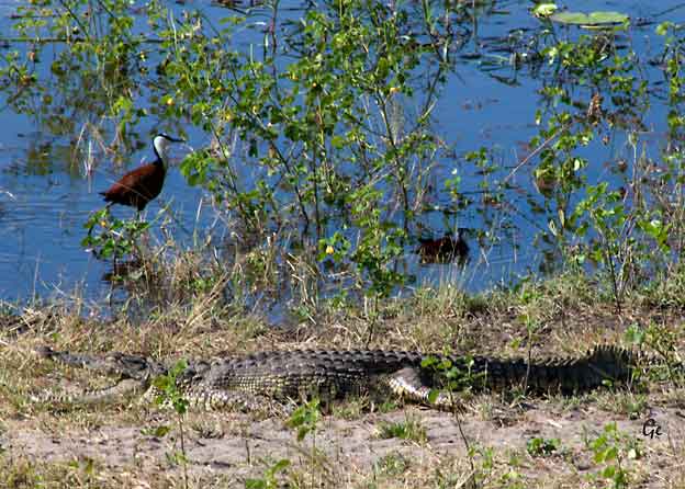
Afrikabladhøen, african Jacana (fuglen) og en krokodille.
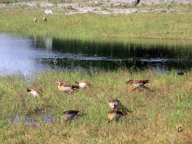
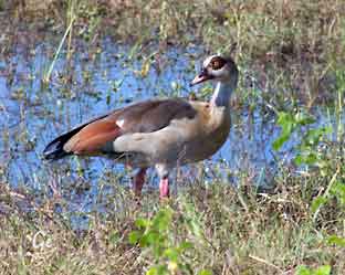 The Egyptian goose (Alopochen aegyptiaca) is a member of the duck, goose, and swan family Anatidae. It is native to Africa south of the Sahara and the Nile Valley. Egyptian geese were considered sacred by the Ancient Egyptians, and appeared in much of their artwork. They have been raised for food and extensively bred in parts of Africa since they were domesticated by the ancient Egyptians. Because of their popularity chiefly as ornamental bird, escapes are common and small feral populations have become established in Western Europe. https://en.wikipedia.org/wiki/Egyptian_goose |
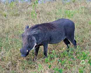 Warthogs are members
of the same
family as domestic pigs, but present a much different appearance. These sturdy hogs are not among the world's most aesthetically pleasing animals—their large, flat heads are covered with "warts," which are actually protective bumps. Warthogs also sport four sharp tusks. They are mostly bald, but they do have some sparse hair and a thicker mane on their backs. Behavior
Though warthogs appear
ferocious,
https://www.nationalgeographic.com/animals/they are basically grazers. They eat grasses and plants, and also use their snouts to dig or “root” for roots or bulbs. When startled or threatened, warthogs can be surprisingly fast, running at speeds of up to 30 miles an hour. mammals/w/warthog/ |
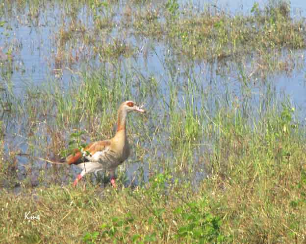
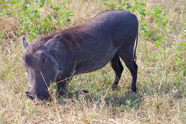
Vortesvin
Warthogs kneel on their front knees to feed because they have short necks and
relativity long legs. They have adapted by developing special kneepads.
---------------------------------------------------------------------------------------------
The warthog is mainly a grazer and has adapted an interesting practice of
kneeling on its calloused, hairy, padded knees to eat short grass. Using its
snout and tusks, it also digs for bulbs, tubers and roots during the dry season.
http://www.outtoafrica.nl/animals/engwarthog.html
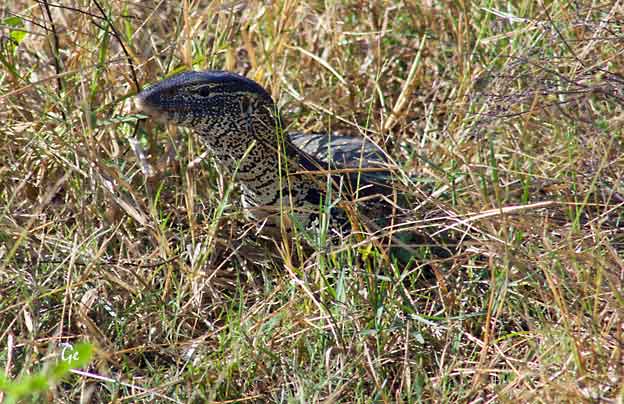
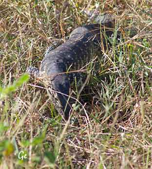 |
Monitor lizards have long
necks, powerful tails and claws, and well-developed limbs. The adult length of extant species ranges from 20 cm (7.9 in) in some species, to over 3 m (10 ft) in the case of the Komodo dragon, though the extinct varanid known as megalania (Varanus priscus) may have been capable of reaching lengths of more than 7 m (23 ft). Most monitor species are terrestrial, but arboreal and semiaquatic monitors are also known. While most monitor lizards are carnivorous, eating eggs, smaller reptiles, fish, birds and small mammals, some also eat fruit and vegetation, depending on where they live. https://en.wikipedia.org/wiki/Monitor_lizard |
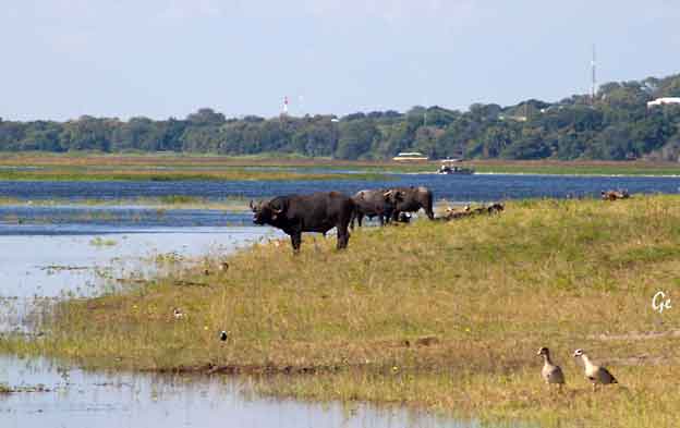
Bøfler ved Chobe-elva
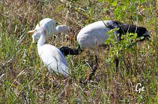 |
 Vi ser etter dyrespor, men ser mest bilspor. |
An adult individual is 68 cm (27 in) long with all-white body plumage apart from
dark plumes on the rump. The bald head and neck, thick curved bill and legs are
black. The white wings show a black rear border in flight. Sexes are similar,
but juveniles have dirty white plumage, a smaller bill and some feathering on the
neck.
This bird is usually silent, but occasionally makes some croaking noises, unlike its
vocal relative, the hadada ibis.
https://en.wikipedia.org/wiki/African_sacred_ibis
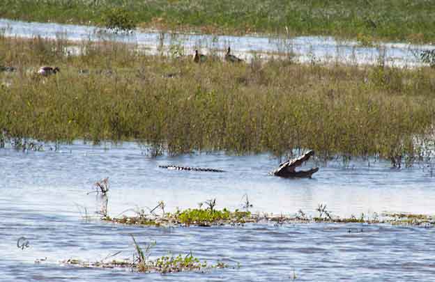
Krokodille
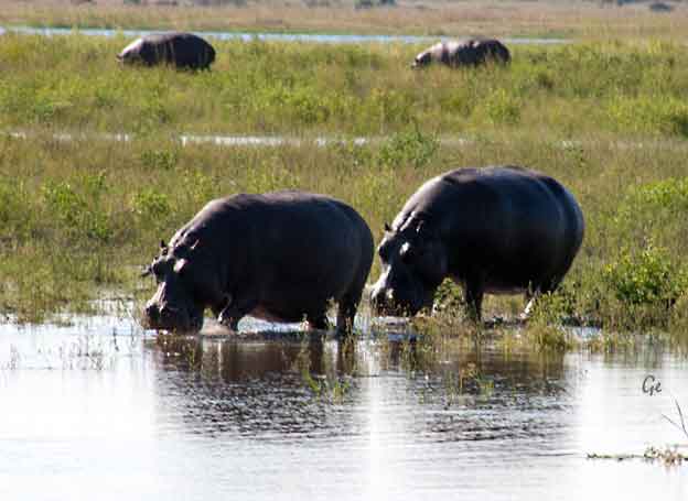
Flodhest
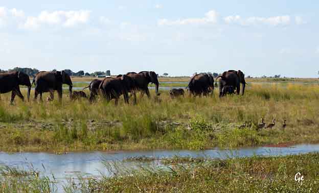
Elefanter
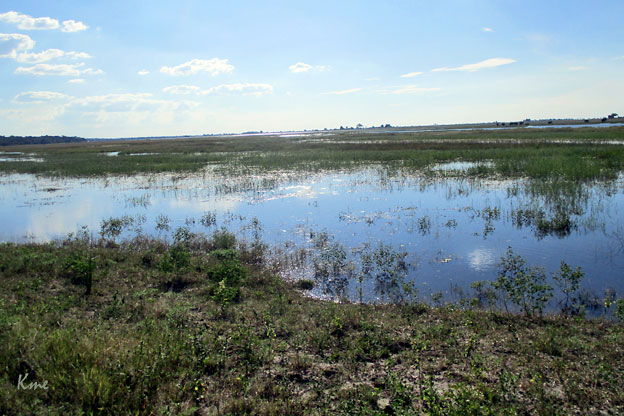
Chobe
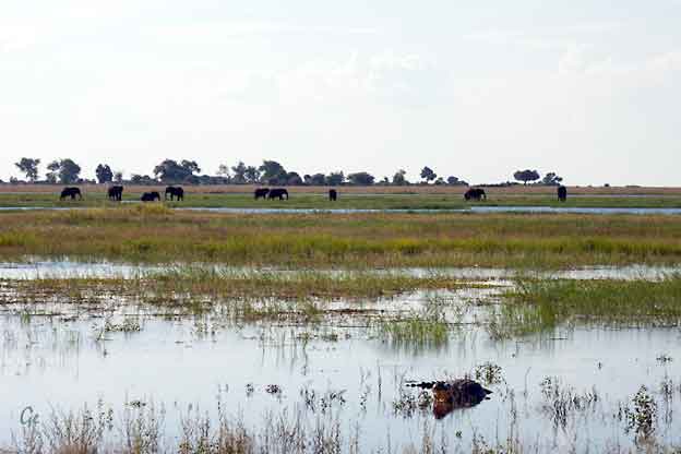
Elefanter og krokodille
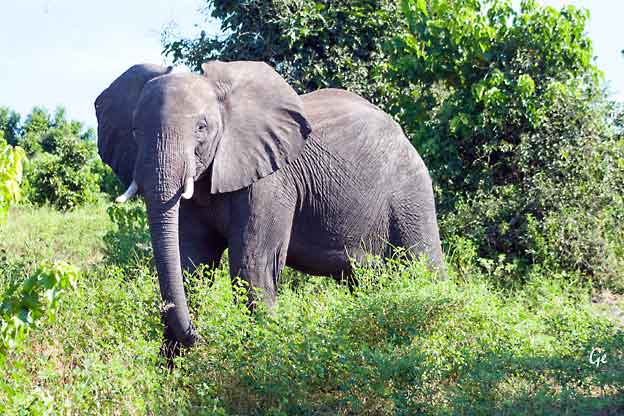
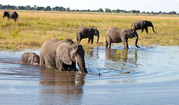
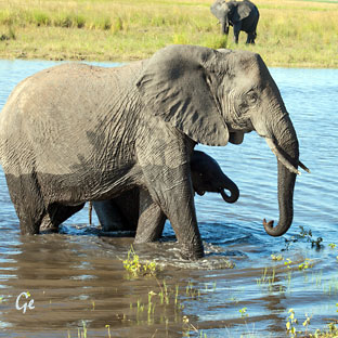 |
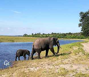 |
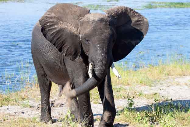
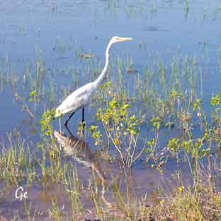 Egrett-hegre, Great Egret |
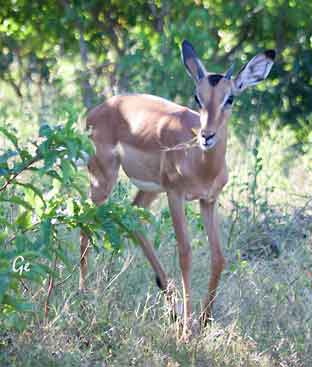 Impala |
(in the Old World) great white heron, is a large, widely distributed egret, with
four subspecies found in Asia, Africa, the Americas, and southern Europe.
Distributed across most of the tropical and warmer temperate regions of the
world. It builds tree nests in colonies close to water.
https://en.wikipedia.org/wiki/Great_egret
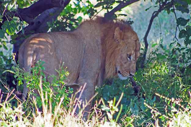
Lions are the only cats that live in groups, which are called prides.
Prides are family units that may include up to three males, a dozen or so
females, and their young. All of a pride's lionesses are related, and female
cubs typically stay with the group as they age. Young males eventually
leave and establish their own prides by taking over a group headed by
another male.
http://www.nationalgeographic.com/animals/mammals/a/african-lion/
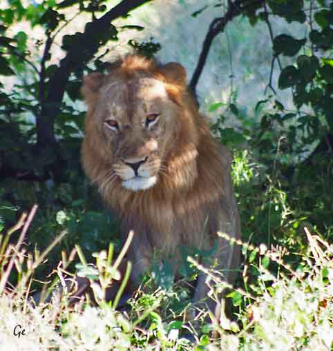
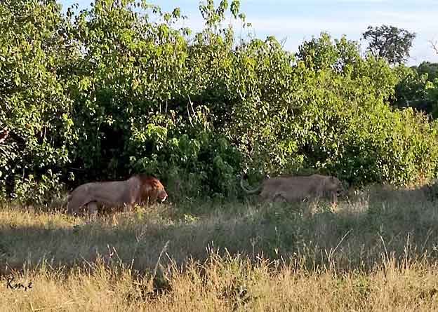
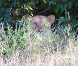 |
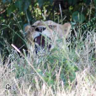 |
upon antelopes, zebras, wildebeest, and other large animals of the open grasslands.
Many of these animals are faster than lions, so teamwork pays off.
http://www.nationalgeographic.com/animals/mammals/a/african-lion/
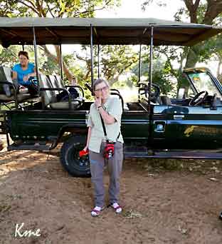 |
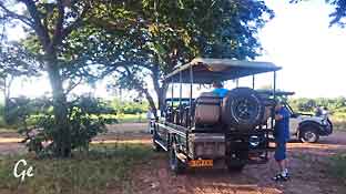 En pause i safariparken. |
Proclaimed a wildlife reserve in 1968, and covering 11,700km2, Chobe National
Park is situated in the far north-east of Botswana, bordered to the north by the
Chobe River.
Chobe is game-viewing country, particularly in winter (March - July).
November - December sees the migration of herbivores between the
Chobe River and Savuti Marsh (and back between February and April).
Game-viewing and bird-watching cruises on the Chobe River.
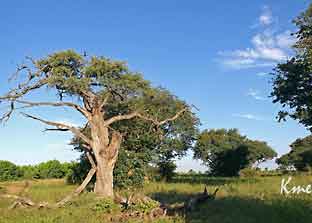 |
 Skyggen vår |
The Chobe's perennial waters rise in the northern Angolan highlands. Chobe has
four physically and vegetationally distinctive areas; the barely discernible dry
Savuti Channel, Linyati, Serondella and Nogatsaa.Each area known for
concentrations of specific game. Savuti famous for lion and hyaena, Linyati for
hippo and crocodile, and Nogatsaa and Serondella for elephant. Savuti's
carnivores follow large herds of zebra, wildebeest, buffalo and impala that
move through the area.
Many types of animals seen including the fairly rare puku and Chobe bushbuck.
460 bird species, including raptors, vultures and inland waterbirds.
http://www.botswana.co.za/Area_Guides-travel/chobe-faqs.html (20.8.2019)
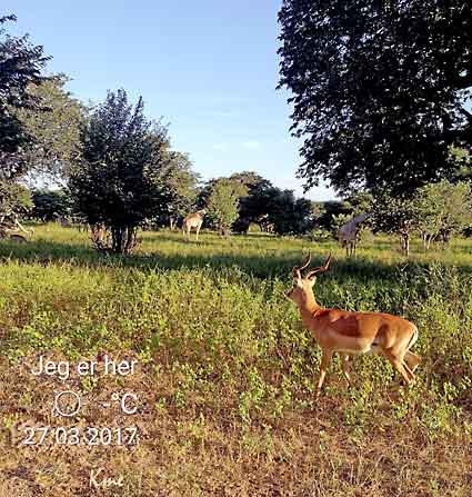
Sjiraffer og impala
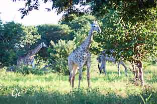 Sjiraffer |
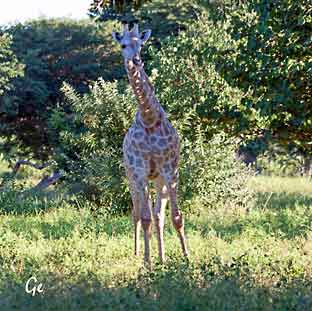 |
The Chobe River is the northern boundary of the Chobe National Park, where
the great elephant concentrations occur on the river during the dry season.
The national park encompasses a vast area that also includes Savuti.
http://www.botswana.co.za/Area_Guides-travel/chobe-faqs.html
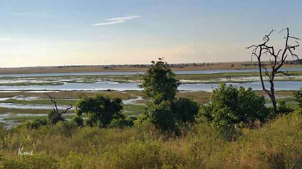
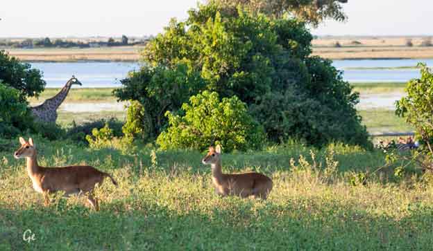
Sjiraff, impala, det ligger en sebra helt til høyre i bildet
og jeg tror det ligger noe i gresset foran sebraen.
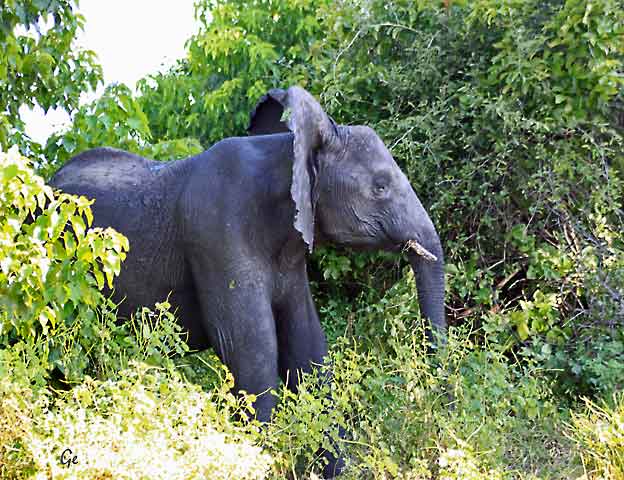
Sinna elefant
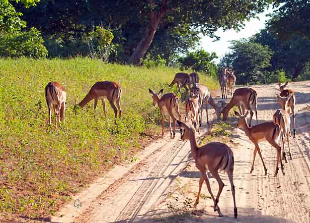
Impalaflokk
Fra dagsprogrammet: Etter frokost blir det nok en spesiell tur, denne gangen safari med en bred, åpen båt med tak. Slik kommer vi tett innpå dyrene fra elvesiden. Man ser ofte bl.a. flodhester og mye fugler på denne turen og selvfølgelig mange elefanter som koser seg med ungene sine i vannet. Om ettermiddagen slapper vi av ved bassenget eller tar en liten tur i byen. Middag på hotellet. |
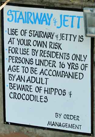 |
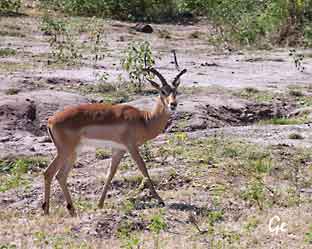 |
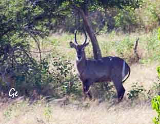 Vannbukk |
sub-Saharan Africa. It is placed in the genus Kobus of the family Bovidae.
It was first described by Irish naturalist William Ogilby in 1833.
The thirteen subspecies are grouped under two varieties: the common or ellipsen waterbuck and the defassa waterbuck. The head-and-body length is typically
between 177–235 cm (70–93 in) and the average height is between 120 and
136 cm (47 and 54 in).
The waterbuck is of a robust build. The shaggy coat is reddish brown to grey, and
becomes progressively darker with age. Males are darker than females.
Though apparently thick, the hair is sparse on the coat. The hair on the neck is,
however, long and shaggy. When sexually excited, the skin of the waterbuck
secretes a greasy substance with the odour of musk, giving it the name "greasy kob".
The odor of this is so unpleasant that it repels predators. This secretion also assists
in water-proofing the body when the animal dives into water.
https://en.wikipedia.org/wiki/Waterbuck
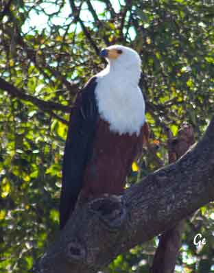 |
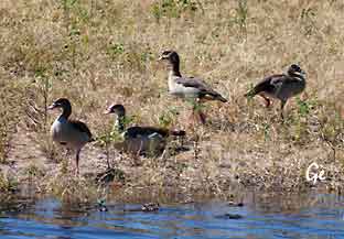 The African Fish Eagle is a fairly large eagle. It has a distinctive black, brown, and white plumage. It is most frequently seen sitting high in a tall tree from where it has a good view of the stretch of river, lakeshore or coastline, |
require less than a square mile of water to find enough food, whereas next
to a small river, they may require a stretch of 15 miles or more.
Some tend to move around to avoid the wettest weather,
whereas others stay where they are all year round.
http://www.krugerpark.co.za/africa_fish_eagle.html
African fish eagles breed during the dry season, when water levels are low.
They are believed to mate for life. Pairs often maintain two or more nests,
which they frequently reuse. Because nests are reused and built upon over
the years, they can grow quite large, some reaching 2 m (6.0 ft) across and
1.2 m (3.9 ft) deep. The nests are placed in a large tree and are built
mostly of sticks and other pieces of wood
The female lays one to three eggs, which are primarily white with a few
reddish speckles. Incubation is mostly done by the female, but the male
incubates when the female leaves to hunt. Incubation lasts for 42 to 45
days before the chicks hatch. Siblicide does not normally occur in this
taxon, and the parents often successfully rear two or three chicks.
Chicks fledge around 70 to 75 days old. Postfledgling dependence lasts up
to three months, whereafter the juveniles become nomadic, and may
congregate in groups away from territorial adults. Those that survive
their first year have a life expectancy of some 12 to 24 years
https://en.wikipedia.org/wiki/African_fish_eagle
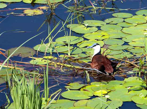
The African jacana (Actophilornis africanus) is a wader in the family Jacanidae, identifiable by long toes and long claws that enable them to walk on floating
vegetation in shallow lakes, their preferred habitat. Jacanas are found worldwide
within the tropical zone, and this species is found in sub-saharan Africa.
The jacana has evolved a highly unusually polyandrous mating system, meaning
that one female mates with multiple males and the male alone cares for the chicks.
Such a system has evolved due to a combination of two factors: firstly, the lakes
that the jacana lives on are so resource-rich that the relative energy expended by
the female in producing each egg is effectively negligible. Secondly the jacana, as
a bird, lays eggs and eggs can be equally well incubated and cared for by a parent
bird of either gender. This means that the rate-limiting factor of the jacana's
breeding is the rate at which the males can raise and care for the chicks. Such a
system of females forming harems of males is in direct contrast to the more usual
system of leks seen in animals such as stags and grouse, where the males compete
and display in order to gain harems of females.
The
parent that forms part of the harem is almost always
the one that ends up
caring for the offspring; in this case, each male
jacana incubates and rears a
nest of chicks. The male African jacana has
therefore evolved some
remarkable adaptations for parental care, such as
the ability to pick up and
carry chicks underneath its wings.
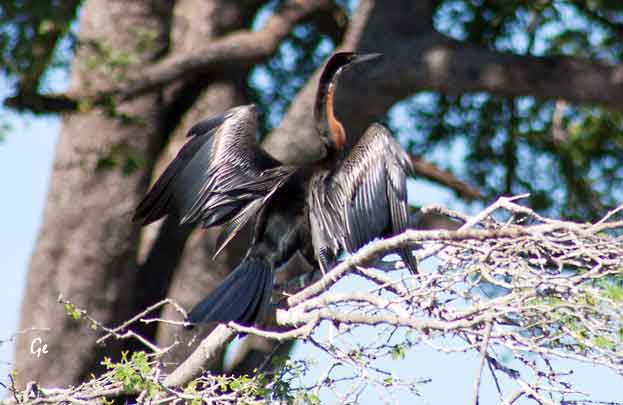
The male is mainly glossy black with white streaking, but females and
immature birds are browner.
The African darter differs in appearance from the American darter
most recognisably by its thin white lateral neck stripe against a
rufous background colour. The pointed bill should prevent
confusion with cormorants.
It is an 80 cm long cormorant-like fish-eating species with a very long
neck, like other anhingas.
This species builds a stick nest in a tree and lays 3–6 eggs.
It often nests with herons, egrets and cormorants.
It often swims with only the neck above water, hence the common name
snakebird. This, too, is a habit shared with the other anhingas.
Unlike many other waterbirds the feathers of the African darter do not
contain any oil and are therefore not waterproof. Because of this, the bird
is less positively buoyant and its diving capabilities are enhanced.
After diving for fish, the feathers can become waterlogged. In order to be
able to fly and maintain heat insulation, it needs to dry its feathers. Thus the
African darter is often seen sitting along the waterside spreading its wings
and drying its feathers in the wind and the sun along with cormorants
which may share its habitat.
https://en.wikipedia.org/wiki/African_darte
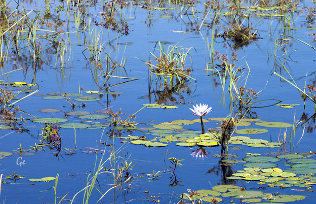
Chobe River
The river begins its existence as a small mountain spring in Angola,
where it is known as the Kwando (a Hambukushu name).
From here, it travels great distances through the Kalahari
sands before it reaches Botswana and becomes the Linyanti (a Subiya name).
It finally becomes the Chobe at the border post of Ngoma,
from where it continues to run along Botswana’s northern border before
meeting the mighty Zambezi and tumbling over the precipice at Victoria Falls.
The Chobe’s course, like the Okavango and the Zambezi River, is affected by
fault lines which are extensions of the Great Rift Valley.
By the time the river reaches the national park’s northern border, it has become
a broad, twisting mass of water that snakes its way through swampland and
is interspersed by a number of lush, green islands.
http://www.chobenationalpark.com/chobe-river
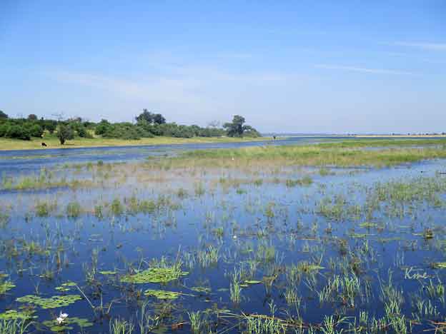
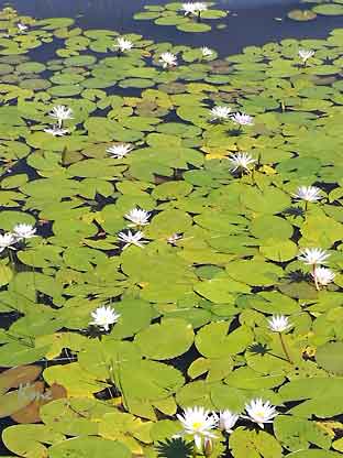 |
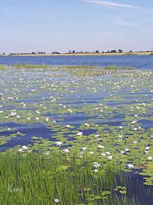 |
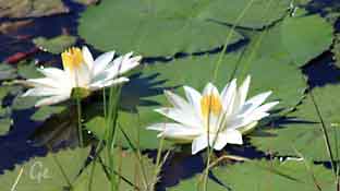 |
 |
Fotografering av elefanter
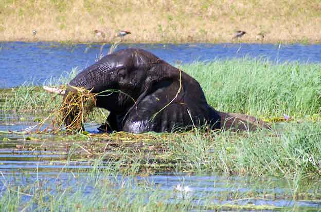
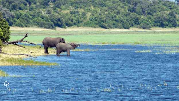
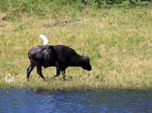 |
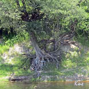 |
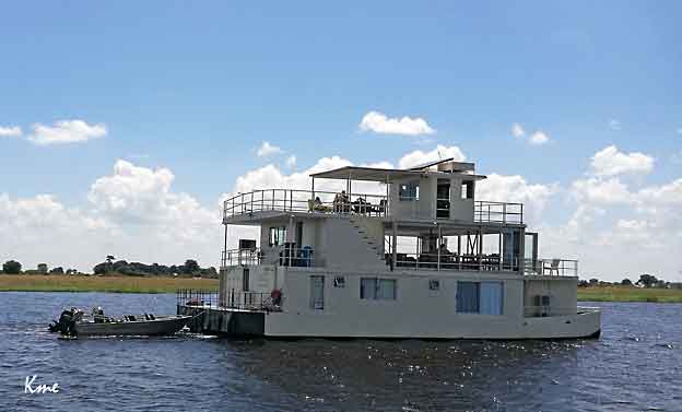
Cruiseskip på Chobe: over Chobe Princess
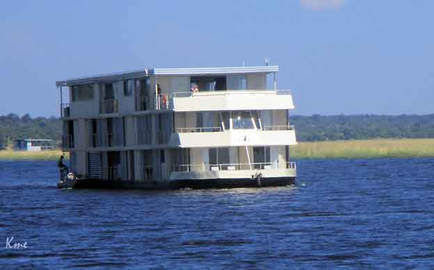
Zambezi Queen
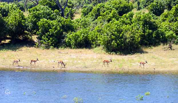
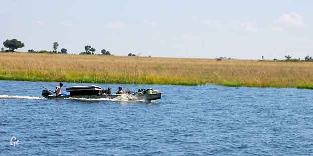
Namibier på båttur
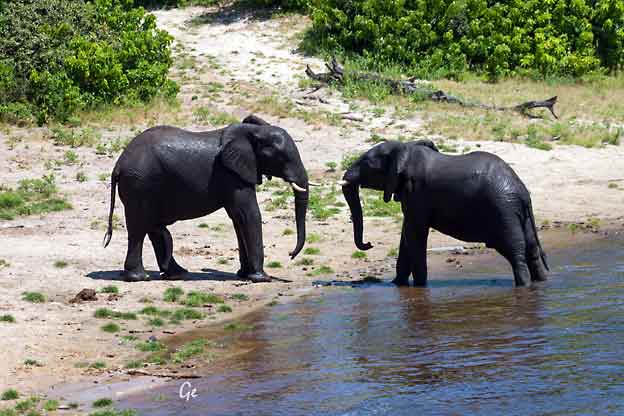
Litt uenige
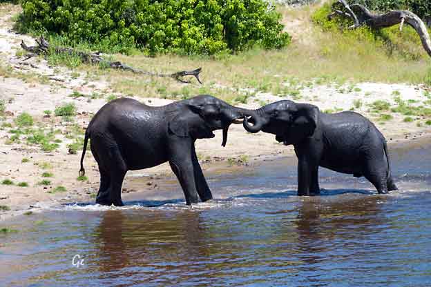
En liten slåsskamp
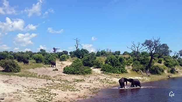
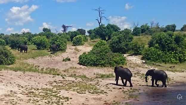
og så er de venner igjen
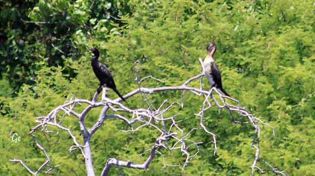
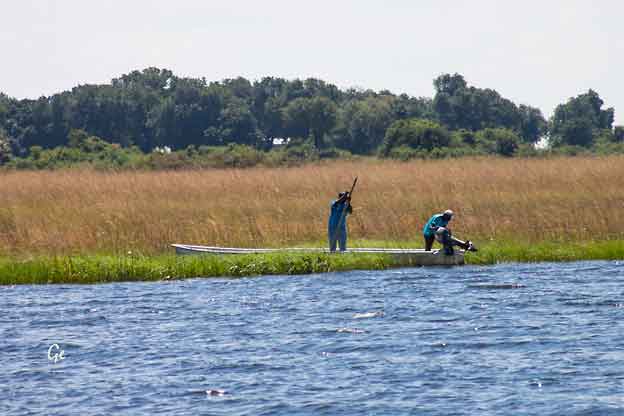
Vi ser over til Namibia
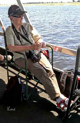 |
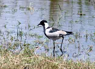 Black-Smith Povel, Smedvipe The blacksmith lapwing or blacksmith plover (Vanellus armatus) occurs commonly from Kenya through central Tanzania to southern and southwestern Africa. The vernacular name derives from the repeated metallic 'tink, tink, tink' alarm call, which suggests a blacksmith's hammer striking an anvil. https://en.wikipedia.org/wiki/Blacksmith_lapwing |
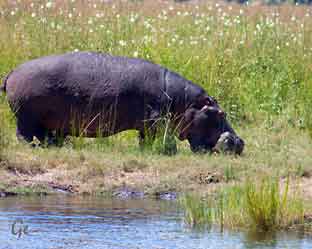 |
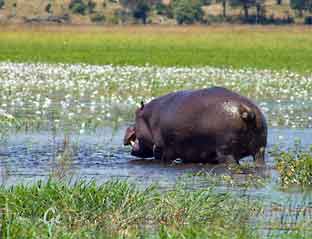 |
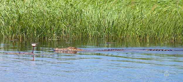
og enda en krokodille
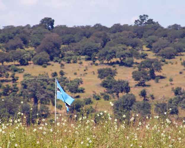
Flagget til Botswana
The colours of the flag carry cultural, political, and regional meanings.
The light blue represents water—specifically, in its form of rain, as it is
a precious resource in Botswana, which relies on agriculture and suffers
from frequent droughts due to the dry and arid climate of the Kalahari Desert.
The blue also alludes to the motto featured on the coat of arms of
Botswana—Pula, which means "Let there be rain" in Setswana—as well as
life, which is sustained by water.
The black band with the white
frame has two meanings. Firstly, they
symbolize the harmony and cooperation between the
people of different
races who live in Botswana, as well as the racial
diversity of the country.
Furthermore, they represent the stripes of
the zebra, the national
animal of Botswana.
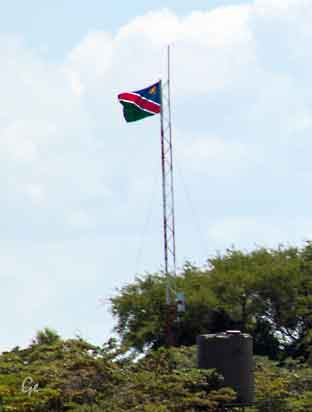 og flagget til Namibia |
Namibias flagg From the 1960s the South West Africa People’s Organization (SWAPO) was the leading group working toward independence in what was then South West Africa, a de facto colony of neighbouring South Africa. When South Africa, under pressure from the international community, eventually agreed to relinquish control over the territory, a flag design competition was held for the future Republic of Namibia. |
(a horizontal tricolour of blue, red, and green) would be influential when
the choice was made.
Working with the 835 proposals submitted, the National Symbols
Sub-Committee of the transitional government met throughout January
1990 and finally approved a flag recommended by South African State
Herald Frederick Brownell. That design placed the blue-red-green SWAPO
stripes diagonally and added white fimbriations (narrow borders) on
either side of the red to set off the colours. A golden 12-pointed sun was
added in the upper hoist corner to represent life and energy. While no
specific colour attributions were originally made, red is now considered
to reflect the heroism of the people and their determination to build a
future of equal opportunity. Green is for agricultural resources, blue is for
the sky and the Atlantic Ocean, and white is for peace and unity. The flag
was adopted by the Constituent Assembly on February 2, 1990, and was
first officially hoisted on independence day, March 21, that same year
https://www.britannica.com/topic/flag-of-Namibia
(20.8.2019)
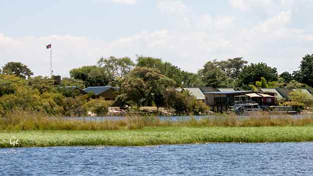
Namibia
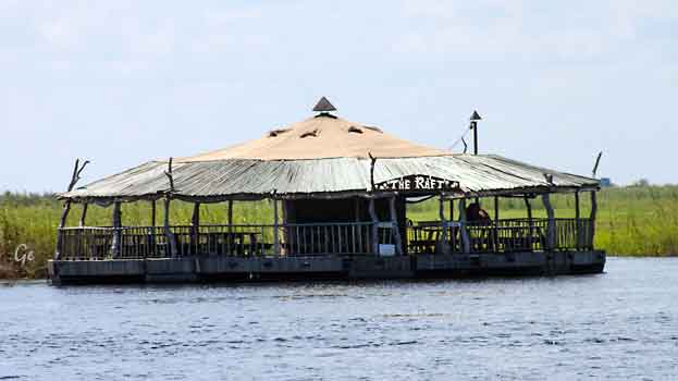
Restauranten The Raft
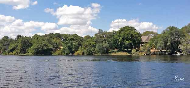
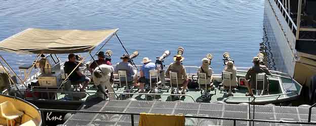
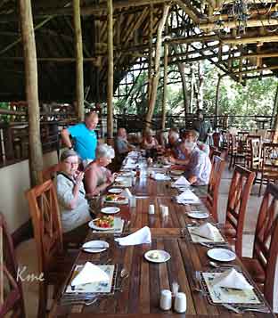 |
Lunsj på
Chobe Safari Lodge |
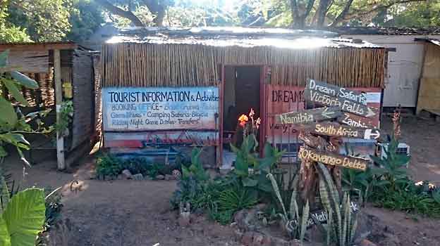
Kasane turistinformasjon
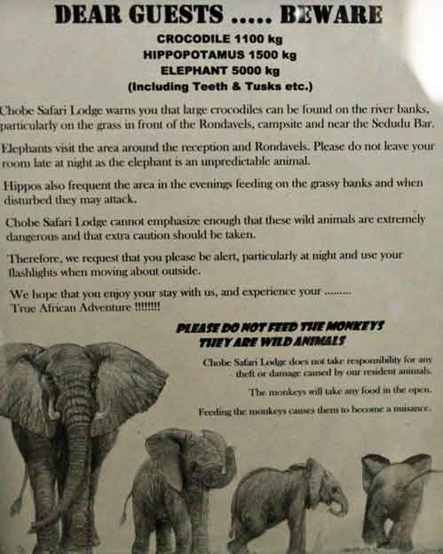
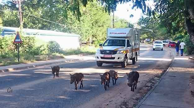
Vortesvin på vei til Chobe Marina Lodge. Ambulansen må kjøre sakte.
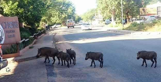
Dyra er framme ved lodgen.
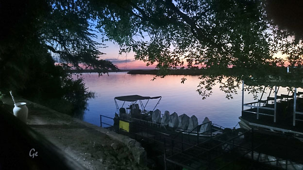
 |
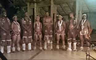 |
Solnedgang over Chobe
Vi fikk musikk og dans til den siste middagen i Afrika. (Siste på denne turen)
| Onsdag 29. mars 2017 Program for dagen: Etter en rolig frokost sjekker vi ut fra hotellet. Vi kjører til flyplassen i Kasane, busstur på ca. 10 minutter. Vi flyr først til Johannesburg. Derfra tar vi fly til Heathrow, London |
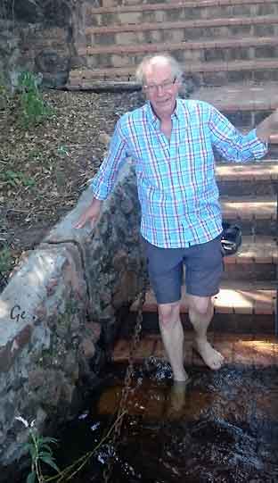 |
 |
 |
 |
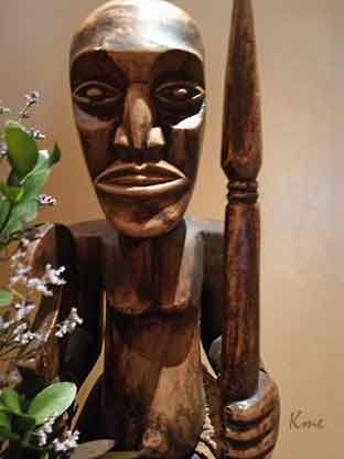 |
Bilder fra salongen på lodgen
 |
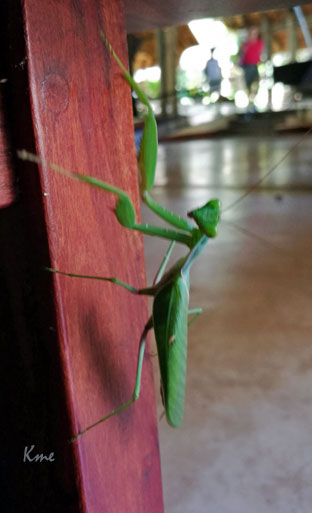 |
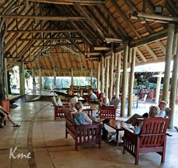 |
En rolig
formiddag. Flyet skulle ikke gå før kl 1400 |
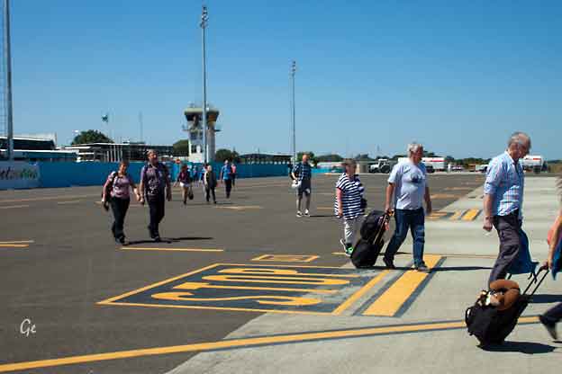
Flyplassen i Kasane, Botswana
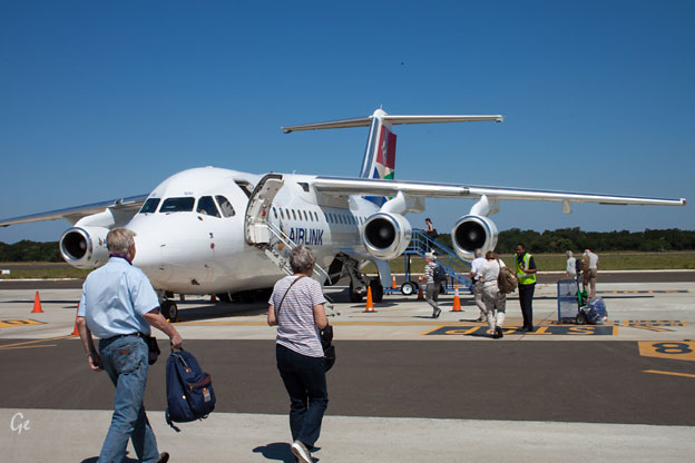
Kasane flyplass 2017
| Torsdag 30. mars 2017 Vi ankommer London om morgenen og flyr videre til Oslo med ankomst kl 1330. Fra Gardermoen fortsatte de fleste i gruppa vår med fly til Værnes. Vi var ferdig med flyvninger for denne gang og fortsatte med flytog og buss hjem til Slemmestad. |
 Grete med wienerbrød og te på Heathrow |
Tekst: Karl Martin Emblemsvåg, Grete Emblemsvåg og
tekster fra internett og brosjyrer.